List of architectural monuments in Kurtatsch
The list of architectural monuments in Kurtatsch ( Cortaccia in Italian ) contains the 30 objects designated as architectural monuments in the area of the municipality of Kurtatsch in South Tyrol .
The basis is the official directory of the monuments in South Tyrol, which can be viewed on the Internet. These can be, for example, sacred buildings , residential houses, farms and aristocratic residences. The order in this list is based on the designation, alternatively it can also be sorted according to the address or the date on which it was placed under protection.
list
| photo | designation | Location | registration | description | Metadata |
|---|---|---|---|---|---|
| Old mill ID: 15452 |
46 ° 18 ′ 44 ″ N, 11 ° 13 ′ 11 ″ E |
Apr. 4, 1977 (BLR-LAB 2048) |
Mill |
KG: Kurtatsch building plot: 13
|
|
|
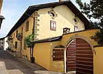
Old Widum ID: 15457 |
46 ° 18 ′ 50 ″ N, 11 ° 13 ′ 27 ″ E |
Apr. 4, 1977 (BLR-LAB 2048) |
Widum / Canon House |
KG: Kurtatsch building plot: 34, 35, 36
|
| Altlehen ID: 15474 |
46 ° 18 ′ 47 "N, 11 ° 12 ′ 59" E |
Oct 15, 1951 (MD) |
Raised hide |
KG: Kurtatsch building plot: 218
|
|

|
Messenger House ID: 15458 |
46 ° 18 ′ 50 ″ N, 11 ° 13 ′ 26 ″ E |
Apr. 4, 1977 (BLR-LAB 2048) |
Rural house / farm |
KG: Kurtatsch building plot: 41
|

|
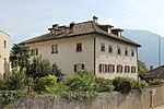
Eberle ID: 15463 |
46 ° 18 ′ 55 ″ N, 11 ° 13 ′ 12 ″ E |
Apr. 4, 1977 (BLR-LAB 2048) |
Rural house / farm |
KG: Kurtatsch building plot: 81
|
|
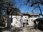
Former district court ID: 15459 |
46 ° 18 ′ 52 ″ N, 11 ° 13 ′ 24 ″ E |
Apr. 4, 1977 (BLR-LAB 2048) |
Rural house / farm |
KG: Kurtatsch building plot: 52/1
|
|
Fennhals with chapel ID: 15477 |
46 ° 17 ′ 54 ″ N, 11 ° 11 ′ 19 ″ E |
Dec 28, 1949 (MD) |
Raised hide |
KG: Kurtatsch building plot: 296/1, 296/3, 732
|

|
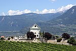
Freienfeld with outbuildings ID: 15462 |
46 ° 18 ′ 54 ″ N, 11 ° 13 ′ 20 ″ E |
Apr. 4, 1977 (BLR-LAB 2048) |
Raised hide |
KG: Kurtatsch building plot: 61, 62, 65, 68, 69, 72, 75
|
|
Cemetery Chapel and Cemetery ID: 15465 |
46 ° 18 '54 "N, 11 ° 13' 37" E |
Apr. 4, 1977 (BLR-LAB 2048) |
chapel |
KG: Kurtatsch building plot: 97
|
| Gasthaus Rose ID: 50109 |
46 ° 18 ′ 46 ″ N, 11 ° 13 ′ 17 ″ E |
Apr. 4, 1977 (BLR-LAB 2048) |
Inn |
KG: Kurtatsch building plot: 22, 23 basic plot: 52
|
|
| Kauderle 13 ID: 18153 |
Kauderle 13 46 ° 18 ′ 25 ″ N, 11 ° 12 ′ 8 ″ E Fraction: Penon |
November 20, 1995 (BLR-LAB 6028) |
Urban residential building |
KG: Kurtatsch building plot: 179
|
|

|
Mariahilfkapelle in Oberfennberg ID: 15478 |
46 ° 16 ′ 49 ″ N, 11 ° 10 ′ 32 ″ E Fraction: Oberfennberg |
Apr. 4, 1977 (BLR-LAB 2048) |
chapel |
KG: Kurtatsch building plot: 307
|
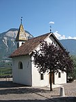
| Marienkapelle bei Sulzhof ID: 15470 |
46 ° 17 ′ 43 "N, 11 ° 12 ′ 6" E Fraction: Penon |
Apr. 4, 1977 (BLR-LAB 2048) |
chapel |
KG: Kurtatsch building plot: 157
|
|
|
Lady Chapel in Entiklar ID: 15466 |
46 ° 18 ′ 0 ″ N, 11 ° 12 ′ 45 ″ E Fraction: Entiklar |
Apr. 4, 1977 (BLR-LAB 2048) |
chapel |
KG: Kurtatsch building plot: 117
|
| Nussdorf ID: 15473 |
46 ° 18 '39 "N, 11 ° 12' 59" E |
Oct 15, 1951 (MD) |
Raised hide |
KG: Kurtatsch building plot: 216/1, 216/3, 216/5
|
|
| Nussegg ID: 15471 |
46 ° 18 ′ 33 ″ N, 11 ° 12 ′ 45 ″ E Fraction: Rain |
Apr. 4, 1977 (BLR-LAB 2048) |
Ansitz, the core of a late Gothic building (pointed arched door). Remodeled in the 16th century. |
KG: Kurtatsch building plot: 201
|
|

|
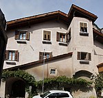
Obergasse 16-18 ID: 15461 |
Obergasse 16-18 46 ° 18 ′ 55 ″ N, 11 ° 13 ′ 22 ″ E |
Apr. 4, 1977 (BLR-LAB 2048) |
Rural house / farm |
KG: Kurtatsch building plot: 59
|
|
Obergasse 25-27 ID: 15464 |
Obergasse 25-27 46 ° 18 ′ 56 ″ N, 11 ° 13 ′ 22 ″ E |
Apr. 4, 1977 (BLR-LAB 2048) |
Rural house / farm |
KG: Kurtatsch building plot: 87
|
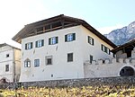
| Obergasse 26-28 ID: 15460 |
Obergasse 26-28 46 ° 18 ′ 56 ″ N, 11 ° 13 ′ 24 ″ E |
Apr. 4, 1977 (BLR-LAB 2048) |
Rural house / farm |
KG: Kurtatsch building plot: 53/1, 53/4
|
|
|
Ortenburg ID: 15451 |
46 ° 18 ′ 42 ″ N, 11 ° 13 ′ 15 ″ E |
Apr. 4, 1977 (BLR-LAB 2048) |
Raised hide |
KG: Kurtatsch building plot: 4/1, 4/2, 6
|

|
Parish church St. Georg in Graun ID: 15476 |
46 ° 19 ′ 14 ″ N, 11 ° 13 ′ 5 ″ E Fraction: Graun |
Apr. 4, 1977 (BLR-LAB 2048) |
church |
KG: Kurtatsch building plot: 268
|

|
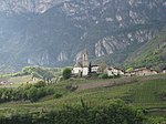
Parish Church of St. Nicholas in Penon ID: 15469 |
46 ° 18 ′ 13 ″ N, 11 ° 12 ′ 4 ″ E Fraction: Penon |
Apr. 4, 1977 (BLR-LAB 2048) |
church |
KG: Kurtatsch building plot: 140
|
|
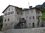
Parish church St. Vigil with flag box ID: 15455 |
46 ° 18 ′ 45 ″ N, 11 ° 13 ′ 26 ″ E |
Apr. 4, 1977 (BLR-LAB 2048) |
church |
KG: Kurtatsch building plot: 24, 25
|
|
Parish dedication with chapel St. Simon and Juda in Graun ID: 15475 |
46 ° 19 ′ 21 ″ N, 11 ° 12 ′ 55 ″ E Fraction: Graun |
Apr. 4, 1977 (BLR-LAB 2048) |
Widum / Canon House |
KG: Kurtatsch building plot: 262, 738
|
| Rain 19-21 ID: 15472 |
Rain 19-21 46 ° 18 ′ 34 ″ N, 11 ° 12 ′ 51 ″ E Fraction: Rain |
Oct 15, 1951 (MD) |
Rural house / farm |
KG: Kurtatsch building plot: 205, 206, 207, 208, 210, 211, 214
|
|

|
Black eagle ID: 50111 |
46 ° 18 ′ 48 ″ N, 11 ° 13 ′ 25 ″ E |
Apr. 4, 1977 (BLR-LAB 2048) |
Inn |
KG: Kurtatsch building plot: 31/2
|

|
Season field ID: 15453 |
46 ° 18 ′ 45 ″ N, 11 ° 13 ′ 17 ″ E |
Apr. 4, 1977 (BLR-LAB 2048) |
Raised hide |
KG: Kurtatsch building plot: 21/1, 21/2, 21/3, 21/4
|

|
Strehlburg with chapel and outbuildings ID: 15450 |
46 ° 18 ′ 40 "N, 11 ° 13 ′ 14" E |
Apr. 4, 1977 (BLR-LAB 2048) |
Raised hide |
KG: Kurtatsch building plot: 1, 2
|

|
Tiefenbrunner in Entiklar ID: 15467 |
46 ° 18 ′ 3 ″ N, 11 ° 12 ′ 47 ″ E Fraction: Entiklar |
Dec 28, 1949 (MD) |
Ansitz, possibly the former seat of the Entiklar castle captain; the remains of the castle Entiklar provided along with the raised hide under protective located slightly above to 46 ° 18 '9.6 " N , 11 ° 12' 41.7" O . |
KG: Kurtatsch building parcel: 131, 131/1, 131/2 basic parcel : 1828
|

|
Voldersberg in Penon ID: 15468 |
46 ° 18 ′ 11 ″ N, 11 ° 12 ′ 18 ″ E Fraction: Penon |
Apr. 4, 1977 (BLR-LAB 2048) |
Raised hide |
KG: Kurtatsch building plot: 136/1, 136/2 |
If no coordinates are known for a monument, the cadastral data at the time it was placed under protection are given as a substitute. These are neither official nor necessarily up-to-date.
The addresses taken from the State Monuments Office may be out of date.
| Photo: | Photograph of the monument. Click the photo generates an enlarged view. There are also two symbols: |
| ID | Identifier at the South Tyrolean Monuments Office |
| KG | Cadastral parish |
| MD | Ministerial Decree |
| BLR-LAB | Decision of the state government - state committee decision |
Web links
- Monument browser of the South Tyrolean Monuments Office
Individual evidence
- ↑ Heinz Tiefenbrunner: Entiklar . In: Magdalena Hörmann-Weingartner (ed.), Tiroler Burgenbuch. Volume X: Überetsch and South Tyrolean Unterland . Athesia publishing house, Bozen 2011, ISBN 978-88-8266-780-1 , pp. 309-314.