List of architectural monuments in Ulten
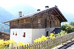
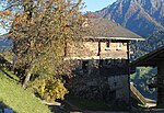
The list of architectural monuments in Ulten ( Italian Ultimo ) contains the 20 objects designated as architectural monuments in the area of the municipality of Ulten in South Tyrol .
The basis is the official directory of the monuments in South Tyrol, which can be viewed on the Internet. These can be, for example, sacred buildings , residential houses, farms and aristocratic residences. The order in this list is based on the designation, alternatively it can also be sorted according to the address or the date on which it was placed under protection.
list
| photo | designation | Location | registration | description | Metadata |
|---|---|---|---|---|---|

|
Wayside shrine at Eggwirt ID: 17754 |
46 ° 32 ′ 58 ″ N, 11 ° 0 ′ 18 ″ E |
Feb. 13, 1984 (BLR-LAB 635) |
Wayside shrine |
KG: Sankt Walburg building plot: 540/1
|
| Breitenberg ID: 17753 |
46 ° 33 ′ 7 ″ N, 10 ° 59 ′ 51 ″ E |
Jan 16, 1969 (MD) |
Rural house / farm |
KG: Sankt Walburg building plot: 252/1, 252/4, 252/5
|
|
| Doppler ID: 17742 |
46 ° 30 ′ 20 "N, 10 ° 54 ′ 55" E |
Feb. 13, 1984 (BLR-LAB 635) |
Rural house / farm |
KG: Sankt Nikolaus building plot: 140/1, 140/3, 141
|
|
| Gasthaus Bad Überwasser ID: 50615 |
46 ° 32 ′ 39 ″ N, 11 ° 0 ′ 21 ″ E |
July 24, 2018 (BLR-LAB 729) |
Inn |
KG: Sankt Walburg building plot: 76
|
|
| Innerdurach ID: 18192 |
46 ° 33 ′ 25 ″ N, 11 ° 0 ′ 12 ″ E |
Sep 2 1996 (BLR-LAB 4112) |
Rural house / farm |
KG: Sankt Walburg building plot: 258
|
|

|
Mitterschwienbach ID: 17739 |
46 ° 30 '46 "N, 10 ° 55' 34" E |
Feb. 13, 1984 (BLR-LAB 635) |
Rural house / farm |
KG: Sankt Nikolaus building plot: 15
|

|
Nieschhof (Pecknhütt) ID: 17748 |
46 ° 32 ′ 57 ″ N, 11 ° 0 ′ 17 ″ E |
Feb. 13, 1984 (BLR-LAB 635) |
Rural house / farm |
KG: Sankt Walburg building plot: 86
|

|
Obernieschen ID: 17749 |
46 ° 32'53 "N, 11 ° 0'8" E |
Feb. 13, 1984 (BLR-LAB 635) |
Rural house / farm |
KG: Sankt Walburg building plot: 90
|

|
Parish church St. Gertraud with cemetery and ossuary in St. Gertraud ID: 17744 |
46 ° 29 ′ 19 ″ N, 10 ° 52 ′ 9 ″ E |
Feb. 13, 1984 (BLR-LAB 635) |
church |
KG: Sankt Nikolaus building plot: 293, 294 Basic plot: 1851
|

|
Parish church of St. Nikolaus with cemetery in St. Nikolaus ID: 17737 |
46 ° 30 ′ 41 ″ N, 10 ° 55 ′ 25 ″ E |
Feb. 13, 1984 (BLR-LAB 635) |
church |
KG: Sankt Nikolaus building plot: 1 basic plot: 1
|

|
Parish church St. Walburg with cemetery chapel and cemetery in St. Walburg ID: 17747 |
46 ° 33 ′ 5 ″ N, 11 ° 0 ′ 27 ″ E |
Feb. 13, 1984 (BLR-LAB 635) |
church |
KG: Sankt Walburg building plot: 410, 57 basic plot: 489
|

|
Parish dedication in St. Gertraud ID: 17745 |
46 ° 29 ′ 18 ″ N, 10 ° 52 ′ 10 ″ E |
Feb. 13, 1984 (BLR-LAB 635) |
Widum / Canon House |
KG: Sankt Nikolaus building plot: 296
|

|
St. Mauritius ID: 17751 |
46 ° 32 ′ 11 "N, 10 ° 56 ′ 56" E |
Feb. 13, 1984 (BLR-LAB 635) |
church |
KG: Sankt Walburg building plot: 238
|
| Thurner ID: 17740 |
46 ° 30 ′ 48 "N, 10 ° 55 ′ 20" E |
Sep 7 1984 (BLR-LAB 4618) |
Rural house / farm |
KG: Sankt Nikolaus building plot: 26
|
|

|
Saucer with house mill ID: 17741 |
46 ° 30 ′ 40 ″ N, 10 ° 55 ′ 19 ″ E |
Feb. 13, 1984 (BLR-LAB 635) |
Rural house / farm |
KG: Sankt Nikolaus building plot: 136/1, 137
|

|
Widum in St. Nicholas ID: 17738 |
46 ° 30 ′ 41 ″ N, 10 ° 55 ′ 24 ″ E |
Feb. 13, 1984 (BLR-LAB 635) |
Widum / Canon House |
KG: Sankt Nikolaus building plot: 3
|

|
Farm building of the Kuppelwieserhof ID: 17750 |
46 ° 31 ′ 48 "N, 10 ° 57 ′ 28" E |
October 30, 1989 (BLR-LAB 6904) |
Barn |
KG: Sankt Walburg building plot: 135/2
|

|
Zeppen ID: 17752 |
46 ° 34 '2 "N, 11 ° 1' 47" E |
Feb. 11, 1991 (BLR-LAB 535) |
Rural house / farm |
KG: Sankt Walburg building plot: 299
|
| To Bach with grain bin ID: 17743 |
46 ° 29 ′ 41 ″ N, 10 ° 51 ′ 46 ″ E |
Feb. 13, 1984 (BLR-LAB 635) |
Rural house / farm |
KG: Sankt Walburg building lot: 267/1, 267/2, 832, 833, 834
|
|
| At courtyard ID: 17746 |
46 ° 31 ′ 36 "N, 10 ° 57 ′ 1" E |
Feb. 13, 1984 (BLR-LAB 635) |
Rural house / farm |
KG: Sankt Nikolaus building plot: 397, 401 |
If no coordinates are known for a monument, the cadastral data at the time it was placed under protection are given as a substitute. These are neither official nor necessarily up-to-date.
The addresses taken from the State Monuments Office may be out of date.
| Photo: | Photograph of the monument. Click the photo generates an enlarged view. There are also two symbols: |
| ID | Identifier at the South Tyrolean Monuments Office |
| KG | Cadastral parish |
| MD | Ministerial Decree |
| BLR-LAB | Decision of the state government - state committee decision |
Web links
- Monument browser of the South Tyrolean Monuments Office