List of architectural monuments in Glurns
The list of architectural monuments in Glurns ( Glorenza in Italian ) contains the 90 objects designated as architectural monuments in the area of the municipality of Glurns in South Tyrol .
The basis is the official directory of the monuments in South Tyrol, which can be viewed on the Internet. These can be, for example, sacred buildings , residential houses, farms and aristocratic residences. The order in this list is based on the designation, alternatively it can also be sorted according to the address or the date on which it was placed under protection.
list
| photo | designation | Location | registration | description | Metadata |
|---|---|---|---|---|---|

|
Trinity Chapel ID: 14912 |
46 ° 40 ′ 16 "N, 10 ° 33 ′ 17" E |
July 27, 1950 (MD) |
chapel |
KG: Glurns building plot: 27
|

|
Former Gasthof Schwarzer Adler ID: 14943 |
46 ° 40 ′ 14 "N, 10 ° 33 ′ 16" E |
December 30, 1988 (BLR-LAB 9007) |
Urban residential building |
KG: Glurns building plot: 90
|

|
Former court house ID: 14953 |
46 ° 40 ′ 14 "N, 10 ° 33 ′ 12" E |
Oct 11, 1971 (MD) |
House with a medieval tower built into it |
KG: Glurns building plot: 107, 108/1, 108/2
|
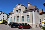
|
Florastrasse 2 ID: 14952 |
Florastrasse 2 46 ° 40 ′ 13 ″ N, 10 ° 33 ′ 12 ″ E |
December 30, 1988 (BLR-LAB 9007) |
Urban residential building |
KG: Glurns building plot: 106
|

|
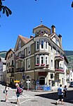
Florastraße 8 ID: 14937 |
Florastrasse 8 46 ° 40 ′ 15 ″ N, 10 ° 33 ′ 14 ″ E |
December 30, 1988 (BLR-LAB 9007) |
Urban residential building |
KG: Glurns building plot: 80
|
|
Florastrasse 15 ID: 14902 |
Florastrasse 15 46 ° 40 ′ 15 ″ N, 10 ° 33 ′ 11 ″ E |
December 30, 1988 (BLR-LAB 9007) |
Urban residential building |
KG: Glurns building plot: 6
|

|
Florastraße 22 ID: 14917 |
Florastrasse 22 46 ° 40 ′ 15 ″ N, 10 ° 33 ′ 17 ″ E |
December 30, 1988 (BLR-LAB 9007) |
Urban residential building |
KG: Glurns building plot: 40/3
|

|
Florastrasse 29 ID: 14915 |
Florastrasse 29 46 ° 40 ′ 16 ″ N, 10 ° 33 ′ 23 ″ E |
December 30, 1988 (BLR-LAB 9007) |
Urban residential building |
KG: Glurns building plot: 37/2
|

|
Frauenkirche ID: 14899 |
46 ° 40 ′ 15 ″ N, 10 ° 33 ′ 13 ″ E |
December 30, 1988 (BLR-LAB 9007) |
church |
KG: Glurns building plot: 1
|
|
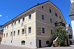
Gasthaus Post ID: 14911 |
Florastrasse 15 46 ° 40 ′ 16 ″ N, 10 ° 33 ′ 16 ″ E |
Oct 11, 1971 (MD) |
Inn |
KG: Glurns building plot: 26/1, 26/2
|

|
Gasthaus Weißes Kreuz ID: 50371 |
46 ° 40 ′ 15 "N, 10 ° 33 ′ 11" E |
Aug 5, 1971 (MD) |
Inn |
KG: Glurns building plot: 7
|

|
Gasthof Grüner Baum ID: 14957 |
Stadtplatz 7 46 ° 40 ′ 14 ″ N, 10 ° 33 ′ 8 ″ E |
December 30, 1988 (BLR-LAB 9007) |
Inn |
KG: Glurns building plot: 115
|

|
Gasthof Krone ID: 14963 |
Town square 46 ° 40 ′ 14 ″ N, 10 ° 33 ′ 9 ″ E |
Oct 11, 1971 (MD) |
Inn |
KG: Glurns building plot: 130/1, 130/2
|

|
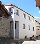
Gasthof Steinbock ID: 14901 |
Florastrasse 9 46 ° 40 ′ 15 ″ N, 10 ° 33 ′ 12 ″ E |
December 30, 1988 (BLR-LAB 9007) |
Inn |
KG: Glurns building plot: 5
|
|
Gerbergasse 1 ID: 14947 |
Gerbergasse 1 46 ° 40 ′ 12 ″ N, 10 ° 33 ′ 15 ″ E |
December 30, 1988 (BLR-LAB 9007) |
Urban residential building |
KG: Glurns building plot: 96, 96/1, 96/2
|

|
Gloria Vallis ID: 14959 |
46 ° 40 ′ 13 ″ N, 10 ° 33 ′ 5 ″ E |
Feb 6, 1971 (MD) |
Castle |
KG: Glurns building plot: 120/1, 120/2
|

|
Graf-Trapp-Gasse 10 ID: 14961 |
Graf-Trapp-Gasse 10 46 ° 40 ′ 15 ″ N, 10 ° 33 ′ 7 ″ E |
Aug 5, 1971 (MD) |
Urban residential building |
KG: Glurns building plot: 127
|

|
Graf-Trapp-Gasse 20 ID: 14960 |
Graf-Trapp-Gasse 20 46 ° 40 ′ 15 ″ N, 10 ° 33 ′ 6 ″ E |
Aug 5, 1971 (MD) |
Urban residential building |
KG: Glurns building plot: 125/1 basic plot: 24, 25
|

|
Graf-Trapp-Gasse 16 ID: 14962 |
Graf-Trapp-Gasse 16 46 ° 40 ′ 14 ″ N, 10 ° 33 ′ 8 ″ E |
December 30, 1988 (BLR-LAB 9007) |
Urban residential building |
KG: Glurns building plot: 129
|
|
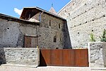
In Winkel 6 ID: 14913 |
At an angle of 6 46 ° 40 ′ 19 ″ N, 10 ° 33 ′ 17 ″ E |
December 30, 1988 (BLR-LAB 9007) |
Urban residential building |
KG: Glurns building plot: 28
|

|
Piston tower ID: 14949 |
46 ° 40 ′ 13 ″ N, 10 ° 33 ′ 14 ″ E |
Oct 11, 1971 (MD) |
Urban residential building |
KG: Glurns building plot: 100/1
|

|
Laubengasse 1 ID: 14938 |
Laubengasse 1 46 ° 40 ′ 14 ″ N, 10 ° 33 ′ 14 ″ E |
December 30, 1988 (BLR-LAB 9007) |
Urban residential building |
KG: Glurns building plot: 81/1, 81/2
|

|
Laubengasse 3 ID: 14936 |
Laubengasse 3 46 ° 40 ′ 14 ″ N, 10 ° 33 ′ 14 ″ E |
December 30, 1988 (BLR-LAB 9007) |
Urban residential building |
KG: Glurns building plot: 78/1, 78/2, 78/3
|

|
Laubengasse 4 ID: 14951 |
Laubengasse 4 46 ° 40 ′ 13 ″ N, 10 ° 33 ′ 13 ″ E |
December 30, 1988 (BLR-LAB 9007) |
Urban residential building |
KG: Glurns building plot: 104/1, 104/2
|

|
Laubengasse 5 ID: 14935 |
Laubengasse 5 46 ° 40 ′ 14 ″ N, 10 ° 33 ′ 15 ″ E |
December 30, 1988 (BLR-LAB 9007) |
Urban residential building |
KG: Glurns building plot: 77
|

|
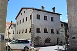
Laubengasse 7 ID: 14934 |
Laubengasse 7 46 ° 40 ′ 14 ″ N, 10 ° 33 ′ 16 ″ E |
December 30, 1988 (BLR-LAB 9007) |
Urban residential building |
KG: Glurns building plot: 76/1, 76/2, 76/3
|
|
Laubengasse 8 ID: 14939 |
Laubengasse 8 46 ° 40 ′ 14 ″ N, 10 ° 33 ′ 13 ″ E |
December 30, 1988 (BLR-LAB 9007) |
Urban residential building |
KG: Glurns building plot: 83
|

|
Laubengasse 9 ID: 14933 |
Laubengasse 9 46 ° 40 ′ 14 ″ N, 10 ° 33 ′ 16 ″ E |
December 30, 1988 (BLR-LAB 9007) |
Urban residential building |
KG: Glurns building plot: 75
|

|
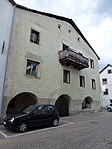
Laubengasse 10 ID: 14986 |
Laubengasse 10 46 ° 40 ′ 14 ″ N, 10 ° 33 ′ 13 ″ E |
Oct 11, 1971 (MD) |
Urban residential building |
KG: Glurns building plot: 84
|
|
Laubengasse 11 ID: 14932 |
Laubengasse 11 46 ° 40 ′ 14 ″ N, 10 ° 33 ′ 17 ″ E |
December 30, 1988 (BLR-LAB 9007) |
Urban residential building |
KG: Glurns building plot: 74
|

|
Laubengasse 12 ID: 14940 |
Laubengasse 12 46 ° 40 ′ 14 ″ N, 10 ° 33 ′ 14 ″ E |
December 30, 1988 (BLR-LAB 9007) |
Urban residential building |
KG: Glurns building plot: 85
|

|
Laubengasse 13 ID: 14918 |
Laubengasse 13 46 ° 40 ′ 15 ″ N, 10 ° 33 ′ 17 ″ E |
December 30, 1988 (BLR-LAB 9007) |
Urban residential building |
KG: Glurns building plot: 41
|

|
Laubengasse 14 A ID: 14987 |
Laubengasse 14 A 46 ° 40 ′ 14 ″ N, 10 ° 33 ′ 14 ″ E |
Oct 11, 1971 (MD) |
Urban residential building |
KG: Glurns building plot: 86/1, 86/2
|

|
Laubengasse 18 ID: 14941 |
Laubengasse 18 46 ° 40 ′ 14 ″ N, 10 ° 33 ′ 15 ″ E |
December 30, 1988 (BLR-LAB 9007) |
Urban residential building |
KG: Glurns building plot: 87/1
|

|
Laubengasse 19 ID: 14919 |
Laubengasse 19 46 ° 40 ′ 14 ″ N, 10 ° 33 ′ 18 ″ E |
December 30, 1988 (BLR-LAB 9007) |
Urban residential building |
KG: Glurns building plot: 44
|

|
Laubengasse 21 ID: 14920 |
Laubengasse 21 46 ° 40 ′ 14 ″ N, 10 ° 33 ′ 19 ″ E |
December 30, 1988 (BLR-LAB 9007) |
Urban residential building |
KG: Glurns building plot: 45/1
|
|
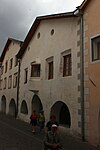
Laubengasse 22 ID: 14942 |
Laubengasse 22 46 ° 40 ′ 14 ″ N, 10 ° 33 ′ 15 ″ E |
December 30, 1988 (BLR-LAB 9007) |
Urban residential building |
KG: Glurns building plot: 88
|

|
Laubengasse 23 ID: 14921 |
Laubengasse 23 46 ° 40 ′ 14 ″ N, 10 ° 33 ′ 19 ″ E |
December 30, 1988 (BLR-LAB 9007) |
Urban residential building |
KG: Glurns building plot: 46
|

|
Laubengasse 25 ID: 14922 |
Laubengasse 25 46 ° 40 ′ 14 ″ N, 10 ° 33 ′ 20 ″ E |
December 30, 1988 (BLR-LAB 9007) |
Urban residential building |
KG: Glurns building plot: 47
|

|
Laubengasse 26 ID: 14944 |
Laubengasse 26 46 ° 40 ′ 14 ″ N, 10 ° 33 ′ 16 ″ E |
December 30, 1988 (BLR-LAB 9007) |
Urban residential building |
KG: Glurns building plot: 91
|

|
Laubengasse 30 ID: 14945 |
Laubengasse 30 46 ° 40 ′ 14 ″ N, 10 ° 33 ′ 17 ″ E |
December 30, 1988 (BLR-LAB 9007) |
Urban residential building |
KG: Glurns building plot: 92
|
|
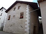
Laubengasse 34 ID: 14931 |
Laubengasse 34 46 ° 40 ′ 14 ″ N, 10 ° 33 ′ 19 ″ E |
December 30, 1988 (BLR-LAB 9007) |
Urban residential building |
KG: Glurns building plot: 72
|
|
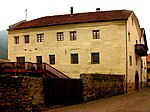
Laubengasse 36 ID: 14925 |
Laubengasse 36 46 ° 40 ′ 14 ″ N, 10 ° 33 ′ 19 ″ E |
December 30, 1988 (BLR-LAB 9007) |
Urban residential building |
KG: Glurns building plot: 54
|

|
Malser Strasse 3 ID: 14967 |
Malser Strasse 3 46 ° 40 ′ 15 ″ N, 10 ° 33 ′ 10 ″ E |
Dec 27, 2009 (RIP 36.11-730168) |
Urban residential building |
KG: Glurns building plot: 135
|

|
Malser Strasse 4 ID: 14903 |
Malser Strasse 4 46 ° 40 ′ 16 ″ N, 10 ° 33 ′ 11 ″ E |
Aug 5, 1971 (MD) |
Urban residential building |
KG: Glurns building plot: 9
|

|
Malser Strasse 5 ID: 14966 |
Malser Strasse 5 46 ° 40 ′ 16 ″ N, 10 ° 33 ′ 10 ″ E |
Dec 27, 2009 (RIP 36.11-730168) |
Urban residential building |
KG: Glurns building plot: 134/1
|
|
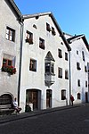
Malser Strasse 6 ID: 14904 |
Malser Strasse 6 46 ° 40 ′ 16 ″ N, 10 ° 33 ′ 11 ″ E |
Aug 5, 1971 (MD) |
Urban residential building |
KG: Glurns building plot: 10
|

|
Malser Strasse 7 ID: 14969 |
Malser Strasse 7 46 ° 40 ′ 16 ″ N, 10 ° 33 ′ 9 ″ E |
Aug 5, 1971 (MD) |
Urban residential building |
KG: Glurns building plot: 137/1
|

|
Malser Strasse 8 ID: 14905 |
Malser Strasse 8 46 ° 40 ′ 16 ″ N, 10 ° 33 ′ 11 ″ E |
December 30, 1988 (BLR-LAB 9007) |
Urban residential building |
KG: Glurns building plot: 11
|

|
Malser Strasse 9 ID: 14968 |
Malser Strasse 9 46 ° 40 ′ 16 ″ N, 10 ° 33 ′ 10 ″ E |
Aug 5, 1971 (MD) |
Urban residential building |
KG: Glurns building plot: 136
|

|
Malser Strasse 10 ID: 14906 |
Malser Strasse 10 46 ° 40 ′ 17 ″ N, 10 ° 33 ′ 11 ″ E |
December 30, 1988 (BLR-LAB 9007) |
Urban residential building |
KG: Glurns building plot: 12
|

|
Malser Strasse 11 ID: 14970 |
Malser Strasse 11 46 ° 40 ′ 17 ″ N, 10 ° 33 ′ 10 ″ E |
December 30, 1988 (BLR-LAB 9007) |
Urban residential building |
KG: Glurns building plot: 138
|

|
Malser Strasse 12 ID: 14907 |
Malser Strasse 12 46 ° 40 ′ 17 ″ N, 10 ° 33 ′ 11 ″ E |
December 30, 1988 (BLR-LAB 9007) |
Urban residential building |
KG: Glurns building plot: 13
|

|
Malser Strasse 13 ID: 14971 |
Malser Strasse 13 46 ° 40 ′ 17 ″ N, 10 ° 33 ′ 10 ″ E |
December 30, 1988 (BLR-LAB 9007) |
Urban residential building |
KG: Glurns building plot: 139
|

|
Malser Strasse 15 ID: 14972 |
Malser Strasse 15 46 ° 40 ′ 17 ″ N, 10 ° 33 ′ 11 ″ E |
Aug 5, 1971 (MD) |
Urban residential building |
KG: Glurns building plot: 140, 423
|

|
Malser Strasse 16 ID: 14909 |
Malser Strasse 16 46 ° 40 ′ 18 ″ N, 10 ° 33 ′ 13 ″ E |
December 30, 1988 (BLR-LAB 9007) |
|
KG: Glurns building plot: 15
|
| Malsertorgasse ID: 50370 |
46 ° 40 ′ 15 "N, 10 ° 33 ′ 11" E |
Aug 5, 1971 (MD) |
Barn |
KG: Glurns building plot: 8
|
|
|
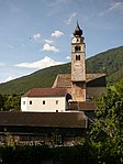
Parish church of St. Pankraz with cemetery ID: 14979 |
46 ° 40 ′ 10 ″ N, 10 ° 33 ′ 8 ″ E |
December 30, 1988 (BLR-LAB 9007) |
church |
KG: Glurns building plot: 170 basic plots: 883, 884
|
|
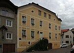
Parish Deed ID: 14900 |
46 ° 40 ′ 16 ″ N, 10 ° 33 ′ 12 ″ E |
December 30, 1988 (BLR-LAB 9007) |
Widum / Canon House |
KG: Glurns building plot: 2
|

|
Town Hall ID: 14916 |
Rathausplatz 1 46 ° 40 ′ 16 ″ N, 10 ° 33 ′ 18 ″ E |
December 30, 1988 (BLR-LAB 9007) |
Administrative building |
KG: Glurns building plot: 39/1, 39/2
|

|
Schlandersberg ID: 14908 |
Malser Strasse 14 46 ° 40 ′ 17 ″ N, 10 ° 33 ′ 12 ″ E |
December 30, 1988 (BLR-LAB 9007) |
Urban residential building |
KG: Glurns building plot: 14/1, 14/2
|

|
Silbergasse 1 ID: 14977 |
Silbergasse 1 46 ° 40 ′ 15 ″ N, 10 ° 33 ′ 9 ″ E |
Oct 11, 1971 (MD) |
Urban residential building |
KG: Glurns building plot: 154
|

|
Silbergasse 4 ID: 18054 |
Silbergasse 4 46 ° 40 ′ 17 ″ N, 10 ° 33 ′ 9 ″ E |
Aug 5, 1971 (MD) |
Urban residential building |
KG: Glurns building plot: 137/2
|

|
Silbergasse 7-9 ID: 14976 |
Silbergasse 7-9 46 ° 40 ′ 16 ″ N, 10 ° 33 ′ 8 ″ E |
December 30, 1988 (BLR-LAB 9007) |
Urban residential building |
KG: Glurns building plot: 151/1, 151/2
|

|
Silbergasse 8 ID: 14974 |
Silbergasse 8 46 ° 40 ′ 18 ″ N, 10 ° 33 ′ 9 ″ E |
December 30, 1988 (BLR-LAB 9007) |
Urban residential building |
KG: Glurns building plot: 143
|

|
Silbergasse 29 ID: 14975 |
Silbergasse 29 46 ° 40 ′ 18 ″ N, 10 ° 33 ′ 8 ″ E |
December 30, 1988 (BLR-LAB 9007) |
Urban residential building |
KG: Glurns building plot: 144/1, 144/2, 144/3, 144/4
|

|
Sparrow tower with courtyard ID: 14958 |
46 ° 40 ′ 14 "N, 10 ° 33 ′ 6" E |
Feb 6, 1971 (MD) |
Urban residential building |
KG: Glurns building plot: 117, 119 basic plot: 23
|

|
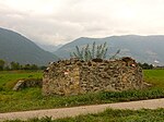
St. Jakob with the former cemetery at Söleshof ID: 14984 |
46 ° 39 ′ 33 "N, 10 ° 33 ′ 28" E |
December 30, 1988 (BLR-LAB 9007) |
graveyard |
KG: Glurns building parcel: 172 Basic parcel: 1265, 1267/1, 1267/2
|
|
St. Laurentius ID: 14983 |
46 ° 40 ′ 34 "N, 10 ° 33 ′ 16" E |
December 30, 1988 (BLR-LAB 9007) |
Church ruin |
KG: Glurns land parcel: 436/3
|

|
St. Martin with enclosure ID: 14980 |
46 ° 39 ′ 41 ″ N, 10 ° 32 ′ 45 ″ E |
December 30, 1988 (BLR-LAB 9007) |
church |
KG: Glurns building plot: 71/1, 171/2
|

|
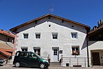
St. Johannes Nepomuk at the cemetery ID: 14978 |
46 ° 40 ′ 10 ″ N, 10 ° 33 ′ 9 ″ E |
December 30, 1988 (BLR-LAB 9007) |
chapel |
KG: Glurns building plot: 169
|
|
St.-Pankratius-Gasse 3 ID: 14950 |
St.-Pankratius-Gasse 3 46 ° 40 ′ 13 ″ N, 10 ° 33 ′ 13 ″ E |
December 30, 1988 (BLR-LAB 9007) |
Urban residential building |
KG: Glurns building plot: 103
|

|
St.-Pankratius-Gasse 6 ID: 14948 |
St.-Pankratius-Gasse 6 46 ° 40 ′ 12 ″ N, 10 ° 33 ′ 14 ″ E |
December 30, 1988 (BLR-LAB 9007) |
Urban residential building |
KG: Glurns building plot: 97
|

|
St.-Pankratius-Gasse 12 ID: 14929 |
St.-Pankratius-Gasse 12 46 ° 40 ′ 13 ″ N, 10 ° 33 ′ 18 ″ E |
December 30, 1988 (BLR-LAB 9007) |
Urban residential building |
KG: Glurns building plot: 67/1
|

|
St.-Pankratius-Gasse 15-17 ID: 14946 |
St.-Pankratius-Gasse 15-17 46 ° 40 ′ 13 ″ N, 10 ° 33 ′ 17 ″ E |
December 30, 1988 (BLR-LAB 9007) |
Urban residential building |
KG: Glurns building plot: 94
|

|
St.-Pankratius-Gasse 18 ID: 14928 |
St.-Pankratius-Gasse 18 46 ° 40 ′ 12 ″ N, 10 ° 33 ′ 19 ″ E |
December 30, 1988 (BLR-LAB 9007) |
Urban residential building |
KG: Glurns building plot: 66
|

|
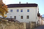
St.-Pankratius-Gasse 20 ID: 14927 |
St.-Pankratius-Gasse 20 46 ° 40 ′ 12 ″ N, 10 ° 33 ′ 21 ″ E |
December 30, 1988 (BLR-LAB 9007) |
Urban residential building |
KG: Glurns building plot: 59
|
|
St.-Pankratius-Gasse 29 ID: 14926 |
St.-Pankratius-Gasse 29 46 ° 40 ′ 14 ″ N, 10 ° 33 ′ 20 ″ E |
December 30, 1988 (BLR-LAB 9007) |
Urban residential building |
KG: Glurns building parcel: 57/1, 57/2 Basic parcel : 21/1, 21/2
|

|
St.-Pankratius-Gasse 31 ID: 14923 |
St.-Pankratius-Gasse 31 46 ° 40 ′ 14 ″ N, 10 ° 33 ′ 21 ″ E |
December 30, 1988 (BLR-LAB 9007) |
Urban residential building |
KG: Glurns building plot: 48/2
|

|
St.-Pankratius-Gasse 33 ID: 14924 |
St.-Pankratius-Gasse 33 46 ° 40 ′ 15 ″ N, 10 ° 33 ′ 22 ″ E |
December 30, 1988 (BLR-LAB 9007) |
Urban residential building |
KG: Glurns building plot: 49/1
|

|
City wall, city gates and roundabouts ID: 14982 |
46 ° 40 ′ 18 ″ N, 10 ° 33 ′ 11 ″ E |
December 30, 1988 (BLR-LAB 9007) |
Fortifications |
KG: Glurns building plot: 111, 113, 118, 122, 123, 142, 148, 149, 16, 29, 30, 31, 32, 33, 63, 64, 65, 98, 99/1
|

|
Town mill ID: 14930 |
St.-Pankratius-Gasse 8 46 ° 40 ′ 13 ″ N, 10 ° 33 ′ 16 ″ E |
Dec 27, 2009 (RIP 36.11-730168) |
Mill |
KG: Glurns building parcel: 182, 69/1, 69/2, 70 basic parcel : 22
|

|
Stadtplatz 1 ID: 14954 |
Stadtplatz 1 46 ° 40 ′ 13 ″ N, 10 ° 33 ′ 10 ″ E |
December 30, 1988 (BLR-LAB 9007) |
Urban residential building |
KG: Glurns building plot: 109
|

|
Stadtplatz 3 ID: 14955 |
Stadtplatz 3 46 ° 40 ′ 13 ″ N, 10 ° 33 ′ 9 ″ E |
December 30, 1988 (BLR-LAB 9007) |
Urban residential building |
KG: Glurns building plot: 112
|

|
Stadtplatz 5 ID: 14956 |
Stadtplatz 5 46 ° 40 ′ 13 ″ N, 10 ° 33 ′ 9 ″ E |
December 30, 1988 (BLR-LAB 9007) |
|
KG: Glurns building plot: 114
|

|
Stadtplatz 11 ID: 14964 |
Stadtplatz 11 46 ° 40 ′ 15 ″ N, 10 ° 33 ′ 9 ″ E |
July 27, 1950 (MD) |
Urban residential building |
KG: Glurns building plot: 131
|

|
Stadtplatz 13 ID: 14965 |
Stadtplatz 13 46 ° 40 ′ 15 ″ N, 10 ° 33 ′ 10 ″ E |
July 27, 1950 (MD) |
Urban residential building |
KG: Glurns building plot: 132
|

|
Gate keeper's house at Schludernser Tor ID: 14914 |
46 ° 40 ′ 16 ″ N, 10 ° 33 ′ 23 ″ E |
December 30, 1988 (BLR-LAB 9007) |
Fortifications |
KG: Glurns building plot: 36
|

|
Gate keeper's house , Malser Straße 26 ID: 14973 |
Malser Strasse 26 46 ° 40 ′ 18 ″ N, 10 ° 33 ′ 11 ″ E |
14 Mar 2011 (BLR-LAB 380) |
Fortifications |
KG: Glurns building plot: 141
|

|
Widumplatz 13 ID: 14910 |
Widumplatz 13 46 ° 40 ′ 16 ″ N, 10 ° 33 ′ 13 ″ E |
December 30, 1988 (BLR-LAB 9007) |
Urban residential building |
KG: Glurns building plot: 23 |
If no coordinates are known for a monument, the cadastral data at the time it was placed under protection are given as a substitute. These are neither official nor necessarily up-to-date.
The addresses taken from the State Monuments Office may be out of date.
| Photo: | Photograph of the monument. Click the photo generates an enlarged view. There are also two symbols: |
| ID | Identifier at the South Tyrolean Monuments Office |
| KG | Cadastral parish |
| MD | Ministerial Decree |
| BLR-LAB | Decision of the state government - state committee decision |
Web links
- Monument browser of the South Tyrolean Monuments Office
Individual evidence
- ^ Oswald Trapp : Tiroler Burgenbuch. Volume I: Vinschgau . Verlagsanstalt Athesia, Bozen 1972, pp. 71-74.