List of architectural monuments in Terlano
The list of architectural monuments in Terlano ( Terlano in Italian ) contains the 32 objects designated as architectural monuments in the area of the municipality of Terlan in South Tyrol .
The basis is the official directory of the monuments in South Tyrol, which can be viewed on the Internet. These can be, for example, sacred buildings , residential houses, farms and aristocratic residences. The order in this list is based on the designation, alternatively it can also be sorted according to the address or the date on which it was placed under protection.
list
| photo | designation | Location | registration | description | Metadata |
|---|---|---|---|---|---|

|
Old parish church St. Josef in Vilpian ID: 17550 |
46 ° 33 ′ 33 ″ N, 11 ° 13 ′ 25 ″ E |
Apr. 27, 1979 (BLR-LAB 2708) |
church |
KG: Terlan building plot: 149
|
|
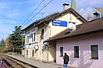
Terlan-Andrian Railway Station ID: 50398 |
46 ° 31 '43 "N, 11 ° 14' 55" E |
April 5, 2004 (BLR-LAB 1083) |
Train station / Remise |
KG: Terlan building plot: 322
|

|
Vilpian-Nals train station ID: 50399 |
46 ° 33 ′ 15 ″ N, 11 ° 13 ′ 13 ″ E |
April 5, 2004 (BLR-LAB 1083) |
Train station / Remise |
KG: Terlan building plot: 323
|

|
Benefit house ID: 17524 |
Kirchgasse 22 46 ° 31 ′ 50 ″ N, 11 ° 14 ′ 59 ″ E |
Apr. 27, 1979 (BLR-LAB 2708) |
Rural house / farm |
KG: Terlan building plot: 24 basic plot: 14/1
|

|
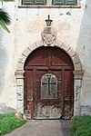
Date in Siebeneich ID: 17547 |
46 ° 30 ′ 56 ″ N, 11 ° 16 ′ 16 ″ E |
Apr. 27, 1979 (BLR-LAB 2708) |
Rural house / farm
1490 owned by the Niedertor, in 1760 belonging to the Maria Waldrast monastery . |
KG: Terlan building plot: 293
|
|
Deutschhaus with Antonius Chapel in Siebeneich ID: 17546 |
46 ° 30 ′ 43 "N, 11 ° 16 ′ 34" E |
July 27, 1950 (MD) |
Rural house / farm
In 1234, Bishop Heinrich von Brixen gave the court to the hospital of the Teutonic Order in Bozen. |
KG: Terlan building plot: 272, 273, 274
|

|
Durcher in Kreut ID: 17540 |
46 ° 32 '22 "N, 11 ° 14' 45" E |
Apr. 27, 1979 (BLR-LAB 2708) |
Rural house / farm |
KG: Terlan building plot: 104/1
|

|
Gasthof Engl in Unterkreut ID: 17537 |
46 ° 32 ′ 14 "N, 11 ° 14 ′ 29" E |
Apr. 27, 1979 (BLR-LAB 2708) |
Inn |
KG: Terlan building plot: 77
|

|
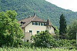
Großkarnell in Siebeneich ID: 17545 |
46 ° 30 ′ 35 "N, 11 ° 16 ′ 57" E |
Apr. 27, 1979 (BLR-LAB 2708) |
Rural house / farm
Mentioned in 1288, owned by Josef Bernardin von Wolkenstain in 1750 |
KG: Terlan building plot: 256, 257
|
|
Gschnofer with the Three Kings Chapel ID: 17538 |
46 ° 32 ′ 20 "N, 11 ° 14 ′ 55" E |
Apr. 27, 1979 (BLR-LAB 2708) |
Rural house / farm |
KG: Terlan building plot: 97, 98
|

|
Haller in Klaus ID: 17533 |
46 ° 31 ′ 21 ″ N, 11 ° 15 ′ 21 ″ E |
July 27, 1950 (MD) |
Rural house / farm
Mentioned in 1440 as Haller in the Clausen zu Törlan |
KG: Terlan building plot: 319
|

|
Haller in Kreut ID: 17543 |
46 ° 32 '22 "N, 11 ° 14' 43" E |
Sep 14 1949 (MD) |
Rural house / farm
1750 Hallerhof in Kreit, in 1598 Abraham Hafner Richter in Neuhaus stands above a room door |
KG: Terlan building plot: 113
|
|
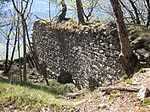
Helfenburg ID: 17549 |
46 ° 31 ′ 19 ″ N, 11 ° 16 ′ 31 ″ E |
Apr. 27, 1979 (BLR-LAB 2708) |
Castle ruins |
KG: Terlan land parcel: 1755
|
|
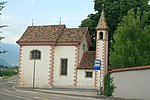
Church of the Immaculate Conception in Unterkreut (Gratlkirche) ID: 17536 |
46 ° 32 ′ 13 ″ N, 11 ° 14 ′ 30 ″ E |
July 27, 1950 (MD) |
church |
KG: Terlan building plot: 73
|

|
Klause under Neuhaus ID: 17534 |
46 ° 31 ′ 25 ″ N, 11 ° 15 ′ 16 ″ E |
Apr. 27, 1979 (BLR-LAB 2708) |
Castle ruins |
KG: Terlan basic parcel: 104/1
|

|
Köstenholz with Park ID: 17526 |
46 ° 32 ′ 2 ″ N, 11 ° 15 ′ 17 ″ E |
Apr. 27, 1979 (BLR-LAB 2708) |
Raised hide |
KG: Terlan building plot: 46 basic plot: 110
|

|
Way of the Cross in Kreut ID: 17539 |
46 ° 32 '21 "N, 11 ° 14' 46" E |
Apr. 27, 1979 (BLR-LAB 2708) |
Rural house / farm |
KG: Terlan building plot: 102/1, 102/2, 102/3
|

|
Lechenegg ID: 17528 |
46 ° 32 ′ 5 ″ N, 11 ° 15 ′ 9 ″ E |
Apr. 27, 1979 (BLR-LAB 2708) |
Raised hide |
KG: Terlan building plot: 50
|
|
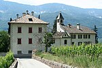
Liebeneich with St. Johannes Nepomuk Chapel ID: 17530 |
46 ° 32 ′ 9 ″ N, 11 ° 15 ′ 11 ″ E |
Apr. 27, 1979 (BLR-LAB 2708) |
Raised hide |
KG: Terlan building plot: 196, 197
|

|
Lindeplatt in Kreut ID: 17541 |
46 ° 32 '23 "N, 11 ° 14' 49" E |
July 27, 1950 (MD) |
Rural house / farm |
KG: Terlan building plot: 108
|
|
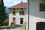
Linsl ID: 17529 |
46 ° 32 ′ 16 ″ N, 11 ° 15 ′ 20 ″ E |
Apr. 27, 1979 (BLR-LAB 2708) |
Rural house / farm |
KG: Terlan building plot: 187, 188
|
|
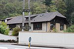
Marstallstadel ID: 17525 |
46 ° 31 ′ 42 "N, 11 ° 15 ′ 12" E |
Apr. 27, 1979 (BLR-LAB 2708) |
Barn |
KG: Terlan building plot: 34
|

|
Meitinger ID: 17527 |
46 ° 32 ′ 5 ″ N, 11 ° 15 ′ 20 ″ E |
Apr. 27, 1979 (BLR-LAB 2708) |
Rural house / farm |
KG: Terlan building plot: 48
|

|
Neuhaus ID: 17531 |
46 ° 31 ′ 31 ″ N, 11 ° 15 ′ 17 ″ E |
Apr. 27, 1979 (BLR-LAB 2708) |
Castle ruins |
KG: Terlan basic parcel: 94
|
|
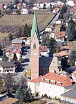
Parish Church of the Assumption of Mary with tower, cemetery chapel and cemetery ID: 17523 |
46 ° 31 '47 "N, 11 ° 14' 55" E |
Apr. 27, 1979 (BLR-LAB 2708) |
church |
KG: Terlan building plot: 1, 2/1, 2/2, 3 basic plot: 1
|

|
Parish Church of the Sacred Heart of Jesus in Siebeneich ID: 17548 |
46 ° 30 ′ 38 "N, 11 ° 16 ′ 31" E |
Apr. 27, 1979 (BLR-LAB 2708) |
church |
KG: Terlan building plot: 408
|

|
Pfarrwidum ID: 18088 |
Kirchgasse 1 46 ° 31 ′ 49 ″ N, 11 ° 14 ′ 58 ″ E |
Apr. 27, 1979 (BLR-LAB 2708) |
Widum |
KG: Terlan building plot: 14
|

|
Ries on Montigl ID: 50580 |
46 ° 31 ′ 28 ″ N, 11 ° 16 ′ 11 ″ E |
June 3, 2014 (BLR-LAB 645) |
late Gothic building |
KG: Terlan building plot: 227
|

|
St. Margareth in Klaus ID: 17535 |
46 ° 31 ′ 11 "N, 11 ° 15 ′ 55" E |
Apr. 27, 1979 (BLR-LAB 2708) |
Church ruin |
KG: Terlan land parcel: 2277
|

|
St. Peter ID: 17532 |
46 ° 32 ′ 19 "N, 11 ° 15 ′ 26" E |
Apr. 27, 1979 (BLR-LAB 2708) |
Church ruin |
KG: Terlan basic parcel: 1535/1
|

|
Steiner in Siebeneich ID: 17544 |
46 ° 30 ′ 40 "N, 11 ° 16 ′ 50" E |
Apr. 27, 1979 (BLR-LAB 2708) |
Rural house / farm |
KG: Terlan building plot: 251, 252
|

|
Tower of Kreut ID: 17542 |
46 ° 32 ′ 23 "N, 11 ° 14 ′ 47" E |
July 27, 1950 (MD) |
medieval residential tower |
KG: Terlan building plot: 109 |
If no coordinates are known for a monument, the cadastral data at the time it was placed under protection are given as a substitute. These are neither official nor necessarily up-to-date.
The addresses taken from the State Monuments Office may be out of date.
| Photo: | Photograph of the monument. Click the photo generates an enlarged view. There are also two symbols: |
| ID | Identifier at the South Tyrolean Monuments Office |
| KG | Cadastral parish |
| MD | Ministerial Decree |
| BLR-LAB | Decision of the state government - state committee decision |
literature
- Karl Atz : Chronicle of Terlan , Bozen 1901 ( digital copy online from Teßmann )
- Josef Tarneller : The court names in the Burggrafenamt and in the neighboring communities: Meraner area, Schnals, Passeier, Tschögglberg, Sarntal, Neuhaus court, Maienburg court, German area on the Nons, Ulten and Martell ( Archive for Austrian History 100). Vienna: Hölder 1909. ( digitized online from Teßmann )
Web links
- Monument browser of the South Tyrolean Monuments Office
Individual evidence
- ↑ Tarneller 2585
- ↑ Tarneller 2579
- ↑ Tarneller 2574
- ↑ Tarneller 2599
- ↑ Tarneller 2670
- ^ Matthias Schmelzer: Helfenberg . In: Oswald Trapp (ed.), Tiroler Burgenbuch. Volume VIII: Bolzano area . Athesia publishing house, Bozen 1989, ISBN 978-88-7014-495-6 , pp. 303-310.