List of architectural monuments in Laces
The list of architectural monuments in Latsch ( Italian Laces ) contains the 47 objects designated as architectural monuments in the area of the municipality of Latsch in South Tyrol .
The basis is the official directory of the monuments in South Tyrol, which can be viewed on the Internet. These can be, for example, sacred buildings , residential houses, farms and aristocratic residences. The order in this list is based on the designation, alternatively it can also be sorted according to the address or the date on which it was placed under protection.
list
| photo | designation | Location | registration | description | Metadata |
|---|---|---|---|---|---|
|
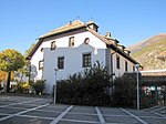
Old Widum ID: 15659 |
46 ° 37 ′ 3 "N, 10 ° 51 ′ 34" E |
April 28, 1980 (BLR-LAB 2594) |
Widum / Canon House |
KG: Latsch building plot: 66/1
|

|
Angerer ID: 15680 |
46 ° 36 ′ 24 ″ N, 10 ° 52 ′ 31 ″ E Fraction: Tarsch |
Feb. 6, 1981 (BLR-LAB 613) |
Rural house / farm |
KG: Tarsch building plot: 124
|

|
Annenberg ID: 15671 |
46 ° 37 ′ 49 ″ N, 10 ° 50 ′ 21 ″ E Fraction: Sankt Martin am Vorberg |
May 8, 1950 (MD) |
Castle |
KG: Sankt Martin am Vorberg Building plot: 49, 51
|
|
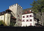
Latsch Castle with side wings ID: 15660 |
Bahnhofstrasse 14 46 ° 37 ′ 5 ″ N, 10 ° 51 ′ 35 ″ E |
Oct 7, 1965 (MD) |
Castle |
KG: Latsch building plot: 68, 69, 71/1, 71/2, 72/1, 72/2, 72/3
|

|
Fricken ID: 15652 |
46 ° 36 ′ 21 ″ N, 10 ° 49 ′ 14 ″ E Fraction: Morter |
Feb. 6, 1981 (BLR-LAB 613) |
Rural house / farm |
KG: Morter building plot: 98/4
|

|
Gaßmair ID: 15650 |
46 ° 36 ′ 27 "N, 10 ° 49 ′ 23" E Fraction: Morter |
Feb. 6, 1981 (BLR-LAB 613) |
Rural house / farm |
KG: Morter building plot: 67
|

|
Gasthaus Roter Adler ID: 18176 |
Hauptstrasse 40-45 46 ° 37 ′ 4 ″ N, 10 ° 51 ′ 36 ″ E |
25th Mar 1996 (BLR-LAB 1200) |
Inn |
KG: Latsch building plot: 65
|

|
Gasthof zum Giant ID: 15676 |
46 ° 36 ′ 28 ″ N, 10 ° 52 ′ 42 ″ E Fraction: Tarsch |
Feb. 6, 1981 (BLR-LAB 613) |
Inn |
KG: Tarsch building plot: 59
|

|
Count house ID: 15661 |
46 ° 37 ′ 5 ″ N, 10 ° 51 ′ 31 ″ E |
July 8, 1996 (BLR-LAB 3146) |
Raised hide |
KG: Latsch building plot: 73
|

|
Herrengasse 8 ID: 15658 |
Herrengasse 8 46 ° 36 ′ 57 ″ N, 10 ° 51 ′ 36 ″ E |
Feb. 6, 1981 (BLR-LAB 613) |
Egger-Rudl
Rural house / farm |
KG: Latsch building plot: 49
|
|
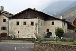
Hofgasse 12 ID: 15666 |
Hofgasse 12 46 ° 37 ′ 0 ″ N, 10 ° 51 ′ 24 ″ E |
Feb. 6, 1981 (BLR-LAB 613) |
Oberhof
Rural house / farm |
KG: Latsch building plot: 111/1
|

|
Chapel of Our Lady of Sorrows at the bridge ID: 15668 |
46 ° 37 ′ 19 ″ N, 10 ° 52 ′ 4 ″ E |
Feb. 6, 1981 (BLR-LAB 613) |
chapel |
KG: Latsch building plot: 172
|

|
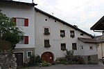
Card ID: 15664 |
46 ° 37 ′ 3 ″ N, 10 ° 51 ′ 28 ″ E |
Feb. 6, 1981 (BLR-LAB 613) |
Rural house / farm |
KG: Latsch building plot: 674, 675
|
|
Knofl ID: 15678 |
46 ° 36 ′ 23 ″ N, 10 ° 52 ′ 38 ″ E Fraction: Tarsch |
Feb. 6, 1981 (BLR-LAB 613) |
Rural house / farm |
KG: Tarsch building plot: 89/1
|

|
Kofl ID: 15642 |
46 ° 37 ′ 25 ″ N, 10 ° 50 ′ 13 ″ E Fraction: Goldrain |
Feb. 6, 1981 (BLR-LAB 613) |
Rural house / farm |
KG: Goldrain building plot: 6
|

|
Kofler ID: 18181 |
46 ° 36 ′ 29 ″ N, 10 ° 52 ′ 43 ″ E Fraction: Tarsch |
November 14, 1994 (BLR-LAB 6736) |
Rural house / farm |
KG: Tarsch building plot: 58/1
|

|
Kugelgasse 3 ID: 15657 |
Kugelgasse 3 46 ° 37 ′ 2 ″ N, 10 ° 51 ′ 42 ″ E |
Feb. 6, 1981 (BLR-LAB 613) |
Walter
Rural house / farm |
KG: Latsch building plot: 35
|

|
Maria-Hilf-Chapel in Tarsch ID: 50433 |
46 ° 36 ′ 45 ″ N, 10 ° 52 ′ 57 ″ E Fraction: Tarsch |
Feb. 27, 2006 (BLR-LAB 645) |
chapel |
KG: Tarsch building plot: 158
|

|
Matill ID: 15665 |
46 ° 37 ′ 0 ″ N, 10 ° 51 ′ 33 ″ E |
Feb. 6, 1981 (BLR-LAB 613) |
Rural house / farm |
KG: Latsch building plot: 99/1
|

|
Mühlrain with St. Anna Chapel ID: 15662 |
46 ° 37 ′ 6 "N, 10 ° 51 ′ 26" E |
May 30, 1968 (MD) |
Raised hide |
KG: Latsch building plot: 383, 79/1, 79/2, 79/3
|

|
Neuhaus ID: 15674 |
46 ° 36 ′ 29 ″ N, 10 ° 52 ′ 41 ″ E Fraction: Tarsch |
Jan 20, 1951 (MD) |
Rural house / farm |
KG: Tarsch building plot: 42
|

|
Obermontani , Untermontani and St. Stephen's Chapel ID: 15653 |
46 ° 36 ′ 3 ″ N, 10 ° 49 ′ 39 ″ E |
Nov 16, 2009 (BLR-LAB 2754) |
two castle ruins and a chapel; the coordinates on the left in the Location column refer to Obermontani; Untermontani is a little north at 46 ° 36 ′ 16.7 ″ N , 10 ° 49 ′ 39.2 ″ E , the St. Stephen's Chapel is a little west at 46 ° 36 ′ 1.1 ″ N , 10 ° 49 ′ 29.7 " O ; |
KG: Morter building plot: 146, 147 basic plot: 987/3, 987/4
|

|
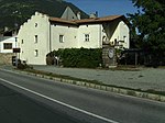
Upper Plattgut ID: 15679 |
46 ° 36 ′ 26 ″ N, 10 ° 52 ′ 36 ″ E Fraction: Tarsch |
Feb. 6, 1981 (BLR-LAB 613) |
Rural house / farm |
KG: Tarsch building plot: 99
|
|
Obermoosburg ID: 15646 |
46 ° 37 ′ 1 ″ N, 10 ° 49 ′ 29 ″ E Fraction: Goldrain |
Feb. 6, 1981 (BLR-LAB 613) |
Raised hide |
KG: Goldrain building plot: 71/1, 71/2
|

|
Parish Church of St. Dionysius with cemetery chapel and cemetery ID: 15651 |
46 ° 36 ′ 17 "N, 10 ° 49 ′ 22" E Fraction: Morter |
Feb. 6, 1981 (BLR-LAB 613) |
church |
KG: Morter building plot: 91, 92 basic plot: 132
|

|
Parish Church of St. Lucius in Tiss ID: 15641 |
46 ° 37 ′ 22 ″ N, 10 ° 50 ′ 18 ″ E Fraction: Goldrain |
Feb. 6, 1981 (BLR-LAB 613) |
church |
KG: Goldrain
|

|
Parish Church of St. Michael with cemetery chapel and cemetery ID: 15672 |
46 ° 36 ′ 28 ″ N, 10 ° 52 ′ 33 ″ E Fraction: Tarsch |
Feb. 6, 1981 (BLR-LAB 613) |
church |
KG: Tarsch building plot: 1 basic plot: 1
|

|
Parish church of St. Peter and Paul with cemetery chapel and cemetery ID: 15654 |
46 ° 37 ′ 5 ″ N, 10 ° 51 ′ 37 ″ E |
Feb. 6, 1981 (BLR-LAB 613) |
church |
KG: Latsch building plot: 6, 7 basic plot: 17
|
| Parish dedication in Sankt Martin am Vorberg ID: 50522 |
46 ° 38 ′ 19 ″ N, 10 ° 51 ′ 20 ″ E Fraction: Sankt Martin am Vorberg |
July 6, 2009 (BLR-LAB 1775) |
Widum / Canon House |
KG: Sankt Martin am Vorberg Building plot: 4
|
|

|
Pfitscher (Pfriemengütl) ID: 15673 |
46 ° 36 ′ 30 ″ N, 10 ° 52 ′ 32 ″ E Fraction: Tarsch |
Feb. 6, 1981 (BLR-LAB 613) |
Residential building |
KG: Tarsch building plot: 9/1
|

|
Pitschen ID: 15648 |
Mühlweg 26 46 ° 36 ′ 26 ″ N, 10 ° 49 ′ 10 ″ E Fraction: Morter |
Feb. 6, 1981 (BLR-LAB 613) |
Residential building |
KG: Morter building plot: 8
|

|
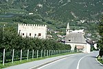
Back fence good ID: 50563 |
46 ° 36 ′ 31 ″ N, 10 ° 52 ′ 42 ″ E Fraction: Tarsch |
Jan. 14, 2013 (BLR-LAB 44) |
Farm with farm buildings, house partly from the 15th century |
KG: Tarsch building plot: 44
|
|
Schanzen with St. Anna Chapel ID: 15645 |
46 ° 37 ′ 2 ″ N, 10 ° 49 ′ 26 ″ E Fraction: Goldrain |
Feb. 6, 1981 (BLR-LAB 613) |
Raised hide |
KG: Goldrain building plot: 69/1, 70
|

|
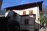
Goldrain Castle ID: 15643 |
46 ° 37 ′ 28 ″ N, 10 ° 49 ′ 47 ″ E Fraction: Goldrain |
Feb. 15, 1985 (BLR-LAB 686) |
Castle |
KG: Goldrain building plot : 12 basic plots: 416/1, 417
|
|
Siglgut ID: 15675 |
46 ° 36 ′ 30 ″ N, 10 ° 52 ′ 46 ″ E Fraction: Tarsch |
Feb. 6, 1981 (BLR-LAB 613) |
Rural house / farm |
KG: Tarsch building plot: 50/1
|

|
Hospital with Holy Spirit Chapel and cemetery ID: 15655 |
46 ° 37 '5 "N, 10 ° 51' 43" E |
Feb. 6, 1981 (BLR-LAB 613) |
hospital |
KG: Latsch building plot: 21, 22 basic plot: 31
|
| St. Anton im Weinberg ID: 15647 |
46 ° 37 ′ 40 ″ N, 10 ° 49 ′ 47 ″ E Fraction: Goldrain |
Feb. 6, 1981 (BLR-LAB 613) |
Church ruin |
KG: Goldrain basic parcel: 197/1
|
|

|
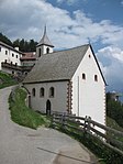
St. Karpophorus ID: 15677 |
46 ° 36 ′ 26 ″ N, 10 ° 52 ′ 47 ″ E Fraction: Tarsch |
Feb. 6, 1981 (BLR-LAB 613) |
church |
KG: Tarsch building plot: 70
|
|
St. Martin ID: 15669 |
46 ° 38 ′ 18 ″ N, 10 ° 51 ′ 19 ″ E |
Feb. 6, 1981 (BLR-LAB 613) |
church |
KG: Sankt Martin am Vorberg Building plot: 1
|

|
St. Medardus ID: 15682 |
46 ° 36 ′ 18 ″ N, 10 ° 53 ′ 28 ″ E Fraction: Tarsch |
Feb. 6, 1981 (BLR-LAB 613) |
church |
KG: Tarsch building plot: 148
|

|
St. Nicholas ID: 15663 |
46 ° 37 ′ 5 ″ N, 10 ° 51 ′ 30 ″ E |
Feb. 6, 1981 (BLR-LAB 613) |
church |
KG: Latsch building plot: 88
|

|
St. Sebastian in Platz ID: 15670 |
46 ° 38 ′ 5 ″ N, 10 ° 53 ′ 10 ″ E Fraction: Sankt Martin am Vorberg |
Feb. 6, 1981 (BLR-LAB 613) |
chapel |
KG: Sankt Martin am Vorberg Building plot: 40
|

|
St. Vigil ID: 15649 |
46 ° 36 ′ 30 ″ N, 10 ° 49 ′ 19 ″ E Fraction: Morter |
Feb. 6, 1981 (BLR-LAB 613) |
church |
KG: Morter building plot: 24
|

|
St. Medardus Court ID: 15681 |
46 ° 36 ′ 19 ″ N, 10 ° 53 ′ 27 ″ E Fraction: Tarsch |
Feb. 6, 1981 (BLR-LAB 613) |
Rural house / farm |
KG: Tarsch building plot: 147
|

|
Our Lady on the Bichl ID: 15656 |
46 ° 37 ′ 5 "N, 10 ° 51 ′ 47" E |
Feb. 6, 1981 (BLR-LAB 613) |
Church, place where the statue menhir from Laces was found |
KG: Latsch building plot: 28
|

|
Untermoosburg ID: 15644 |
46 ° 37 ′ 11 ″ N, 10 ° 49 ′ 34 ″ E Fraction: Goldrain |
Feb. 6, 1981 (BLR-LAB 613) |
Raised hide |
KG: Goldrain building plot: 62/1
|

|
Zafigweg 4 ID: 15667 |
Zafigweg 4 46 ° 36 ′ 58 ″ N, 10 ° 51 ′ 22 ″ E |
Feb. 6, 1981 (BLR-LAB 613) |
Rural house / farm |
KG: Latsch building plot: 115 |
If no coordinates are known for a monument, the cadastral data at the time it was placed under protection are given as a substitute. These are neither official nor necessarily up-to-date.
The addresses taken from the State Monuments Office may be out of date.
| Photo: | Photograph of the monument. Click the photo generates an enlarged view. There are also two symbols: |
| ID | Identifier at the South Tyrolean Monuments Office |
| KG | Cadastral parish |
| MD | Ministerial Decree |
| BLR-LAB | Decision of the state government - state committee decision |
swell
- ↑ a b c The field names of South Tyrol . Naturmuseum Südtirol , Bolzano 2016, ISBN 978-88-87108-07-1
Web links
- Monument browser of the South Tyrolean Monuments Office