List of architectural monuments in Racines
The list of architectural monuments in Ratschings ( Racines in Italian ) contains the 68 objects designated as architectural monuments in the area of the municipality of Racines in South Tyrol .
The basis is the official directory of the monuments in South Tyrol, which can be viewed on the Internet. These can be, for example, sacred buildings , residential houses, farms and aristocratic residences. The order in this list is based on the designation, alternatively it can also be sorted according to the address or the date on which it was placed under protection.
list
| photo | designation | Location | registration | description | Metadata |
|---|---|---|---|---|---|
| Old primary school in Gasteig ID: 16624 |
46 ° 52 ′ 52 ″ N, 11 ° 24 ′ 15 ″ E |
5th Mar 1990 (BLR-LAB 1193) |
Inn |
KG: Jaufental building plot: 7/1
|
|
| Angerkapelle ID: 16667 |
46 ° 54 ′ 13 ″ N, 11 ° 19 ′ 1 ″ E |
May 18, 1987 (BLR-LAB 2618) |
chapel |
KG: Ridnaun building plot: 120
|
|
| Oven at the Plun ID: 18083 |
46 ° 54 ′ 19 ″ N, 11 ° 19 ′ 54 ″ E |
May 11, 2009 (BLR-LAB 1299) |
oven |
KG: Ridnaun land parcel: 24
|
|
| Oven at the Templar ID: 16673 |
46 ° 55 ′ 26 "N, 11 ° 16 ′ 59" E |
May 18, 1987 (BLR-LAB 2618) |
Freestanding brick oven with barrel vault and protruding pent roof. |
KG: Ridnaun land parcel: 2026
|
|
| Wayside shrine at the Marxer ID: 16656 |
46 ° 52 '47 "N, 11 ° 21' 53" E |
May 18, 1987 (BLR-LAB 2618) |
Wayside shrine |
KG: Ratschings basic parcel: 695/3
|
|
| Wayside shrine beyond the Mareiter Bach ID: 16640 |
46 ° 53 ′ 34 "N, 11 ° 21 ′ 22" E |
May 18, 1987 (BLR-LAB 2618) |
Wayside shrine, statue with pyramid roof, early 16th century |
KG: Mareit land parcel: 1535
|
|

|
Wayside shrine in front of the village ID: 16637 |
46 ° 53 ′ 28 ″ N, 11 ° 21 ′ 12 ″ E |
May 18, 1987 (BLR-LAB 2618) |
Wayside shrine |
KG: Mareit building plot: 231
|
| Well chapel ID: 16627 |
46 ° 52 ′ 5 ″ N, 11 ° 24 ′ 14 ″ E |
July 9, 2007 (BLR-LAB 2325) |
chapel |
KG: Jaufental building plot: 106
|
|
| Christlkapelle ID: 16635 |
46 ° 53 ′ 41 ″ N, 11 ° 21 ′ 0 ″ E |
May 18, 1987 (BLR-LAB 2618) |
chapel |
KG: Mareit building plot: 122
|
|
| Former Gasthaus zum Steinbock ID: 16665 |
46 ° 54 ′ 37 "N, 11 ° 18 ′ 31" E |
May 18, 1987 (BLR-LAB 2618) |
Inn |
KG: Ridnaun building plot: 105
|
|

|
Eller-Stöckl in Kalch ID: 16655 |
46 ° 52 ′ 11 ″ N, 11 ° 22 ′ 6 ″ E |
May 18, 1987 (BLR-LAB 2618) |
chapel |
KG: Ratschings building plot: 311
|
| Freihof with chapel ID: 16675 |
46 ° 53 '36 "N, 11 ° 23' 23" E |
May 18, 1987 (BLR-LAB 2618) |
Rural house / farm |
KG: Telfes building plot : 13 basic plot: 1024/1
|
|

|
Goberle ID: 16678 |
46 ° 53 ′ 38 "N, 11 ° 22 ′ 56" E |
July 7, 1951 (MD) |
Rural house / farm |
KG: Telfes building plot: 49
|
| Gorgeler ID: 16650 |
46 ° 52 ′ 8 ″ N, 11 ° 19 ′ 45 ″ E |
May 18, 1987 (BLR-LAB 2618) |
Rural house / farm |
KG: Ratschings building plot: 128
|
|
| Gratznhäusl ID: 16632 |
46 ° 54 ′ 3 ″ N, 11 ° 19 ′ 19 ″ E |
May 18, 1987 (BLR-LAB 2618) |
Rural house / farm |
KG: Mareit building plot: 81/1, 81/2
|
|
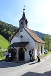
|
Jaufensteg Chapel ID: 16647 |
46 ° 52 ′ 30 "N, 11 ° 21 ′ 28" E |
July 6, 1951 (MD) |
chapel |
KG: Ratschings building plot: 83/1
|
| Kalcherwirt ID: 16646 |
46 ° 52 ′ 4 "N, 11 ° 21 ′ 48" E |
May 18, 1987 (BLR-LAB 2618) |
Rural house / farm |
KG: Ratschings building plot: 72
|
|
| Chapel at the Bartler ID: 18078 |
46 ° 54 '39 "N, 11 ° 17' 56" E |
May 18, 1987 (BLR-LAB 2618) |
chapel |
KG: Ridnaun building plot: 95
|
|

|
Chapel near Blössner ID: 16681 |
46 ° 53 ′ 38 "N, 11 ° 22 ′ 34" E |
July 7, 1951 (MD) |
chapel |
KG: Telfes building plot: 76
|
| Chapel at Hochstranses ID: 16639 |
46 ° 54 ′ 20 "N, 11 ° 20 ′ 23" E |
May 18, 1987 (BLR-LAB 2618) |
chapel |
KG: Mareit land parcel: 1448
|
|
| Chapel at the Larch ID: 16653 |
46 ° 52 ′ 7 ″ N, 11 ° 17 ′ 20 ″ E |
July 6, 1951 (MD) |
chapel |
KG: Ratschings building plot: 179
|
|

|
Chapel at the armorer ID: 16657 |
46 ° 52 ′ 4 ″ N, 11 ° 16 ′ 46 ″ E |
May 18, 1987 (BLR-LAB 2618) |
chapel |
KG: Ratschings building plot: 182, 615 Base plot: 1521
|

|
Chapel by the perennials ID: 16670 |
46 ° 55 ′ 18 ″ N, 11 ° 16 ′ 16 ″ E |
November 14, 2005 (BLR-LAB 4266) |
chapel |
KG: Ridnaun building plot: 157
|
| Chapel at the Volgger in Pardaun ID: 16649 |
46 ° 53 ′ 1 ″ N, 11 ° 21 ′ 55 ″ E |
May 18, 1987 (BLR-LAB 2618) |
chapel |
KG: Ratschings building plot: 106
|
|
| Chapel in the mine ID: 16672 |
46 ° 55 ′ 44 ″ N, 11 ° 16 ′ 16 ″ E |
May 18, 1987 (BLR-LAB 2618) |
chapel |
KG: Ridnaun building plot : 230 Basic plot: 1045/1
|
|

|
Chapel in the Rod ID: 16641 |
46 ° 52 ′ 55 "N, 11 ° 22 ′ 43" E |
May 18, 1987 (BLR-LAB 2618) |
chapel |
KG: Ratschings building plot: 14
|

|
Chapel in Flading ID: 16682 |
46 ° 52 ′ 7 ″ N, 11 ° 15 ′ 6 ″ E |
May 18, 1987 (BLR-LAB 2618) |
chapel |
KG: Ratschings building plot: 192
|
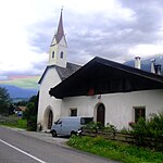
|
Chapel in Schönau ID: 16644 |
46 ° 52 ′ 52 "N, 11 ° 23 ′ 9" E |
July 6, 1951 (MD) |
chapel |
KG: Ratschings building plot: 28
|
| Germ ID: 16642 |
46 ° 52 ′ 51 ″ N, 11 ° 22 ′ 44 ″ E |
May 18, 1987 (BLR-LAB 2618) |
Rural house / farm |
KG: Ratschings building plot: 20
|
|
| Angerkapelle ID: 16667 |
46 ° 54 ′ 13 ″ N, 11 ° 19 ′ 1 ″ E |
May 18, 1987 (BLR-LAB 2618) |
chapel |
KG: Ridnaun building plot: 120
|
|

|
Knabl ID: 50590 |
46 ° 53 '32 "N, 11 ° 21' 1" E |
Feb 10, 2015 (BLR-LAB 165) |
Einhof built in 1819 |
KG: Mareit building plot: 7/1
|
| Knappe (Knappenhäusl) ID: 16666 |
46 ° 54 ′ 6 "N, 11 ° 18 ′ 54" E |
May 18, 1987 (BLR-LAB 2618) |
Rural house / farm |
KG: Ridnaun building plot: 117
|
|
| Abraham's grain bin ID: 16652 |
46 ° 51 ′ 49 ″ N, 11 ° 18 ′ 27 ″ E |
May 18, 1987 (BLR-LAB 2618) |
Grain box in wooden block construction on posts, one of the two granaries of this type still preserved in the valley. Open gable. |
KG: Ratschings building plot: 149
|
|
| Granary at Mart ID: 16661 |
46 ° 54 '50 "N, 11 ° 17' 46" E |
May 18, 1987 (BLR-LAB 2618) |
Grain box |
KG: Ridnaun building plot: 87
|
|
| Granary at the Schneiderhof ID: 50189 |
46 ° 53 ′ 59 "N, 11 ° 19 ′ 16" E |
20 Mar 2000 (BLR-LAB 894) |
Grain box |
KG: Mareit building plot: 202
|
|
| Granary at Wieser ID: 16660 |
46 ° 55 ′ 18 ″ N, 11 ° 17 ′ 5 ″ E |
May 18, 1987 (BLR-LAB 2618) |
Grain box in wood block construction with protruding söller and donkey back door spar. |
KG: Ridnaun building plot: 49
|
|
| Granary at the Wurzer ID: 16630 |
46 ° 53 ′ 42 "N, 11 ° 20 ′ 5" E |
May 18, 1987 (BLR-LAB 2618) |
Grain box |
KG: Mareit building plot: 36/2
|
|
| Grain bin and oven at Bartler's ID: 16662 |
46 ° 54 ′ 40 "N, 11 ° 17 ′ 57" E |
May 18, 1987 (BLR-LAB 2618) |
Grain box |
KG: Ridnaun building plot: 433, 94
|
|
| Teacher's house ID: 50185 |
46 ° 53 ′ 25 ″ N, 11 ° 21 ′ 17 ″ E |
July 31, 1997 (BLR-LAB 3634) |
school |
KG: Mareit building plot: 4
|
|

|
Maria Visitation at Jaufenpass ID: 16654 |
46 ° 50 ′ 36 "N, 11 ° 19 ′ 39" E |
May 18, 1987 (BLR-LAB 2618) |
chapel |
KG: Ratschings building plot: 239
|
| Maria Visitation in Rust (Einsiedel) ID: 16625 |
46 ° 52 ′ 59 "N, 11 ° 24 ′ 58" E |
May 18, 1987 (BLR-LAB 2618) |
chapel |
KG: Jaufental building plot: 41
|
|
| Maria-Schnee-Chapel in the Becherhaus ID: 16671 |
46 ° 57 '39 "N, 11 ° 11' 32" E |
December 30, 1988 (BLR-LAB 9022) |
chapel |
KG: Ridnaun building plot: 213
|
|
| Melcher ID: 16634 |
46 ° 54 ′ 0 ″ N, 11 ° 20 ′ 30 ″ E |
May 18, 1987 (BLR-LAB 2618) |
Rural house / farm |
KG: Mareit building plot: 94
|
|
| Mill at Hofer ID: 16658 |
46 ° 55 ′ 13 ″ N, 11 ° 17 ′ 36 ″ E |
May 18, 1987 (BLR-LAB 2618) |
Mill |
KG: Ridnaun building plot: 46
|
|
| Paulheis I ID: 18100 |
46 ° 53 ′ 43 "N, 11 ° 20 ′ 6" E |
May 18, 1987 (BLR-LAB 2618) |
Farm with a grain box |
KG: Mareit building plot: 37, 40
|
|
| Paulheis II ID: 16633 |
46 ° 54 ′ 9 ″ N, 11 ° 20 ′ 12 ″ E |
May 18, 1987 (BLR-LAB 2618) |
Grain box |
KG: Mareit building plot: 89/2
|
|
| Parish church of St. Andreas with cemetery ID: 16651 |
46 ° 51 ′ 54 "N, 11 ° 18 ′ 44" E |
Nov 28, 2005 (BLR-LAB 4595) |
church |
KG: Ratschings building plot: 142 Base plot: 1133
|
|
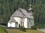
|
Parish church of St. Josef with cemetery ID: 16663 |
46 ° 54 ′ 38 ″ N, 11 ° 18 ′ 19 ″ E |
November 14, 2005 (BLR-LAB 4268) |
church |
KG: Ridnaun building plot: 98 basic plot: 1748
|

|
Parish church St. Nikolaus with cemetery in Untertelfes ID: 16680 |
46 ° 53 ′ 38 "N, 11 ° 22 ′ 58" E |
November 14, 2005 (BLR-LAB 4255) |
church |
KG: Telfes building plot: 66
|
| Parish church of St. Ursula with cemetery ID: 16628 |
46 ° 51 '17 "N, 11 ° 23" 10 "E |
May 18, 1987 (BLR-LAB 2618) |
church |
KG: Jaufental building plot : 147 basic plot: 1148/2
|
|
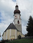
|
Parish church St. Veit with cemetery in Obertelfes ID: 16674 |
46 ° 53 ′ 32 "N, 11 ° 23 ′ 24" E |
November 14, 2005 (BLR-LAB 4255) |
church |
KG: Telfes building plot: 1
|

|
Parish dedication Mareit ID: 18082 |
46 ° 53 ′ 34 "N, 11 ° 21 ′ 3" E |
May 18, 1987 (BLR-LAB 2618) |
Widum / Kanonikerhaus, elongated building, the year 1709 on the polygonal bay window |
KG: Mareit building parcel: 2/1 basic parcel: 5, 6, 6/1, 6/2, 6/3
|
| Parish widow Ridnaun ID: 16664 |
46 ° 54 ′ 37 "N, 11 ° 18 ′ 17" E |
May 18, 1987 (BLR-LAB 2618) |
Widum / Kanonikerhaus, built around 1764. |
KG: Ridnaun building plot: 99
|
|
| Pfitscher ID: 50541 |
46 ° 55 ′ 12 ″ N, 11 ° 17 ′ 40 ″ E |
6 Sep 2010 (BLR-LAB 1408) |
Rural house / farm |
KG: Ridnaun building plot: 43/1
|
|

|
Parish church St. Pankraz with cemetery chapel, cemetery and burial chapel of the Barons von Sternbach in Mareit ID: 16636 |
46 ° 53 ′ 34 "N, 11 ° 21 ′ 3" E |
May 15, 2008 (LGVD 265330) |
church |
KG: Mareit building plot: 1/1, 1/2
|
| Platzer ID: 16679 |
46 ° 53 ′ 38 "N, 11 ° 22 ′ 57" E |
July 7, 1951 (MD) |
Rural house / farm |
KG: Telfes building plot: 65
|
|

|
Reifenegg ID: 16643 |
46 ° 52 ′ 38 "N, 11 ° 22 ′ 30" E |
July 6, 1951 (MD) |
Castle ruins |
KG: Ratschings building plot: 23
|
| Saxl with chapel ID: 16676 |
46 ° 53 '36 "N, 11 ° 23' 29" E |
May 18, 1987 (BLR-LAB 2618) |
Rural house / farm |
KG: Telfes building plot: 31/1, 31/2
|
|
| Sprenger ID: 16648 |
46 ° 52 ′ 36 "N, 11 ° 21 ′ 37" E |
May 18, 1987 (BLR-LAB 2618) |
Rural house / farm |
KG: Ratschings building plot: 88
|
|

|
St. Anton in Ausser Valley ID: 16626 |
46 ° 52 ′ 5 ″ N, 11 ° 24 ′ 14 ″ E |
July 9, 2007 (BLR-LAB 2325) |
church |
KG: Jaufental building plot: 105
|

|
St. Anton in Kalch ID: 16645 |
46 ° 52 ′ 4 "N, 11 ° 21 ′ 51" E |
May 18, 1987 (BLR-LAB 2618) |
chapel |
KG: Ratschings building plot: 71
|

|
St. Josef in Gasteig ID: 16623 |
46 ° 52 ′ 49 ″ N, 11 ° 24 ′ 18 ″ E |
July 9, 2007 (BLR-LAB 2325) |
church |
KG: Jaufental building plot: 1
|
| St. Lorenz in Maiern ID: 16659 |
46 ° 55 ′ 15 ″ N, 11 ° 17 ′ 14 ″ E |
November 14, 2005 (BLR-LAB 4268) |
church |
KG: Ridnaun building plot: 47
|
|
|
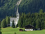
St. Magdalena ID: 16668 |
46 ° 54 ′ 31 ″ N, 11 ° 19 ′ 1 ″ E |
November 14, 2005 (BLR-LAB 4267) |
church |
KG: Ridnaun building plot: 124
|
| Star ID: 18077 |
46 ° 52 ′ 52 ″ N, 11 ° 23 ′ 10 ″ E |
July 6, 1951 (MD) |
Rural house / farm |
KG: Ratschings building plot: 29
|
|
| Stricknerkapelle ID: 16638 |
46 ° 54 ′ 18 "N, 11 ° 18 ′ 33" E |
May 18, 1987 (BLR-LAB 2618) |
chapel |
KG: Mareit basic parcel: 457
|
|
| Wildner ID: 16677 |
46 ° 53 ′ 37 "N, 11 ° 22 ′ 59" E |
July 7, 1951 (MD) |
Rural house / farm |
KG: Telfes building plot: 45
|
|

|
Wolfsthurn with Park ID: 16629 |
46 ° 53 '35 "N, 11 ° 20' 57" E |
May 18, 1987 (BLR-LAB 2618) |
Baroque castle, seat of the South Tyrolean State Museum for Hunting and Fishing |
KG: Mareit building plot: 12/1, 12/3, 179, 206, 225, 226, 227 |
If no coordinates are known for a monument, the cadastral data at the time it was placed under protection are given as a substitute. These are neither official nor necessarily up-to-date.
The addresses taken from the State Monuments Office may be out of date.
| Photo: | Photograph of the monument. Click the photo generates an enlarged view. There are also two symbols: |
| ID | Identifier at the South Tyrolean Monuments Office |
| KG | Cadastral parish |
| MD | Ministerial Decree |
| BLR-LAB | Decision of the state government - state committee decision |
Web links
- Monument browser of the South Tyrolean Monuments Office