List of architectural monuments in Castelrotto
The list of architectural monuments in Castelrotto ( Ladin Ciastel , Italian Castelrotto ) contains the 62 objects designated as architectural monuments in the area of the municipality of Castelrotto in South Tyrol .
The basis is the official directory of the monuments in South Tyrol, which can be viewed on the Internet. These can be, for example, sacred buildings , residential houses, farms and aristocratic residences. The order in this list is based on the designation, alternatively it can also be sorted according to the address or the date on which it was placed under protection.
list
| photo | designation | Location | registration | description | Metadata |
|---|---|---|---|---|---|

|
Aichach ID: 15330 |
46 ° 32 ′ 43 ″ N, 11 ° 31 ′ 38 ″ E Fraction: St. Oswald |
April 8, 1980 (BLR-LAB 1908) |
Castle ruins, first mentioned in 1234 |
KG: Kastelruth basic parcel: 6524, 6525
|

|
Brandhof ID: 50084 |
46 ° 32 ′ 18 ″ N, 11 ° 33 ′ 28 ″ E Fraction: Seis |
Nov. 17, 2003 (BLR-LAB 4112) |
two-storey farmhouse from the first half of the 19th century |
KG: Kastelruth building plot: 664
|

|
Col de Sëura ID: 15305 |
Pineisstrasse 46 ° 34 ′ 31 ″ N, 11 ° 38 ′ 22 ″ E Fraction: Runggaditsch |
April 8, 1980 (BLR-LAB 1908) |
Residential building |
KG: Kastelruth building plot: 314
|

|
Trinity Chapel at Drockerhof ID: 18151 |
46 ° 33 ′ 2 ″ N, 11 ° 31 ′ 38 ″ E Fraction: St. Oswald |
Nov. 27, 1995 (BLR-LAB 6191) |
Baroque path chapel from the 18th century |
KG: Kastelruth building plot: 3075, 744
|

|
Fisherman's house ID: 15289 |
Kofelgasse 3 46 ° 34 ′ 7 ″ N, 11 ° 33 ′ 33 ″ E |
April 8, 1980 (BLR-LAB 1908) |
Residential house, facade bay window with baroque frescoes |
KG: Kastelruth building plot: 39
|

|
Frühmesserhaus ID: 18239 |
Bühlweg 10 46 ° 34 ′ 6 ″ N, 11 ° 33 ′ 37 ″ E |
Jan. 20, 1997 (BLR-LAB 136) |
three-storey house |
KG: Kastelruth building plot: 9
|

|
Gasthof Goldenes Rössl ID: 15283 |
Krausplatz 46 ° 34 ′ 4 ″ N, 11 ° 33 ′ 36 ″ E |
May 30, 1960 (MD) |
15th century construction |
KG: Kastelruth building plot: 14/1
|

|
Gasthof Turm ID: 15288 |
Kofelgasse 8 46 ° 34 ′ 6 ″ N, 11 ° 33 ′ 34 ″ E |
May 6, 1960 (MD) |
three-storey building |
KG: Kastelruth building plot: 36/1, 36/3
|

|
Greilenstein ID: 15295 |
Plojerweg 46 ° 33 ′ 43 ″ N, 11 ° 33 ′ 32 ″ E |
July 6, 1979 (BLR-LAB 3968) |
House with built-in tower from the 13th century |
KG: Kastelruth building plot: 126
|
|
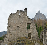
Hauenstein ID: 15328 |
46 ° 32 ′ 11 ″ N, 11 ° 34 ′ 7 ″ E Fraction: Seis |
April 8, 1980 (BLR-LAB 1908) |
Castle ruins from the 12th century, residence of Oswald von Wolkenstein |
KG: Kastelruth basic parcel: 5987
|

|
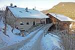
Hotel Salegg ID: 50089 |
Schlernstrasse 45 46 ° 32 ′ 14 ″ N, 11 ° 33 ′ 20 ″ E Fraction: Seis |
April 22, 2003 (BLR-LAB 1287) |
Hotel complex built in 1903 |
KG: Kastelruth building plot: 665
|
|
Innerpitschuel ID: 15306 |
Pineisstrasse 46 ° 34 ′ 12 ″ N, 11 ° 38 ′ 36 ″ E Fraction: Runggaditsch |
April 8, 1980 (BLR-LAB 1908) |
Residential building |
KG: Kastelruth building plot: 332
|

|
Kampedeller ID: 15321 |
46 ° 32 ′ 33 ″ N, 11 ° 32 ′ 11 ″ E Fraction: St. Vigil |
April 8, 1980 (BLR-LAB 1908) |
Residential building |
KG: Kastelruth building plot: 693
|

|
Chapel at the Flösser ID: 15324 |
46 ° 34 ′ 2 ″ N, 11 ° 31 ′ 21 ″ E |
December 17, 1990 (BLR-LAB 8107) |
Construction from the 18th or 19th century |
KG: Kastelruth building plot: 737
|

|
Kofelgasse 6 ID: 15287 |
Kofelgasse 6 46 ° 34 ′ 6 ″ N, 11 ° 33 ′ 34 ″ E |
April 8, 1980 (BLR-LAB 1908) |
two-storey building with a hallway from the 16th century |
KG: Kastelruth building plot: 35/1
|

|
Kranebitter in St. Vigil ID: 18215 |
46 ° 32 ′ 21 ″ N, 11 ° 32 ′ 41 ″ E Fraction: St. Vigil |
June 16, 1997 (BLR-LAB 2742) |
House, painted baroque facade around 1750 |
KG: Castelrotto building plot: 670/1
|

|
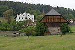
Ladinser ID: 15296 |
46 ° 33 ′ 58 "N, 11 ° 34 ′ 32" E Fraction: Tiosels |
April 8, 1980 (BLR-LAB 1908) |
House built after 1848 with a facade fresco |
KG: Kastelruth building plot: 134
|
|
Lafay ID: 15292 |
Lafayweg 46 ° 34 ′ 17 ″ N, 11 ° 33 ′ 58 ″ E |
Nov 20, 1950 (MD) |
Raised hide |
KG: Kastelruth building plot: 78
|

|
Lafogler ID: 15298 |
Bühlweg 46 ° 34 ′ 26 ″ N, 11 ° 34 ′ 43 ″ E |
April 8, 1980 (BLR-LAB 1908) |
Residential building |
KG: Kastelruth building plot: 155
|

|
Lampele-Hof in St. Michael ID: 50481 |
46 ° 34 ′ 29 ″ N, 11 ° 35 ′ 47 ″ E Fraction: St. Michael |
December 10, 2001 (BLR-LAB 4481) |
Farmhouse with room paneling |
KG: Kastelruth building plot: 170
|

|
Maria-Hilf-Kirche in Seis ID: 15317 |
46 ° 32 ′ 42 ″ N, 11 ° 33 ′ 35 ″ E Fraction: Seis |
April 8, 1980 (BLR-LAB 1908) |
Consecrated in 1657 |
KG: Kastelruth building plot: 614
|

|
Lady Chapel on the Alpe di Siusi ID: 15312 |
46 ° 30 ′ 40 ″ N, 11 ° 41 ′ 15 ″ E Fraction: Alpe di Siusi |
April 8, 1980 (BLR-LAB 1908) |
Erected in Gothic style in 1857 |
KG: Kastelruth building plot: 457/1
|

|
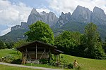
Mendelhaus ID: 50080 |
Vogelweidergasse 4 46 ° 34 ′ 4 ″ N, 11 ° 33 ′ 33 ″ E |
Oct. 8, 2001 (BLR-LAB 3531) |
Built in 1886, the facade was painted in a neo-baroque style |
KG: Kastelruth building plot: 30/2
|
|
Mill at Malenger ID: 15320 |
46 ° 32 ′ 30 ″ N, 11 ° 32 ′ 34 ″ E Fraction: St. Vigil |
April 8, 1980 (BLR-LAB 1908) |
brick mill |
KG: Kastelruth building plot: 685
|

|
Upper, middle and lower mill at the Pufler Bach ID: 15310 |
46 ° 33 ′ 24 ″ N, 11 ° 38 ′ 3 ″ E Fraction: Bulla |
April 8, 1980 (BLR-LAB 1908) |
three masonry mills: The geocoordinates given on the left refer to the upper mill. The average mill is located at position 46 ° 33 '25.6 " N , 11 ° 38' 3.3" O , the lower mill to 46 ° 33 '27.3 " N , 11 ° 38' 6" O . |
KG: Kastelruth building plot: 371, 372, 373
|

|
Oberpray with farm building ID: 15280 |
Kofelgasse 46 ° 34 ′ 8 ″ N, 11 ° 33 ′ 36 ″ E |
May 6, 1950 (MD) |
Raised hide |
KG: Castelrotto building plot: 3, 4
|
|
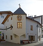
Oswald-von-Wolkenstein-Platz 7 ID: 15284 |
Oswald-von-Wolkenstein-Platz 7 46 ° 34 ′ 3 ″ N, 11 ° 33 ′ 37 ″ E |
April 8, 1980 (BLR-LAB 1908) |
Residential house with late Gothic bay window and baroque facade fresco |
KG: Kastelruth building plot: 19
|

|
Panider ID: 15300 |
46 ° 34 ′ 50 ″ N, 11 ° 37 ′ 2 ″ E Fraction: St. Michael |
April 8, 1980 (BLR-LAB 1908) |
Residential house with late Gothic walls |
KG: Kastelruth building plot: 182
|

|
Parish church Seis ID: 15327 |
46 ° 32 ′ 38 ″ N, 11 ° 33 ′ 39 ″ E Fraction: Seis |
December 17, 1990 (BLR-LAB 8107) |
Start of construction in 1937 |
KG: Castelrotto building plot: 1804
|

|
Parish church of St. Peter and Paul with tower and cemetery ID: 15279 |
46 ° 34 ′ 6 ″ N, 11 ° 33 ′ 36 ″ E |
April 8, 1980 (BLR-LAB 1908) |
three-aisled classical church built between 1846 and 1849, tower with onion dome from 1753 |
KG: Kastelruth building plot: 1, 34 basic plot: 67
|

|
Pfarrwidum Bulla ID: 15308 |
46 ° 33 ′ 54 ″ N, 11 ° 38 ′ 8 ″ E Fraction: Bulla |
December 17, 1990 (BLR-LAB 8107) |
Widum in the core from the 17th century |
KG: Kastelruth building plot: 357
|

|
Pfleger-Stadl ID: 15325 |
46 ° 32 ′ 43 ″ N, 11 ° 31 ′ 39 ″ E Fraction: St. Oswald |
April 8, 1980 (BLR-LAB 1908) |
Farm buildings below the ring wall of the Aichach castle ruins |
KG: Kastelruth building plot: 747
|
|
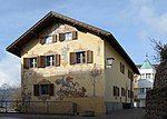
Plattenstrasse 10 ID: 15290 |
Plattenstrasse 10 46 ° 34 ′ 6 ″ N, 11 ° 33 ′ 31 ″ E |
April 8, 1980 (BLR-LAB 1908) |
In the cellar, remains of the medieval wall of the Ödenberg tower, later converted into the current house, facade fresco around 1900 |
KG: Kastelruth building plot: 44
|

|
Ploner ID: 15314 |
46 ° 33 ′ 3 ″ N, 11 ° 34 ′ 3 ″ E Fraction: St. Valentin |
April 8, 1980 (BLR-LAB 1908) |
Residential house with facade painting |
KG: Castelrotto building plot: 563/1
|

|
Pluncher ID: 15285 |
46 ° 34 ′ 4 "N, 11 ° 33 ′ 33" E |
May 6, 1950 (MD) |
Residential house with crenellated gables |
KG: Castelrotto building plot: 30/1
|

|
Pseier ID: 15315 |
46 ° 33 ′ 6 ″ N, 11 ° 33 ′ 58 ″ E Fraction: St. Valentin |
May 6, 1950 (MD) |
late medieval courtyard with facade frescoes |
KG: Castelrotto building plot: 564
|

|
Town Hall ID: 15286 |
Krausplatz 1 46 ° 34 ′ 5 ″ N, 11 ° 33 ′ 34 ″ E |
April 8, 1980 (BLR-LAB 1908) |
Former residence Krausegg, built between 1603 and 1607 |
KG: Castelrotto building plot: 33
|

|
Rescion de Sot ID: 15311 |
Vidalongstrasse 46 ° 34 ′ 14 ″ N, 11 ° 40 ′ 12 ″ E Fraction: Overwater |
April 8, 1980 (BLR-LAB 1908) |
medieval wooden house |
KG: Castelrotto building plot: 397/1
|

|
Ritsch ID: 15299 |
46 ° 34 ′ 25 "N, 11 ° 35 ′ 40" E |
April 8, 1980 (BLR-LAB 1908) |
medieval dwelling house |
KG: Kastelruth building plot: 168
|

|
Salegg ID: 15329 |
46 ° 32 ′ 10 ″ N, 11 ° 33 ′ 30 ″ E Fraction: Seis |
April 8, 1980 (BLR-LAB 1908) |
Castle ruins, built towards the end of the 12th century |
KG: Kastelruth basic parcel: 6002/5
|

|
Saddler ID: 15323 |
46 ° 33 ′ 24 ″ N, 11 ° 31 ′ 44 ″ E Fraction: St. Oswald |
April 8, 1980 (BLR-LAB 1908) |
Construction from the end of the 16th century |
KG: Kastelruth building plot: 723
|
|
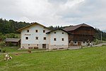
Schgaguler ID: 15297 |
Bühlweg 46 ° 34 ′ 23 ″ N, 11 ° 34 ′ 40 ″ E |
April 8, 1980 (BLR-LAB 1908) |
medieval house, later extended |
KG: Kastelruth building plot: 145
|

|
Schoberstein with farm building ID: 15281 |
46 ° 34 '10 "N, 11 ° 33' 38" E |
Nov 20, 1950 (MD) |
Medieval house, later raised, barn with thatched roof |
KG: Kastelruth building plot: 6/1, 6/2
|

|
Schoolmaster ID: 15293 |
46 ° 34 ′ 3 "N, 11 ° 33 ′ 47" E |
Nov 20, 1950 (MD) |
Residential building |
KG: Castelrotto building plot: 86/1, 86/2, 86/3
|

|
St. Anna in Ploj ID: 15294 |
St.-Anna-Weg 46 ° 33 ′ 48 ″ N, 11 ° 33 ′ 28 ″ E |
April 8, 1980 (BLR-LAB 1908) |
Chapel building from the first half of the 18th century |
KG: Castelrotto building plot: 99
|

|
St. Anton am Kofel with Kalvarienberg chapel ID: 15291 |
46 ° 34 '12 "N, 11 ° 33' 36" E |
April 8, 1980 (BLR-LAB 1908) |
Two-storey chapel from the end of the 17th century, a slightly higher Calvary chapel with rich stucco and monastery vaults |
KG: Kastelruth building plot: 66, 1795 basic plot: 1, 2
|

|
St. Leonhard with cemetery chapel and cemetery in Bulla ID: 15309 |
46 ° 33 ′ 51 ″ N, 11 ° 38 ′ 12 ″ E Fraction: Bulla |
April 8, 1980 (BLR-LAB 1908) |
Romanesque tower, church extensions in 1555, 1740, 1845 and 1855 |
KG: Castelrotto Building plot: 360, 1387 Base plot: 3176
|

|
St. Magdalena in Tagusens ID: 15304 |
46 ° 35 ′ 37 ″ N, 11 ° 33 ′ 19 ″ E Fraction: Tagusens |
April 8, 1980 (BLR-LAB 1908) |
Tower and nave walls from the first half of the 14th century, redesign around 1500, 1687 and 1725 |
KG: Kastelruth building plot: 264
|

|
St. Michael ID: 15301 |
46 ° 34 ′ 42 ″ N, 11 ° 36 ′ 7 ″ E Fraction: St. Michael |
April 8, 1980 (BLR-LAB 1908) |
Mentioned in 1353, Romanesque tower, choir built around 1500, nave redesigned in the 17th century |
KG: Kastelruth building plot: 188
|

|
St. Nicholas in Tesimo ID: 15303 |
46 ° 34 ′ 21 ″ N, 11 ° 32 ′ 54 ″ E Fraction: Tisens |
April 8, 1980 (BLR-LAB 1908) |
Mentioned in 1353, late Gothic church from the 16th century |
KG: Kastelruth building plot: 222
|

|
St. Oswald ID: 15322 |
46 ° 33 ′ 26 ″ N, 11 ° 31 ′ 15 ″ E Fraction: St. Oswald |
April 8, 1980 (BLR-LAB 1908) |
Romanesque tower, choir around 1400, rebuilt in the 16th century |
KG: Kastelruth building plot: 716
|

|
St. Valentin ID: 15316 |
46 ° 32 ′ 59 ″ N, 11 ° 33 ′ 47 ″ E Fraction: St. Valentin |
April 8, 1980 (BLR-LAB 1908) |
Romanesque tower with onion dome from 1811, choir and vaults late Gothic |
KG: Kastelruth building plot: 572
|

|
St. Vigil ID: 15319 |
46 ° 32 ′ 23 ″ N, 11 ° 32 ′ 22 ″ E Fraction: St. Vigil |
April 8, 1980 (BLR-LAB 1908) |
late Gothic building from the end of the 15th century |
KG: Kastelruth building plot: 679
|

|
Törggele Bridge ID: 18058 |
46 ° 33 ′ 52 "N, 11 ° 30 ′ 56" E |
Pillar-free wooden bridge with a shingle roof, the year 1804 is on a beam |
KG: Kastelruth Basic parcel: 7089/2
|
|

|
Sub spray ID: 15282 |
46 ° 34 '9 "N, 11 ° 33' 39" E |
April 8, 1980 (BLR-LAB 1908) |
Raised hide |
KG: Kastelruth building plot: 7
|

|
Lower level ID: 15302 |
46 ° 34 ′ 48 ″ N, 11 ° 36 ′ 0 ″ E Fraction: St. Michael |
April 8, 1980 (BLR-LAB 1908) |
House with facade frescoes from the 18th century |
KG: Kastelruth building plot: 193
|

|
Valentor ID: 15313 |
46 ° 32 ′ 59 ″ N, 11 ° 34 ′ 56 ″ E Fraction: St. Valentin |
April 8, 1980 (BLR-LAB 1908) |
House with facade frescoes from 1822 |
KG: Castelrotto building plot: 543/1
|

|
Villa Bergfried ID: 18207 |
Hauensteinweg 46 ° 32 ′ 39 ″ N, 11 ° 33 ′ 57 ″ E Fraction: Seis |
Sep 30 1996 (BLR-LAB 4591) |
two-story building from 1901, balcony architecture over three floors |
KG: Castelrotto building plot: 1549
|

|
Villa Felseck ID: 15326 |
46 ° 34 ′ 4 ″ N, 11 ° 33 ′ 25 ″ E |
Jan. 10, 1983 (BLR-LAB 120) |
built in 1904, facade painting in neo-baroque and art nouveau forms |
KG: Castelrotto building plot: 1561
|

|
Villa Friedmann ID: 50086 |
46 ° 32 ′ 42 ″ N, 11 ° 34 ′ 27 ″ E Fraction: Seis |
December 3, 2001 (BLR-LAB 4377) |
originally a farm, expanded to a summer cottage in 1929 |
KG: Castelrotto building plot: 1541
|

|
Ziuger-Stadl ID: 15318 |
Rosengartenstrasse 46 ° 33 ′ 3 ″ N, 11 ° 33 ′ 25 ″ E Fraction: Seis |
December 17, 1990 (BLR-LAB 8107) |
built in 1829 |
KG: Kastelruth building plot: 634 |
If no coordinates are known for a monument, the cadastral data at the time it was placed under protection are given as a substitute. These are neither official nor necessarily up-to-date.
The addresses taken from the State Monuments Office may be out of date.
| Photo: | Photograph of the monument. Click the photo generates an enlarged view. There are also two symbols: |
| ID | Identifier at the South Tyrolean Monuments Office |
| KG | Cadastral parish |
| MD | Ministerial Decree |
| BLR-LAB | Decision of the state government - state committee decision |
Former architectural monuments
| photo | designation | Location | registration | description | Metadata |
|---|---|---|---|---|---|

|
Spitzegg ID: 15307 |
46 ° 34 ′ 7 ″ N, 11 ° 38 ′ 30 ″ E Fraction: Runggaditsch |
April 8, 1980 (BLR-LAB 1908) |
medieval wooden house; Burned down on April 23, 2018, monument protection with BLR-LAB 880 of September 4, 2018 lifted. |
KG: Castelrotto building plot: 335 |
If no coordinates are known for a monument, the cadastral data at the time it was placed under protection are given as a substitute. These are neither official nor necessarily up-to-date.
The addresses taken from the State Monuments Office may be out of date.
| Photo: | Photograph of the monument. Click the photo generates an enlarged view. There are also two symbols: |
| ID | Identifier at the South Tyrolean Monuments Office |
| KG | Cadastral parish |
| MD | Ministerial Decree |
| BLR-LAB | Decision of the state government - state committee decision |
Web links
- Monument browser of the South Tyrolean Monuments Office
Individual evidence
- ^ Helmut Stampfer : Aichach . In: Oswald Trapp (ed.), Tiroler Burgenbuch. IV. Volume: Eisacktal . Athesia publishing house, Bozen 1977, pp. 331–335.