List of architectural monuments in Partschins
The list of architectural monuments in Partschins ( Italian Parcines ) contains the 18 objects designated as architectural monuments in the area of the municipality of Partschins in South Tyrol .
The basis is the official directory of the monuments in South Tyrol, which can be viewed on the Internet. These can be, for example, sacred buildings , residential houses, farms and aristocratic residences. The order in this list is based on the designation, alternatively it can also be sorted according to the address or the date on which it was placed under protection.
list
| photo | designation | Location | registration | description | Metadata |
|---|---|---|---|---|---|

|
Gaudententurm ID: 16382 |
Gaudententurmstrasse 7 46 ° 41 ′ 3 ″ N, 11 ° 4 ′ 29 ″ E |
May 9, 1950 (MD) |
The tower dates back to the Middle Ages and was given its current shape in the 17th century, including the Höllhaus outbuilding ; the left in the column location stationary coordinates refer to the Gaudententurm itself, the Höllhaus is situated at 46 ° 41 '2.8 " N , 11 ° 4' 27.8" O . |
KG: Partschins building plot: 81, 82/1, 83
|
|
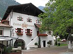
Hanswirt in Rabland ID: 16385 |
Geroldplatz 3 46 ° 40 ′ 10 ″ N, 11 ° 3 ′ 34 ″ E |
April 8, 1980 (BLR-LAB 1909) |
Rural house / farm |
KG: Partschins building plot: 226
|

|
Hochhueb ID: 16377 |
Hubenstrasse 16 46 ° 41 ′ 10 ″ N, 11 ° 4 ′ 26 ″ E |
April 8, 1980 (BLR-LAB 1909) |
Rural house / farm |
KG: Partschins building plot: 29
|

|
Chapel "Bad Egart" ID: 18224 |
Bahnhofstrasse 13 46 ° 40 ′ 19 ″ N, 11 ° 4 ′ 52 ″ E |
July 31, 1997 (BLR-LAB 3633) |
chapel |
KG: Partschins building plot: 251
|

|
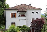
Mairhof ID: 16383 |
Max-von-Isser-Strasse 1 46 ° 41 ′ 0 ″ N, 11 ° 4 ′ 28 ″ E |
April 8, 1980 (BLR-LAB 1909) |
Rural house / farm |
KG: Partschins building plot: 86, 87
|
|
Mairhof in Rabland ID: 16387 |
Vinschgauerstraße 5 46 ° 40 ′ 5 ″ N, 11 ° 3 ′ 34 ″ E |
April 8, 1980 (BLR-LAB 1909) |
Rural house / farm |
KG: Partschins building plot: 239, 240
|

|
Montelbon ID: 16379 |
Schlossergasse 2 46 ° 40 ′ 59 ″ N, 11 ° 4 ′ 20 ″ E |
April 8, 1980 (BLR-LAB 1909) |
Raised hide |
KG: Partschins building plot: 45, 46, 47
|
|
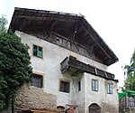
Niederebenhof ID: 18234 |
Saringstrasse 47 46 ° 39 ′ 38 ″ N, 11 ° 4 ′ 11 ″ E |
December 15, 1997 (BLR-LAB 6713) |
Rural house / farm |
KG: Partschins building plot: 248
|
|
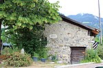
Oberschmiedmühle in Rabland ID: 50181 |
46 ° 40 ′ 30 "N, 11 ° 3 ′ 33" E |
December 21, 1998 (BLR-LAB 6117) |
Mill |
KG: Partschins building plot: 197
|
|
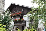
Peter-Mitterhofer-Strasse 26 ID: 50180 |
Peter-Mitterhofer-Strasse 26 46 ° 40 ′ 55 ″ N, 11 ° 4 ′ 18 ″ E |
May 14, 2001 (BLR-LAB 1532) |
Rural house / farm |
KG: Partschins building plot: 107
|

|
Parish Church of St. Peter and Paul ID: 16380 |
46 ° 41 ′ 3 ″ N, 11 ° 4 ′ 25 ″ E |
April 8, 1980 (BLR-LAB 1909) |
church |
KG: Partschins building plot: 68 Basic plot: 105
|

|
High aisle shelter ID: 50570 |
46 ° 42 ′ 46 ″ N, 11 ° 5 ′ 9 ″ E |
18 Mar 2013 (BLR-LAB 411) |
Two-storey building in exposed masonry, built in 1909, supplemented as a shelter in 2010 by a new building next to it |
KG: Partschins building plot: 333
|

|
Spauregg ID: 16381 |
Gaudententurmstrasse 20 46 ° 41 ′ 7 ″ N, 11 ° 4 ′ 31 ″ E |
May 9, 1950 (MD) |
Raised hide |
KG: Partschins building plot: 75
|
|
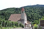
St. Helena on the Töll ID: 16384 |
46 ° 40 ′ 40 "N, 11 ° 5 ′ 3" E |
April 8, 1980 (BLR-LAB 1909) |
church |
KG: Partschins building plot: 108
|
|
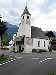
St. Jakob in Rabland ID: 16386 |
46 ° 40 ′ 11 "N, 11 ° 3 ′ 35" E |
April 8, 1980 (BLR-LAB 1909) |
church |
KG: Partschins building plot: 228
|
|
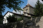
Stachelburg ID: 16378 |
Peter-Mitterhofer-Strasse 2 46 ° 41 ′ 1 ″ N, 11 ° 4 ′ 23 ″ E |
May 9, 1950 (MD) |
Residence dating back to a village castle from the 13th century with the outbuildings Schlerihaus and Rittersaal ; the left in the column location stationary coordinates refer to the Stachlburg itself, the Schlerihaus is situated at 46 ° 41 '2.2 " N , 11 ° 4' 24.2" O , the knight room to 46 ° 41 '2.9 " N , 11 ° 4 '23.8" O . |
KG: Partschins building plot: 35, 36, 37
|

|
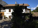
Steidl on the Töll ID: 18171 |
Vinschgauerstraße 95 46 ° 40 ′ 44 ″ N, 11 ° 5 ′ 12 ″ E |
4th Mar 1996 (BLR-LAB 784) |
Customs House |
KG: Partschins building plot: 110
|
|
Unterweirachhof ID: 50612 |
46 ° 40 ′ 56 "N, 11 ° 5 ′ 22" E |
Apr 17, 2018 (BLR-LAB 353) |
The farm has been mentioned in a document since 1344, rebuilt after the fire in 1809, renovated in 1918 and renovated in the 1980s |
KG: Partschins building plot: 121 |
If no coordinates are known for a monument, the cadastral data at the time it was placed under protection are given as a substitute. These are neither official nor necessarily up-to-date.
The addresses taken from the State Monuments Office may be out of date.
| Photo: | Photograph of the monument. Click the photo generates an enlarged view. There are also two symbols: |
| ID | Identifier at the South Tyrolean Monuments Office |
| KG | Cadastral parish |
| MD | Ministerial Decree |
| BLR-LAB | Decision of the state government - state committee decision |
Web links
- Monument browser of the South Tyrolean Monuments Office