List of architectural monuments in Vintl
The list of architectural monuments in Vintl ( Italian Vandoies ) contains the 34 objects designated as architectural monuments in the area of the municipality of Vintl in South Tyrol .
The basis is the official directory of the monuments in South Tyrol, which can be viewed on the Internet. These can be, for example, sacred buildings , residential houses, farms and aristocratic residences. The order in this list is based on the designation, alternatively it can also be sorted according to the address or the date on which it was placed under protection.
list
| photo | designation | Location | registration | description | Metadata |
|---|---|---|---|---|---|

|
Old Parish Church ID: 17866 |
Kirchweg 46 ° 48 ′ 55 ″ N, 11 ° 43 ′ 13 ″ E Fraction: Niedervintl |
Feb. 17, 1986 (BLR-LAB 573) |
church |
KG: Niedervintl building plot: 20
|

|
Vintl train station ID: 50409 |
46 ° 48 ′ 54 ″ N, 11 ° 43 ′ 23 ″ E Fraction: Lower Vintl |
April 5, 2004 (BLR-LAB 1083) |
Train station / Remise |
KG: Niedervintl building plot: 23/3
|

|
Baumgartner ID: 17878 |
Dörfl 46 ° 48 ′ 42 ″ N, 11 ° 45 ′ 56 ″ E Fraction: Obervintl |
Jan 27, 1950 (MD) |
Rural house / farm |
KG: Obervintl building plot: 37
|
|
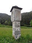
Wayside shrine Haslach ID: 17873 |
46 ° 49 ′ 4 ″ N, 11 ° 42 ′ 21 ″ E Fraction: Lower Vintl |
Feb. 17, 1986 (BLR-LAB 573) |
Wayside shrine |
KG: Niedervintl land parcel: 1708
|
| Vintl castle ruins ID: 17872 |
46 ° 49 ′ 5 ″ N, 11 ° 43 ′ 1 ″ E Fraction: Lower Vintl |
Jan 27, 1950 (MD) |
Castle ruins |
KG: Niedervintl land parcel: 192
|
|
| Burgstaller with chapel ID: 17869 |
Sergser Straße 3 46 ° 49 ′ 26 ″ N, 11 ° 43 ′ 18 ″ E Fraction: Niedervintl |
Feb. 17, 1986 (BLR-LAB 573) |
Rural house / farm |
KG: Niedervintl building plot: 109, 110
|
|

|
Dorfer Chapel ID: 17887 |
46 ° 53 ′ 55 ″ N, 11 ° 42 ′ 7 ″ E Fraction: Pfunders |
May 23, 2011 (BLR-LAB 827) |
chapel |
KG: Pfunders building plot: 275, 91
|

|
Eggerkapelle ID: 17886 |
Eggerseiter Straße 46 ° 54 ′ 4 ″ N, 11 ° 41 ′ 56 ″ E Fraction: Pfunders |
Feb. 17, 1986 (BLR-LAB 573) |
chapel |
KG: Pfunders building plot: 264
|
| Grafmühle ID: 17882 |
46 ° 53 ′ 57 ″ N, 11 ° 42 ′ 11 ″ E Fraction: Pfunders |
Feb. 17, 1986 (BLR-LAB 573) |
Mill |
KG: Pfunders building plot: 88
|
|

|
Pit ID: 17868 |
Bartlmä-von-Guggenberg-Strasse 3 46 ° 49 ′ 1 ″ N, 11 ° 43 ′ 12 ″ E Fraction: Niedervintl |
Feb. 17, 1986 (BLR-LAB 573) |
Rural house / farm |
KG: Niedervintl building plot: 37/1, 38
|

|
Herz-Jesu-Kapelle bei Unterweglechen ID: 17880 |
Schaldern 46 ° 52 ′ 42 ″ N, 11 ° 43 ′ 13 ″ E Fraction: Pfunders |
Feb. 17, 1986 (BLR-LAB 573) |
chapel |
KG: Pfunders building lot: 4, 424 basic lot: 1/1
|
| Huber an der Hilbe with grain box ID: 17876 |
Pustertaler Straße 12 46 ° 48 ′ 54 ″ N, 11 ° 44 ′ 53 ″ E Fraction: Obervintl |
Feb. 17, 1986 (BLR-LAB 573) |
Rural house / farm |
KG: Obervintl building plot: 10, 11
|
|
| Jenewein ID: 17883 |
Eggerseiter Straße 7 46 ° 54 ′ 14 ″ N, 11 ° 41 ′ 59 ″ E Fraction: Pfunders |
Feb. 17, 1986 (BLR-LAB 573) |
Rural house / farm |
KG: Pfunders building plot: 103
|
|
| Joggelewirt ID: 17879 |
Dörfl 5 46 ° 48 ′ 40 ″ N, 11 ° 45 ′ 57 ″ E Fraction: Obervintl |
Feb. 17, 1986 (BLR-LAB 573) |
Rural house / farm |
KG: Obervintl building plot: 41
|
|
| Chamber Schin Chapel ID: 17896 |
Hind third 12 46 ° 52 ′ 18 ″ N, 11 ° 43 ′ 58 ″ E Fraction: Weitental |
Feb. 17, 1986 (BLR-LAB 573) |
chapel |
KG: Weitental building plot: 187
|
|
| Chapel at Kofler ID: 17890 |
Kegelbergstrasse 17 46 ° 50 ′ 43 ″ N, 11 ° 42 ′ 25 ″ E Fraction: Weitental |
Feb. 17, 1986 (BLR-LAB 573) |
chapel |
KG: Weitental building plot: 43
|
|
| Chapel at the Untersteiner ID: 17895 |
Hind third 15 46 ° 52 ′ 24 ″ N, 11 ° 43 ′ 14 ″ E Fraction: Weitental |
Feb. 17, 1986 (BLR-LAB 573) |
chapel |
KG: Weitental building plot: 116
|
|
|
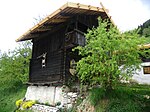
Chapel and granary at the Stöcklhuber ID: 17870 |
Sergser Straße 7 46 ° 49 ′ 24 ″ N, 11 ° 42 ′ 33 ″ E Fraction: Niedervintl |
Feb. 17, 1986 (BLR-LAB 573) |
chapel |
KG: Niedervintl building plot: 116, 117
|
| Granary near Kröll ID: 17891 |
Kegelbergstrasse 19 46 ° 50 ′ 34 ″ N, 11 ° 42 ′ 18 ″ E Fraction: Weitental |
Feb. 17, 1986 (BLR-LAB 573) |
Grain box |
KG: Weitental building plot: 45
|
|
| Lotterhofer ID: 17894 |
Huntsdorfer Straße 44 46 ° 51 ′ 2 ″ N, 11 ° 43 ′ 44 ″ E Fraction: Weitental |
Feb. 17, 1986 (BLR-LAB 573) |
Rural house / farm |
KG: Weitental building plot: 90/1
|
|
| Obergasser ID: 17881 |
Sonnseiter Strasse 1 46 ° 53 ′ 42 ″ N, 11 ° 42 ′ 19 ″ E Fraction: Pfunders |
Feb. 17, 1986 (BLR-LAB 573) |
Rural house / farm |
KG: Pfunders building plot: 76
|
|
| Oberhuber ID: 17892 |
Waidacher Strasse 24? 46 ° 50 ′ 36 ″ N, 11 ° 43 ′ 19 ″ E Fraction: Weitental |
Feb. 17, 1986 (BLR-LAB 573) |
Rural house / farm |
KG: Weitental building plot: 56
|
|
| Orthammer ID: 17871 |
Haslacher Strasse 10 46 ° 48 ′ 56 ″ N, 11 ° 41 ′ 25 ″ E Fraction: Niedervintl |
Feb. 17, 1986 (BLR-LAB 573) |
Rural house / farm |
KG: Niedervintl building plot: 146/1
|
|

|
Parish Church of the Annunciation with the Guggenberg burial chapel and cemetery in Niedervintl ID: 17867 |
Kirchweg 46 ° 48 ′ 55 ″ N, 11 ° 43 ′ 14 ″ E Fraction: Niedervintl |
Feb. 17, 1986 (BLR-LAB 573) |
church |
KG: Niedervintl building plot: 21 basic plot: 120
|

|
Parish church St. Martin with cemetery chapel and cemetery in Pfunders ID: 17885 |
Kirchbichl 46 ° 53 ′ 14 ″ N, 11 ° 42 ′ 31 ″ E Fraction: Pfunders |
Feb. 17, 1986 (BLR-LAB 573) |
church |
KG: Pfunders building plot: 205, 206 basic plot: 1530
|
|
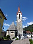
Parish church of St. Nicholas with cemetery chapel and cemetery ID: 17874 |
Weisskircher Strasse 46 ° 48 ′ 48 ″ N, 11 ° 45 ′ 19 ″ E Fraction: Obervintl |
Feb. 17, 1986 (BLR-LAB 573) |
church |
KG: Obervintl building plot: 1, 2 basic plot: 1
|
|
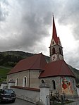
Parish church of St. Thomas with cemetery chapel and cemetery ID: 17888 |
Georg-Lantschner-Strasse 46 ° 50 ′ 39 ″ N, 11 ° 43 ′ 32 ″ E Fraction: Weitental |
Feb. 17, 1986 (BLR-LAB 573) |
church |
KG: Weitental building plot: 1, 2 basic plot: 1
|
| Pfarrwidum ID: 17889 |
Georg-Lantschner-Strasse 5 46 ° 50 ′ 38 ″ N, 11 ° 43 ′ 34 ″ E Fraction: Weitental |
May 18, 1987 (BLR-LAB 2613) |
Widum / Canon House |
KG: Weitental building plot: 5
|
|
| Seng ID: 17884 |
Dunker Strasse 5 46 ° 54 ′ 56 ″ N, 11 ° 41 ′ 18 ″ E Fraction: Pfunders |
Feb. 17, 1986 (BLR-LAB 573) |
Rural house / farm |
KG: Pfunders building plot: 145
|
|
|
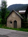
Stiegerstöckl ID: 17877 |
Dörfl 1 46 ° 48 ′ 41 ″ N, 11 ° 45 ′ 54 ″ E Fraction: Obervintl |
Oct. 30, 2000 (BLR-LAB 4072) |
Wayside shrine |
KG: Obervintl building plot: 29/1, 29/2
|
|
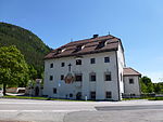
Töpsl ID: 17875 |
Weisskicher Strasse 46 ° 48 ′ 50 ″ N, 11 ° 45 ′ 20 ″ E Fraction: Obervintl |
April 10, 1989 (BLR-LAB 1864) |
Raised hide |
KG: Obervintl building plot: 6
|

|
Troyenbach ID: 17865 |
Jofef-Anton-Zoller-Straße 16 46 ° 48 ′ 56 ″ N, 11 ° 43 ′ 11 ″ E Fraction: Niedervintl |
Feb. 17, 1986 (BLR-LAB 573) |
Raised hide |
KG: Niedervintl building plot: 19
|
| Zasslermühle ID: 17893 |
Kegelbergstrasse 46 ° 50 ′ 33 ″ N, 11 ° 43 ′ 16 ″ E Fraction: Weitental |
Feb. 17, 1986 (BLR-LAB 573) |
Mill |
KG: Weitental building plot: 61/2
|
|

|
Zehentstadel ID: 17864 |
46 ° 48 ′ 56 ″ N, 11 ° 43 ′ 13 ″ E Fraction: Lower Vintl |
Feb. 17, 1986 (BLR-LAB 573) |
Barn |
KG: Niedervintl building plot: 17 |
If no coordinates are known for a monument, the cadastral data at the time it was placed under protection are given as a substitute. These are neither official nor necessarily up-to-date.
The addresses taken from the State Monuments Office may be out of date.
| Photo: | Photograph of the monument. Click the photo generates an enlarged view. There are also two symbols: |
| ID | Identifier at the South Tyrolean Monuments Office |
| KG | Cadastral parish |
| MD | Ministerial Decree |
| BLR-LAB | Decision of the state government - state committee decision |
Web links
- Monument browser of the South Tyrolean Monuments Office