List of architectural monuments in Mühlbach (South Tyrol)
The list of architectural monuments in Mühlbach ( Italian Rio di Pusteria ) contains the 41 objects designated as architectural monuments in the area of the municipality of Mühlbach in South Tyrol .
The basis is the official directory of the monuments in South Tyrol, which can be viewed on the Internet. These can be, for example, sacred buildings , residential houses, farms and aristocratic residences. The order in this list is based on the designation, alternatively it can also be sorted according to the address or the date on which it was placed under protection.
list
| photo | designation | Location | registration | description | Metadata |
|---|---|---|---|---|---|
| Alpine hut in Hochkasen ID: 50547 |
46 ° 48 ′ 51 ″ N, 11 ° 37 ′ 16 ″ E |
21 Mar 2011 (BLR-LAB 440) |
Alm |
KG: Spinges building plot: 81
|
|

|
Bacher ID: 16136 |
46 ° 49 ′ 13 "N, 11 ° 40 ′ 12" E |
10 Mar 1986 (BLR-LAB 1012) |
Rural house / farm |
KG: Meransen building plot: 35
|
| Bachmühle ID: 16146 |
46 ° 47 ′ 47 "N, 11 ° 40 ′ 3" E |
10 Mar 1986 (BLR-LAB 1012) |
Rural house / farm |
KG: Mühlbach building plot: 21
|
|
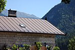
| Badwirt mill ID: 16168 |
46 ° 49 ′ 5 "N, 11 ° 38 ′ 34" E |
10 Mar 1986 (BLR-LAB 1012) |
Mill |
KG: Vals building plot: 141
|
|
|
Mühlbach station ID: 50276 |
46 ° 47 ′ 50 "N, 11 ° 40 ′ 11" E |
April 5, 2004 (BLR-LAB 1083) |
Train station / Remise |
KG: Mühlbach building plot: 27/2
|

|
Wayside shrine at the Mühlbacher Klause ID: 16154 |
Pustertaler Straße 46 ° 48 ′ 40 ″ N, 11 ° 41 ′ 2 ″ E |
10 Mar 1986 (BLR-LAB 1012) |
Wayside shrine |
KG: Mühlbach land parcel: 744
|

|
Bridge over the Valler Bach ID: 16155 |
46 ° 47 ′ 42 "N, 11 ° 39 ′ 57" E |
10 Mar 1986 (BLR-LAB 1012) |
bridge |
KG: Mühlbach land parcel: 837/1
|

|
Former court house ID: 18068 |
Katharina-Lanz-Strasse 90 46 ° 47 ′ 51 ″ N, 11 ° 40 ′ 7 ″ E |
10 Mar 1986 (BLR-LAB 1012) |
Rural house / farm |
KG: Mühlbach building plot: 2
|

|
Felderer ID: 16141 |
46 ° 48 ′ 59 "N, 11 ° 39 ′ 17" E |
May 18, 1951 (MD) |
Rural house / farm |
KG: Maranza building plot: 120
|

|
Freienthurn with garden ID: 16147 |
Pustertaler Strasse 2 46 ° 47 ′ 43 ″ N, 11 ° 40 ′ 3 ″ E |
10 Mar 1986 (BLR-LAB 1012) |
Raised hide; Seat of the Herz-Jesu-Institut |
KG: Mühlbach building plot: 32/1, 32/2 basic plot: 117/1
|
| Gasslermühle ID: 16137 |
46 ° 49 ′ 21 ″ N, 11 ° 39 ′ 55 ″ E |
10 Mar 1986 (BLR-LAB 1012) |
Mill |
KG: Maranza building plot: 49
|
|

|
Gasthof Weißes Lamm ID: 16143 |
46 ° 47 ′ 48 "N, 11 ° 40 ′ 3" E |
10 Mar 1986 (BLR-LAB 1012) |
Inn |
KG: Mühlbach building plot: 15
|

|
Memorial stone ID: 16162 |
46 ° 46 ′ 58 ″ N, 11 ° 39 ′ 3 ″ E |
10 Mar 1986 (BLR-LAB 1012) |
monument |
KG: Spinges land parcel: 39/1, 40
|

|
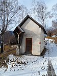
Holy Sepulcher Chapel ID: 16157 |
46 ° 47 ′ 17 "N, 11 ° 39 ′ 10" E |
10 Mar 1986 (BLR-LAB 1012) |
chapel |
KG: Spinges building plot: 2
|
|
Junker-Stöckl ID: 16161 |
46 ° 47 '13 "N, 11 ° 38' 57" E |
10 Mar 1986 (BLR-LAB 1012) |
chapel |
KG: Spinges building plot: 77
|

|
Kandelburg ID: 16148 |
Richtergasse 4 46 ° 47 ′ 47 ″ N, 11 ° 40 ′ 1 ″ E |
Jan 8, 1972 (MD) |
Raised hide |
KG: Mühlbach building plot : 40 basic plot: 81/1
|

|
Chapel at Pichler ID: 16135 |
46 ° 49 ′ 27 "N, 11 ° 40 ′ 39" E |
10 Mar 1986 (BLR-LAB 1012) |
chapel |
KG: Meransen building plot: 22
|
| Granary at Gumpold ID: 16138 |
46 ° 49 ′ 18 "N, 11 ° 39 ′ 38" E |
10 Mar 1986 (BLR-LAB 1012) |
Grain box |
KG: Maranza building plot: 50
|
|

|
Madlaner ID: 50278 |
46 ° 51 ′ 21 ″ N, 11 ° 37 ′ 10 ″ E |
Aug. 30, 1993 (BLR-LAB 5242) |
Rural house / farm |
KG: Vals building plot: 91
|

|
Maria-Hilf-Chapel ID: 50274 |
Katharina-Lanz-Strasse 90, at 46 ° 47 ′ 52 ″ N, 11 ° 40 ′ 7 ″ E |
10 Mar 1986 (BLR-LAB 1012) |
church |
KG: Mühlbach building plot: 1
|

|
Maria-Hilf-Chapel on the Fane-Alm ID: 16169 |
46 ° 53 ′ 0 ″ N, 11 ° 37 ′ 15 ″ E |
10 Mar 1986 (BLR-LAB 1012) |
chapel |
KG: Vals building plot: 150
|

|
Masl ID: 16163 |
46 ° 50 ′ 6 "N, 11 ° 37 ′ 44" E |
10 Mar 1986 (BLR-LAB 1012) |
Rural house / farm |
KG: Vals building plot: 25
|

|
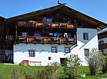
Mühlbacher Klause ID: 16153 |
46 ° 48 ′ 43 "N, 11 ° 41 ′ 5" E |
May 18, 1951 (MD) |
Castle ruins |
KG: Mühlbach building plot: 146, 147
|
|
Oberpranter ID: 16139 |
46 ° 48 '43 "N, 11 ° 39' 36" E |
10 Mar 1986 (BLR-LAB 1012) |
Rural house / farm |
KG: Maranza building plot: 87
|

|
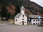
Mount of Olives Chapel ID: 16160 |
46 ° 46 ′ 51 ″ N, 11 ° 39 ′ 21 ″ E |
July 9, 2007 (BLR-LAB 2324) |
chapel |
KG: Spinges building plot: 74
|
|
Mount of Olives Chapel ID: 16170 |
46 ° 50 ′ 7 "N, 11 ° 37 ′ 46" E |
May 8, 1950 (MD) |
chapel |
KG: Vals building plot: 146
|
|
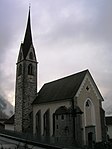
Parish Church of St. Andrew and Cemetery ID: 16164 |
46 ° 50 ′ 22 "N, 11 ° 37 ′ 38" E |
10 Mar 1986 (BLR-LAB 1012) |
church |
KG: Vals building plot: 44 basic plot: 1
|

|
Parish Church of St. Helena with cemetery chapel and cemetery ID: 16150 |
Kirchplatz 46 ° 47 ′ 45 ″ N, 11 ° 40 ′ 0 ″ E |
10 Mar 1986 (BLR-LAB 1012) |
church |
KG: Mühlbach building plot: 70, 71 basic plot: 101, 125
|

|
Parish church St. Jakob with cemetery ID: 16140 |
46 ° 48 '48 "N, 11 ° 39' 44" E |
10 Mar 1986 (BLR-LAB 1012) |
church |
KG: Meransen building plot: 94 basic plot: 785
|

|
Parish church St. Rupert with cemetery ID: 16156 |
46 ° 47 ′ 18 "N, 11 ° 39 ′ 10" E |
10 Mar 1986 (BLR-LAB 1012) |
church |
KG: Spinges building plot: 1 basic plot: 1
|

|
Pfarrwidum ID: 16149 |
Kirchplatz 1 46 ° 47 ′ 45 ″ N, 11 ° 39 ′ 59 ″ E |
10 Mar 1986 (BLR-LAB 1012) |
Widum / Canon House |
KG: Mühlbach building plot: 69
|

|
Pichler ID: 16167 |
46 ° 50 ′ 27 "N, 11 ° 37 ′ 32" E |
10 Mar 1986 (BLR-LAB 1012) |
Rural house / farm |
KG: Vals building plot: 74
|

|
Town hall Mühlbach ID: 50436 |
Katharina-Lanz-Strasse 47 46 ° 47 ′ 47 "N, 11 ° 40 ′ 2" E |
(Art. 5 (gvD 490/1999)) |
|
KG: Mühlbach building plot: 37, 39
|
| Schenk ID: 16145 |
46 ° 47 ′ 48 "N, 11 ° 40 ′ 2" E |
10 Mar 1986 (BLR-LAB 1012) |
Rural house / farm |
KG: Mühlbach building plot: 18
|
|
| Schweiger with mill ID: 16159 |
46 ° 47 ′ 37 "N, 11 ° 38 ′ 48" E |
10 Mar 1986 (BLR-LAB 1012) |
Rural house / farm; the mill is located just north-east at 46 ° 47 '41.6 " N , 11 ° 38' 50.7" O . |
KG: Spinges building plot: 31, 32
|
|
| Barn and granary at Zinggerle ID: 16165 |
46 ° 50 ′ 28 "N, 11 ° 37 ′ 36" E |
10 Mar 1986 (BLR-LAB 1012) |
Barn |
KG: Vals building plot: 47
|
|
|
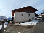
Strong ID: 16158 |
46 ° 47 ′ 17 "N, 11 ° 39 ′ 6" E |
10 Mar 1986 (BLR-LAB 1012) |
Rural house / farm |
KG: Spinges building plot: 17
|
|
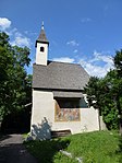
Stöcklvater Chapel ID: 16151 |
Stöcklvaterweg 46 ° 47 ′ 25 ″ N, 11 ° 39 ′ 52 ″ E |
10 Mar 1986 (BLR-LAB 1012) |
chapel |
KG: Mühlbach building plot: 123/2
|

|
Straßhof ID: 16152 |
Straßhof 2 46 ° 47 ′ 44 ″ N, 11 ° 39 ′ 47 ″ E |
10 Mar 1986 (BLR-LAB 1012) |
Rural house / farm |
KG: Mühlbach building plot: 126
|

|
Untergatterer ID: 16166 |
46 ° 50 ′ 36 "N, 11 ° 37 ′ 28" E |
10 Mar 1986 (BLR-LAB 1012) |
Rural house / farm |
KG: Vals building plot: 53
|
| Weissenhaus ID: 16144 |
46 ° 47 ′ 48 "N, 11 ° 40 ′ 3" E |
10 Mar 1986 (BLR-LAB 1012) |
Rural house / farm |
KG: Mühlbach building plot: 16/1 |
If no coordinates are known for a monument, the cadastral data at the time it was placed under protection are given as a substitute. These are neither official nor necessarily up-to-date.
The addresses taken from the State Monuments Office may be out of date.
| Photo: | Photograph of the monument. Click the photo generates an enlarged view. There are also two symbols: |
| ID | Identifier at the South Tyrolean Monuments Office |
| KG | Cadastral parish |
| MD | Ministerial Decree |
| BLR-LAB | Decision of the state government - state committee decision |
Web links
- Monument browser of the South Tyrolean Monuments Office