List of architectural monuments in Terento
The list of monuments in Terenten (Italian Terento ) contains the 26 as monuments designated objects on the territory of the municipality Terenten in South Tyrol .
The basis is the official directory of the monuments in South Tyrol, which can be viewed on the Internet. These can be, for example, sacred buildings , residential houses, farms and aristocratic residences. The order in this list is based on the designation, alternatively it can also be sorted according to the address or the date on which it was placed under protection.
list
| photo | designation | Location | registration | description | Metadata |
|---|---|---|---|---|---|
| Aschburg ID: 17522 |
46 ° 49 ′ 10 "N, 11 ° 46 ′ 38" E |
July 24, 1950 (MD) |
Castle ruins |
KG: Terenten basic parcel: 433
|
|

|
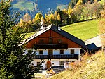
Englstöckl am Hohenbichl ID: 17521 |
46 ° 49 ′ 55 "N, 11 ° 45 ′ 20" E |
13 Mar 1989 (BLR-LAB 1507) |
Wayside shrine |
KG: Terenten building plot: 337
|
|
Falcons in margins ID: 17516 |
46 ° 50 ′ 8 "N, 11 ° 45 ′ 25" E |
16 Sep 1986 (BLR-LAB 5107) |
Rural house / farm |
KG: Terenten building plot: 224
|

|
Josl am Bichl with box ID: 17497 |
46 ° 49 ′ 30 "N, 11 ° 48 ′ 29" E |
16 Sep 1986 (BLR-LAB 5107) |
Two-storey rural house / farm with a wooden attic. Year 1609. |
KG: Pichlern building plot: 12, 81
|

|
Chapel at Mair am Graben ID: 17510 |
46 ° 49 ′ 51 ″ N, 11 ° 47 ′ 29 ″ E |
16 Sep 1986 (BLR-LAB 5107) |
Chapel built around 1700. Simple construction with a barrel and groin vault |
KG: Terenten building plot: 119
|

|
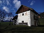
Granary at the Brunner ID: 17512 |
46 ° 49 ′ 30 "N, 11 ° 45 ′ 30" E |
16 Sep 1986 (BLR-LAB 5107) |
Grain box |
KG: Terenten building plot: 169/2
|
|
Granary at Huber an der Ast ID: 17509 |
46 ° 49 ′ 50 ″ N, 11 ° 47 ′ 19 ″ E |
16 Sep 1986 (BLR-LAB 5107) |
Two-storey granary with a boarded wooden gable. On the gable facade frescoes (St. Martin, Georg). Oven attached to the eaves with protruding vault (barrel and pent roof). |
KG: Terenten building plot: 118
|
| Granary at the Mair in Pein ID: 17513 |
46 ° 49 ′ 25 "N, 11 ° 45 ′ 28" E |
16 Sep 1986 (BLR-LAB 5107) |
Grain box |
KG: Terenten building plot: 170
|
|
| Grain box at the Pristaller ID: 17504 |
46 ° 49 ′ 11 "N, 11 ° 45 ′ 57" E |
16 Sep 1986 (BLR-LAB 5107) |
One-storey grain bin with open gable, granite corner blocks, flat arched door with plaster frame and donkey back stile, the rest of the masonry only poorly plastered. Built-in small oven with a gable roof. |
KG: Terenten building plot: 48
|
|

|
Granary and chapel at Kuen ID: 17499 |
46 ° 49 ′ 40 "N, 11 ° 48 ′ 45" E |
16 Sep 1986 (BLR-LAB 5107) |
Grain box |
KG: Pichlern building plot: 21/3 basic plot: 376
|

|
Granary and chapel at the Oberleitner ID: 17511 |
46 ° 49 ′ 59 "N, 11 ° 46 ′ 43" E |
16 Sep 1986 (BLR-LAB 5107) |
Granary and chapel |
KG: Terenten building plot: 129
|
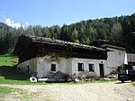
| Granary and shed at the Forchner ID: 17514 |
46 ° 49 ′ 32 "N, 11 ° 44 ′ 49" E |
16 Sep 1986 (BLR-LAB 5107) |
Grain box |
KG: Terenten building plot: 188
|
|
|
Granary and extension at Tötscher ID: 17507 |
46 ° 50 ′ 17 "N, 11 ° 47 ′ 45" E |
16 Sep 1986 (BLR-LAB 5107) |
Grain box |
KG: Terenten building plot: 75
|

|
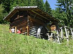
Mair am Gruben with chapel ID: 17498 |
46 ° 49 ′ 20 "N, 11 ° 48 ′ 38" E |
16 Sep 1986 (BLR-LAB 5107) |
Rural house / farm |
KG: Pichlern building plot: 14
|
|
Mill at Oberjakober ID: 17519 |
46 ° 50 ′ 33 "N, 11 ° 46 ′ 27" E |
16 Sep 1986 (BLR-LAB 5107) |
Mill |
KG: Terenten building plot: 286
|

|
Mill, grain bin and oven at Alpegger ID: 17506 |
46 ° 50 ′ 17 "N, 11 ° 47 ′ 37" E |
16 Sep 1986 (BLR-LAB 5107) |
Mill a little east on the Winnebach 46 ° 50 ′ 16.6 ″ N , 11 ° 47 ′ 41.4 ″ E , |
KG: Terenten building plot: 334, 74, 78
|

|
Mühlen am Winnebach ID: 17508 |
46 ° 50 ′ 23 "N, 11 ° 47 ′ 42" E |
16 Sep 1986 (BLR-LAB 5107) |
The coordinates on the left refer to the top of the 3 mills (Tötscher mill); Mill on Bp. 83 is at 46 ° 49 '59.7 " N , 11 ° 47' 38.1" E , Mill on Bp. 84 is at 46 ° 49 '57.4 " N , 11 ° 47' 39 ″ O |
KG: Terenten building plot: 302, 303, 83, 84
|

|
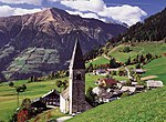
Parish church of St. Georg with the Heiligkreuz cemetery chapel and cemetery ID: 17500 |
46 ° 49 ′ 43 "N, 11 ° 46 ′ 32" E |
16 Sep 1986 (BLR-LAB 5107) |
church |
KG: Terenten building plot: 1, 2 basic plot: 1
|
|
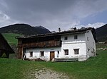
Pichlhaus ID: 17501 |
46 ° 49 ′ 50 "N, 11 ° 46 ′ 35" E |
16 Sep 1986 (BLR-LAB 5107) |
Rural house / farm |
KG: Terenten building plot: 22
|
| Schneiderhäusl in Pein ID: 17517 |
46 ° 50 ′ 11 "N, 11 ° 45 ′ 25" E |
16 Sep 1986 (BLR-LAB 5107) |
Rural house / farm |
KG: Terenten building plot: 227
|
|
|
St. Margareth in Margen ID: 17515 |
46 ° 50 ′ 7 "N, 11 ° 45 ′ 29" E |
16 Sep 1986 (BLR-LAB 5107) |
church |
KG: Terenten building plot: 221
|

|
St. Zeno in Pein ID: 17503 |
46 ° 49 ′ 26 "N, 11 ° 46 ′ 13" E |
16 Sep 1986 (BLR-LAB 5107) |
church |
KG: Terenten building plot: 46
|
| Stockner ID: 17502 |
46 ° 49 ′ 36 "N, 11 ° 46 ′ 22" E |
16 Sep 1986 (BLR-LAB 5107) |
Rural house / farm |
KG: Terenten building plot: 35
|
|

|
Unterpertinger with grain box ID: 17505 |
46 ° 49 ′ 57 "N, 11 ° 48 ′ 21" E |
16 Sep 1986 (BLR-LAB 5107) |
Rural house / farm |
KG: Terenten building plot: 65
|

|
Two grain bins at Gasser in Margen ID: 17518 |
46 ° 50 ′ 12 "N, 11 ° 45 ′ 24" E |
16 Sep 1986 (BLR-LAB 5107) |
Grain box |
KG: Terenten building plot: 228, 229
|

|
Two mills in the Terner Tal ID: 17520 |
46 ° 50 ′ 29 "N, 11 ° 46 ′ 28" E |
16 Sep 1986 (BLR-LAB 5107) |
Gassner mill and a little above Hansleitner mill; the coordinates of the left refer to the Gassner-mill, Hans Leitner mill is situated at 46 ° 50 '32.1 " N , 11 ° 46' 27.4" O . |
KG: Terenten building plot: 287, 288 |
If no coordinates are known for a monument, the cadastral data at the time it was placed under protection are given as a substitute. These are neither official nor necessarily up-to-date.
The addresses taken from the State Monuments Office may be out of date.
| Photo: | Photograph of the monument. Click the photo generates an enlarged view. There are also two symbols: |
| ID | Identifier at the South Tyrolean Monuments Office |
| KG | Cadastral parish |
| MD | Ministerial Decree |
| BLR-LAB | Decision of the state government - state committee decision |
Web links
- Monument browser of the South Tyrolean Monuments Office