List of architectural monuments in Braies
The list of monuments in Prague (Italian Braies ) contains the 18 as monuments designated objects on the territory of the municipality of Prague in South Tyrol .
The basis is the official directory of the monuments in South Tyrol, which can be viewed on the Internet. These can be, for example, sacred buildings , residential houses, farms and aristocratic residences. The order in this list is based on the designation, alternatively it can also be sorted according to the address or the date on which it was placed under protection.
list
| photo | designation | Location | registration | description | Metadata |
|---|---|---|---|---|---|

|
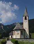
Church of the Redeemer in Ausserprags ID: 16537 |
46 ° 43 ′ 9 ″ N, 12 ° 7 ′ 47 ″ E |
October 17, 1988 (BLR-LAB 6776) |
church |
KG: Prague's building plot: 1
|
| Hansler ID: 16542 |
46 ° 43 ′ 28 "N, 12 ° 7 ′ 56" E |
October 17, 1988 (BLR-LAB 6776) |
Rural house / farm |
KG: Prague's building plot: 107/1
|
|

|
Hotel Pragser Wildsee with Marienkapelle ID: 16550 |
46 ° 41 '56 "N, 12 ° 5' 5" E |
October 17, 1988 (BLR-LAB 6776) |
Hotel; the band is situated at 46 ° 41 '51.3 " N , 12 ° 5' 1.7" O . |
KG: Prague's building plot: 254, 264
|

|
Chapel on the Plätzwiese ID: 16552 |
46 ° 39 '14 "N, 12 ° 10' 46" E |
October 17, 1988 (BLR-LAB 6776) |
chapel |
KG: Prague's building plot: 381
|
| Chapel at the Hansler ID: 16541 |
46 ° 43 ′ 28 "N, 12 ° 7 ′ 59" E |
May 9, 1950 (MD) |
chapel |
KG: Prague's building plot: 103
|
|

|
Chapel in the saw ID: 16551 |
46 ° 43 '16 "N, 12 ° 8' 23" E |
October 17, 1988 (BLR-LAB 6776) |
chapel |
KG: Prague's building plot: 297
|
| Chapel in Hofstatt ID: 16539 |
46 ° 43 ′ 27 "N, 12 ° 8 ′ 26" E |
May 9, 1950 (MD) |
chapel |
KG: Prague's building plot: 78
|
|
| Chapel in Maxbach ID: 16540 |
46 ° 44 ′ 5 ″ N, 12 ° 8 ′ 11 ″ E |
October 17, 1988 (BLR-LAB 6776) |
chapel |
KG: Prague's building plot: 97
|
|
| Chapel in Plung ID: 16538 |
46 ° 43 ′ 3 "N, 12 ° 8 ′ 33" E |
October 17, 1988 (BLR-LAB 6776) |
chapel |
KG: Prague's building plot: 54
|
|
| Messner ID: 16545 |
46 ° 42 ′ 59 "N, 12 ° 6 ′ 14" E |
October 17, 1988 (BLR-LAB 6776) |
Rural house / farm |
KG: Prague building plot: 150
|
|
| Mooserstöckl ID: 16553 |
46 ° 43 ′ 31 ″ N, 12 ° 7 ′ 31 ″ E |
October 17, 1988 (BLR-LAB 6776) |
Wayside shrine |
KG: Prague's parcel: 1569
|
|

|
Parish church St. Veit with cemetery ID: 16547 |
46 ° 42 ′ 55 ″ N, 12 ° 6 ′ 9 ″ E |
October 17, 1988 (BLR-LAB 6776) |
church |
KG: Prague's building plot : 157 Base plot: 2108/1
|
| Pfarrwidum ID: 16546 |
46 ° 42 ′ 56 "N, 12 ° 6 ′ 13" E |
October 17, 1988 (BLR-LAB 6776) |
Widum / Canon House |
KG: Prague's building plot: 154
|
|
| Schachen ID: 16544 |
46 ° 43 ′ 5 ″ N, 12 ° 6 ′ 7 ″ E |
October 17, 1988 (BLR-LAB 6776) |
Rural house / farm |
KG: Prague's building plot: 137
|
|
| St. Theobald in Bad Altprags ID: 16549 |
46 ° 42 ′ 26 "N, 12 ° 9 ′ 18" E |
October 17, 1988 (BLR-LAB 6776) |
church |
KG: Prague's building plot: 193/5
|
|
| Stauder ID: 16543 |
46 ° 43 ′ 37 "N, 12 ° 7 ′ 33" E |
October 17, 1988 (BLR-LAB 6776) |
Rural house / farm |
KG: Prague's building plot: 109
|
|
| Thomaser ID: 16548 |
46 ° 42 ′ 46 "N, 12 ° 5 ′ 58" E |
October 17, 1988 (BLR-LAB 6776) |
Rural house / farm |
KG: Prague's building plot: 164
|
|

|
Plätzwiese plant ID: 50452 |
46 ° 38 ′ 30 "N, 12 ° 11 ′ 43" E |
Aug 28, 2006 (BLR-LAB 3046) |
Fortifications; the building is located exactly on the municipal boundary between Braies and Toblach , where it is registered as building lot 1026 and placed under protection. |
KG: Prague's building plot: 482 |
If no coordinates are known for a monument, the cadastral data at the time it was placed under protection are given as a substitute. These are neither official nor necessarily up-to-date.
The addresses taken from the State Monuments Office may be out of date.
| Photo: | Photograph of the monument. Click the photo generates an enlarged view. There are also two symbols: |
| ID | Identifier at the South Tyrolean Monuments Office |
| KG | Cadastral parish |
| MD | Ministerial Decree |
| BLR-LAB | Decision of the state government - state committee decision |
Web links
- Monument browser of the South Tyrolean Monuments Office