List of architectural monuments in Laas (South Tyrol)
The list of architectural monuments in Laas ( Italian Lasa ) contains the 49 objects designated as architectural monuments in the area of the municipality of Laas in South Tyrol .
The basis is the official directory of the monuments in South Tyrol, which can be viewed on the Internet. These can be, for example, sacred buildings , residential houses, farms and aristocratic residences. The order in this list is based on the designation, alternatively it can also be sorted according to the address or the date on which it was placed under protection.
list
| photo | designation | Location | registration | description | Metadata |
|---|---|---|---|---|---|

|
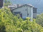
Eyrsburg (Moosburg) ID: 15499 |
46 ° 37 ′ 46 ″ N, 10 ° 39 ′ 3 ″ E Fraction: Eyrs |
May 12, 1981 (BLR-LAB 2536) |
Raised hide |
KG: Eyrs building plot: 92
|
|
Galministein ID: 15527 |
46 ° 38 ′ 32 "N, 10 ° 39 ′ 4" E Fraction: Tanas |
May 12, 1981 (BLR-LAB 2536) |
Rural house / farm |
KG: Tana's building plot: 56/1, 56/2, 56/3, 56/4, 56/5, 56/6
|

|
Gasthaus Glöggl ID: 15524 |
46 ° 38 ′ 22 "N, 10 ° 40 ′ 0" E Fraction: Tanas |
May 12, 1981 (BLR-LAB 2536) |
Former inn |
KG: Tana's building plot: 28, 29
|

|
Gasthaus Krone ID: 15504 |
Hauptplatz 10 46 ° 37 ′ 0 ″ N, 10 ° 42 ′ 4 ″ E |
May 12, 1981 (BLR-LAB 2536) |
Inn |
KG: Laas building plot: 38/1
|

|
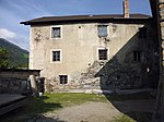
Gasthof Lamm ID: 15498 |
46 ° 37 ′ 48 "N, 10 ° 38 ′ 58" E Fraction: Eyrs |
May 12, 1981 (BLR-LAB 2536) |
Former inn |
KG: Eyrs building plot: 71/2
|
|
Gerbergasse 8 ID: 15507 |
Gerbergasse 8 46 ° 36 ′ 57 ″ N, 10 ° 42 ′ 8 ″ E |
May 12, 1981 (BLR-LAB 2536) |
Rural house / farm |
KG: Laas building plot: 97
|

|
Gsal ID: 15528 |
46 ° 38 ′ 29 ″ N, 10 ° 39 ′ 1 ″ E Fraction: Tanas |
May 12, 1981 (BLR-LAB 2536) |
Rural house / farm |
KG: Tanas Bauparzelle: 57, 58/2
|

|
Hauptplatz 8 ID: 15505 |
Hauptplatz 8 46 ° 37 ′ 0 ″ N, 10 ° 42 ′ 5 ″ E |
May 12, 1981 (BLR-LAB 2536) |
Rural house / farm |
KG: Laas building plot: 39
|

|
Hauptplatz 12-14 ID: 15503 |
Hauptplatz 12-14 46 ° 37 ′ 0 ″ N, 10 ° 42 ′ 3 ″ E |
May 12, 1981 (BLR-LAB 2536) |
Rural house / farm |
KG: Laas building plot: 35
|
|
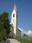
Herz-Jesu parish church with cemetery ID: 15530 |
46 ° 38 ′ 25 "N, 10 ° 39 ′ 51" E Fraction: Tanas |
May 12, 1981 (BLR-LAB 2536) |
church |
KG: Tana's building plot : 68 Base plot: 61/2
|

|
Josefshaus ID: 15519 |
46 ° 37 ′ 6 ″ N, 10 ° 41 ′ 55 ″ E |
May 12, 1981 (BLR-LAB 2536) |
school |
KG: Laas building plot: 278
|

|
Chapel near Unterburg ID: 15489 |
46 ° 37 ′ 57 ″ N, 10 ° 43 ′ 15 ″ E Fraction: Allitz |
6th Mar 1989 (BLR-LAB 1254) |
chapel |
KG: Allitz building plot: 6/3
|

|
Chapel in Parnetz ID: 15514 |
46 ° 36 ′ 36 "N, 10 ° 40 ′ 14" E |
May 12, 1981 (BLR-LAB 2536) |
chapel |
KG: Laas building plot: 204/1
|

|
Cemeteries ID: 15493 |
46 ° 38 ′ 8 ″ N, 10 ° 42 ′ 41 ″ E Fraction: Allitz |
May 12, 1981 (BLR-LAB 2536) |
Rural house / farm |
KG: Allitz building plot: 46, 47, 49
|

|
Maria Visitation in Alitz ID: 15516 |
46 ° 37 ′ 58 "N, 10 ° 42 ′ 55" E |
May 12, 1981 (BLR-LAB 2536) |
chapel |
KG: Laas building plot: 238
|
|
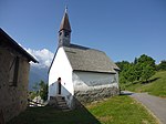
Marienkapelle bei Untertrög ID: 15490 |
46 ° 38 ′ 8 ″ N, 10 ° 41 ′ 57 ″ E Fraction: Allitz |
May 12, 1981 (BLR-LAB 2536) |
chapel |
KG: Allitz building plot: 24
|
|
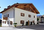
Dilapidated ID: 15497 |
46 ° 37 ′ 50 "N, 10 ° 38 ′ 53" E Fraction: Eyrs |
May 12, 1981 (BLR-LAB 2536) |
Rural house / farm |
KG: Eyrs building plot: 40
|

|
Mittertrög ID: 15491 |
46 ° 38 ′ 11 ″ N, 10 ° 41 ′ 52 ″ E Fraction: Allitz |
May 12, 1981 (BLR-LAB 2536) |
Rural house / farm |
KG: Allitz building plot: 35, 38, 39
|

|
Oberhof ID: 15535 |
46 ° 36 ′ 42 ″ N, 10 ° 38 ′ 5 ″ E Fraction: Tschengls |
May 12, 1981 (BLR-LAB 2536) |
Rural house / farm |
KG: Tschengls building plot: 82
|
|
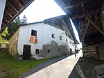
Obertels ID: 15529 |
46 ° 38 ′ 34 "N, 10 ° 38 ′ 6" E Fraction: Tanas |
May 12, 1981 (BLR-LAB 2536) |
Rural house / farm |
KG: Tana's building plot: 63, 64/1, 64/2, 65
|

|
Perlingerhaus ID: 15532 |
46 ° 36 ′ 45 ″ N, 10 ° 38 ′ 14 ″ E Fraction: Tschengls |
May 12, 1981 (BLR-LAB 2536) |
Rural house / farm |
KG: Tschengls building plot: 14/1, 14/2
|

|
Parish Church of the Birth of Mary with cemetery chapel and cemetery ID: 15531 |
46 ° 36 ′ 46 ″ N, 10 ° 38 ′ 15 ″ E Fraction: Tschengls |
May 12, 1981 (BLR-LAB 2536) |
church |
KG: Tschengls building plot: 1, 2 basic plot: 11
|
|
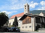
Parish church of St. John the Baptist with cemetery chapel and cemetery ID: 15500 |
46 ° 37 ′ 1 ″ N, 10 ° 41 ′ 56 ″ E |
May 12, 1981 (BLR-LAB 2536) |
church |
KG: Laas building plot: 1, 319 basic plot: 77
|

|
Platt ID: 15521 |
46 ° 38 ′ 24 ″ N, 10 ° 39 ′ 59 ″ E Fraction: Tanas |
May 12, 1981 (BLR-LAB 2536) |
Rural house / farm |
KG: Tana's building plot: 18
|

|
Plawenngut ID: 15494 |
46 ° 37 ′ 46 ″ N, 10 ° 39 ′ 4 ″ E Fraction: Eyrs |
May 12, 1981 (BLR-LAB 2536) |
Rural house / farm |
KG: Eyrs building plot: 1
|

|
Riglgut ID: 15536 |
46 ° 36 ′ 42 ″ N, 10 ° 38 ′ 3 ″ E Fraction: Tschengls |
May 12, 1981 (BLR-LAB 2536) |
Rural house / farm |
KG: Tschengls building plot: 83
|

|
Röder ID: 15522 |
46 ° 38 ′ 23 "N, 10 ° 39 ′ 59" E Fraction: Tanas |
May 12, 1981 (BLR-LAB 2536) |
Rural house / farm |
KG: Tana's building plot: 19/1, 19/3, 19/4
|

|
Schneidergasse 5 ID: 15510 |
Schneidergasse 5 46 ° 36 ′ 59 ″ N, 10 ° 42 ′ 3 ″ E |
May 12, 1981 (BLR-LAB 2536) |
Rural house / farm |
KG: Laas building plot: 128/1
|

|
St. Anna in the village ID: 15523 |
46 ° 38 ′ 23 "N, 10 ° 40 ′ 0" E Fraction: Tanas |
May 12, 1981 (BLR-LAB 2536) |
church |
KG: Tana's building plot: 20
|

|
St. Martin ID: 15513 |
46 ° 36 '26 "N, 10 ° 41' 53" E |
May 12, 1981 (BLR-LAB 2536) |
church |
KG: Laas building plot: 199
|

|
St. Marx ID: 15511 |
46 ° 37 ′ 0 ″ N, 10 ° 41 ′ 55 ″ E |
May 12, 1981 (BLR-LAB 2536) |
church |
KG: Laas building plot: 146
|

|
St. Moritz ID: 15492 |
46 ° 38 ′ 8 ″ N, 10 ° 42 ′ 42 ″ E Fraction: Allitz |
May 12, 1981 (BLR-LAB 2536) |
church |
KG: Allitz building plot: 45
|
|
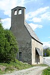
St. Nicholas ID: 15517 |
46 ° 37 ′ 4 "N, 10 ° 42 ′ 35" E |
May 12, 1981 (BLR-LAB 2536) |
church |
KG: Laas building plot: 241
|

|
St. Ottilia ID: 15537 |
46 ° 36 ′ 43 ″ N, 10 ° 37 ′ 25 ″ E Fraction: Tschengls |
May 12, 1981 (BLR-LAB 2536) |
church |
KG: Tschengls building plot: 91
|

|
St. Peter ID: 15526 |
46 ° 38 ′ 34 "N, 10 ° 39 ′ 12" E Fraction: Tanas |
May 12, 1981 (BLR-LAB 2536) |
church |
KG: Tana's building plot: 55
|

|
St. Remigius ID: 15495 |
46 ° 37 ′ 50 ″ N, 10 ° 39 ′ 2 ″ E Fraction: Eyrs |
May 12, 1981 (BLR-LAB 2536) |
church |
KG: Eyrs building plot: 17
|

|
St. Sisinius ID: 15515 |
46 ° 37 '24 "N, 10 ° 41' 35" E |
May 12, 1981 (BLR-LAB 2536) |
church |
KG: Laas building plot: 218
|

|
Ortisei at Lazarushof ID: 15512 |
46 ° 36 ′ 18 "N, 10 ° 42 ′ 27" E |
May 12, 1981 (BLR-LAB 2536) |
chapel |
KG: Laas building plot: 189
|

|
Telser ID: 15502 |
46 ° 37 ′ 4 ″ N, 10 ° 42 ′ 5 ″ E |
May 12, 1981 (BLR-LAB 2536) |
Rural house / farm |
KG: Laas building plot: 30
|

|
Tinzlhaus with farm building ID: 15509 |
46 ° 36 ′ 58 "N, 10 ° 42 ′ 3" E |
May 12, 1981 (BLR-LAB 2536) |
Rural house / farm |
KG: Laas building plot: 117, 118/1, 119
|

|
Tschenglsberg ID: 15538 |
46 ° 36 ′ 24 ″ N, 10 ° 37 ′ 18 ″ E Fraction: Tschengls |
May 12, 1981 (BLR-LAB 2536) |
Castle ruins |
KG: Tschengls building plot: 97
|

|
Tschenglsburg ID: 15533 |
46 ° 36 ′ 40 ″ N, 10 ° 38 ′ 15 ″ E Fraction: Tschengls |
May 12, 1981 (BLR-LAB 2536) |
Castle |
KG: Tschengls building plot: 22
|

|
Umer ID: 15539 |
46 ° 37 ′ 2 ″ N, 10 ° 42 ′ 3 ″ E |
May 12, 1981 (BLR-LAB 2536) |
Rural house / farm |
KG: Laas building plot: 28
|
|
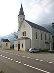
Our Lady of Lourdes ID: 15518 |
46 ° 36 '59 "N, 10 ° 43' 2" E |
May 12, 1981 (BLR-LAB 2536) |
church |
KG: Laas building plot: 250
|

|
Unterfrinig with chapel ID: 15525 |
46 ° 39 ′ 10 ″ N, 10 ° 39 ′ 19 ″ E Fraction: Tanas |
May 12, 1981 (BLR-LAB 2536) |
Rural house / farm |
KG: Tana's building plot: 49, 50, 51, 52/1, 52/2, 52/3, 52/4, 52/5
|

|
Unterloretz ID: 15501 |
Dr.-Franz-Tappeiner-Gasse 7 46 ° 37 ′ 1 ″ N, 10 ° 42 ′ 3 ″ E |
May 27, 1991 (BLR-LAB 2806) |
Rural house / farm |
KG: Laas building plot: 27
|

|
Vinschgaustraße 23 ID: 15506 |
Vinschgaustraße 23 46 ° 37 ′ 0 ″ N, 10 ° 42 ′ 12 ″ E |
Apr 14, 1950 (MD) |
Rural house / farm |
KG: Laas building plot: 86
|

|
Vinschgaustraße 43 ID: 15508 |
Vinschgaustraße 43 46 ° 36 ′ 59 ″ N, 10 ° 42 ′ 6 ″ E |
May 12, 1981 (BLR-LAB 2536) |
Rural house / farm |
KG: Laas building plot: 105/1, 105/2
|

|
Voglsang ID: 15496 |
46 ° 37 ′ 53 ″ N, 10 ° 39 ′ 3 ″ E Fraction: Eyrs |
May 12, 1981 (BLR-LAB 2536) |
Widum / Canon House |
KG: Eyrs building plot: 19 |
If no coordinates are known for a monument, the cadastral data at the time it was placed under protection are given as a substitute. These are neither official nor necessarily up-to-date.
The addresses taken from the State Monuments Office may be out of date.
| Photo: | Photograph of the monument. Click the photo generates an enlarged view. There are also two symbols: |
| ID | Identifier at the South Tyrolean Monuments Office |
| KG | Cadastral parish |
| MD | Ministerial Decree |
| BLR-LAB | Decision of the state government - state committee decision |
Web links
- Monument browser of the South Tyrolean Monuments Office
Individual evidence
- ^ Oswald Trapp : Tiroler Burgenbuch. Volume I: Vinschgau . Verlagsanstalt Athesia, Bozen 1972, pp. 143–144.