List of architectural monuments in Laives
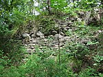
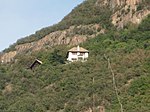
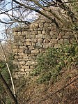
The list of monuments in Laives ( Italian Laives ) contains the 13 as monuments designated objects on the territory of the municipality Leifers in South Tyrol .
The basis is the official directory of the monuments in South Tyrol, which can be viewed on the Internet. These can be, for example, sacred buildings , residential houses, farms and aristocratic residences. The order in this list is based on the designation, alternatively it can also be sorted according to the address or the date on which it was placed under protection.
list
| photo | designation | Location | registration | description | Metadata |
|---|---|---|---|---|---|

|
Burger with wayside shrine ID: 15692 |
46 ° 25 ′ 33 "N, 11 ° 19 ′ 59" E |
Feb. 6, 1978 (BLR-LAB 780) |
Rural house / farm burger with wayside shrine |
KG: Laives Bauparzelle: 25/1, 25/5 basic plot: 1,582
|

|
Damiano-Chiesa-Straße 18-20 ID: 15693 |
Damiano-Chiesa-Straße 18-20 46 ° 25 ′ 41 ″ N, 11 ° 20 ′ 14 ″ E |
Feb. 6, 1978 (BLR-LAB 780) |
Rural house / farm |
KG: Laives building plot: 39/1
|

|
Gasthaus zur Pflege ID: 15691 |
46 ° 25 ′ 21 ″ N, 11 ° 20 ′ 36 ″ E |
July 24, 1950 (MD) |
Inn |
KG: Laives Bauparzelle: 13/1, 13/2, 13/5
|

|
Gasthof Großhaus ID: 15694 |
46 ° 25 ′ 41 ″ N, 11 ° 20 ′ 21 ″ E |
July 24, 1950 (MD) |
Inn |
KG: Laives Bauparzelle: 42/1
|

|
Köhlmühle ID: 15700 |
46 ° 27 '32 "N, 11 ° 21' 9" E |
October 24, 1983 (BLR-LAB 6147) |
Mill |
KG: Laives building plot: 183
|

|
Liechtenstein ID: 15701 |
46 ° 25 ′ 13 ″ N, 11 ° 20 ′ 39 ″ E |
Feb. 6, 1978 (BLR-LAB 780) |
Castle ruins |
KG: Laives land parcel: 1504, 1505
|

|
Parish Church of St. Anton Abbot and Nikolaus in Laives ID: 15690 |
46 ° 25 ′ 35 "N, 11 ° 20 ′ 21" E |
Feb. 6, 1978 (BLR-LAB 780) |
church |
KG: Laives building plot: 1
|

|
Parish church of Blessed Heinrich von Bozen in Since ID: 15698 |
46 ° 27 ′ 30 ″ N, 11 ° 21 ′ 3 ″ E |
Feb. 6, 1978 (BLR-LAB 780) |
church |
KG: Laives building plot: 106
|

|
Rennerhof ID: 15695 |
46 ° 26 ′ 42 "N, 11 ° 20 ′ 38" E |
June 5, 1989 (BLR-LAB 2448) |
Rural house / farm |
KG: Laives building plot: 75
|

|
St. Jakob in der Au ID: 15696 |
46 ° 27 ′ 27 ″ N, 11 ° 20 ′ 15 ″ E |
Feb. 6, 1978 (BLR-LAB 780) |
church |
KG: Laives building plot: 80
|

|
St. Peter am Kofl ID: 15699 |
46 ° 25 ′ 14 "N, 11 ° 20 ′ 36" E |
Feb. 6, 1978 (BLR-LAB 780) |
church |
KG: Laives building plot: 151
|

|
Stallerhof ID: 15697 |
46 ° 27 '46 "N, 11 ° 20' 25" E |
Feb. 6, 1978 (BLR-LAB 780) |
Rural house / farm |
KG: Laives Bauparzelle: 96/2
|

|
Tower on the Tinzlleiten ID: 15702 |
46 ° 27 ′ 3 "N, 11 ° 20 ′ 42" E |
Feb. 6, 1978 (BLR-LAB 780) |
Tower ruin |
KG: Laives land parcel: 1039 |
If no coordinates are known for a monument, the cadastral data at the time it was placed under protection are given as a substitute. These are neither official nor necessarily up-to-date.
The addresses taken from the State Monuments Office may be out of date.
| Photo: | Photograph of the monument. Click the photo generates an enlarged view. There are also two symbols: |
| ID | Identifier at the South Tyrolean Monuments Office |
| KG | Cadastral parish |
| MD | Ministerial Decree |
| BLR-LAB | Decision of the state government - state committee decision |
Web links
- Monument browser of the South Tyrolean Monuments Office