List of architectural monuments in Prad am Stilfserjoch
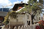
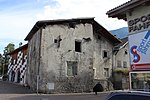
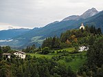
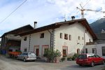
The list of architectural monuments in Prad am Stilfser Joch ( Italian Prato allo Stelvio ) contains the 34 objects designated as architectural monuments in the area of the municipality of Prad am Stilfserjoch in South Tyrol .
The basis is the official directory of the monuments in South Tyrol, which can be viewed on the Internet. These can be, for example, sacred buildings , residential houses, farms and aristocratic residences. The order in this list is based on the designation, alternatively it can also be sorted according to the address or the date on which it was placed under protection.
list
| photo | designation | Location | registration | description | Metadata |
|---|---|---|---|---|---|

|
Old parish church St. Georg with cemetery chapel and cemetery in Agums ID: 16529 |
46 ° 37 ′ 21 ″ N, 10 ° 34 ′ 48 ″ E |
June 1, 1981 (BLR-LAB 3136) |
church |
KG: Prad building plot: 164, 165 basic plot: 2374
|
| Extra magazine ID: 16512 |
46 ° 38 ′ 3 ″ N, 10 ° 32 ′ 35 ″ E |
June 1, 1981 (BLR-LAB 3136) |
Rural house / farm |
KG: Lichtenberg building plot: 74
|
|
| Blassegg ID: 16510 |
46 ° 38 ′ 17 "N, 10 ° 33 ′ 23" E |
June 1, 1981 (BLR-LAB 3136) |
Rural house / farm |
KG: Lichtenberg building plot: 63
|
|
| Drögg ID: 16534 |
46 ° 36 ′ 9 ″ N, 10 ° 34 ′ 12 ″ E |
June 1, 1981 (BLR-LAB 3136) |
Rural house / farm |
KG: Prad building plot: 203/1, 203/2
|
|
| Gasthof Weißes Rößl ID: 16508 |
Marktweg 8 46 ° 38 ′ 12 ″ N, 10 ° 34 ′ 3 ″ E |
June 1, 1981 (BLR-LAB 3136) |
Inn |
KG: Lichtenberg building plot: 27
|
|
| Count house ID: 16507 |
Lahnweg 19 46 ° 38 ′ 5 ″ N, 10 ° 34 ′ 2 ″ E |
June 1, 1981 (BLR-LAB 3136) |
Raised hide |
KG: Lichtenberg building plot: 6
|
|

|
Hauptstrasse 20 ID: 16520 |
Hauptstrasse 20 46 ° 37 ′ 4 ″ N, 10 ° 35 ′ 40 ″ E |
June 1, 1981 (BLR-LAB 3136) |
Rural house / farm |
KG: Prad building plot: 28
|

|
Main street 35 ID: 16521 |
Main Street 35 46 ° 37 ′ 2 ″ N, 10 ° 35 ′ 38 ″ E |
June 1, 1981 (BLR-LAB 3136) |
Rural house / farm |
KG: Prad building plot: 34
|
| House number 32 in Agums ID: 16528 |
46 ° 37 ′ 18 "N, 10 ° 34 ′ 56" E |
June 1, 1981 (BLR-LAB 3136) |
Rural house / farm |
KG: Prad building plot: 140
|
|
| House, Vellnair 13 ID: 18172 |
Vellnair 13 46 ° 36 ′ 9 ″ N, 10 ° 34 ′ 13 ″ E |
Jan. 29, 1996 (BLR-LAB 260) |
Rural house / farm |
KG: Prad building plot: 204
|
|
| Lime kiln in the Schmelz ID: 18243 |
46 ° 36 ′ 44 "N, 10 ° 34 ′ 54" E |
May 25, 1998 (BLR-LAB 2265) |
Melting furnace |
KG: Prad building plot: 249
|
|
| Lerch ID: 16513 |
46 ° 37 ′ 57 ″ N, 10 ° 33 ′ 5 ″ E |
June 1, 1981 (BLR-LAB 3136) |
Rural house / farm |
KG: Lichtenberg building plot: 91
|
|

|
Lichtenberg ID: 16515 |
46 ° 38 ′ 1 ″ N, 10 ° 33 ′ 52 ″ E |
June 1, 1981 (BLR-LAB 3136) |
Castle ruins |
KG: Lichtenberg basic parcel: 740
|
| Maur ID: 16533 |
46 ° 36 '9 "N, 10 ° 33' 59" E |
June 1, 1981 (BLR-LAB 3136) |
Rural house / farm |
KG: Prad building plot: 194
|
|
| Mitterhof ID: 16530 |
Agums 65a 46 ° 37 ′ 11 "N, 10 ° 34 ′ 35" E |
June 1, 1981 (BLR-LAB 3136) |
Rural house / farm |
KG: Prad building plot: 169
|
|
| Moss ID: 16532 |
46 ° 36 '24 "N, 10 ° 34' 12" E |
June 1, 1981 (BLR-LAB 3136) |
Rural house / farm |
KG: Prad building plot: 192, 193
|
|
| Patzlaid ID: 16531 |
46 ° 37 ′ 2 "N, 10 ° 34 ′ 38" E |
June 1, 1981 (BLR-LAB 3136) |
Rural house / farm |
KG: Prad building plot: 172
|
|

|
Parish Church of Maria Königin ID: 50513 |
46 ° 37 ′ 4 "N, 10 ° 35 ′ 21" E |
Dec. 15, 2008 (BLR-LAB 4792) |
church |
KG: Prad building plot: 304/1
|

|
Parish Church of the Holy Trinity with Cemetery ID: 16506 |
46 ° 38 ′ 0 ″ N, 10 ° 33 ′ 59 ″ E |
June 1, 1981 (BLR-LAB 3136) |
church |
KG: Lichtenberg building plot: 1 basic plot: 87
|

|
Silbergasse 17 ID: 16522 |
Silbergasse 17 46 ° 37 ′ 0 ″ N, 10 ° 35 ′ 34 ″ E |
June 1, 1981 (BLR-LAB 3136) |
Rural house / farm |
KG: Prad building plot: 70/1, 70/2
|

|
Silbergasse 18 ID: 16519 |
Silbergasse 18 46 ° 37 ′ 1 ″ N, 10 ° 35 ′ 37 ″ E |
June 1, 1981 (BLR-LAB 3136) |
Rural house / farm |
KG: Prad building plot: 21/1
|

|
Silbergasse 23-25 ID: 16523 |
Silbergasse 23-25 46 ° 37 ′ 0 ″ N, 10 ° 35 ′ 31 ″ E |
June 1, 1981 (BLR-LAB 3136) |
Rural house / farm |
KG: Prad building plot: 86
|
| Silbergasse 51 ID: 16524 |
Silbergasse 51 46 ° 36 ′ 58 ″ N, 10 ° 35 ′ 28 ″ E |
June 1, 1981 (BLR-LAB 3136) |
Rural house / farm |
KG: Prad building plot: 96
|
|

|
Silbergasse 55 ID: 16525 |
Silbergasse 55 46 ° 36 ′ 58 ″ N, 10 ° 35 ′ 27 ″ E |
June 1, 1981 (BLR-LAB 3136) |
Rural house / farm |
KG: Prad building plot: 103
|

|
Silbergasse 59 ID: 16526 |
Silbergasse 59 46 ° 36 ′ 57 ″ N, 10 ° 35 ′ 26 ″ E |
June 1, 1981 (BLR-LAB 3136) |
Rural house / farm |
KG: Prad building plot: 108/1
|
| Silbergasse 65 ID: 16527 |
Silbergasse 65 46 ° 36 ′ 55 ″ N, 10 ° 35 ′ 26 ″ E |
June 1, 1981 (BLR-LAB 3136) |
Rural house / farm |
KG: Prad building plot: 109
|
|

|
St. Christina ID: 16509 |
46 ° 37 ′ 56 "N, 10 ° 34 ′ 12" E |
June 1, 1981 (BLR-LAB 3136) |
chapel |
KG: Lichtenberg building plot: 60
|

|
St. Johann with cemetery ID: 16516 |
46 ° 36 '53 "N, 10 ° 35' 43" E |
June 1, 1981 (BLR-LAB 3136) |
church |
KG: Prad building plot: 1 basic plot: 754
|

|
St.-Johannes-Gasse 19 ID: 16518 |
St.-Johannes-Gasse 19 46 ° 36 ′ 56 ″ N, 10 ° 35 ′ 40 ″ E |
June 1, 1981 (BLR-LAB 3136) |
Rural house / farm |
KG: Prad building plot: 6
|

|
St.-Johannes-Gasse 21 ID: 16517 |
St.-Johannes-Gasse 21 46 ° 36 ′ 56 ″ N, 10 ° 35 ′ 39 ″ E |
June 1, 1981 (BLR-LAB 3136) |
Rural house / farm |
KG: Prad building plot: 3
|
| St. Joseph's Chapel near Wallnöf ID: 16514 |
46 ° 38 ′ 3 ″ N, 10 ° 33 ′ 0 ″ E |
June 1, 1981 (BLR-LAB 3136) |
chapel |
KG: Lichtenberg building plot: 100
|
|
| Thial ID: 16535 |
46 ° 36 ′ 30 "N, 10 ° 34 ′ 53" E |
June 1, 1981 (BLR-LAB 3136) |
Rural house / farm |
KG: Prad building plot: 208
|
|

|
Villa Irene with farm building and garden ID: 16536 |
46 ° 37 ′ 2 ″ N, 10 ° 35 ′ 19 ″ E |
6th Mar 1989 (BLR-LAB 1259) |
Villa / summer cottage |
KG: Prad building plot : 305 Base plot: 317/1, 3204
|
| Wallnöf ID: 16511 |
46 ° 38 '3 "N, 10 ° 32' 58" E |
June 1, 1981 (BLR-LAB 3136) |
Rural house / farm |
KG: Lichtenberg building plot: 67 |
If no coordinates are known for a monument, the cadastral data at the time it was placed under protection are given as a substitute. These are neither official nor necessarily up-to-date.
The addresses taken from the State Monuments Office may be out of date.
| Photo: | Photograph of the monument. Click the photo generates an enlarged view. There are also two symbols: |
| ID | Identifier at the South Tyrolean Monuments Office |
| KG | Cadastral parish |
| MD | Ministerial Decree |
| BLR-LAB | Decision of the state government - state committee decision |
Web links
- Monument browser of the South Tyrolean Monuments Office