List of architectural monuments in Sarntal
The list of architectural monuments in Sarntal ( Sarentino in Italian ) contains the 75 objects designated as architectural monuments in the area of the municipality of Sarntal in South Tyrol .
The basis is the official directory of the monuments in South Tyrol, which can be viewed on the Internet. These can be, for example, sacred buildings , residential houses, farms and aristocratic residences. The order in this list is based on the designation, alternatively it can also be sorted according to the address or the date on which it was placed under protection.
list
| photo | designation | Location | registration | description | Metadata |
|---|---|---|---|---|---|

|
Adam in Nordheim ID: 17166 |
46 ° 39 ′ 31 ″ N, 11 ° 21 ′ 34 ″ E |
Aug. 24, 1987 (BLR-LAB 5083) |
Rural house / farm |
KG: Sarntal building plot: 534
|
| Aigmann in Öttenbach ID: 17175 |
46 ° 39 ′ 25 "N, 11 ° 20 ′ 35" E |
Aug. 24, 1987 (BLR-LAB 5083) |
Rural house / farm |
KG: Sarntal building plot: 689
|
|
| Angerhaus ID: 17144 |
46 ° 38 ′ 31 ″ N, 11 ° 21 ′ 3 ″ E |
Aug 19, 1950 (MD) |
Raised hide |
KG: Sarntal building plot: 206
|
|
|
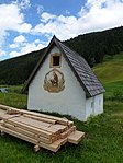
Antoniuskapelle bei Gisser ID: 17190 |
46 ° 45 ′ 21 ″ N, 11 ° 21 ′ 50 ″ E |
Aug. 24, 1987 (BLR-LAB 5083) |
chapel |
KG: Sarntal building plot: 1068
|

|
Pharmacy ID: 17132 |
46 ° 38 ′ 34 "N, 11 ° 21 ′ 23" E |
Aug 19, 1950 (MD) |
Rural house / farm |
KG: Sarntal building plot: 26
|
| Ausser- and Hintermurr in Pens ID: 18198 |
46 ° 46 ′ 43 "N, 11 ° 23 ′ 38" E |
Jan. 11, 1993 (BLR-LAB 64) |
Rural house / farm |
KG: Sarntal building plot: 1174/1, 1174/2
|
|
| Baur on Kandelsberg ID: 17174 |
46 ° 40 ′ 53 "N, 11 ° 21 ′ 47" E |
Aug. 24, 1987 (BLR-LAB 5083) |
Rural house / farm |
KG: Sarntal building plot: 652
|
|
| At the messenger in Stet ID: 17151 |
46 ° 38 '4 "N, 11 ° 21' 48" E |
Aug. 24, 1987 (BLR-LAB 5083) |
Rural house / farm |
KG: Sarntal building plot: 251
|
|
| Bremstall in Putzen ID: 17153 |
46 ° 38 ′ 4 "N, 11 ° 20 ′ 38" E |
Aug. 24, 1987 (BLR-LAB 5083) |
Rural house / farm |
KG: Sarntal building plot: 288
|
|

|
Teutonic nuns house ID: 17134 |
46 ° 38 ′ 30 ″ N, 11 ° 21 ′ 21 ″ E |
Aug. 24, 1987 (BLR-LAB 5083) |
monastery |
KG: Sarntal building plot: 3587, 36
|
| Verschbamgütl with farm building ID: 17143 |
46 ° 38 ′ 31 ″ N, 11 ° 21 ′ 13 ″ E |
Aug. 24, 1987 (BLR-LAB 5083) |
Rural house / farm |
KG: Sarntal building plot: 202, 203
|
|
| Fiechter ID: 17156 |
46 ° 37 ′ 10 "N, 11 ° 22 ′ 33" E |
Aug. 24, 1987 (BLR-LAB 5083) |
Rural house / farm |
KG: Sarntal building plot: 338/1
|
|
|
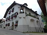
Gasthof zum Hirschen ID: 17135 |
46 ° 38 ′ 31 ″ N, 11 ° 21 ′ 28 ″ E |
Aug 19, 1950 (MD) |
Inn |
KG: Sarntal building plot: 46
|
| Geirerdiktlgut ID: 17196 |
46 ° 46 ′ 41 ″ N, 11 ° 24 ′ 6 ″ E |
Aug. 24, 1987 (BLR-LAB 5083) |
Rural house / farm |
KG: Sarntal building plot: 1188
|
|

|
Court House ID: 17137 |
46 ° 38 ′ 33 "N, 11 ° 21 ′ 29" E |
June 12, 1967 (MD) |
Rural house / farm |
KG: Sarntal building plot: 63, 66 Basic plot: 61, 8370/2
|
| Guggenhaus ID: 17184 |
46 ° 41 ′ 16 ″ N, 11 ° 25 ′ 13 ″ E |
Aug. 24, 1987 (BLR-LAB 5083) |
Rural house / farm |
KG: Sarntal building plot: 913
|
|
| Hamann in Aberstückl ID: 17180 |
46 ° 43 '59 "N, 11 ° 20' 8" E |
Aug. 24, 1987 (BLR-LAB 5083) |
Rural house / farm |
KG: Sarntal building plot: 744
|
|
| Heiligkreuz in Putzen ID: 17154 |
46 ° 37 ′ 27 ″ N, 11 ° 20 ′ 4 ″ E |
Aug. 24, 1987 (BLR-LAB 5083) |
chapel |
KG: Sarntal building plot: 291
|
|
| Heiss ID: 17191 |
46 ° 45 '49 "N, 11 ° 21' 57" E |
Aug. 24, 1987 (BLR-LAB 5083) |
Rural house / farm |
KG: Sarntal building plot: 1081
|
|
| Hofer in Öttenbach ID: 17176 |
46 ° 39 ′ 25 "N, 11 ° 20 ′ 32" E |
Aug. 24, 1987 (BLR-LAB 5083) |
Rural house / farm |
KG: Sarntal building plot: 691
|
|
| Chapel on Gebrack ID: 17202 |
46 ° 42 ′ 13 ″ N, 11 ° 21 ′ 3 ″ E |
Aug. 24, 1987 (BLR-LAB 5083) |
Simple chapel from the 18th / 19th centuries century |
KG: Sarntal basic plot: 5274
|
|
| Chapel at the Trattmann ID: 17201 |
46 ° 41 ′ 54 ″ N, 11 ° 25 ′ 0 ″ E |
Aug. 24, 1987 (BLR-LAB 5083) |
chapel |
KG: Sarntal building plot: 1924
|
|
|
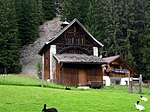
Chapel in the mine ID: 17189 |
46 ° 44 ′ 40 "N, 11 ° 21 ′ 18" E |
Aug. 24, 1987 (BLR-LAB 5083) |
chapel |
KG: Sarntal building plot: 1048/3
|

|
Chapel in Asten ID: 17200 |
46 ° 47 ′ 37 ″ N, 11 ° 26 ′ 24 ″ E |
Aug. 24, 1987 (BLR-LAB 5083) |
chapel |
KG: Sarntal building plot: 1252
|

|
Kellerburg ID: 17141 |
46 ° 38 ′ 43 "N, 11 ° 21 ′ 27" E |
July 6, 1965 (MD) |
Raised hide |
KG: Sarntal building plot: 133/1, 133/2, 2482, 2483 Basic plot: 152, 153, 155/1
|
| Core chapel ID: 17199 |
46 ° 46 ′ 56 "N, 11 ° 25 ′ 13" E |
Aug. 24, 1987 (BLR-LAB 5083) |
chapel |
KG: Sarntal building plot: 1237
|
|
|
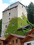
Kränzelstein ID: 17138 |
46 ° 38 ′ 36 "N, 11 ° 21 ′ 33" E |
Aug 19, 1950 (MD) |
Castle |
KG: Sarntal building plot : 77 basic plot: 59/3
|

|
Mair am Count ID: 17140 |
46 ° 38 ′ 42 "N, 11 ° 21 ′ 24" E |
Aug 19, 1950 (MD) |
Rural house / farm |
KG: Sarntal building plot: 132/1, 132/2
|
| Mair in the meadows with a mill in Glern ID: 17164 |
46 ° 39 ′ 9 ″ N, 11 ° 21 ′ 24 ″ E |
Aug. 24, 1987 (BLR-LAB 5083) |
Rural house / farm; the mill is located just south of 46 ° 39 '7.2 " N , 11 ° 21' 23.2" O . |
KG: Sarntal building plot: 509, 510/2
|
|

|
Maria Einsiedeln in the Dick ID: 17157 |
46 ° 36 ′ 52 "N, 11 ° 22 ′ 27" E |
Aug. 24, 1987 (BLR-LAB 5083) |
church |
KG: Sarntal building plot: 345
|
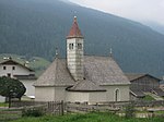
| Lady Chapel ID: 17187 |
46 ° 44 ′ 9 ″ N, 11 ° 26 ′ 0 ″ E |
Aug. 24, 1987 (BLR-LAB 5083) |
chapel |
KG: Sarntal building plot: 1004
|
|
|
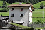
Marienkapelle in Weißenbach ID: 17194 |
46 ° 46 ′ 16 ″ N, 11 ° 22 ′ 2 ″ E |
Aug. 24, 1987 (BLR-LAB 5083) |
chapel |
KG: Sarntal building plot: 1094
|
|
Mesnergütl in Nordheim ID: 17204 |
46 ° 39 '34 "N, 11 ° 21' 43" E |
Aug. 24, 1987 (BLR-LAB 5083) |
Rural house / farm |
KG: Sarntal building plot: 554
|

|
Mitterbäck ID: 17139 |
46 ° 38 ′ 37 "N, 11 ° 21 ′ 26" E |
Aug 19, 1950 (MD) |
Rural house / farm |
KG: Sarntal building plot: 103
|

|
Morgenstätter with Anna Chapel ID: 17162 |
46 ° 38 ′ 19 ″ N, 11 ° 23 ′ 5 ″ E |
Aug. 24, 1987 (BLR-LAB 5083) |
Rural house / farm |
KG: Sarntal building plot: 455, 456
|
| Moser in Stet ID: 17146 |
46 ° 37 '57 "N, 11 ° 21' 39" E |
Aug 19, 1950 (MD) |
Rural house / farm |
KG: Sarntal building plot: 233
|
|

|
Mill at Winkl zu Fuesberg ID: 17171 |
46 ° 40 ′ 9 ″ N, 11 ° 21 ′ 57 ″ E |
Aug. 24, 1987 (BLR-LAB 5083) |
Mill |
KG: Sarntal building plot: 626
|
| Nagler (Oberhinterfreisinger) ID: 17193 |
46 ° 46 ′ 15 ″ N, 11 ° 22 ′ 1 ″ E |
Aug. 24, 1987 (BLR-LAB 5083) |
Rural house / farm |
KG: Sarntal building plot: 1088
|
|
| Niederhauser ID: 17149 |
46 ° 38 ′ 16 "N, 11 ° 21 ′ 42" E |
Aug. 24, 1987 (BLR-LAB 5083) |
Rural house / farm |
KG: Sarntal building plot: 246
|
|
| Nissl with mill ID: 17178 |
46 ° 41 ′ 9 ″ N, 11 ° 20 ′ 53 ″ E |
Aug. 24, 1987 (BLR-LAB 5083) |
Rural house / farm; the mill is at 46 ° 41 ′ 10.9 " N , 11 ° 20 ′ 51.2" E |
KG: Sarntal building plot: 720, 721
|
|

|
Parish Church of the Assumption of Mary with Cemetery ID: 17130 |
46 ° 38 ′ 35 "N, 11 ° 21 ′ 22" E |
Aug. 24, 1987 (BLR-LAB 5083) |
church |
KG: Sarntal building plot: 1 basic plot: 1/2
|

|
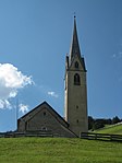
Parish church St. Martin with cemetery chapel and cemetery in Reinswald ID: 17183 |
46 ° 41 ′ 19 ″ N, 11 ° 25 ′ 0 ″ E |
Aug. 24, 1987 (BLR-LAB 5083) |
church |
KG: Sarntal building plot: 893, 894 Base plot: 5748
|
|
Parish church St. Nikolaus with cemetery chapel and cemetery in Durnholz ID: 17186 |
46 ° 44 ′ 23 "N, 11 ° 26 ′ 21" E |
Aug. 24, 1987 (BLR-LAB 5083) |
church |
KG: Sarntal building plot: 994 Base plot: 6454
|

|
Parish Church of St. Peter and Paul with cemetery chapel and cemetery in Pens ID: 17197 |
46 ° 46 ′ 50 "N, 11 ° 24 ′ 54" E |
Aug. 24, 1987 (BLR-LAB 5083) |
church |
KG: Sarntal building plot: 1223, 2079 Base plot: 7006
|

|
Pfarrwidum ID: 17133 |
46 ° 38 ′ 34 "N, 11 ° 21 ′ 20" E |
Jan. 22, 1990 (BLR-LAB 248) |
Widum / Canon House |
KG: Sarntal building plot: 27/1
|

|
Platzmann ID: 17147 |
46 ° 38 ′ 29 "N, 11 ° 21 ′ 28" E |
Aug 19, 1950 (MD) |
Rural house / farm |
KG: Sarntal building plot: 241
|
| Ploner ID: 17188 |
46 ° 44 ′ 42 "N, 11 ° 21 ′ 33" E |
Aug. 24, 1987 (BLR-LAB 5083) |
Rural house / farm |
KG: Sarntal building plot: 1035/1
|
|

|
Raiffeisenkasse building ID: 17131 |
46 ° 38 ′ 34 "N, 11 ° 21 ′ 25" E |
Aug 19, 1950 (MD) |
Inn |
KG: Sarntal building plot: 14/1
|

|
Reinegg ID: 17163 |
46 ° 38 ′ 27 "N, 11 ° 21 ′ 50" E |
Aug 19, 1950 (MD) |
Castle |
KG: Sarntal building plot: 462
|
| Ribner on Agratsberg ID: 17182 |
46 ° 41 ′ 13 ″ N, 11 ° 23 ′ 32 ″ E |
Aug. 24, 1987 (BLR-LAB 5083) |
Rural house / farm |
KG: Sarntal building plot: 841
|
|

|
Rohrer in Rungg ID: 17145 |
46 ° 38 '24 "N, 11 ° 21' 14" E |
Aug 19, 1950 (MD) |
Rural house / farm |
KG: Sarntal building plot: 220
|
| Ruebmühle in Dick ID: 17155 |
46 ° 37 '34 "N, 11 ° 21' 59" E |
Aug. 24, 1987 (BLR-LAB 5083) |
Mill |
KG: Sarntal building plot: 325
|
|
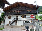
| Sallmann ID: 17179 |
46 ° 41 ′ 41 "N, 11 ° 20 ′ 43" E |
Aug. 24, 1987 (BLR-LAB 5083) |
Rural house / farm |
KG: Sarntal building plot: 724
|
|
|
Samer in Rungg ID: 17142 |
46 ° 38 ′ 29 ″ N, 11 ° 21 ′ 15 ″ E |
Aug. 24, 1987 (BLR-LAB 5083) |
Rural house / farm |
KG: Sarntal building plot: 196
|

|
Schussbrugg in Astfeld ID: 17170 |
46 ° 40 ′ 4 "N, 11 ° 21 ′ 56" E |
Aug. 24, 1987 (BLR-LAB 5083) |
Rural house / farm |
KG: Sarntal building plot: 625
|
| Seven Pastors ID: 17159 |
46 ° 35 ′ 51 ″ N, 11 ° 23 ′ 6 ″ E |
Aug. 24, 1987 (BLR-LAB 5083) |
Rural house / farm |
KG: Sarntal building plot: 408
|
|
| St. Bartholomäus in Aberstückl ID: 17181 |
46 ° 43 ′ 35 "N, 11 ° 19 ′ 59" E |
Aug. 24, 1987 (BLR-LAB 5083) |
church |
KG: Sarntal building plot: 762
|
|

|
St. Cyprian with enclosure ID: 17136 |
46 ° 38 ′ 31 ″ N, 11 ° 21 ′ 29 ″ E |
Aug. 24, 1987 (BLR-LAB 5083) |
church |
KG: Sarntal building plot: 51
|

|
St. Erasmus in Astfeld ID: 17168 |
46 ° 40 ′ 0 ″ N, 11 ° 21 ′ 57 ″ E |
Aug. 24, 1987 (BLR-LAB 5083) |
church |
KG: Sarntal building plot: 585
|
| St. John Baptist in the forest ID: 17195 |
46 ° 46 ′ 32 "N, 11 ° 23 ′ 1" E |
Aug. 24, 1987 (BLR-LAB 5083) |
church |
KG: Sarntal building plot: 1161
|
|

|
St. Nikolaus with cemetery in Nordheim ID: 17167 |
46 ° 39 '33 "N, 11 ° 21' 43" E |
Aug. 24, 1987 (BLR-LAB 5083) |
church |
KG: Sarntal building plot : 552 Basic plot: 3136/3, 3136/4
|

|
St. Valentin on Kandelsberg ID: 17173 |
46 ° 40 ′ 31 ″ N, 11 ° 22 ′ 9 ″ E |
Aug. 24, 1987 (BLR-LAB 5083) |
church |
KG: Sarntal building plot: 648
|
| Stofen ID: 17150 |
46 ° 38 '9 "N, 11 ° 21' 53" E |
Aug 19, 1950 (MD) |
Rural house / farm |
KG: Sarntal building plot: 247
|
|
| Stofner in Öttenbach ID: 17177 |
46 ° 39 ′ 34 "N, 11 ° 19 ′ 20" E |
Aug. 24, 1987 (BLR-LAB 5083) |
Rural house / farm |
KG: Sarntal building plot: 709
|
|
| Stuefer in Glern ID: 17165 |
46 ° 39 '57 "N, 11 ° 21' 24" E |
Aug. 24, 1987 (BLR-LAB 5083) |
Rural house / farm |
KG: Sarntal building plot: 518
|
|
| Stuefer in Riedelsberg ID: 17161 |
46 ° 37 '59 "N, 11 ° 22' 56" E |
Aug. 24, 1987 (BLR-LAB 5083) |
Rural house / farm |
KG: Sarntal building plot: 448
|
|
| Storm ID: 17192 |
46 ° 46 '17 "N, 11 ° 21' 59" E |
23 Aug 1988 (BLR-LAB 5425) |
Rural house / farm |
KG: Sarntal building plot: 1086
|
|
| Forward in Niederwangen ID: 17158 |
46 ° 34 ′ 41 ″ N, 11 ° 22 ′ 56 ″ E |
Aug. 24, 1987 (BLR-LAB 5083) |
Rural house / farm |
KG: Sarntal building plot: 395
|
|
| Tratter in Stet ID: 17152 |
46 ° 37 ′ 58 ″ N, 11 ° 22 ′ 13 ″ E |
Aug. 24, 1987 (BLR-LAB 5083) |
Rural house / farm |
KG: Sarntal building plot: 256
|
|
| Trienbach ID: 17169 |
46 ° 40 ′ 37 "N, 11 ° 23 ′ 5" E |
Aug. 24, 1987 (BLR-LAB 5083) |
Rural house / farm |
KG: Sarntal building plot: 600
|
|
| Unter-Weifen ID: 17185 |
46 ° 42 ′ 33 "N, 11 ° 24 ′ 51" E |
23 Aug 1988 (BLR-LAB 5425) |
Rural house / farm |
KG: Sarntal building plot: 946
|
|
| Untersauleg in Kandelsberg ID: 17172 |
46 ° 40 ′ 45 "N, 11 ° 21 ′ 26" E |
Aug. 24, 1987 (BLR-LAB 5083) |
Rural house / farm |
KG: Sarntal building plot: 639
|
|
| Wacker in Stet ID: 17148 |
46 ° 38 ′ 28 "N, 11 ° 21 ′ 42" E |
Aug. 24, 1987 (BLR-LAB 5083) |
Rural house / farm |
KG: Sarntal building plot: 243
|
|

|
Widumgut (Hof am Ort) and Widum in Pens ID: 17198 |
46 ° 46 ′ 52 "N, 11 ° 24 ′ 54" E |
Aug. 24, 1987 (BLR-LAB 5083) |
Widumgut: brick building with late Gothic structure and arched door; Widum: built in historicizing forms around 1880 with plaster decor on the facade; the adjacent geographic coordinates refer to the Widumgut; the Widum is located right next to 46 ° 46 '51.4 " N , 11 ° 24' 54.8" O . |
KG: Sarntal building plot: 1224 |
If no coordinates are known for a monument, the cadastral data at the time it was placed under protection are given as a substitute. These are neither official nor necessarily up-to-date.
The addresses taken from the State Monuments Office may be out of date.
| Photo: | Photograph of the monument. Click the photo generates an enlarged view. There are also two symbols: |
| ID | Identifier at the South Tyrolean Monuments Office |
| KG | Cadastral parish |
| MD | Ministerial Decree |
| BLR-LAB | Decision of the state government - state committee decision |
Former architectural monuments
| photo | designation | Location | registration | description | Metadata |
|---|---|---|---|---|---|
| Jöchler in Windlahn ID: 17160 |
46 ° 37 ′ 10 "N, 11 ° 23 ′ 56" E |
Aug. 24, 1987 (BLR-LAB 5083) |
Farm; Destroyed by fire, monument protection revoked with BLR-LAB 248 of March 11, 2014. |
KG: Sarntal building plot: 414 |
If no coordinates are known for a monument, the cadastral data at the time it was placed under protection are given as a substitute. These are neither official nor necessarily up-to-date.
The addresses taken from the State Monuments Office may be out of date.
| Photo: | Photograph of the monument. Click the photo generates an enlarged view. There are also two symbols: |
| ID | Identifier at the South Tyrolean Monuments Office |
| KG | Cadastral parish |
| MD | Ministerial Decree |
| BLR-LAB | Decision of the state government - state committee decision |
Web links
- Monument browser of the South Tyrolean Monuments Office