List of architectural monuments in Montan
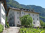
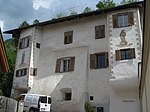
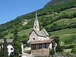
The list of architectural monuments in Montan ( Italian Montagna ) contains the 40 objects designated as architectural monuments in the area of the municipality of Montan in South Tyrol .
The basis is the official directory of the monuments in South Tyrol, which can be viewed on the Internet. These can be, for example, sacred buildings , residential houses, farms and aristocratic residences. The order in this list is based on the designation, alternatively it can also be sorted according to the address or the date on which it was placed under protection.
list
| photo | designation | Location | registration | description | Metadata |
|---|---|---|---|---|---|

|
Amplatz ID: 16079 |
46 ° 19 ′ 53 ″ N, 11 ° 18 ′ 16 ″ E |
October 31, 1977 (BLR-LAB 7581) |
Rural house / farm |
KG: Montan building plot: 24/1
|

|
Image stock ID: 16113 |
46 ° 19 '36 "N, 11 ° 17' 50" E |
April 10, 1989 (BLR-LAB 1871) |
Wayside shrine |
KG: Montan land parcel: 594, 594/1, 594/2
|

|
Image stock ID: 16112 |
46 ° 19 ′ 39 "N, 11 ° 17 ′ 54" E |
April 10, 1989 (BLR-LAB 1871) |
Wayside shrine |
KG: Montan basic plot: 75/1
|

|
Enn ID: 16076 |
46 ° 19 ′ 54 ″ N, 11 ° 18 ′ 28 ″ E |
July 19, 1949 (MD) |
Castle |
KG: Montan building plot: 4/1
|

|
Feldsaltner ID: 16089 |
46 ° 19 ′ 40 ″ N, 11 ° 18 ′ 6 ″ E |
October 31, 1977 (BLR-LAB 7581) |
Rural house / farm |
KG: Montan building plot: 54, 54/1
|

|
Gasthaus zur Rose ID: 16083 |
Kirchplatz 17 46 ° 19 ′ 51 ″ N, 11 ° 18 ′ 15 ″ E |
October 31, 1977 (BLR-LAB 7581) |
Inn |
KG: Montan building plot: 30/1
|

|
Golden Lion Inn ID: 16081 |
Kirchplatz 11 46 ° 19 ′ 52 ″ N, 11 ° 18 ′ 17 ″ E |
October 31, 1977 (BLR-LAB 7581) |
Inn |
KG: Montan building plot: 28
|

|
Gregori ID: 16094 |
46 ° 19 ′ 41 ″ N, 11 ° 17 ′ 57 ″ E |
October 31, 1977 (BLR-LAB 7581) |
Rural house / farm |
KG: Montan building plot: 520, 61
|

|
Green wine in Pinzon ID: 16104 |
46 ° 19 ′ 10 "N, 11 ° 17 ′ 34" E |
October 31, 1977 (BLR-LAB 7581) |
Rural house / farm |
KG: Montan building plots: 481, 482, 93 Basic plots: 823, 825, 826
|

|
Hans-Klocker-Gasse 1 in Pinzon ID: 16098 |
Hans-Klocker-Gasse 1 46 ° 19 ′ 14 ″ N, 11 ° 17 ′ 34 ″ E |
October 31, 1977 (BLR-LAB 7581) |
Raised hide |
KG: Montan building plot: 82, 89
|

|
Hans-Klocker-Gasse 2 in Pinzon ID: 16100 |
Hans-Klocker-Gasse 2 46 ° 19 ′ 15 ″ N, 11 ° 17 ′ 34 ″ E |
October 31, 1977 (BLR-LAB 7581) |
Rural house / farm |
KG: Montan building plot: 84
|

|
Hans-Klocker-Gasse 4 in Pinzon ID: 16099 |
Hans-Klocker-Gasse 4 46 ° 19 ′ 15 ″ N, 11 ° 17 ′ 33 ″ E |
October 31, 1977 (BLR-LAB 7581) |
Rural house / farm |
KG: Montan building plot: 83/1
|

|
Hans-Klocker-Gasse 8 in Pinzon ID: 16097 |
Hans-Klocker-Gasse 8 46 ° 19 ′ 16 ″ N, 11 ° 17 ′ 32 ″ E |
October 31, 1977 (BLR-LAB 7581) |
Rural house / farm |
KG: Montan building plot: 77
|

|
Hilber ID: 16080 |
46 ° 19 ′ 53 ″ N, 11 ° 18 ′ 17 ″ E |
October 31, 1977 (BLR-LAB 7581) |
Rural house |
KG: Montan building plot: 25
|

|
Hilber in Pinzon ID: 16102 |
46 ° 19 ′ 15 ″ N, 11 ° 17 ′ 35 ″ E |
April 10, 1989 (BLR-LAB 1871) |
Rural house / farm |
KG: Montan building plot: 86
|

|
Hofkeller ID: 16093 |
46 ° 19 ′ 41 ″ N, 11 ° 17 ′ 59 ″ E |
October 31, 1977 (BLR-LAB 7581) |
Rural house / farm |
KG: Montan building plot: 60
|

|
Jansen ID: 16096 |
46 ° 19 ′ 37 "N, 11 ° 17 ′ 51" E |
October 31, 1977 (BLR-LAB 7581) |
Rural house / farm |
KG: Montan building plot: 64
|

|
Kaserer ID: 16091 |
46 ° 19 ′ 40 ″ N, 11 ° 18 ′ 6 ″ E |
October 31, 1977 (BLR-LAB 7581) |
Rural house / farm |
KG: Montan building plot: 57/2, 57/4
|

|
Kirchplatz 14-15 ID: 16082 |
Kirchplatz 14-15 46 ° 19 ′ 51 ″ N, 11 ° 18 ′ 15 ″ E |
October 31, 1977 (BLR-LAB 7581) |
Rural house / farm |
KG: Montan building plot: 29
|

|
Lindenhöfl in Pinzon ID: 16101 |
46 ° 19 ′ 16 ″ N, 11 ° 17 ′ 36 ″ E |
October 31, 1977 (BLR-LAB 7581) |
Rural house / farm |
KG: Montan building plot: 85
|

|
Maria-Schnee-Kapelle in Gschnon ID: 16108 |
46 ° 18 ′ 13 "N, 11 ° 18 ′ 33" E |
October 31, 1977 (BLR-LAB 7581) |
monastery |
KG: Montan building plot: 156
|

|
Oberberger ID: 16077 |
46 ° 19 ′ 55 ″ N, 11 ° 18 ′ 12 ″ E |
October 31, 1977 (BLR-LAB 7581) |
Rural house / farm |
KG: Montan building plot: 19/2
|

|
Oberer Weißensteiner ID: 16088 |
46 ° 19 ′ 45 ″ N, 11 ° 18 ′ 11 ″ E |
October 31, 1977 (BLR-LAB 7581) |
Rural house / farm |
KG: Montan building plot: 53
|

|
Parish Church of St. Bartholomew ID: 16074 |
46 ° 19 ′ 51 ″ N, 11 ° 18 ′ 16 ″ E |
October 31, 1977 (BLR-LAB 7581) |
church |
KG: Montan building plot: 1/1, 1/2
|

|
Pfarrwidum ID: 16075 |
46 ° 19 ′ 51 ″ N, 11 ° 18 ′ 18 ″ E |
October 31, 1977 (BLR-LAB 7581) |
Widum / Canon House |
KG: Montan building plot: 2/1
|

|
Piebl in Kalditsch ID: 16109 |
46 ° 20 ′ 37 "N, 11 ° 19 ′ 42" E |
April 10, 1989 (BLR-LAB 1871) |
Rural house / farm |
KG: Montan building plot: 170
|

|
Pinzoner Strasse 13 ID: 16085 |
Pinzoner Straße 13 46 ° 19 ′ 50 ″ N, 11 ° 18 ′ 14 ″ E |
October 31, 1977 (BLR-LAB 7581) |
Rural house / farm |
KG: Montan building plot: 41, 503, 504 Base plot: 2104
|

|
Rainer ID: 16090 |
46 ° 19 ′ 40 ″ N, 11 ° 18 ′ 6 ″ E |
October 31, 1977 (BLR-LAB 7581) |
Rural house / farm |
KG: Montan building plot: 56
|

|
Rainer in Glen ID: 16106 |
46 ° 19 ′ 23 "N, 11 ° 18 ′ 5" E |
April 10, 1989 (BLR-LAB 1871) |
Rural house / farm |
KG: Montan building plot: 97
|

|
Rothenhof with Loreto Chapel in Kalditsch ID: 16110 |
46 ° 20 ′ 35 "N, 11 ° 19 ′ 27" E |
July 19, 1949 (MD) |
Rural house / farm; the Loreto Chapel is located a little south at 46 ° 20 ′ 31.6 ″ N , 11 ° 19 ′ 28.4 ″ E |
KG: Montan building plot: 172, 173
|

|
Sagmeisterhaus ID: 16086 |
46 ° 19 ′ 49 ″ N, 11 ° 18 ′ 13 ″ E |
April 10, 1989 (BLR-LAB 1871) |
Rural house / farm |
KG: Montan building plot: 46
|

|
Saltner house in Pinzon ID: 16105 |
46 ° 19 ′ 13 ″ N, 11 ° 17 ′ 25 ″ E |
October 31, 1977 (BLR-LAB 7581) |
Rural house / farm |
KG: Montan building plot: 94
|

|
Schulgasse 3 ID: 16084 |
Schulgasse 3 46 ° 19 ′ 50 ″ N, 11 ° 18 ′ 13 ″ E |
April 10, 1989 (BLR-LAB 1871) |
Rural house / farm |
KG: Montan building plot: 36
|

|
St. Kosmas and Damian in Glen ID: 16107 |
46 ° 19 ′ 2 ″ N, 11 ° 17 ′ 51 ″ E |
July 19, 1949 (MD) |
chapel |
KG: Montan building plot: 120
|

|
St. Stefan with cemetery in Pinzon ID: 16103 |
46 ° 19 ′ 13 ″ N, 11 ° 17 ′ 36 ″ E |
October 31, 1977 (BLR-LAB 7581) |
church |
KG: Montan building plot: 261, 91/1, 91/2
|

|
Tombl ID: 16092 |
46 ° 19 ′ 41 ″ N, 11 ° 18 ′ 2 ″ E |
October 31, 1977 (BLR-LAB 7581) |
Rural house / farm |
KG: Montan building plot: 59
|

|
Tschaup ID: 16095 |
46 ° 19 ′ 40 "N, 11 ° 17 ′ 56" E |
October 31, 1977 (BLR-LAB 7581) |
Rural house / farm |
KG: Montan building plot: 62
|

|
Lower Weißensteiner ID: 16087 |
46 ° 19 ′ 47 "N, 11 ° 18 ′ 10" E |
October 31, 1977 (BLR-LAB 7581) |
Rural house / farm |
KG: Montan building plot: 52/1, 52/2
|

|
Varesco ID: 16078 |
Friedhofstrasse 3 46 ° 19 ′ 53 ″ N, 11 ° 18 ′ 14 ″ E |
October 31, 1977 (BLR-LAB 7581) |
Rural house / farm |
KG: Montan building plot: 21
|

|
Veitner in Kalditsch ID: 16111 |
46 ° 19 ′ 57 ″ N, 11 ° 18 ′ 51 ″ E |
April 10, 1989 (BLR-LAB 1871) |
Rural house / farm |
KG: Montan building plot: 184 |
If no coordinates are known for a monument, the cadastral data at the time it was placed under protection are given as a substitute. These are neither official nor necessarily up-to-date.
The addresses taken from the State Monuments Office may be out of date.
| Photo: | Photograph of the monument. Click the photo generates an enlarged view. There are also two symbols: |
| ID | Identifier at the South Tyrolean Monuments Office |
| KG | Cadastral parish |
| MD | Ministerial Decree |
| BLR-LAB | Decision of the state government - state committee decision |
Web links
- Monument browser of the South Tyrolean Monuments Office