List of architectural monuments in Monguelfo-Taisten
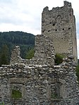
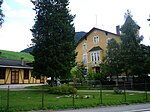
The list of architectural monuments in Monguelfo-Tesido ( Italian : Monguelfo-Tesido ) contains the 31 objects identified as architectural monuments in the area of the municipality of Monguelfo-Taisten in South Tyrol .
The basis is the official directory of the monuments in South Tyrol, which can be viewed on the Internet. These can be, for example, sacred buildings , residential houses, farms and aristocratic residences. The order in this list is based on the designation, alternatively it can also be sorted according to the address or the date on which it was placed under protection.
list
| photo | designation | Location | registration | description | Metadata |
|---|---|---|---|---|---|
| Old Widum ID: 17976 |
46 ° 45 ′ 29 ″ N, 12 ° 6 ′ 20 ″ E |
June 9, 1987 (BLR-LAB 3272) |
Widum / Canon House |
KG: Welsberg building plot: 27
|
|
| Antonius Chapel in Ried ID: 17982 |
46 ° 45 ′ 17 "N, 12 ° 5 ′ 50" E |
June 9, 1987 (BLR-LAB 3275) |
chapel |
KG: Welsberg building plot: 170
|
|
| Ausserbier ID: 17969 |
46 ° 46 ′ 3 ″ N, 12 ° 8 ′ 56 ″ E |
June 9, 1987 (BLR-LAB 3275) |
Rural house / farm |
KG: Taisten building plot: 168/2
|
|
| Bachmann Seppl House ID: 50388 |
46 ° 45 ′ 26 ″ N, 12 ° 6 ′ 12 ″ E |
July 4, 2005 (BLR-LAB 2416) |
Rural house / farm |
KG: Welsberg building plot: 83
|
|

|
Monguelfo Station ID: 50255 |
46 ° 45 ′ 11 "N, 12 ° 6 ′ 26" E |
April 5, 2004 (BLR-LAB 1083) |
Monguelfo Railway Station; the coordinates on the left in the Location column refer to the main building; the Bahnwärterhaus is situated at 46 ° 45 '12.4 " N , 12 ° 6' 20.2" O , the water station to 46 ° 45 '7.8 " N , 12 ° 6' 36.8" O . |
KG: Welsberg building parcel: 190, 192, 193, 598 Basic parcel: 1370/1, 1370/10, 1370/11, 1370/12, 1370/13, 1370/14, 1370/5, 1370/6, 1370/7, 1370/8, 1370/9
|

|
Image stock ID: 17974 |
46 ° 46 ′ 4 "N, 12 ° 6 ′ 54" E |
June 9, 1987 (BLR-LAB 3275) |
Wayside shrine |
KG: Taisten basic parcel: 2875/1
|

|
Wayside shrine at the parish church ID: 17986 |
46 ° 45 ′ 24 ″ N, 12 ° 6 ′ 16 ″ E |
June 9, 1987 (BLR-LAB 3275) |
Wayside shrine |
KG: Welsberg basic plot: 1581/8
|
| Former grain bin at Widum ID: 17971 |
46 ° 46 ′ 4 "N, 12 ° 6 ′ 45" E |
June 9, 1987 (BLR-LAB 3275) |
Grain box |
KG: Taisten building plot: 203
|
|
| Gasthof Erharter ID: 18114 |
46 ° 45 ′ 26 ″ N, 12 ° 6 ′ 20 ″ E |
May 24, 1993 (BLR-LAB 2886) |
Inn |
KG: Welsberg building plot: 43
|
|
| Houses in Ried ID: 17981 |
46 ° 45 ′ 12 ″ N, 12 ° 5 ′ 51 ″ E |
June 9, 1987 (BLR-LAB 3275) |
Rural house / farm |
KG: Welsberg building plot: 164/1
|
|

|
Chapel at the Villa Welsberg ID: 17984 |
46 ° 45 ′ 17 "N, 12 ° 6 ′ 28" E |
June 9, 1987 (BLR-LAB 3275) |
chapel |
KG: Welsberg building plot: 232
|

|
Chapel at Feichter ID: 17970 |
46 ° 46 ′ 14 "N, 12 ° 4 ′ 4" E |
June 9, 1987 (BLR-LAB 3275) |
chapel |
KG: Taisten building plot: 191
|
| Chapel near the Moar in Wiesen ID: 17973 |
46 ° 46 ′ 1 ″ N, 12 ° 9 ′ 1 ″ E |
June 9, 1987 (BLR-LAB 3275) |
chapel |
KG: Taisten basic parcel: 2514
|
|
| Chapel in Plun ID: 17985 |
46 ° 44 ′ 55 "N, 12 ° 5 ′ 32" E |
June 9, 1987 (BLR-LAB 3275) |
chapel |
KG: Welsberg building plot: 249
|
|
| Chapel in Wiesen ID: 17968 |
46 ° 46 ′ 11 ″ N, 12 ° 8 ′ 9 ″ E |
June 9, 1987 (BLR-LAB 3275) |
chapel |
KG: Taisten building plot: 155
|
|

|
Keilwirt ID: 17966 |
46 ° 46 ′ 8 "N, 12 ° 6 ′ 53" E |
June 9, 1987 (BLR-LAB 3275) |
Rural house / farm |
KG: Taisten building plot: 45
|
| Marenklhof ID: 50566 |
46 ° 46 ′ 9 ″ N, 12 ° 6 ′ 56 ″ E |
Aug 8, 2013 (BLR-LAB 1032) |
Medieval building, presumably the birthplace of the late Gothic painter Simon von Taisten (around 1450–1515). Einhof with a gable roof and a wooden-paneled gable. |
KG: Taisten building plot: 54
|
|
| Marienkapelle am Friedhof (Lourdes Chapel) ID: 17962 |
46 ° 46 ′ 3 "N, 12 ° 6 ′ 49" E |
June 9, 1987 (BLR-LAB 3275) |
chapel |
KG: Taisten building plot: 24/2
|
|
| Mason ID: 17967 |
46 ° 46 ′ 40 ″ N, 12 ° 7 ′ 0 ″ E |
June 9, 1987 (BLR-LAB 3275) |
Rural house / farm |
KG: Taisten building plot: 127
|
|

|
Parish church of St. Ingenuin and Albuin with cemetery ID: 17963 |
46 ° 46 ′ 4 "N, 12 ° 6 ′ 47" E |
June 9, 1987 (BLR-LAB 3275) |
church |
KG: Taisten building plot: 25 Basic plot: 86
|

|
Parish Church of St. Margareth ID: 17975 |
46 ° 45 ′ 25 ″ N, 12 ° 6 ′ 15 ″ E |
June 9, 1987 (BLR-LAB 3275) |
Church altar painting by Paul Troger |
KG: Welsberg building plot: 1
|

|
Pfarrwidum ID: 17964 |
46 ° 46 ′ 5 "N, 12 ° 6 ′ 47" E |
June 9, 1987 (BLR-LAB 3275) |
Widum / Canon House |
KG: Taisten building plot: 28
|
| Rainstaller ID: 50254 |
46 ° 44 ′ 31 ″ N, 12 ° 6 ′ 45 ″ E |
July 3, 2000 (BLR-LAB 2417) |
Rural house / farm |
KG: Welsberg building plot: 144/1
|
|

|
St. Georg with enclosure ID: 17965 |
46 ° 46 ′ 8 "N, 12 ° 6 ′ 51" E |
June 9, 1987 (BLR-LAB 3275) |
church |
KG: Taisten building plot : 42 basic plot: 2876/1
|

|
St. Jakob am Friedhof ID: 17961 |
46 ° 46 ′ 4 "N, 12 ° 6 ′ 48" E |
June 9, 1987 (BLR-LAB 3275) |
church |
KG: Taisten building plot: 24/1
|

|
Thurn ID: 17972 |
46 ° 45 '43 "N, 12 ° 6' 48" E |
June 9, 1987 (BLR-LAB 3275) |
Castle ruins |
KG: Taisten basic parcel: 180/2
|

|
Trogerhaus ID: 17977 |
46 ° 45 ′ 27 "N, 12 ° 6 ′ 11" E |
June 9, 1987 (BLR-LAB 3275) |
Urban residential building |
KG: Welsberg building plot: 52
|

|
Our Lady on the Rain with cemetery chapel and cemetery ID: 17979 |
46 ° 45 ′ 19 ″ N, 12 ° 6 ′ 33 ″ E |
June 9, 1987 (BLR-LAB 3275) |
church |
KG: Welsberg building plot : 127 basic plot: 213/1
|

|
Villa Monguelfo with park ID: 17983 |
46 ° 45 ′ 19 ″ N, 12 ° 6 ′ 24 ″ E |
June 9, 1987 (BLR-LAB 3275) |
Villa / summer cottage |
KG: Welsberg Bauparzelle: 208/1 basic plot: 201/1
|

|
Welsberg ID: 17980 |
46 ° 45 ′ 35 "N, 12 ° 6 ′ 50" E |
June 9, 1987 (BLR-LAB 3275) |
Castle |
KG: Welsberg building plot: 130
|
| Zellheim with Stöckl building and garden ID: 17978 |
46 ° 45 ′ 23 "N, 12 ° 6 ′ 18" E |
May 31, 1950 (MD) |
Raised hide |
KG: Welsberg building plot: 109, 228 |
If no coordinates are known for a monument, the cadastral data at the time it was placed under protection are given as a substitute. These are neither official nor necessarily up-to-date.
The addresses taken from the State Monuments Office may be out of date.
| Photo: | Photograph of the monument. Click the photo generates an enlarged view. There are also two symbols: |
| ID | Identifier at the South Tyrolean Monuments Office |
| KG | Cadastral parish |
| MD | Ministerial Decree |
| BLR-LAB | Decision of the state government - state committee decision |
Web links
- Monument browser of the South Tyrolean Monuments Office