List of architectural monuments in Lana
The list of architectural monuments in Lana contains the 77 objects designated as architectural monuments in the area of the municipality of Lana in South Tyrol .
The basis is the official directory of the monuments in South Tyrol, which can be viewed on the Internet. These can be, for example, sacred buildings , residential houses, farms and aristocratic residences. The order in this list is based on the designation, alternatively it can also be sorted according to the address or the date on which it was placed under protection.
list
| photo | designation | Location | registration | description | Metadata |
|---|---|---|---|---|---|

|
Aichholz ID: 15630 |
Aichholzer Weg 3 46 ° 35 ′ 23 ″ N, 11 ° 9 ′ 6 ″ E Fraction: Völlan |
Aug. 3, 1979 (BLR-LAB 4937) |
Raised hide
Tarneller no. 3273 |
KG: Völlan building plot: 20/1
|

|
Old parish church of the Assumption with tower, cemetery chapel and cemetery ID: 15619 |
Schnatterpeckstrasse 46 ° 36 ′ 1 ″ N, 11 ° 9 ′ 46 ″ E |
Aug. 3, 1979 (BLR-LAB 4854) |
church |
KG: Lana building plot: 408, 409, 410 Base plot: 2305
|

|
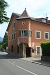
Old Widum with Anna Chapel ID: 15615 |
Treibgasse 13 46 ° 36 ′ 25 ″ N, 11 ° 9 ′ 36 ″ E |
Aug. 3, 1979 (BLR-LAB 4854) |
Widum / Canon House |
KG: Lana building plot: 351, 352
|
|
Angerheim ID: 15609 |
Andreas-Hofer-Strasse 24 46 ° 36 ′ 53 ″ N, 11 ° 9 ′ 10 ″ E |
Aug. 3, 1979 (BLR-LAB 4854) |
Raised hide |
KG: Lana building plot: 260/1
|
| Ausserrunggögl ID: 50120 |
Mitterlana 5 46 ° 36 ′ 40 ″ N, 11 ° 8 ′ 37 ″ E |
Nov 25, 2002 (BLR-LAB 4388) |
Rural house / farm |
KG: Lana building plot: 115
|
|

|
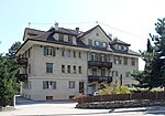
Bach and Gerngut ID: 15618 |
Schnatterpeckstrasse 4 46 ° 36 ′ 11 ″ N, 11 ° 9 ′ 44 ″ E |
Aug. 3, 1979 (BLR-LAB 4854) |
Rural house / farm |
KG: Lana building plot: 392/1
|
|
Battistel ID: 50589 |
46 ° 37 ′ 13 ″ N, 11 ° 8 ′ 36 ″ E |
Feb 10, 2015 (BLR-LAB 164) |
three-storey residential building, built in 1929 in the form of the Heimat style |
KG: Lana building plot: 224/1
|
| Blasbichl ID: 50119 |
Völlanerweg 20 46 ° 36 ′ 38 ″ N, 11 ° 8 ′ 23 ″ E |
Sep 30 2002 (BLR-LAB 3522) |
Urban residential building |
KG: Lana building plot: 111
|
|
| Blasbichlkapelle ID: 18245 |
46 ° 36 ′ 45 ″ N, 11 ° 8 ′ 24 ″ E |
June 22, 1998 (BLR-LAB 2734) |
chapel |
KG: Lana building plot: 626/1
|
|
|
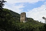
Brandis ID: 15624 |
46 ° 35 ′ 40 "N, 11 ° 9 ′ 40" E |
Aug. 3, 1979 (BLR-LAB 4854) |
Castle ruins; the Neubrandis residence is located somewhat southeast at 46 ° 35 '35.8 " N , 11 ° 9" 48.7 " E |
KG: Lana building plot: 439, 442
|
|
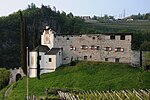
Braunsberg with Blasius Chapel ID: 15591 |
46 ° 36 ′ 54 ″ N, 11 ° 8 ′ 21 ″ E |
Nov 20, 1950 (MD) |
Raised hide |
KG: Lana building plot: 96, 97
|

|
Teutonic Order Convention with Holy Cross Chapel ID: 15607 |
46 ° 36 ′ 51 ″ N, 11 ° 9 ′ 3 ″ E |
Aug. 3, 1979 (BLR-LAB 4854) |
monastery |
KG: Lana building plot: 246
|

|
Erbhof ID: 50127 |
St.-Agatha-Weg 7 46 ° 36 ′ 49 ″ N, 11 ° 9 ′ 24 ″ E |
June 22, 1998 (BLR-LAB 2735) |
Rural house / farm |
KG: Lana building plot: 280/2
|

|
Falschauerdammstraße 1 ID: 50412 |
Falschauerdammstrasse 1 46 ° 37 ′ 11 ″ N, 11 ° 8 ′ 35 ″ E |
July 25, 2005 (BLR-LAB 2666) |
Goose tower
Urban residential building |
KG: Lana building plot: 221/1
|

|
Foehrner ID: 15596 |
46 ° 36 '54 "N, 11 ° 8' 45" E |
Aug. 3, 1979 (BLR-LAB 4854) |
Rural house / farm |
KG: Lana building plot: 134
|

|
Gagers with Magnus Chapel ID: 15592 |
46 ° 36 ′ 57 ″ N, 11 ° 8 ′ 8 ″ E |
Aug. 3, 1979 (BLR-LAB 4854) |
Manor with chapel; the adjacent coordinates refer to the manor; the band is at 46 ° 36 '57.9 " N , 11 ° 8' 7.8" O . |
KG: Lana building plot: 100, 99 basic plot: 507/16, 507/18
|

|
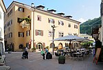
Gartscheid ID: 15594 |
Kapuzinerstraße 10 46 ° 36 ′ 49 ″ N, 11 ° 8 ′ 48 ″ E |
Aug. 3, 1979 (BLR-LAB 4854) |
Raised hide |
KG: Lana building plot: 122/1
|
|
Gasthof Schwarzer Adler ID: 15597 |
46 ° 36 ′ 55 "N, 11 ° 8 ′ 38" E |
Aug. 3, 1979 (BLR-LAB 4854) |
Inn |
KG: Lana building plot: 144
|

|
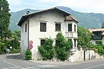
Gasthof Weißes Keuz ID: 15598 |
46 ° 36 ′ 56 "N, 11 ° 8 ′ 36" E |
June 12, 1989 (BLR-LAB 3564) |
Inn |
KG: Lana building plot: 160
|
|
Gilman ID: 15604 |
Andreas-Hofer-Strasse 13 46 ° 36 ′ 55 ″ N, 11 ° 9 ′ 6 ″ E |
Aug. 3, 1979 (BLR-LAB 4854) |
Rural house / farm |
KG: Lana building plot : 241/1 Basic plot: 1448/2
|

|
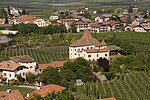
Glaserer ID: 18189 |
46 ° 36 ′ 41 ″ N, 11 ° 9 ′ 11 ″ E |
Nov. 15, 2004 (BLR-LAB 4139) |
Rural house / farm |
KG: Lana building plot: 324/1
|
|
Goldegg ID: 15608 |
46 ° 36 '44 "N, 11 ° 9' 5" E |
Nov 20, 1950 (MD) |
Raised hide |
KG: Lana building plot: 259/1, 259/2
|

|
Goesslheim ID: 15621 |
46 ° 35 '53 "N, 11 ° 9' 41" E |
Aug. 3, 1979 (BLR-LAB 4854) |
Rural house / farm |
KG: Lana building plot: 420
|

|
Grießenstein with Magdalena Chapel ID: 15588 |
46 ° 37 ′ 34 "N, 11 ° 8 ′ 44" E |
Aug. 3, 1979 (BLR-LAB 4854) |
Raised hide |
KG: Lana building plot: 61/1, 62
|

|
House Dorigo ID: 50123 |
Am Gries 18 46 ° 36 '56 "N, 11 ° 8' 38" E |
December 13, 1999 (BLR-LAB 5562) |
Urban residential building |
KG: Lana building plot: 181/1
|

|
Heiligkreuz in Lanegg ID: 15626 |
46 ° 36 ′ 33 ″ N, 11 ° 9 ′ 3 ″ E |
Aug. 3, 1979 (BLR-LAB 4854) |
church |
KG: Lana building plot: 595
|

|
Helmstorf with Holy Cross Chapel ID: 15639 |
Völlanerweg 18 46 ° 36 ′ 33 ″ N, 11 ° 8 ′ 26 ″ E Fraction: Völlan |
Aug. 3, 1979 (BLR-LAB 4937) |
Raised hide
Tarneller no. 3219 |
KG: Völlan building plot: 93
|
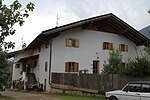
| Herrenhaus bei Gruebl ID: 50118 |
46 ° 37 ′ 3 ″ N, 11 ° 8 ′ 3 ″ E |
June 2, 1998 (BLR-LAB 2368) |
Urban residential building |
KG: Lana building plot: 93
|
|
|
Hofer ID: 15637 |
Zehentweg 8 46 ° 36 ′ 1 ″ N, 11 ° 8 ′ 49 ″ E Fraction: Völlan |
Aug. 3, 1979 (BLR-LAB 4937) |
Rural house / farm |
KG: Völlan building plot: 76
|

|
Chapel in the Weinreichhof ID: 15632 |
Probst-Wieser-Weg 36 46 ° 35 ′ 42 ″ N, 11 ° 8 ′ 32 ″ E Fraction: Völlan |
Aug. 3, 1979 (BLR-LAB 4937) |
Chapel, for the courtyard s. Tarneller no. 3263 |
KG: Völlan building plot: 36
|

|
Kappler ID: 15622 |
46 ° 35 ′ 44 "N, 11 ° 10 ′ 2" E |
Aug. 3, 1979 (BLR-LAB 4854) |
Rural house / farm |
KG: Lana building plot: 431
|

|
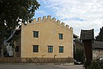
Capuchin monastery with church of St. Joachim and Anna ID: 15595 |
46 ° 36 ′ 55 "N, 11 ° 8 ′ 47" E |
Aug. 3, 1979 (BLR-LAB 4854) |
monastery |
KG: Lana building plot: 125, 127, 2468, 2469
|
|
Kelz ID: 15614 |
Treibgasse 3 46 ° 36 ′ 42 ″ N, 11 ° 9 ′ 22 ″ E |
Aug. 3, 1979 (BLR-LAB 4854) |
Rural house / farm |
KG: Lana building plot: 334
|

|
Lanegg Monastery and Girls' School ID: 50140 |
46 ° 36 ′ 32 "N, 11 ° 9 ′ 4" E |
April 9, 2001 (BLR-LAB 1118) |
Monastery; the school is next door at 46 ° 36 ′ 33.3 ″ N , 11 ° 9 ′ 5.9 ″ E |
KG: Lana building plot: 347, 591
|
|
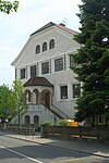
Boys' School ID: 50138 |
46 ° 36 ′ 51 ″ N, 11 ° 9 ′ 12 ″ E |
Feb. 5, 2001 (BLR-LAB 308) |
School architect: Theodor Fischer |
KG: Lana building plot: 600
|

|
Kobald ID: 15636 |
46 ° 35 ′ 49 ″ N, 11 ° 8 ′ 37 ″ E Fraction: Völlan |
Aug. 3, 1979 (BLR-LAB 4937) |
Rural house / farm
Tarneller no. 3275 |
KG: Völlan building plot: 70/1, 70/2
|
| Koflegg with home ID: 15593 |
Braunsberger Weg 46 ° 36 ′ 57 ″ N, 11 ° 8 ′ 2 ″ E |
Aug. 3, 1979 (BLR-LAB 4854) |
Rural house / farm |
KG: Lana building plot: 104, 105
|
|

|
Krogner ID: 15613 |
St.-Peter-Weg 6 46 ° 36 ′ 42 ″ N, 11 ° 9 ′ 20 ″ E |
Aug. 3, 1979 (BLR-LAB 4854) |
Rural house / farm |
KG: Lana building plot: 332/1, 332/3
|

|
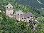
Larchgut ID: 15620 |
Brandis-Waalweg 4 46 ° 35 ′ 58 ″ N, 11 ° 9 ′ 41 ″ E |
Aug. 3, 1979 (BLR-LAB 4854) |
Ansitz (seat of the South Tyrolean Fruit Tree Museum) |
KG: Lana building plot: 415
|
|
Leonburg ID: 15625 |
46 ° 35 '5 "N, 11 ° 9' 48" E |
Aug. 3, 1979 (BLR-LAB 4854) |
Castle |
KG: Lana building plot: 450
|

|
Mayenburg ID: 15631 |
Schlossweg 46 ° 35 ′ 31 ″ N, 11 ° 8 ′ 55 ″ E Fraction: Völlan |
Feb 12, 1952 (MD) |
Castle
Tarneller no. 3265 |
KG: Völlan building plot: 33
|

|
Mair at the tower ID: 15635 |
St.-Magdalena-Weg 46 ° 36 ′ 5 ″ N, 11 ° 8 ′ 18 ″ E Fraction: Völlan |
Aug. 3, 1979 (BLR-LAB 4937) |
Rural house / farm |
KG: Völlan building plot: 63
|

|
Nagele ID: 15633 |
Propst-Wieser-Weg 46 ° 35 ′ 27 ″ N, 11 ° 8 ′ 37 ″ E Fraction: Völlan |
Aug. 3, 1979 (BLR-LAB 4937) |
Rural house / farm
Tarneller no. 3261 |
KG: Völlan building plot: 39/1, 39/2, 39/3, 39/4, 40 basic plot: 453/9
|

|
Oberampoßegg ID: 15606 |
Andreas-Hofer-Strasse 18 46 ° 36 ′ 54 ″ N, 11 ° 9 ′ 4 ″ E |
Aug. 3, 1979 (BLR-LAB 4854) |
Raised hide |
KG: Lana building plot: 244, 244/1, 244/2
|

|
Oberbrunn ID: 15589 |
Raffeingasse 46 ° 37 ′ 33 ″ N, 11 ° 8 ′ 17 ″ E |
Aug. 3, 1979 (BLR-LAB 4854) |
Rural house / farm |
KG: Lana building plot: 63
|

|
Petererwirt ID: 18185 |
Goldeggstrasse 14 46 ° 36 ′ 40 ″ N, 11 ° 9 ′ 10 ″ E |
Sep 2 1996 (BLR-LAB 4110) |
Inn |
KG: Lana building plot: 323
|

|
Parish church St. Severin with cemetery ID: 15628 |
46 ° 35 ′ 24 ″ N, 11 ° 8 ′ 45 ″ E Fraction: Völlan |
Aug. 3, 1979 (BLR-LAB 4937) |
church |
KG: Völlan building plot: 1 basic plot: 1
|

|
Pfarrwidum ID: 15629 |
Badlweg 46 ° 35 ′ 18 ″ N, 11 ° 8 ′ 49 ″ E Fraction: Völlan |
Aug. 3, 1979 (BLR-LAB 4937) |
Widum / Canon House |
KG: Völlan building plot: 16
|

|
Town hall ID: 50133 |
Maria-Hilf-Straße 5 46 ° 36 ′ 58 ″ N, 11 ° 8 ′ 43 ″ E |
Feb. 5, 2001 (BLR-LAB 309) |
Hotel construction; Built in 1906 as the "Hotel Royal" and since 1919 the seat of the local government. |
KG: Lana building plot: 554/1
|
| Reichenegg ID: 50391 |
46 ° 37 ′ 6 ″ N, 11 ° 8 ′ 15 ″ E |
May 2, 2005 (BLR-LAB 1460) |
Rural house / farm |
KG: Lana building plot: 91
|
|

|
Rose garden with park ID: 15600 |
46 ° 36 '59 "N, 11 ° 8' 40" E |
Dec. 4, 1962 (MD) |
Raised hide |
KG: Lana building plot: 183/1, 183/2, 743, 744, 745/1
|
| Runst ID: 15638 |
Völlaner Weg 46 ° 36 ′ 26 ″ N, 11 ° 8 ′ 37 ″ E Fraction: Völlan |
Aug. 3, 1979 (BLR-LAB 4937) |
Rural house / farm
Tarneller no. 3218 |
KG: Völlan building plot: 88
|
|

|
Schaller ID: 15590 |
Raffeingasse 2 46 ° 37 ′ 18 ″ N, 11 ° 8 ′ 27 ″ E |
Aug. 3, 1979 (BLR-LAB 4854) |
Raised hide |
KG: Lana building plot: 76
|

|
Schießstandweg 4 ID: 50122 |
Shooting range 4 46 ° 36 ′ 56 ″ N, 11 ° 8 ′ 31 ″ E |
July 29, 2002 (BLR-LAB 2766) |
New shooting range
Rural house / farm |
KG: Lana building plot: 155
|

|
Hospital with St. Martin's Chapel ID: 15603 |
46 ° 37 ′ 0 ″ N, 11 ° 9 ′ 1 ″ E |
Aug. 3, 1979 (BLR-LAB 4854) |
hospital |
KG: Lana building plot: 237, 238/1
|

|
St. Agatha in the meadow ID: 15602 |
46 ° 37 ′ 15 "N, 11 ° 9 ′ 36" E |
Aug. 3, 1979 (BLR-LAB 4854) |
church |
KG: Lana building plot: 233
|

|
St. George ID: 15617 |
46 ° 36 ′ 2 ″ N, 11 ° 9 ′ 25 ″ E |
Aug. 3, 1979 (BLR-LAB 4854) |
church |
KG: Lana building plot: 382
|

|
St. Magdalena in Oberlehen ID: 15634 |
46 ° 36 ′ 0 ″ N, 11 ° 8 ′ 13 ″ E Fraction: Völlan |
June 30, 1952 (MD) |
church |
KG: Völlan building plot: 56
|

|
St. Margareth ID: 15616 |
46 ° 36 '16 "N, 11 ° 9' 23" E |
Aug. 3, 1979 (BLR-LAB 4854) |
church |
KG: Lana building plot: 379
|

|
St. Oswald in Pawigl ID: 15587 |
46 ° 37 ′ 16 "N, 11 ° 6 ′ 28" E |
Aug. 3, 1979 (BLR-LAB 4854) |
church |
KG: Lana building plot: 42
|

|
St. Peter ID: 15612 |
46 ° 36 ′ 40 "N, 11 ° 9 ′ 14" E |
Aug. 3, 1979 (BLR-LAB 4854) |
church |
KG: Lana building plot: 328
|

|
Ortisei ID: 15623 |
46 ° 35 ′ 44 "N, 11 ° 10 ′ 4" E |
Aug. 3, 1979 (BLR-LAB 4854) |
church |
KG: Lana building plot: 432
|

|
St. Vigil am Joch ID: 15586 |
46 ° 38 ′ 11 "N, 11 ° 5 ′ 35" E |
Aug. 3, 1979 (BLR-LAB 4854) |
church |
KG: Lana building plot: 1
|

|
St. John Nepomuk ID: 15601 |
46 ° 37 ′ 1 ″ N, 11 ° 8 ′ 35 ″ E |
Aug. 3, 1979 (BLR-LAB 4854) |
church |
KG: Lana building plot: 199
|

|
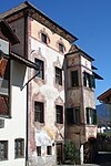
Steinhauser ID: 15611 |
46 ° 36 ′ 47 ″ N, 11 ° 9 ′ 16 ″ E |
Aug. 3, 1979 (BLR-LAB 4854) |
Rural house / farm |
KG: Lana building plot: 272
|
|
Thaler ID: 15599 |
Am Gries 20 46 ° 36 ′ 56 ″ N, 11 ° 8 ′ 37 ″ E |
Aug. 3, 1979 (BLR-LAB 4854) |
Rural house / farm |
KG: Lana building plot: 177/1, 177/2
|

|
Dead Rest Chapel ID: 15627 |
Metzgergasse 8 46 ° 36 ′ 53 ″ N, 11 ° 8 ′ 35 ″ E |
5th Mar 1990 (BLR-LAB 1192) |
chapel |
KG: Lana building plot: 768
|

|
Unterampoßegg ID: 15605 |
Andreas-Hofer-Strasse 20 46 ° 36 ′ 54 ″ N, 11 ° 9 ′ 4 ″ E |
Aug. 3, 1979 (BLR-LAB 4854) |
Raised hide |
KG: Lana building plot: 242
|

|
Unterlana 76 ID: 50130 |
St. Margarethenweg 5 46 ° 36 ′ 20 ″ N, 11 ° 9 ′ 17 ″ E |
Nov 25, 1996 (BLR-LAB 5755) |
Stöckler
Rural house / farm |
KG: Lana building plot: 375
|

|
Villa Carli ID: 50392 |
46 ° 37 ′ 12 ″ N, 11 ° 8 ′ 26 ″ E |
May 30, 2005 (BLR-LAB 1865) |
Villa / summer cottage |
KG: Lana building plot: 581
|

|
Villa Klarenbrunn ID: 50131 |
Maria-Hilf-Straße 8 46 ° 36 ′ 58 ″ N, 11 ° 8 ′ 46 ″ E |
Sep 2 2002 (BLR-LAB 3129) |
Raised hide |
KG: Lana building plot: 522
|

|
Villa Koellensperger ID: 50134 |
Andreas-Hofer-Strasse 5 46 ° 36 ′ 57 ″ N, 11 ° 8 ′ 49 ″ E |
April 14, 2003 (BLR-LAB 1206) |
Villa / summer cottage |
KG: Lana building plot: 563
|

|
Villa Stefania ID: 18194 |
Meraner Strasse 27 46 ° 37 ′ 19 ″ N, 11 ° 8 ′ 38 ″ E |
June 24, 1996 (BLR-LAB 2915) |
Villa / summer cottage |
KG: Lana building plot: 592
|

|
Wegleiterhaus ID: 50132 |
Am Gries 14 46 ° 36 ′ 56 ″ N, 11 ° 8 ′ 40 ″ E |
16 Sep 2002 (BLR-LAB 3328) |
Urban residential building |
KG: Lana building plot: 524/1
|
| Werrenberg ID: 15640 |
46 ° 36 ′ 9 ″ N, 11 ° 8 ′ 21 ″ E Fraction: Völlan |
Aug. 3, 1979 (BLR-LAB 4937) |
Castle ruins |
KG: Völlan building plot: 351, 352 Basic plot: 587/1, 587/2, 587/3
|
|
| Widum in Pawigl ID: 18099 |
46 ° 37 ′ 15 ″ N, 11 ° 6 ′ 27 ″ E |
December 9, 1997 (BLR-LAB 6552) |
Widum / Canon House |
KG: Lana building plot: 43
|
|

|
Zurglburg ID: 15610 |
Andreas-Hofer-Strasse 27 46 ° 36 ′ 52 ″ N, 11 ° 9 ′ 14 ″ E |
Nov 20, 1950 (MD) |
Raised hide |
KG: Lana building plot: 262 |
If no coordinates are known for a monument, the cadastral data at the time it was placed under protection are given as a substitute. These are neither official nor necessarily up-to-date.
The addresses taken from the State Monuments Office may be out of date.
| Photo: | Photograph of the monument. Click the photo generates an enlarged view. There are also two symbols: |
| ID | Identifier at the South Tyrolean Monuments Office |
| KG | Cadastral parish |
| MD | Ministerial Decree |
| BLR-LAB | Decision of the state government - state committee decision |
Individual evidence
- ↑ a b c The field names of South Tyrol . Naturmuseum Südtirol , Bolzano 2016, ISBN 978-88-87108-07-1
literature
- Christoph Gufler: Lana and surroundings, art - culture - history , Bozen 2016
- Josef Tarneller : The court names in the Burggrafenamt and in the neighboring communities: Meraner area, Schnals, Passeier, Tschögglberg, Sarntal, Neuhaus court, Maienburg court, German area on the Nons, Ulten and Martell ( Archive for Austrian History 100). Vienna: Hölder 1909. ( digitized online from Teßmann )
Web links
- Monument browser of the South Tyrolean Monuments Office
- Culture guide Lana, PDF with all architectural monuments