List of architectural monuments in Brixen
The list of architectural monuments in Bressanone ( Bressanone in Italian ) contains the 278 objects designated as architectural monuments in the area of the municipality of Bressanone in South Tyrol .
The basis is the official directory of the monuments in South Tyrol, which can be viewed on the Internet. These can be, for example, sacred buildings , residential houses, farms and aristocratic residences. The order in this list is based on the designation, alternatively it can also be sorted according to the address or the date on which it was placed under protection.
list
| photo | designation | Location | registration | description | Metadata |
|---|---|---|---|---|---|

|
Adlerbrückengasse 2 ID: 14231 |
Adlerbrückengasse 2 46 ° 42 ′ 59 ″ N, 11 ° 39 ′ 30 ″ E |
May 18, 1951 (MD) |
Urban residential building |
KG: Brixen building plot: 300, 300/1, 300/2
|

|
Adlerbrückengasse 3 ID: 14111 |
Adlerbrückengasse 3 46 ° 43 ′ 0 ″ N, 11 ° 39 ′ 30 ″ E |
May 18, 1951 (MD) |
Urban residential building |
KG: Brixen building plot: 4
|

|
Adlerbrückengasse 4 ID: 14232 |
Adlerbrückengasse 4 46 ° 43 ′ 0 ″ N, 11 ° 39 ′ 30 ″ E |
May 18, 1951 (MD) |
Urban residential building |
KG: Brixen building plot: 301
|
|
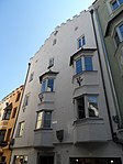
Adlerbrückengasse 6 ID: 14233 |
Adlerbrückengasse 6 46 ° 43 ′ 0 ″ N, 11 ° 39 ′ 31 ″ E |
May 18, 1951 (MD) |
Urban residential building |
KG: Brixen building plot: 302
|

|
Adlerbrückengasse 7 ID: 14110 |
Adlerbrückengasse 7 46 ° 43 ′ 0 ″ N, 11 ° 39 ′ 30 ″ E |
May 18, 1951 (MD) |
Urban residential building |
KG: Brixen building plot: 2
|
|
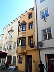
Adlerbrückengasse 8 ID: 14234 |
Adlerbrückengasse 8 46 ° 43 ′ 0 ″ N, 11 ° 39 ′ 31 ″ E |
Feb. 13, 1984 (BLR-LAB 637) |
Urban residential building |
KG: Brixen building plot: 303
|

|
Adlerbrückengasse 10 ID: 14235 |
Adlerbrückengasse 10 46 ° 43 ′ 0 ″ N, 11 ° 39 ′ 31 ″ E |
July 6, 1951 (MD) |
Urban residential building |
KG: Brixen building plot: 304
|

|
Adlerbrückengasse 12 ID: 14236 |
Adlerbrückengasse 12 46 ° 43 ′ 0 ″ N, 11 ° 39 ′ 32 ″ E |
Feb. 13, 1984 (BLR-LAB 637) |
Urban residential building |
KG: Brixen building plot: 309
|
| Aichner ID: 14108 |
46 ° 40 ′ 19 "N, 11 ° 38 ′ 57" E |
Nov 28, 2005 (BLR-LAB 4579) |
Rural house / farm |
KG: Sankt Andrea building plot: 76
|
|

|
Albuingasse 2 ID: 14188 |
Albuingasse 2 46 ° 42 ′ 56 ″ N, 11 ° 39 ′ 29 ″ E |
Feb. 13, 1984 (BLR-LAB 637) |
Urban residential building |
KG: Brixen building plot: 220
|
|
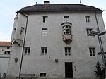
Albuingasse 5 (Propstei) ID: 14230 |
Albuingasse 5 46 ° 42 ′ 58 "N, 11 ° 39 ′ 30" E |
Feb. 13, 1984 (BLR-LAB 637) |
Widum / Canon House |
KG: Brixen building plot: 299
|
|
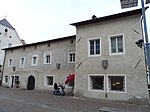
Albuingasse 7 ID: 14229 |
Albuingasse 7 46 ° 42 ′ 57 ″ N, 11 ° 39 ′ 31 ″ E |
Feb. 13, 1984 (BLR-LAB 637) |
Widum / Canon House |
KG: Brixen building plot: 298
|
| Almdötscher in Mellaun ID: 14328 |
46 ° 40 ′ 15 "N, 11 ° 40 ′ 18" E |
8 Sep 1986 (BLR-LAB 4973) |
Rural house / farm |
KG: Brixen building plot: 61
|
|

|
Old parish church Maria am Sand, cemetery chapel and cemetery ID: 14283 |
46 ° 42 ′ 5 "N, 11 ° 39 ′ 51" E |
November 14, 2005 (BLR-LAB 4258) |
church |
KG: Brixen building plot: 1, 2 basic plot: 1
|
|
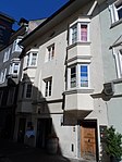
Altenmarktgasse 6 ID: 14115 |
Altenmarktgasse 6 46 ° 43 ′ 3 ″ N, 11 ° 39 ′ 27 ″ E |
July 6, 1951 (MD) |
Urban residential building |
KG: Brixen building plot: 18
|

|
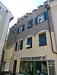
Altenmarktgasse 7 ID: 18042 |
Altenmarktgasse 7 46 ° 43 ′ 3 ″ N, 11 ° 39 ′ 25 ″ E |
December 3, 1990 (BLR-LAB 7622) |
Urban residential building |
KG: Brixen building plot: 110
|
|
Altenmarktgasse 9 ID: 50273 |
Altenmarktgasse 9 46 ° 43 ′ 4 ″ N, 11 ° 39 ′ 24 ″ E |
May 5, 2003 (BLR-LAB 1450) |
Urban residential building |
KG: Brixen building plot: 109
|

|
Altenmarktgasse 10 ID: 50260 |
Altenmarktgasse 10 46 ° 43 ′ 4 ″ N, 11 ° 39 ′ 25 ″ E |
Dec. 2, 1996 (BLR-LAB 5920) |
Urban residential building |
KG: Brixen building plot: 20
|

|
Altenmarktgasse 11 ID: 18148 |
Altenmarktgasse 11 46 ° 43 ′ 4 ″ N, 11 ° 39 ′ 24 ″ E |
6th Mar 1995 (BLR-LAB 1063) |
Urban residential building |
KG: Brixen building plot: 108
|

|
Altenmarktgasse 14 ID: 14117 |
Altenmarktgasse 14 46 ° 43 ′ 5 ″ N, 11 ° 39 ′ 25 ″ E |
July 6, 1951 (MD) |
Urban residential building |
KG: Brixen building plot: 22
|

|
Altenmarktgasse 18 ID: 50261 |
Altenmarktgasse 18 46 ° 43 ′ 6 ″ N, 11 ° 39 ′ 25 ″ E |
Jan. 19, 2004 (BLR-LAB 76) |
Urban residential building |
KG: Brixen building plot: 27
|

|
Altenmarktgasse 19 ID: 14131 |
Altenmarktgasse 19 46 ° 43 ′ 5 ″ N, 11 ° 39 ′ 23 ″ E |
October 16, 1989 (BLR-LAB 6466) |
Urban residential building |
KG: Brixen building plot: 103
|
|
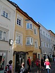
Altenmarktgasse 21 ID: 14415 |
Altenmarktgasse 21 46 ° 43 ′ 6 ″ N, 11 ° 39 ′ 23 ″ E |
Aug 21, 1952 (MD) |
Urban residential building |
KG: Brixen building plot: 102/1, 102/2
|

|
Old hospital with park ID: 14275 |
46 ° 43 '23 "N, 11 ° 38' 54" E |
Feb. 16, 1987 (BLR-LAB 604) |
Hospital / sanatorium |
KG: Brixen building plot: 600
|
|
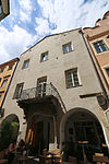
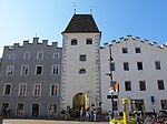
Old Town Hall ID: 14144 |
Large Arbors 14 - Großer Graben 23 46 ° 43 ′ 1 ″ N, 11 ° 39 ′ 22 ″ E |
Feb. 13, 1984 (BLR-LAB 637) |
Urban residential building |
KG: Brixen building plot: 129
|
|
Lachmüller residence ID: 14149 |
Säbnertorgasse 3 46 ° 43 ′ 0 ″ N, 11 ° 39 ′ 18 ″ E |
5th Sep 1983 (BLR-LAB 5130) |
Raised hide |
KG: Brixen building plot: 136, 137
|

|
Antoniuskapelle bei Schnatzer ID: 14097 |
46 ° 40 ′ 16 "N, 11 ° 43 ′ 58" E |
8 Sep 1986 (BLR-LAB 4973) |
chapel |
KG: Sankt Andrea building plot: 142
|
| Bäckergasse 4 ID: 14163 |
Bäckergasse 4 46 ° 42 ′ 58 ″ N, 11 ° 39 ′ 22 ″ E |
Aug 20, 1952 (MD) |
Urban residential building |
KG: Brixen building plot: 184
|
|

|
Brixen railway station ID: 50404 |
46 ° 42 ′ 36 "N, 11 ° 39 ′ 0" E |
April 5, 2004 (BLR-LAB 1083) |
Brixen railway station; the coordinates on the left in the Location column refer to the main building; The water station is located at 46 ° 42 '43.5 " N , 11 ° 38' 57.8" O , the Güterschuppen to 46 ° 42 '43.4 " N , 11 ° 39' 0.6" O . |
KG: Brixen building plot: 472/3, 472/5, 472/6, 810
|

|
Bahnhofstrasse 40 ID: 14273 |
Bahnhofstrasse 40 46 ° 42 ′ 45 ″ N, 11 ° 39 ′ 3 ″ E |
Feb. 13, 1984 (BLR-LAB 637) |
Villa / summer cottage |
KG: Brixen building plot: 571
|
| Baumgartner in Payrdorf ID: 14297 |
46 ° 41 ′ 50 ″ N, 11 ° 38 ′ 3 ″ E |
8 Sep 1986 (BLR-LAB 4973) |
Rural house / farm |
KG: Pfeffersberg building plot: 66/1
|
|

|
Wayside shrine at the intersection of Landesstraße - Dorfgasse ID: 14320 |
46 ° 41 ′ 17 "N, 11 ° 38 ′ 54" E |
8 Sep 1986 (BLR-LAB 4973) |
Wayside shrine |
KG: Sarns building plot: 37
|

|
Wayside shrine at the Hotel Elefant ID: 18039 |
46 ° 43 ′ 11 ″ N, 11 ° 39 ′ 12 ″ E |
Feb. 13, 1984 (BLR-LAB 637) |
Wayside shrine |
KG: Brixen land parcel: 579
|
| Wayside shrine at the payer ID: 14282 |
46 ° 43 ′ 56 "N, 11 ° 40 ′ 2" E |
8 Sep 1986 (BLR-LAB 4973) |
Wayside shrine |
KG: Elvas basic parcel: 894/2
|
|

|
Wayside shrine in Tötschling ID: 14315 |
46 ° 41 ′ 40 "N, 11 ° 37 ′ 24" E |
8 Sep 1986 (BLR-LAB 4973) |
Wayside shrine |
KG: Pfeffersberg basic parcel: 926
|
| Bishop in Mellaun ID: 14324 |
46 ° 41 ′ 29 "N, 11 ° 40 ′ 2" E |
8 Sep 1986 (BLR-LAB 4973) |
Rural house / farm |
KG: Sankt Andrea building plot: 39
|
|
|
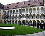
Episcopal Hofburg with new building, outbuildings, tree garden and Herrengarten ID: 14192 |
46 ° 42 ′ 54 "N, 11 ° 39 ′ 20" E |
Feb. 13, 1984 (BLR-LAB 637) |
Former Episcopal Palace, today the seat of the Diocesan Museum ; the coordinates on the left in the Location column refer to the Hofburg, the new building is at 46 ° 42 ′ 56 ″ N , 11 ° 39 ′ 20.6 ″ E , the garden house at 46 ° 42 ′ 52.3 ″ N , 11 ° 39 ′ 27.6 ″ E , the Chinese Pavilion at 46 ° 42 ′ 47.7 ″ N , 11 ° 39 ′ 20 ″ E , the Japanese Pavilion at 46 ° 42 ′ 48.1 ″ N , 11 ° 39 ′ 28.3 " O ; Baumgarten is situated at 46 ° 42 '49.7 " N , 11 ° 39' 23.6" O , the Herrngarten to 46 ° 42 '55.8 " N , 11 ° 39' 18.7" O . |
KG: Brixen building plots: 165, 226, 227, 233/1, 233/3, 233/4 ground plots : 137, 143
|
| Bittertschöl ID: 14106 |
46 ° 40 ′ 24 "N, 11 ° 38 ′ 31" E |
8 Sep 1986 (BLR-LAB 4973) |
Rural house / farm |
KG: Albeins building plot: 69
|
|

|
Brunogasse 5 ID: 14197 |
Brunogasse 5 46 ° 42 ′ 54 ″ N, 11 ° 39 ′ 29 ″ E |
Feb. 13, 1984 (BLR-LAB 637) |
Urban residential building |
KG: Brixen building plot: 235
|

|
Brunogasse 9 ID: 14196 |
Brunogasse 9 46 ° 42 ′ 54 ″ N, 11 ° 39 ′ 28 ″ E |
Feb. 13, 1984 (BLR-LAB 637) |
Urban residential building |
KG: Brixen building plot: 232
|

|
Brunogasse 11 ID: 14195 |
Brunogasse 11 46 ° 42 ′ 53 ″ N, 11 ° 39 ′ 26 ″ E |
Feb. 13, 1984 (BLR-LAB 637) |
Urban residential building |
KG: Brixen building plot: 231
|
| Cusanus Academy ID: 50613 |
Seminar place 2 46 ° 42 ′ 53 ″ N, 11 ° 39 ′ 34 ″ E |
April 10, 2018 (BLR-LAB 334) |
first major public building by Othmar Barth , built 1960–1962 on behalf of the Diocese of Bozen-Brixen , skeleton structure made of reinforced concrete in visible construction |
KG: Brixen building plot: 287/2
|
|

|
Cathedral of the Assumption ID: 14187 |
46 ° 42 ′ 57 "N, 11 ° 39 ′ 28" E |
Feb. 13, 1984 (BLR-LAB 637) |
church |
KG: Brixen building plot: 219
|

|
Domherrenhaus ID: 14194 |
Brunogasse 13 46 ° 42 ′ 53 ″ N, 11 ° 39 ′ 25 ″ E |
Feb. 13, 1984 (BLR-LAB 637) |
Widum / Canon House |
KG: Brixen building plot: 230
|

|
Domhof ID: 14286 |
46 ° 42 ′ 10 "N, 11 ° 39 ′ 35" E |
Nov 28, 2005 (BLR-LAB 4578) |
Rural house / farm |
KG: Milland building plot: 28/1
|

|
Cathedral cloister ID: 14184 |
46 ° 42 ′ 56 "N, 11 ° 39 ′ 28" E |
Feb. 13, 1984 (BLR-LAB 637) |
church |
KG: Brixen building plot: 214
|

|
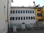
Cathedral Square 3 ID: 14182 |
Domplatz 3 46 ° 42 ′ 56 ″ N, 11 ° 39 ′ 27 ″ E |
Feb. 13, 1984 (BLR-LAB 637) |
Widum / Canon House |
KG: Brixen building plot: 211, 212
|
|
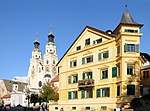
Domplatz 4 ID: 14190 |
Domplatz 4 46 ° 42 ′ 55 ″ N, 11 ° 39 ′ 25 ″ E |
4th Mar 1987 (BLR-LAB 887) |
Urban residential building |
KG: Brixen building plot: 224
|
|
Domplatz 5 ID: 14191 |
Domplatz 5 46 ° 42 ′ 55 ″ N, 11 ° 39 ′ 25 ″ E |
Feb. 13, 1984 (BLR-LAB 637) |
Urban residential building |
KG: Brixen building plot: 225
|

|
Cathedral Square 11 ID: 14180 |
Domplatz 11 46 ° 42 ′ 56 ″ N, 11 ° 39 ′ 23 ″ E |
Feb. 13, 1984 (BLR-LAB 637) |
Widum / Canon House |
KG: Brixen building plot: 207
|
|
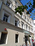
Domplatz 13 ID: 14177 |
Domplatz 13 46 ° 42 ′ 58 ″ N, 11 ° 39 ′ 23 ″ E |
Feb. 13, 1984 (BLR-LAB 637) |
Urban residential building |
KG: Brixen building plot: 204
|

|
Dompropstei ID: 14193 |
Hofburgplatz 1 46 ° 42 ′ 53 ″ N, 11 ° 39 ′ 24 ″ E |
Feb. 13, 1984 (BLR-LAB 637) |
Widum / Canon House |
KG: Brixen building plot: 229/1
|

|
Former health insurance company Brixen ID: 50512 |
46 ° 43 ′ 0 ″ N, 11 ° 39 ′ 13 ″ E |
22 Sep 2008 (BLR-LAB 3419) |
Administrative building |
KG: Brixen building plot: 651
|

|
Former Seidner brewery ID: 50264 |
46 ° 42 ′ 54 "N, 11 ° 39 ′ 59" E |
8 Sep 1986 (BLR-LAB 4973) |
factory |
KG: Brixen building plot: 1537, 502
|
| Former St. Valentin chapel in Monstrol ID: 50470 |
46 ° 42 ′ 18 "N, 11 ° 40 ′ 11" E |
December 28, 2007 (BLR-LAB 4615) |
chapel |
KG: Sankt Andrea building plot: 138
|
|
| Former Palmschoss pulmonary hospital ID: 14098 |
46 ° 40 ′ 33 "N, 11 ° 42 ′ 36" E |
8 Sep 1986 (BLR-LAB 4973) |
Hospital / sanatorium |
KG: Afers building plot: 149, 150
|
|
|
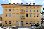
Former post office building ID: 14112 |
46 ° 43 ′ 2 "N, 11 ° 39 ′ 29" E |
Feb. 13, 1984 (BLR-LAB 637) |
Administrative building |
KG: Brixen building plot: 12
|
|
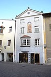
Erhardgasse 4 ID: 50461 |
Erhardgasse 4 46 ° 42 ′ 57 ″ N, 11 ° 39 ′ 19 ″ E |
Feb. 19, 2007 (BLR-LAB 500) |
Urban residential building |
KG: Brixen building plot: 150
|
|
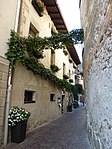
Finsterwirt ID: 14179 |
Domgasse 3 46 ° 42 ′ 57 ″ N, 11 ° 39 ′ 23 ″ E |
Aug 20, 1952 (MD) |
Inn |
KG: Brixen building plot: 206
|

|
Franciscan monastery ID: 14210 |
46 ° 42 ′ 42 "N, 11 ° 39 ′ 32" E |
Feb. 13, 1984 (BLR-LAB 637) |
monastery |
KG: Brixen building plot: 262
|
|
Cemetery arcades and cemetery chapel ID: 14125 |
46 ° 43 ′ 1 ″ N, 11 ° 39 ′ 11 ″ E |
Feb. 13, 1984 (BLR-LAB 637) |
graveyard |
KG: Brixen building plot: 66, 67
|
| Garden house at the Hotel Elefant ID: 50263 |
46 ° 43 ′ 7 ″ N, 11 ° 39 ′ 6 ″ E |
22 Mar 1999 (BLR-LAB 921) |
Raised hide |
KG: Brixen building plot: 560
|
|

|
Gasthaus Schwarzer Adler ID: 14152 |
Small arbors 2 46 ° 42 ′ 59 ″ N, 11 ° 39 ′ 19 ″ E |
Oct 3, 1951 (MD) |
Inn |
KG: Brixen building plot: 140
|
|
Gasthaus Weißes Rössl ID: 14118 |
Altenmarktgasse 22 46 ° 43 ′ 6 ″ N, 11 ° 39 ′ 24 ″ E |
July 6, 1951 (MD) |
Inn |
KG: Brixen building plot: 29
|

|
Gasthof Goldener Adler ID: 14109 |
46 ° 43 ′ 1 ″ N, 11 ° 39 ′ 31 ″ E |
May 18, 1951 (MD) |
Inn |
KG: Brixen building plot: 1
|

|
Gasthof Goldener Stern ID: 14116 |
Altenmarktgasse 8 46 ° 43 ′ 4 ″ N, 11 ° 39 ′ 26 ″ E |
July 6, 1951 (MD) |
Inn |
KG: Brixen building plot: 19
|
|
Gasthof Rose ID: 14174 |
Large arbors 46 ° 43 ′ 0 ″ N, 11 ° 39 ′ 24 ″ E |
Oct 3, 1951 (MD) |
Inn |
KG: Brixen building plot: 199
|
|
Gasthof Sonne ID: 14156 |
46 ° 42 ′ 57 "N, 11 ° 39 ′ 18" E |
Feb. 15, 1985 (BLR-LAB 687) |
Inn |
KG: Brixen building plot: 151
|

|
Gasthof zur Traube ID: 14162 |
Small arbors 9 46 ° 42 ′ 58 ″ N, 11 ° 39 ′ 21 ″ E |
Oct 3, 1951 (MD) |
Inn |
KG: Brixen building plot: 179
|
| Croatians in Karnol ID: 14332 |
46 ° 42 ′ 56 "N, 11 ° 40 ′ 42" E |
8 Sep 1986 (BLR-LAB 4973) |
Rural house / farm |
KG: Sankt Andrea building plot: 150
|
|

|
Bell foundry house ID: 14261 |
Brennerstrasse 28-30 46 ° 43 ′ 26 ″ N, 11 ° 39 ′ 20 ″ E |
Aug 20, 1952 (MD) |
Urban residential building |
KG: Brixen building plot: 1701, 1750, 422/1
|
| Gostner in St. Leonhard ID: 14335 |
46 ° 42 ′ 52 "N, 11 ° 41 ′ 41" E |
8 Sep 1986 (BLR-LAB 4973) |
Rural house / farm |
KG: Sankt Andrea building plot: 180
|
|

|
Griesgasse 2 ID: 14237 |
Griesgasse 2 46 ° 43 ′ 0 ″ N, 11 ° 39 ′ 32 ″ E |
Aug 20, 1952 (MD) |
Urban residential building |
KG: Brixen building plot: 310
|

|
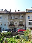
Griesgasse 10 ID: 14227 |
Griesgasse 10 46 ° 42 ′ 58 ″ N, 11 ° 39 ′ 33 ″ E |
Feb. 13, 1984 (BLR-LAB 637) |
Urban residential building |
KG: Brixen building plot: 293
|
|
Griesgasse 14 ID: 14226 |
Griesgasse 14 46 ° 42 ′ 58 ″ N, 11 ° 39 ′ 34 ″ E |
Feb. 13, 1984 (BLR-LAB 637) |
Urban residential building |
KG: Brixen building plot: 291
|

|
Griesgasse 16 ID: 14225 |
Griesgasse 16 46 ° 42 ′ 57 ″ N, 11 ° 39 ′ 34 ″ E |
Feb. 13, 1984 (BLR-LAB 637) |
Urban residential building |
KG: Brixen building plot: 290
|

|
Large arbors 3 ID: 50297 |
Large arbors 3 46 ° 42 ′ 59 ″ N, 11 ° 39 ′ 25 ″ E |
July 10, 2000 (BLR-LAB 2527) |
Inn |
KG: Brixen building plot: 201
|

|
Large arbors 4 - Großer Graben 9 ID: 50483 |
Large Arbors 4 - Großer Graben 9 46 ° 43 ′ 1 ″ N, 11 ° 39 ′ 25 ″ E |
31 Mar 2008 (BLR-LAB 1046) |
Urban residential building |
KG: Brixen building plot: 123
|

|
Large arbors 6 - Großer Graben 13 ID: 14140 |
Large Arbors 6 - Großer Graben 13 46 ° 43 ′ 0 ″ N, 11 ° 39 ′ 24 ″ E |
Oct 3, 1951 (MD) |
Urban residential building |
KG: Brixen building plot: 124/1
|

|
Large arbors 8 - Großer Graben 15 ID: 14141 |
Large Arbors 8 - Großer Graben 15 46 ° 43 ′ 1 ″ N, 11 ° 39 ′ 24 ″ E |
Oct 3, 1951 (MD) |
Urban residential building |
KG: Brixen building plot: 125
|

|
Large arbors 9 ID: 14173 |
Large arbors 9 46 ° 42 ′ 59 ″ N, 11 ° 39 ′ 24 ″ E |
Oct 3, 1951 (MD) |
Urban residential building |
KG: Brixen building plot: 198
|

|
Large arbors 10 - Großer Graben 17 ID: 14142 |
Large arbors 10 - Großer Graben 17 46 ° 43 ′ 1 ″ N, 11 ° 39 ′ 23 ″ E |
Oct 3, 1951 (MD) |
Urban residential building |
KG: Brixen building plot: 126, 127
|

|
Large arbors 11C ID: 14172 |
Large arbors 11C 46 ° 42 ′ 59 ″ N, 11 ° 39 ′ 23 ″ E |
Feb. 13, 1984 (BLR-LAB 637) |
Urban residential building |
KG: Brixen building plot: 197/1, 197/2
|

|
Large arbors 12 - Großer Graben 21 ID: 14143 |
Large Arbors 12 - Großer Graben 21 46 ° 43 ′ 0 ″ N, 11 ° 39 ′ 23 ″ E |
Aug 20, 1952 (MD) |
Urban residential building |
KG: Brixen building plot: 128
|

|
Large arbors 13 ID: 14171 |
Large arbors 13 46 ° 42 ′ 59 ″ N, 11 ° 39 ′ 22 ″ E |
Feb. 15, 1985 (BLR-LAB 687) |
Urban residential building |
KG: Brixen building plot: 1602/1, 1602/2
|

|
Large arbors 17 ID: 50280 |
Large arbors 17 46 ° 42 ′ 59 ″ N, 11 ° 39 ′ 22 ″ E |
Aug. 12, 2003 (BLR-LAB 2735) |
Urban residential building |
KG: Brixen building plot: 183, 194, 195
|
|
|
Large arbors 19 ID: 14170 |
Large arbors 19 46 ° 42 ′ 59 ″ N, 11 ° 39 ′ 22 ″ E |
Feb. 13, 1984 (BLR-LAB 637) |
Urban residential building |
KG: Brixen building plot: 193
|

|
Large arbors 20 - Großer Graben 25 ID: 14145 |
Large Arbors 20 - Großer Graben 25 46 ° 43 ′ 0 ″ N, 11 ° 39 ′ 21 ″ E |
May 18, 1987 (BLR-LAB 2614) |
Urban residential building |
KG: Brixen building plot: 132
|
|
|
Large arbors 21 ID: 14169 |
Large arbors 21 46 ° 42 ′ 59 ″ N, 11 ° 39 ′ 21 ″ E |
Aug 20, 1952 (MD) |
Urban residential building |
KG: Brixen building plot: 192
|

|
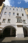
Large arbors 22-24 - Großer Graben 27 ID: 14146 |
Large Arbors 22-24 - Großer Graben 27 46 ° 43 '0 "N, 11 ° 39' 21" E |
Aug 20, 1952 (MD) |
Urban residential building |
KG: Brixen building plot: 133
|
|
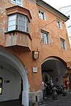
Large arbors 26 - Großer Graben 29 ID: 14147 |
Large Arbors 26 - Großer Graben 29 46 ° 43 ′ 0 ″ N, 11 ° 39 ′ 20 ″ E |
Aug 20, 1952 (MD) |
Urban residential building |
KG: Brixen building plot: 134
|
|
Large arbors 27 ID: 14168 |
Large arbors 27 46 ° 42 ′ 59 ″ N, 11 ° 39 ′ 20 ″ E |
Aug 20, 1952 (MD) |
Urban residential building |
KG: Brixen building plot: 189/1, 189/2
|

|
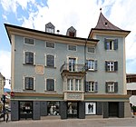
Large arbors 28 - Großer Graben 31 ID: 14148 |
Large arbors 28 - Großer Graben 31 46 ° 43 ′ 0 ″ N, 11 ° 39 ′ 19 ″ E |
Feb. 13, 1984 (BLR-LAB 637) |
Urban residential building |
KG: Brixen building plot: 135
|
|
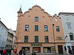
Großer Graben 2 ID: 14114 |
Great Trench 2 46 ° 43 ′ 2 ″ N, 11 ° 39 ′ 28 ″ E |
8 Sep 1986 (BLR-LAB 4973) |
Urban residential building |
KG: Brixen building plot: 16
|
|
Großer Graben 3 ID: 14134 |
Great Trench 3 46 ° 43 ′ 2 ″ N, 11 ° 39 ′ 27 ″ E |
Feb. 13, 1984 (BLR-LAB 637) |
Urban residential building |
KG: Brixen building plot: 115
|

|
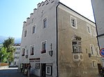
Hahnberg ID: 14280 |
46 ° 43 ′ 31 ″ N, 11 ° 39 ′ 36 ″ E |
30th Mar 1998 (BLR-LAB 1268) |
Raised hide |
KG: Elvas building plot: 24, 392, 69
|
|
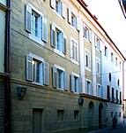
Hartwiggasse 1 ID: 14222 |
Hartwiggasse 1 46 ° 42 ′ 56 ″ N, 11 ° 39 ′ 31 ″ E |
Feb. 13, 1984 (BLR-LAB 637) |
Widum / Canon House |
KG: Brixen building plot: 286
|
|
Hartwiggasse 2 ID: 14189 |
Hartwiggasse 2 46 ° 42 ′ 55 ″ N, 11 ° 39 ′ 30 ″ E |
Feb. 13, 1984 (BLR-LAB 637) |
Rural house / farm |
KG: Brixen building plot: 221
|

|
Hartwiggasse 5-7 ID: 14221 |
Hartwiggasse 5-7 46 ° 42 ′ 55 ″ N, 11 ° 39 ′ 31 ″ E |
Aug 20, 1952 (MD) |
Urban residential building |
KG: Brixen building plot: 285
|

|
Hartwiggasse 8 ID: 14199 |
Hartwiggasse 8 46 ° 42 ′ 53 ″ N, 11 ° 39 ′ 31 ″ E |
Aug 20, 1952 (MD) |
Urban residential building |
KG: Brixen building plot: 238
|

|
Hartwiggasse 9 ID: 14220 |
Hartwiggasse 9 46 ° 42 ′ 54 ″ N, 11 ° 39 ′ 32 ″ E |
Aug 20, 1952 (MD) |
Urban residential building |
KG: Brixen building plot: 284
|
| Heidner in Payrdorf ID: 14299 |
46 ° 41 ′ 56 "N, 11 ° 38 ′ 24" E |
8 Sep 1986 (BLR-LAB 4973) |
Rural house / farm |
KG: Pfeffersberg building plot: 70/1
|
|

|
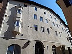
Heilig-Geist-Spital with church ID: 14126 |
46 ° 43 ′ 2 ″ N, 11 ° 39 ′ 16 ″ E |
Feb. 13, 1984 (BLR-LAB 637) |
hospital |
KG: Brixen building plot: 1374, 64, 70/1, 71
|
|
Hirschenwirt ID: 14256 |
Obere Schutzengelgasse 1 46 ° 43 ′ 1 ″ N, 11 ° 39 ′ 36 ″ E |
July 6, 1951 (MD) |
Inn |
KG: Brixen building plot: 356
|
| Hofer ID: 14094 |
46 ° 40 ′ 14 "N, 11 ° 41 ′ 47" E |
8 Aug 2011 (BLR-LAB 1187) |
Residential building |
KG: Afers building plot: 391
|
|

|
Holderer in Karnol ID: 14334 |
46 ° 42 ′ 49 "N, 11 ° 40 ′ 55" E |
8 Sep 1986 (BLR-LAB 4973) |
Raised hide |
KG: Sankt Andrea building plot: 155
|

|
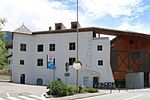
Hotel Elefant ID: 14124 |
Weißlahnstrasse 4-10 46 ° 43 ′ 10 ″ N, 11 ° 39 ′ 12 ″ E |
Aug 20, 1952 (MD) |
hotel |
KG: Brixen building plot: 1682, 51/1, 51/2, 52/1
|

|
Hotel Goldenes Rössl ID: 14119 |
Brennerstrasse 3 46 ° 43 ′ 11 ″ N, 11 ° 39 ′ 21 ″ E |
Feb. 13, 1984 (BLR-LAB 637) |
hotel |
KG: Brixen building plot: 37/1
|
|
Hubenstein (Kofler) ID: 14285 |
46 ° 42 ′ 15 ″ N, 11 ° 39 ′ 37 ″ E |
8 Sep 1986 (BLR-LAB 4973) |
Raised hide |
KG: Milland building plot: 24/3
|

|
Millennium column at Hofburgplatz ID: 18040 |
46 ° 42 ′ 54 "N, 11 ° 39 ′ 24" E |
Feb. 13, 1984 (BLR-LAB 637) |
monument |
KG: Brixen land parcel: 982
|
| Kampan ID: 14317 |
46 ° 41 ′ 31 "N, 11 ° 38 ′ 56" E |
8 Sep 1986 (BLR-LAB 4973) |
Raised hide |
KG: Sarns building plot: 10
|
|

|
Chapel at the Egarter in Gereuth ID: 14313 |
46 ° 42 ′ 14 "N, 11 ° 37 ′ 15" E |
8 Sep 1986 (BLR-LAB 4973) |
chapel |
KG: Pfeffersberg building plot: 147
|
| Chapel at Perlunger in Gereuth ID: 14314 |
46 ° 42 ′ 32 "N, 11 ° 36 ′ 56" E |
8 Sep 1986 (BLR-LAB 4973) |
chapel |
KG: Pfeffersberg basic parcel: 603
|
|
| Chapel at Sader ID: 14099 |
46 ° 39 ′ 41 "N, 11 ° 40 ′ 52" E |
8 Sep 1986 (BLR-LAB 4973) |
chapel |
KG: Afers parcel: 311
|
|

|
Chapel at the Wegscheider in Gereuth ID: 14311 |
46 ° 42 ′ 26 "N, 11 ° 36 ′ 44" E |
8 Sep 1986 (BLR-LAB 4973) |
chapel |
KG: Pfeffersberg building plot: 138
|
| Chapel of the Assumption of Mary at the Burger in Untereben ID: 14312 |
46 ° 43 ′ 23 "N, 11 ° 38 ′ 29" E |
8 Sep 1986 (BLR-LAB 4973) |
chapel |
KG: Pfeffersberg building plot: 140
|
|
|
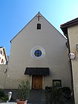
Capuchin Church and Monastery ID: 14211 |
46 ° 42 ′ 47 "N, 11 ° 39 ′ 34" E |
Feb. 13, 1984 (BLR-LAB 637) |
church |
KG: Brixen building plot: 264, 265
|

|
Karlsburg ID: 14287 |
46 ° 42 ′ 13 ″ N, 11 ° 39 ′ 39 ″ E |
June 18, 1958 (MD) |
Raised hide |
KG: Milland building plot: 31
|

|
Kassianeum ID: 50302 |
46 ° 42 ′ 54 "N, 11 ° 39 ′ 30" E |
May 15, 2003 (BLR-LAB 1449) |
Kurhaus |
KG: Brixen building plot: 222
|
| Khuen in the Mahr ID: 14303 |
46 ° 41 ′ 23 "N, 11 ° 38 ′ 5" E |
8 Sep 1986 (BLR-LAB 4973) |
Rural house / farm |
KG: Pfeffersberg building plot: 96
|
|

|
Kienerhäuser ID: 14274 |
46 ° 42 ′ 44 "N, 11 ° 39 ′ 20" E |
Feb. 13, 1984 (BLR-LAB 637) |
Terraced housing estate |
KG: Brixen building plot: 577, 578, 579, 580, 581, 582
|

|
Kirchbergerhaus ID: 14176 |
Domplatz 20 46 ° 42 ′ 59 ″ N, 11 ° 39 ′ 26 ″ E |
4th Mar 1987 (BLR-LAB 887) |
Urban residential building |
KG: Brixen building plot: 202
|
| Kircher in St. Leonhard ID: 14337 |
46 ° 43 ′ 5 ″ N, 11 ° 41 ′ 21 ″ E |
8 Sep 1986 (BLR-LAB 4973) |
Rural house / farm |
KG: Sankt Andrea building plot: 220/1
|
|
|
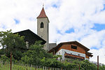
Kircher in Tschötsch ID: 14300 |
46 ° 41 ′ 30 "N, 11 ° 37 ′ 56" E |
Feb. 11, 1991 (BLR-LAB 536) |
Rural house / farm |
KG: Pfeffersberg building plot: 75/1
|
| Kircher with home ID: 14102 |
46 ° 40 ′ 30 "N, 11 ° 37 ′ 59" E |
8 Sep 1986 (BLR-LAB 4973) |
Rural house / farm |
KG: Albeins building plot: 18/1, 19
|
|

|
Poor Clare Church of St. Elisabeth and Monastery ID: 14209 |
46 ° 42 ′ 42 "N, 11 ° 39 ′ 30" E |
Feb. 13, 1984 (BLR-LAB 637) |
church |
KG: Brixen building plot: 255, 256, 261
|

|
Small arbors 3 ID: 14167 |
Small arbors 3 46 ° 42 ′ 59 ″ N, 11 ° 39 ′ 20 ″ E |
Feb. 13, 1984 (BLR-LAB 637) |
Urban residential building |
KG: Brixen building plot: 188/1
|

|
Small arbors 5 ID: 14166 |
Small arbors 5 46 ° 42 ′ 58 ″ N, 11 ° 39 ′ 20 ″ E |
Feb. 13, 1984 (BLR-LAB 637) |
Urban residential building |
KG: Brixen building plot: 187
|

|
Small arbors 7 ID: 14165 |
Small arbors 7 46 ° 42 ′ 58 ″ N, 11 ° 39 ′ 20 ″ E |
Oct 3, 1951 (MD) |
Urban residential building |
KG: Brixen building plot: 186
|

|
Small arbors 7A ID: 14164 |
Small arbors 7A 46 ° 42 ′ 58 ″ N, 11 ° 39 ′ 20 ″ E |
Oct 3, 1951 (MD) |
Urban residential building |
KG: Brixen building plot: 185
|

|
Kleine Lauben 8 - Kleiner Graben 13 ID: 14154 |
Kleine Lauben 8 - Kleiner Graben 13 46 ° 42 ′ 58 ″ N, 11 ° 39 ′ 19 ″ E |
Oct 3, 1951 (MD) |
Urban residential building |
KG: Brixen building plot: 147
|
|
|
Small arbors 10-12 ID: 14155 |
Small arbors 10-12 46 ° 42 ′ 58 ″ N, 11 ° 39 ′ 19 ″ E |
Oct 3, 1951 (MD) |
Urban residential building |
KG: Brixen building plot: 148
|

|
Small arbors 11 ID: 14161 |
Small arbors 11 46 ° 42 ′ 57 ″ N, 11 ° 39 ′ 21 ″ E |
Aug 20, 1952 (MD) |
Urban residential building |
KG: Brixen building plot: 176
|

|
Kleiner Graben 5 ID: 14153 |
Small ditch 5 46 ° 42 ′ 59 ″ N, 11 ° 39 ′ 18 ″ E |
Aug 20, 1952 (MD) |
Urban residential building |
KG: Brixen building plot: 142
|

|
Monastery of the English Misses and St. Joseph's Church ID: 14132 |
46 ° 43 ′ 5 ″ N, 11 ° 39 ′ 21 ″ E |
Feb. 13, 1984 (BLR-LAB 637) |
monastery |
KG: Brixen building plot: 104/1, 105, 1818 basic plot: 124/1
|

|
Köstlan ID: 14257 |
Köstlanstrasse 7-12 46 ° 42 ′ 53 ″ N, 11 ° 39 ′ 57 ″ E |
May 18, 1951 (MD) |
Raised hide |
KG: Brixen building plot: 398/1, 398/2, 398/3, 398/5
|

|
Krakofl ID: 14260 |
Seeburgstrasse 2 46 ° 43 ′ 7 ″ N, 11 ° 39 ′ 56 ″ E |
Aug 20, 1952 (MD) |
Urban residential building |
KG: Brixen building plot: 414
|
|
Kreuzgasse 1 ID: 14158 |
Kreuzgasse 1 46 ° 42 ′ 57 ″ N, 11 ° 39 ′ 16 ″ E |
4th Mar 1987 (BLR-LAB 887) |
Urban residential building |
KG: Brixen building plot: 162/1
|

|
Kreuzgasse 2 ID: 14157 |
Kreuzgasse 2 46 ° 42 ′ 58 ″ N, 11 ° 39 ′ 16 ″ E |
Aug 21, 1952 (MD) |
Municipal house, Hotel Goldenes Kreuz |
KG: Brixen building plot: 152
|
| Kropp with grain box ID: 14326 |
46 ° 41 ′ 40 "N, 11 ° 40 ′ 6" E |
8 Sep 1986 (BLR-LAB 4973) |
Rural house / farm |
KG: Sankt Andrea building plot: 50, 51
|
|

|
Lutzenhaus ID: 50532 |
46 ° 43 ′ 0 ″ N, 11 ° 39 ′ 44 ″ E |
22 Mar 2010 (BLR-LAB 502) |
Urban residential building |
KG: Brixen building plot: 396
|

|
Mariahilf am Friedhof ID: 14322 |
46 ° 41 ′ 53 "N, 11 ° 40 ′ 32" E |
Nov 28, 2005 (BLR-LAB 4577) |
chapel |
KG: Sankt Andrea building plot: 2
|
| Mariahilfkapelle am Freienbühel with forecourt ID: 14093 |
46 ° 40 ′ 23 "N, 11 ° 41 ′ 20" E |
Nov 28, 2005 (BLR-LAB 4584) |
chapel |
KG: Afers building plot: 44 basic plot: 451
|
|

|
Mariahilfkirche in Zinggen ID: 14262 |
46 ° 43 ′ 31 ″ N, 11 ° 39 ′ 16 ″ E |
Feb. 13, 1984 (BLR-LAB 637) |
church |
KG: Brixen building plot: 423
|

|
Mühlgasse 3 ID: 14219 |
Mühlgasse 3 46 ° 42 ′ 53 ″ N, 11 ° 39 ′ 33 ″ E |
8 Sep 1986 (BLR-LAB 4973) |
Urban residential building |
KG: Brixen building plot: 282/1
|

|
Outbuilding at the inn on the Mahr (so-called Schmiedhaus) ID: 50460 |
46 ° 41 ′ 48 "N, 11 ° 38 ′ 31" E |
April 10, 2007 (BLR-LAB 1162) |
Inn |
KG: Pfeffersberg building plot: 102/2
|

|
Neuhaus ID: 14113 |
Schlachthausgasse 3 46 ° 43 ′ 3 ″ N, 11 ° 39 ′ 30 ″ E |
Aug 20, 1952 (MD) |
Raised hide |
KG: Brixen building plot: 14/1
|
| Niederhuber in Mellaun ID: 14325 |
46 ° 41 ′ 35 "N, 11 ° 40 ′ 8" E |
8 Sep 1986 (BLR-LAB 4973) |
Rural house / farm |
KG: Sankt Andrea building plot: 46/1, 46/2
|
|
|
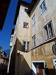
Obere Schutzengelgasse 3 ID: 14255 |
Obere Schutzengelgasse 3 46 ° 43 ′ 1 ″ N, 11 ° 39 ′ 37 ″ E |
July 6, 1951 (MD) |
Urban residential building |
KG: Brixen building plot: 355
|

|
Obere Schutzengelgasse 5 ID: 14254 |
Obere Schutzengelgasse 5 46 ° 43 ′ 0 ″ N, 11 ° 39 ′ 37 ″ E |
July 6, 1951 (MD) |
Urban residential building |
KG: Brixen building plot: 354
|

|
Obere Schutzengelgasse 10 ID: 14253 |
Obere Schutzengelgasse 10 46 ° 42 ′ 59 ″ N, 11 ° 39 ′ 38 ″ E |
Feb. 13, 1984 (BLR-LAB 637) |
Urban residential building |
KG: Brixen building plot: 351
|
| Oberjaufner ID: 14101 |
46 ° 40 ′ 31 ″ N, 11 ° 37 ′ 55 ″ E |
Nov 28, 2005 (BLR-LAB 4587) |
Rural house / farm |
KG: Albeins building plot: 13
|
|
| Obermair ID: 14104 |
46 ° 40 ′ 32 "N, 11 ° 37 ′ 54" E |
8 Sep 1986 (BLR-LAB 4973) |
Rural house / farm |
KG: Albeins building plot: 28/1 basic plot: 96
|
|

|
Pallaus with park ID: 14316 |
46 ° 41 ′ 28 "N, 11 ° 39 ′ 0" E |
8 Sep 1986 (BLR-LAB 4973) |
Raised hide |
KG: Sarns building plot: 6 basic plots: 1, 10/1, 2, 3, 5/1, 8, 9/1, 9/2
|
| Pediller in St. Leonhard ID: 14339 |
46 ° 43 ′ 20 ″ N, 11 ° 41 ′ 0 ″ E |
8 Sep 1986 (BLR-LAB 4973) |
Rural house / farm |
KG: Sankt Andrea building plot: 227
|
|
| Pedoferer ID: 14096 |
46 ° 40 ′ 29 "N, 11 ° 42 ′ 44" E |
8 Sep 1986 (BLR-LAB 4793) |
Rural house / farm |
KG: Afers building plot: 78
|
|

|
Pestbildstock ID: 14291 |
46 ° 42 ′ 34 "N, 11 ° 39 ′ 43" E |
8 Sep 1986 (BLR-LAB 4793) |
Wayside shrine |
KG: Milland building plot: 104/1
|

|
Parish church of St. Andreas, cemetery chapel and cemetery ID: 14321 |
46 ° 41 ′ 54 "N, 11 ° 40 ′ 33" E |
Nov 28, 2005 (BLR-LAB 4577) |
church |
KG: Sankt Andrea building plot: 1, 3 basic plot: 1
|

|
Parish church St. Georg with cemetery ID: 14095 |
46 ° 40 ′ 7 "N, 11 ° 41 ′ 37" E |
Nov 28, 2005 (BLR-LAB 4586) |
church |
KG: Afers building plot: 53 basic plot: 463
|

|
Parish church of St. Hermagoras and Fortunat with cemetery chapel and cemetery ID: 14105 |
46 ° 40 ′ 35 "N, 11 ° 37 ′ 58" E |
8 Sep 1986 (BLR-LAB 4973) |
church |
KG: Albeins building plot: 55, 56, 96
|

|
Parish Church of St. Michael ID: 14186 |
46 ° 42 ′ 59 "N, 11 ° 39 ′ 28" E |
Feb. 13, 1984 (BLR-LAB 637) |
church |
KG: Brixen building plot: 218/1
|

|
Parish Church of St. Peter and Paul with cemetery chapel and cemetery ID: 14281 |
46 ° 43 '56 "N, 11 ° 39' 59" E |
Nov 28, 2005 (BLR-LAB 4585) |
church |
KG: Elvas building plot: 40 Basic plot: 466
|

|
Parish church St. Sebastian with church square ID: 14318 |
46 ° 41 ′ 19 ″ N, 11 ° 38 ′ 51 ″ E |
8 Sep 1986 (BLR-LAB 4973) |
church |
KG: Sarns building plot: 18 basic plot: 275
|
|
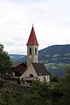
Parish church St. Veit with cemetery in Tils ID: 14292 |
46 ° 42 ′ 38 "N, 11 ° 37 ′ 56" E |
November 14, 2005 (BLR-LAB 4262) |
church |
KG: Pfeffersberg building plot: 6 basic plot: 202
|

|
Pfarrplatz 1 ID: 14139 |
Pfarrplatz 1 46 ° 43 ′ 0 ″ N, 11 ° 39 ′ 26 ″ E |
May 18, 1951 (MD) |
Urban residential building |
KG: Brixen building plot: 120
|

|
Pfarrplatz 2 ID: 14138 |
Pfarrplatz 2 46 ° 43 ′ 1 ″ N, 11 ° 39 ′ 26 ″ E |
May 18, 1951 (MD) |
Urban residential building |
KG: Brixen building plot: 119/1
|

|
Pfarrwidum ID: 14178 |
46 ° 42 ′ 57 "N, 11 ° 39 ′ 23" E |
Feb. 13, 1984 (BLR-LAB 637) |
Widum / Canon House |
KG: Brixen building plot: 205
|

|
Pfarrwidum ID: 14323 |
46 ° 41 ′ 55 "N, 11 ° 40 ′ 33" E |
November 14, 2005 (BLR-LAB 4264) |
Widum |
KG: Sankt Andrea building plot: 4, 6/1
|

|
Parish dedication in Tschötsch ID: 14301 |
46 ° 41 ′ 31 ″ N, 11 ° 37 ′ 57 ″ E |
8 Sep 1986 (BLR-LAB 4973) |
Widum / Canon House |
KG: Pfeffersberg building plot: 77
|

|
Pfaundlerhaus ID: 14137 |
Pfarrplatz 3 46 ° 43 ′ 0 ″ N, 11 ° 39 ′ 27 ″ E |
27 Mar 1952 (MD) |
Urban residential building |
KG: Brixen building plot: 118/2
|
| Pichler in Payrdorf ID: 14298 |
46 ° 41 ′ 50 "N, 11 ° 38 ′ 4" E |
8 Sep 1986 (BLR-LAB 4973) |
Rural house / farm |
KG: Pfeffersberg building plot: 67
|
|
|
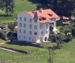
Plabach ID: 14338 |
46 ° 42 ′ 57 "N, 11 ° 40 ′ 10" E |
July 9, 1952 (MD) |
Raised hide |
KG: Sankt Andrea building plot: 226/1
|

|
Splash ID: 14284 |
46 ° 42 ′ 20 "N, 11 ° 39 ′ 51" E |
8 Sep 1986 (BLR-LAB 4973) |
Rural house / farm |
KG: Milland building plot: 15, 17
|

|
Graf-Platz-Haus ID: 14224 |
Griesgasse 18 46 ° 42 ′ 57 ″ N, 11 ° 39 ′ 35 ″ E |
Feb. 13, 1984 (BLR-LAB 637) |
Urban residential building. Late Gothic building with pinnacle gable and corner oriel tower, sundial and Enzenberg coat of arms on the south side. Until around 1600 the residence of the von Wolkenstein and Mohrenberg families, since 1604 that of the von Enzenbergs . Acquired in 1770 by Count Platz, since 1824 in the possession of the seminary. |
KG: Brixen building plot: 289
|
| Platzlunger and Chapel ID: 14107 |
46 ° 40 ′ 40 "N, 11 ° 38 ′ 45" E |
Nov 28, 2005 (BLR-LAB 4580) |
Rural house / farm |
KG: Albeins building plot: 90
|
|
|
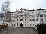
Seminary with Holy Cross Church ID: 14223 |
Seminar place 4 46 ° 42 ′ 55 ″ N, 11 ° 39 ′ 34 ″ E |
Feb. 13, 1984 (BLR-LAB 637) |
four-wing building from the second half of the 18th century, baroque library of the Philosophical-Theological University of Bressanone and Heiligkreuzkirche |
KG: Brixen building plot: 287/1, 288
|

|
Putzer ID: 14279 |
46 ° 43 '24 "N, 11 ° 39' 39" E |
Aug 20, 1952 (MD) |
Rural house / farm |
KG: Elvas building plot: 19
|

|
Town Hall ID: 14175 |
Large arbors 5 46 ° 42 ′ 59 ″ N, 11 ° 39 ′ 24 ″ E |
Feb. 13, 1984 (BLR-LAB 637) |
Administrative building |
KG: Brixen building plot: 200
|
| Razötz ID: 14289 |
46 ° 41 ′ 44 "N, 11 ° 39 ′ 29" E |
8 Sep 1986 (BLR-LAB 4973) |
Rural house / farm |
KG: Milland building plot: 36
|
|

|
Reinegg in the Mahr ID: 14304 |
46 ° 41 ′ 34 "N, 11 ° 38 ′ 21" E |
8 Sep 1986 (BLR-LAB 4973) |
Raised hide |
KG: Pfeffersberg building plot: 97
|
|
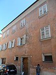
Runggadgasse 1 ID: 14218 |
Runggadgasse 1 46 ° 42 ′ 53 ″ N, 11 ° 39 ′ 32 ″ E |
July 6, 1951 (MD) |
Urban residential building |
KG: Brixen building plot: 280
|
|
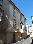
Runggadgasse 2 ID: 18038 |
Runggadgasse 2 46 ° 42 ′ 53 ″ N, 11 ° 39 ′ 31 ″ E |
Feb. 13, 1984 (BLR-LAB 637) |
Urban residential building |
KG: Brixen building plot: 239/2
|
|
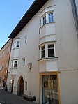
Runggadgasse 3 ID: 14217 |
Runggadgasse 3 46 ° 42 ′ 52 ″ N, 11 ° 39 ′ 32 ″ E |
July 6, 1951 (MD) |
Urban residential building |
KG: Brixen building plot: 279
|

|
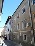
Runggadgasse 4 ID: 14200 |
Runggadgasse 4 46 ° 42 ′ 52 ″ N, 11 ° 39 ′ 32 ″ E |
Feb. 13, 1984 (BLR-LAB 637) |
Urban residential building |
KG: Brixen building plot: 239/1
|
|
Runggadgasse 5 ID: 14216 |
Runggadgasse 5 46 ° 42 ′ 52 ″ N, 11 ° 39 ′ 33 ″ E |
Feb. 13, 1984 (BLR-LAB 637) |
Urban residential building |
KG: Brixen building plot: 278
|

|
Runggadgasse 6 ID: 14201 |
Runggadgasse 6 46 ° 42 ′ 52 ″ N, 11 ° 39 ′ 32 ″ E |
Feb. 13, 1984 (BLR-LAB 637) |
Urban residential building |
KG: Brixen building plot: 240
|

|
Runggadgasse 7 ID: 14215 |
Runggadgasse 7 46 ° 42 ′ 51 ″ N, 11 ° 39 ′ 33 ″ E |
Feb. 13, 1984 (BLR-LAB 637) |
Urban residential building |
KG: Brixen building plot: 277
|

|
Runggadgasse 8 ID: 14202 |
Runggadgasse 8 46 ° 42 ′ 52 ″ N, 11 ° 39 ′ 32 ″ E |
Feb. 13, 1984 (BLR-LAB 637) |
Urban residential building |
KG: Brixen building plot: 241
|
|
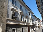
Runggadgasse 10 ID: 14203 |
Runggadgasse 10 46 ° 42 ′ 51 ″ N, 11 ° 39 ′ 32 ″ E |
May 18, 1987 (BLR-LAB 2614) |
Urban residential building |
KG: Brixen building plot: 242/1
|

|
Runggadgasse 11 ID: 14214 |
Runggadgasse 11 46 ° 42 ′ 50 ″ N, 11 ° 39 ′ 34 ″ E |
Feb. 13, 1984 (BLR-LAB 637) |
Urban residential building |
KG: Brixen building plot: 271
|

|
Runggadgasse 12 ID: 14204 |
Runggadgasse 12 46 ° 42 ′ 50 ″ N, 11 ° 39 ′ 32 ″ E |
Oct 3, 1951 (MD) |
Urban residential building |
KG: Brixen building plot: 243
|

|
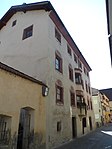
Runggadgasse 14A ID: 14205 |
Runggadgasse 14A 46 ° 42 ′ 49 ″ N, 11 ° 39 ′ 33 ″ E |
Oct 3, 1951 (MD) |
Urban residential building |
KG: Brixen building plot: 244
|
|
Runggadgasse 15 ID: 14213 |
Runggadgasse 15 46 ° 42 ′ 48 ″ N, 11 ° 39 ′ 34 ″ E |
Feb. 13, 1984 (BLR-LAB 637) |
Urban residential building |
KG: Brixen building plot: 270/1 basic plot : 218/2
|

|
Runggadgasse 16 ID: 14206 |
Runggadgasse 16 46 ° 42 ′ 49 ″ N, 11 ° 39 ′ 33 ″ E |
Feb. 13, 1984 (BLR-LAB 637) |
Urban residential building |
KG: Brixen building plot: 246
|

|
Runggadgasse 18 ID: 50306 |
Runggadgasse 18 46 ° 42 ′ 49 ″ N, 11 ° 39 ′ 33 ″ E |
July 5, 1993 (BLR-LAB 3908) |
Urban residential building |
KG: Brixen building plot: 247
|

|
Runggadgasse 20 ID: 14207 |
Runggadgasse 20 46 ° 42 ′ 48 ″ N, 11 ° 39 ′ 33 ″ E |
Feb. 13, 1984 (BLR-LAB 637) |
Urban residential building |
KG: Brixen building plot: 248
|

|
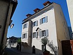
Runggadgasse 21 ID: 14212 |
Runggadgasse 21 46 ° 42 ′ 47 ″ N, 11 ° 39 ′ 34 ″ E |
Nov 20, 1961 (MD) |
Urban residential building |
KG: Brixen building plot: 266, 268/2, 268/3, 270/2
|
|
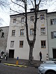
Runggadgasse 24 ID: 14208 |
Runggadgasse 24 46 ° 42 ′ 46 ″ N, 11 ° 39 ′ 32 ″ E |
Feb. 13, 1984 (BLR-LAB 637) |
Urban residential building |
KG: Brixen building plot: 253
|
|
Säbnertorgasse 1 - Kleiner Graben 3 ID: 14151 |
Säbnertorgasse 1 - Kleiner Graben 3 46 ° 42 ′ 59 ″ N, 11 ° 39 ′ 19 ″ E |
Aug 21, 1952 (MD) |
Urban residential building |
KG: Brixen building plot: 139
|

|
Säbnertorgasse 3A ID: 14150 |
Säbnertorgasse 3A 46 ° 43 ′ 0 ″ N, 11 ° 39 ′ 19 ″ E |
Feb. 13, 1984 (BLR-LAB 637) |
Urban residential building |
KG: Brixen building plot: 138
|

|
Sarnfeld with outbuildings and garden ID: 14319 |
46 ° 41 '13 "N, 11 ° 38' 52" E |
8 Sep 1986 (BLR-LAB 4973) |
Raised hide |
KG: Sarns building plot: 23/1, 23/2, 23/5, 24 basic plot: 236/1, 236/2
|
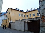
|
Scheuchegg ID: 14198 |
Brunogasse 3 46 ° 42 ′ 53 ″ N, 11 ° 39 ′ 30 ″ E |
Feb. 13, 1984 (BLR-LAB 637) |
Urban residential building |
KG: Brixen building plot: 236
|

|
Schlipfgasse 2 ID: 50587 |
Schlipfgasse 2 46 ° 43 ′ 2 ″ N, 11 ° 39 ′ 36 ″ E |
Feb. 3, 2015 (BLR-LAB 132) |
multi-storey town house with a medieval core stock, early modern facade painting |
KG: Brixen building plot: 357
|

|
Guardian Angel Church in Stufels ID: 14244 |
46 ° 42 ′ 59 "N, 11 ° 39 ′ 38" E |
Feb. 13, 1984 (BLR-LAB 637) |
church |
KG: Brixen building plot: 326
|

|
Seeburg ID: 14259 |
46 ° 43 ′ 10 "N, 11 ° 40 ′ 7" E |
Aug 21, 1952 (MD) |
Raised hide |
KG: Brixen building plot: 410/1, 410/2
|
| Sigmund in Pinzagen ID: 14308 |
46 ° 42 ′ 25 "N, 11 ° 38 ′ 20" E |
8 Sep 1986 (BLR-LAB 4973) |
Rural house / farm |
KG: Pfeffersberg building plot: 111
|
|

|
Sonnentor ID: 14159 |
46 ° 42 ′ 57 "N, 11 ° 39 ′ 18" E |
Feb. 13, 1984 (BLR-LAB 637) |
Fortifications; also called Kreuztor. |
KG: Brixen building plot: 163
|

|
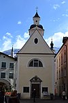
St. Cyrill near Tils ID: 14309 |
46 ° 42 ′ 46 "N, 11 ° 38 ′ 13" E |
November 14, 2005 (BLR-LAB 4261) |
church |
KG: Pfeffersberg building plot: 123
|
|
St. Gotthard and Erhard ID: 14160 |
46 ° 42 ′ 57 ″ N, 11 ° 39 ′ 20 ″ E |
Feb. 13, 1984 (BLR-LAB 637) |
church |
KG: Brixen building plot: 175
|

|
St. Jakob in der Mahr ID: 14305 |
46 ° 41 ′ 34 "N, 11 ° 38 ′ 22" E |
May 8, 1950 (MD) |
church |
KG: Pfeffersberg building plot: 98
|

|
St. Jakob with cemetery ID: 14092 |
46 ° 40 ′ 22 "N, 11 ° 40 ′ 22" E |
Nov 28, 2005 (BLR-LAB 4583) |
church |
KG: Afers building plot: 12 basic plot: 222
|

|
St. Johann with cemetery in Tschötsch ID: 14302 |
46 ° 41 ′ 30 "N, 11 ° 37 ′ 56" E |
Nov 28, 2005 (BLR-LAB 4581) |
church |
KG: Pfeffersberg building plot: 78 basic plot: 1309
|

|
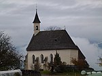
St. Johann with church square in Karnol ID: 14333 |
46 ° 42 ′ 50 "N, 11 ° 40 ′ 52" E |
Nov 28, 2005 (BLR-LAB 4582) |
church |
KG: Sankt Andrea building plot: 154 basic plot: 2105
|
|
St. Johann with church square in Mellaun ID: 14327 |
46 ° 41 ′ 41 ″ N, 11 ° 40 ′ 8 ″ E |
8 Sep 1986 (BLR-LAB 4973) |
church |
KG: Sankt Andrea building parcel: 52 basic parcel: 409
|

|
St. John in the cloister ID: 14183 |
46 ° 42 ′ 55 "N, 11 ° 39 ′ 28" E |
Feb. 13, 1984 (BLR-LAB 637) |
church |
KG: Brixen building plot: 213
|

|
St. Johannes with enclosure in Tötschling ID: 14293 |
46 ° 41 ′ 40 "N, 11 ° 37 ′ 26" E |
November 14, 2005 (BLR-LAB 4257) |
church |
KG: Pfeffersberg building lot: 42 basic lot: 956
|
|
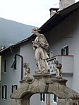
St. John Nepomuk statue at the Eagle Bridge ID: 14276 |
46 ° 43 ′ 0 ″ N, 11 ° 39 ′ 32 ″ E |
Feb. 13, 1984 (BLR-LAB 637) |
monument |
KG: Brixen land parcel: 245/1
|

|
St. John Nepomuk statue in the Rappanlage ID: 14277 |
46 ° 42 ′ 52 "N, 11 ° 39 ′ 39" E |
Feb. 13, 1984 (BLR-LAB 637) |
monument |
KG: Brixen land parcel: 306/1
|
| St. Leonhard with cemetery ID: 14336 |
46 ° 43 ′ 5 ″ N, 11 ° 41 ′ 24 ″ E |
November 14, 2005 (BLR-LAB 4265) |
church |
KG: Sankt Andrea Building plot: 217 Base plot: 2845
|
|

|
St. Margareth ID: 14103 |
46 ° 40 ′ 32 "N, 11 ° 37 ′ 57" E |
8 Sep 1986 (BLR-LAB 4973) |
church |
KG: Albeins building plot: 22
|

|
St. Nikolaus in Tötschling ID: 14294 |
46 ° 41 ′ 42 "N, 11 ° 37 ′ 33" E |
November 14, 2005 (BLR-LAB 4260) |
church |
KG: Pfeffersberg building plot: 47
|

|
St. Nicholas with church square in Klerant ID: 14330 |
46 ° 41 ′ 16 "N, 11 ° 39 ′ 36" E |
November 14, 2005 (BLR-LAB 4263) |
church |
KG: Sankt Andrea building plot: 86 basic plot: 810
|
|
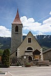
Ortisei in Pinzagen with cemetery ID: 14307 |
46 ° 42 ′ 23 "N, 11 ° 38 ′ 23" E |
November 14, 2005 (BLR-LAB 4256) |
church |
KG: Pfeffersberg building plot: 108 basic plot: 1681
|

|
Stadelgasse 14 ID: 14127 |
Stadelgasse 14 46 ° 43 ′ 6 ″ N, 11 ° 39 ′ 15 ″ E |
Feb. 15, 1985 (BLR-LAB 687) |
Urban residential building |
KG: Brixen building plot: 82/1
|
| Stadelgasse 15 ID: 50531 |
Stadelgasse 15 46 ° 43 ′ 6 ″ N, 11 ° 39 ′ 14 ″ E |
22 Mar 2010 (BLR-LAB 501) |
Municipal house, also Pruggerhaus or Haus Paolina |
KG: Brixen building plot: 55
|
|

|
Stadelgasse 16 ID: 14128 |
Stadelgasse 16 46 ° 43 ′ 6 ″ N, 11 ° 39 ′ 15 ″ E |
Feb. 13, 1984 (BLR-LAB 637) |
Urban residential building |
KG: Brixen building plot: 83/1
|

|
Stuflergasse 10 ID: 14238 |
Stuflergasse 10 46 ° 43 ′ 1 ″ N, 11 ° 39 ′ 34 ″ E |
Aug 20, 1952 (MD) |
Urban residential building |
KG: Brixen building plot: 311
|

|
Tertiary convent with church and garden ID: 50305 |
46 ° 42 ′ 48 "N, 11 ° 39 ′ 33" E |
17th Mar 2003 (BLR-LAB 789) |
Rural house / farm |
KG: Brixen building plot : 249 basic plot: 958/4
|
| Thalhofer in Untereben ID: 14310 |
46 ° 42 ′ 57 "N, 11 ° 38 ′ 38" E |
8 Sep 1986 (BLR-LAB 4973) |
Rural house / farm |
KG: Pfeffersberg building plot: 127
|
|
|
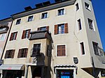
Trattengasse 2 ID: 14120 |
Trattengasse 2 46 ° 43 ′ 9 ″ N, 11 ° 39 ′ 22 ″ E |
July 19, 1952 (MD) |
Urban residential building |
KG: Brixen building plot: 38
|

|
Trattengasse 8 ID: 14121 |
Trattengasse 8 46 ° 43 ′ 9 ″ N, 11 ° 39 ′ 20 ″ E |
Sep 30 1991 (BLR-LAB 5745) |
Urban residential building |
KG: Brixen building plot: 41
|
|
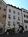
Trattengasse 17 ID: 14130 |
Trattengasse 17 46 ° 43 ′ 8 ″ N, 11 ° 39 ′ 18 ″ E |
July 19, 1952 (MD) |
Urban residential building |
KG: Brixen building plot: 86
|
|
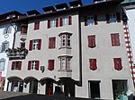
Trattengasse 18 ID: 14122 |
Trattengasse 18 46 ° 43 ′ 9 ″ N, 11 ° 39 ′ 18 ″ E |
July 19, 1952 (MD) |
Urban residential building |
KG: Brixen building plot: 46
|

|
Trattengasse 21 ID: 14129 |
Trattengasse 21 46 ° 43 ′ 7 ″ N, 11 ° 39 ′ 14 ″ E |
Feb. 13, 1984 (BLR-LAB 637) |
Urban residential building |
KG: Brixen building plot: 84
|

|
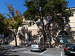
Trattengasse 22 ID: 14123 |
Trattengasse 22 46 ° 43 ′ 9 ″ N, 11 ° 39 ′ 16 ″ E |
July 19, 1952 (MD) |
Urban residential building |
KG: Brixen building plot: 48
|
|
Trattengasse 26 ID: 18037 |
Trattengasse 26 46 ° 43 ′ 9 ″ N, 11 ° 39 ′ 15 ″ E |
Aug 20, 1952 (MD) |
Urban residential building |
KG: Brixen building plot: 50
|

|
Our Lady in the Cloister ID: 14185 |
46 ° 42 ′ 56 "N, 11 ° 39 ′ 27" E |
Feb. 13, 1984 (BLR-LAB 637) |
church |
KG: Brixen building plot: 215
|
| Our Lady of the Seven Sorrows ID: 14263 |
46 ° 42 ′ 56 "N, 11 ° 39 ′ 1" E |
Feb. 13, 1984 (BLR-LAB 637) |
church |
KG: Brixen building plot: 459
|
|
|
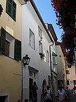
Unterdrittelgasse 6 ID: 14245 |
Unterdrittelgasse 6 46 ° 42 ′ 59 ″ N, 11 ° 39 ′ 39 ″ E |
Feb. 13, 1984 (BLR-LAB 637) |
Urban residential building |
KG: Brixen building plot: 338
|

|
Unterdrittelgasse 7 ID: 14252 |
Unterdrittelgasse 7 46 ° 42 ′ 59 ″ N, 11 ° 39 ′ 40 ″ E |
Feb. 13, 1984 (BLR-LAB 637) |
Urban residential building |
KG: Brixen building plot: 346
|

|
Unterdrittelgasse 8 ID: 14246 |
Unterdrittelgasse 8 46 ° 42 ′ 59 ″ N, 11 ° 39 ′ 40 ″ E |
Feb. 13, 1984 (BLR-LAB 637) |
Urban residential building |
KG: Brixen building plot: 339
|

|
Unterdrittelgasse 9 ID: 14251 |
Unterdrittelgasse 9 46 ° 42 ′ 59 ″ N, 11 ° 39 ′ 40 ″ E |
Feb. 13, 1984 (BLR-LAB 637) |
Urban residential building |
KG: Brixen building plot: 345
|

|
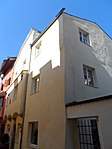
Unterdrittelgasse 10 ID: 14247 |
Unterdrittelgasse 10 46 ° 42 ′ 59 ″ N, 11 ° 39 ′ 40 ″ E |
Feb. 13, 1984 (BLR-LAB 637) |
Urban residential building |
KG: Brixen building plot: 340
|
|
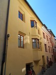
Unterdrittelgasse 11 ID: 14250 |
Unterdrittelgasse 11 46 ° 42 ′ 59 ″ N, 11 ° 39 ′ 41 ″ E |
Feb. 13, 1984 (BLR-LAB 637) |
Urban residential building |
KG: Brixen building plot: 344
|
|
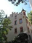
Unterdrittelgasse 14 ID: 14248 |
Unterdrittelgasse 14 46 ° 42 ′ 59 ″ N, 11 ° 39 ′ 41 ″ E |
Feb. 13, 1984 (BLR-LAB 637) |
Urban residential building |
KG: Brixen building plot: 342
|
|
Unterdrittelgasse 16 ID: 14249 |
Unterdrittelgasse 16 46 ° 42 ′ 59 ″ N, 11 ° 39 ′ 41 ″ E |
Aug 20, 1952 (MD) |
Urban residential building |
KG: Brixen building plot: 343
|

|
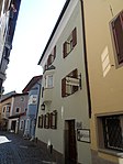
Untere Schutzengelgasse 3 ID: 14239 |
Untere Schutzengelgasse 3 46 ° 43 ′ 1 ″ N, 11 ° 39 ′ 36 ″ E |
4th Mar 1987 (BLR-LAB 887) |
Urban residential building |
KG: Brixen building plot: 317
|
|
Untere Schutzengelgasse 4 ID: 14242 |
Untere Schutzengelgasse 4 46 ° 43 ′ 0 ″ N, 11 ° 39 ′ 36 ″ E |
Aug 9, 1988 (BLR-LAB 5149) |
Urban residential building |
KG: Brixen building plot: 320
|

|
Untere Schutzengelgasse 5 ID: 14240 |
Untere Schutzengelgasse 5 46 ° 43 ′ 0 ″ N, 11 ° 39 ′ 36 ″ E |
Feb. 13, 1984 (BLR-LAB 637) |
Urban residential building |
KG: Brixen building plot: 318
|

|
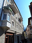
Untere Schutzengelgasse 7 ID: 14241 |
Untere Schutzengelgasse 7 46 ° 43 ′ 0 ″ N, 11 ° 39 ′ 37 ″ E |
4th Mar 1987 (BLR-LAB 887) |
Urban residential building |
KG: Brixen building plot: 319
|
|
Untere Schutzengelgasse 9 ID: 14243 |
Untere Schutzengelgasse 9 46 ° 43 ′ 0 ″ N, 11 ° 39 ′ 37 ″ E |
Feb. 13, 1984 (BLR-LAB 637) |
Urban residential building |
KG: Brixen building plot: 325
|
| Untermair ID: 14100 |
46 ° 40 ′ 30 "N, 11 ° 37 ′ 50" E |
Nov 28, 2005 (BLR-LAB 4588) |
Rural house / farm |
KG: Albeins building plot: 9/1
|
|
| Veitmoar in Moardorf ID: 14331 |
46 ° 42 ′ 16 "N, 11 ° 40 ′ 37" E |
8 Sep 1986 (BLR-LAB 4973) |
Rural house / farm |
KG: Sankt Andrea building plot: 134
|
|
|
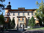
Villa Adele ID: 14266 |
Bahnhofstrasse 18 46 ° 42 ′ 54 ″ N, 11 ° 39 ′ 16 ″ E |
Feb. 13, 1984 (BLR-LAB 637) |
Villa / summer cottage |
KG: Brixen building plot: 518
|

|
Villa Covi ID: 14181 |
46 ° 42 ′ 55 "N, 11 ° 39 ′ 23" E |
Feb. 13, 1984 (BLR-LAB 637) |
Villa / summer cottage |
KG: Brixen building plot: 210
|

|
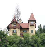
Villa Edelweiß with outbuilding ID: 14267 |
46 ° 43 ′ 3 "N, 11 ° 39 ′ 42" E |
Feb. 13, 1984 (BLR-LAB 637) |
Villa / summer cottage; the outbuilding is north of the villa. |
KG: Brixen building plot: 519/1, 519/2
|
|
Villa Frohsinn (Nana) ID: 14272 |
Elvaser Strasse 36 46 ° 43 ′ 2 ″ N, 11 ° 39 ′ 44 ″ E |
Feb. 13, 1984 (BLR-LAB 637) |
Villa / summer cottage |
KG: Brixen building plot: 564
|

|
Villa Heimat ( Tirolerheim ) ID: 14268 |
46 ° 42 ′ 50 "N, 11 ° 39 ′ 42" E |
Feb. 13, 1984 (BLR-LAB 637) |
Villa / summer cottage |
KG: Brixen building plot: 527
|

|
Villa Kunz ID: 14269 |
Rienzdamm 2 46 ° 42 ′ 51 ″ N, 11 ° 39 ′ 43 ″ E |
4th Mar 1987 (BLR-LAB 887) |
Villa / summer cottage |
KG: Brixen building plot: 534
|

|
Villa Lugegg ID: 14270 |
Elvaser Strasse 43 46 ° 43 ′ 4 ″ N, 11 ° 39 ′ 44 ″ E |
Feb. 13, 1984 (BLR-LAB 637) |
Villa / summer cottage |
KG: Brixen building plot: 540
|

|
Villa Marzari ID: 50453 |
46 ° 43 ′ 8 ″ N, 11 ° 39 ′ 13 ″ E |
Jan. 27, 1992 (BLR-LAB 305) |
Villa / summer cottage |
KG: Brixen building plot: 52/2
|

|
Villa Rifesser with garden and outbuilding ID: 14265 |
46 ° 42 ′ 40 "N, 11 ° 39 ′ 3" E |
4th Mar 1987 (BLR-LAB 887) |
Villa / summer cottage; the outbuilding is to the east of the villa. |
KG: Brixen building plot: 1785, 516 basic plot: 942
|

|
Villa Sabiona ID: 14271 |
46 ° 42 ′ 49 "N, 11 ° 39 ′ 42" E |
Feb. 13, 1984 (BLR-LAB 637) |
Villa / summer cottage |
KG: Brixen building plot: 553
|

|
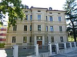
Villa Tavella ID: 50362 |
46 ° 42 ′ 50 ″ N, 11 ° 39 ′ 13 ″ E |
December 30, 2004 (BLR-LAB 4968) |
Raised hide |
KG: Brixen building plot: 525
|
|
Villa Unterpertinger ID: 50262 |
Fallmerayerstraße 9 46 ° 42 ′ 49 ″ N, 11 ° 39 ′ 11 ″ E |
April 14, 2003 (BLR-LAB 1207) |
Raised hide |
KG: Brixen building plot: 488
|

|
Vilseck ID: 14290 |
46 ° 42 ′ 8 "N, 11 ° 39 ′ 32" E |
8 Sep 1986 (BLR-LAB 4973) |
Raised hide |
KG: Milland building plot: 233, 91
|

|
Vincentinum with Church of the Sacred Heart of Jesus ID: 14264 |
Brennerstrasse 37 46 ° 43 ′ 28 ″ N, 11 ° 39 ′ 12 ″ E |
Feb. 13, 1984 (BLR-LAB 637) |
school |
KG: Brixen building plot: 478, 719
|
| Walkner ID: 14278 |
46 ° 43 ′ 9 ″ N, 11 ° 39 ′ 36 ″ E |
Aug 20, 1952 (MD) |
Rural house / farm |
KG: Elvas building plot: 1
|
|

|
Walkner in Kranebitt ID: 18093 |
46 ° 43 ′ 9 ″ N, 11 ° 39 ′ 37 ″ E |
Oct. 21, 1991 (BLR-LAB 6241) |
Urban residential building |
KG: Brixen building plot: 388
|
|
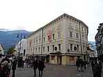
Waltherhaus ID: 14133 |
Altenmarktgasse 1 46 ° 43 ′ 2 ″ N, 11 ° 39 ′ 26 ″ E |
Feb. 13, 1984 (BLR-LAB 637) |
Raised hide |
KG: Brixen building plot: 114
|
| White in Payrdorf ID: 14296 |
46 ° 41 ′ 51 ″ N, 11 ° 37 ′ 46 ″ E |
8 Sep 1986 (BLR-LAB 4973) |
Rural house / farm |
KG: Pfeffersberg building plot: 60
|
|

|
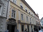
Weißenturmgasse 1 ID: 14136 |
Weißenturmgasse 1 46 ° 43 ′ 0 ″ N, 11 ° 39 ′ 28 ″ E |
Aug 20, 1952 (MD) |
Urban residential building |
KG: Brixen building plot: 117
|
|
Weißenturmgasse 3 ID: 14135 |
Weißenturmgasse 3 46 ° 43 ′ 1 ″ N, 11 ° 39 ′ 28 ″ E |
Aug 20, 1952 (MD) |
Urban residential building |
KG: Brixen building plot: 116
|
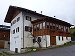
|
Widmann in Klerant ID: 14329 |
Klerant 191 46 ° 41 ′ 18 ″ N, 11 ° 39 ′ 39 ″ E |
8 Sep 1986 (BLR-LAB 4973) |
Rural house / farm |
KG: Sankt Andrea building plot: 81
|
| Winkelhof ID: 14228 |
Seminar place 1 46 ° 42 ′ 56 ″ N, 11 ° 39 ′ 32 ″ E |
Feb. 13, 1984 (BLR-LAB 637) |
Urban residential building |
KG: Brixen building plot: 296
|
|
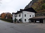
|
Landlord at the Mahr ID: 14306 |
Mahr 116 46 ° 41 ′ 48 ″ N, 11 ° 38 ′ 32 ″ E |
June 27, 1983 (BLR-LAB 3788) |
Inn |
KG: Pfeffersberg building plot: 102/1
|
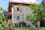
|
Zephyr (Rindl) ID: 14288 |
46 ° 42 ′ 5 "N, 11 ° 39 ′ 36" E |
June 2, 1998 (BLR-LAB 2371) |
Raised hide |
KG: Milland building plot: 35/5 |
If no coordinates are known for a monument, the cadastral data at the time it was placed under protection are given as a substitute. These are neither official nor necessarily up-to-date.
The addresses taken from the State Monuments Office may be out of date.
| Photo: | Photograph of the monument. Click the photo generates an enlarged view. There are also two symbols: |
| ID | Identifier at the South Tyrolean Monuments Office |
| KG | Cadastral parish |
| MD | Ministerial Decree |
| BLR-LAB | Decision of the state government - state committee decision |
Former architectural monuments
| photo | designation | Location | registration | description | Metadata |
|---|---|---|---|---|---|

|
Weingartner in Tötschling ID: 14295 |
46 ° 41 ′ 23 "N, 11 ° 37 ′ 31" E |
8 Sep 1986 (BLR-LAB 4973) |
16th century farm; After the courtyard burned down on August 12, 2017, the monument protection with BLR 632 of June 26, 2018 was lifted. |
KG: Pfeffersberg building plot: 51 |
If no coordinates are known for a monument, the cadastral data at the time it was placed under protection are given as a substitute. These are neither official nor necessarily up-to-date.
The addresses taken from the State Monuments Office may be out of date.
| Photo: | Photograph of the monument. Click the photo generates an enlarged view. There are also two symbols: |
| ID | Identifier at the South Tyrolean Monuments Office |
| KG | Cadastral parish |
| MD | Ministerial Decree |
| BLR-LAB | Decision of the state government - state committee decision |
Web links
- Monument browser of the South Tyrolean Monuments Office
Individual evidence
- ↑ Gerhild Kutschera: Pallaus . In: Oswald Trapp (ed.), Tiroler Burgenbuch. IV. Volume: Eisacktal . Publishing house Athesia, Bozen 1977, pp. 58-68.