List of architectural monuments in Brunico
The list of architectural monuments in Bruneck ( Brunico in Italian ) contains the 165 objects designated as architectural monuments in the area of the municipality of Bruneck in South Tyrol .
The basis is the official directory of the monuments in South Tyrol, which can be viewed on the Internet. These can be, for example, sacred buildings , residential houses, farms and aristocratic residences. The order in this list is based on the designation, alternatively it can also be sorted according to the address or the date on which it was placed under protection.
list
| photo | designation | Location | registration | description | Metadata |
|---|---|---|---|---|---|

|
Adl ID: 14343 |
46 ° 48 ′ 53 "N, 11 ° 56 ′ 45" E |
Aug. 24, 1987 (BLR-LAB 5081) |
Rural house / farm |
KG: Aufhofen building plot: 51
|

|
Old Hospital ID: 14425 |
46 ° 47 ′ 47 "N, 11 ° 56 ′ 26" E |
Aug. 24, 1987 (BLR-LAB 5082) |
hospital |
KG: Bruneck building plot: 225/1
|
|
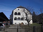
Angerburg ID: 14468 |
46 ° 46 ′ 37 "N, 11 ° 57 ′ 14" E |
Jan 13, 1951 (MD) |
Raised hide |
KG: Reischach building plot: 16, 17
|

|
Anger fief ID: 14467 |
46 ° 46 ′ 38 "N, 11 ° 57 ′ 6" E |
Aug. 24, 1987 (BLR-LAB 5081) |
Rural house / farm |
KG: Reischach building plot: 11/1 basic plot: 31, 32/6
|

|
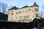
Settlement with outbuildings and park ID: 14350 |
46 ° 47 ′ 36 "N, 11 ° 56 ′ 36" E |
Feb. 4, 1977 (BLR-LAB 584) |
Raised hide |
KG: Bruneck building plot: 1724, 1725, 6, 8, 9
|
|
Settlement with garden ID: 14346 |
46 ° 48 ′ 58 "N, 11 ° 56 ′ 45" E |
May 3, 1989 (BLR-LAB 2449) |
original structure probably from the 12th century, later converted into a residence |
KG: Aufhofen building lot: 68 basic lot: 879
|
| Stegen residence with farm building and courtyard ID: 14431 |
46 ° 47 '48 "N, 11 ° 55' 54" E |
Nov 16, 1962 (MD) |
Raised hide |
KG: Bruneck building plot: 292, 293 basic plot: 504/2, 504/3, 504/5, 505, 993
|
|
|
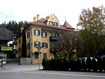
Aschgut ID: 14453 |
46 ° 48 ′ 14 "N, 11 ° 56 ′ 57" E |
Aug. 24, 1987 (BLR-LAB 5081) |
Raised hide |
KG: Dietenheim building plot: 5/1
|

|
Oven at the Oberhuber and Unterhuber ID: 18049 |
46 ° 46 ′ 42 "N, 11 ° 56 ′ 50" E |
Aug. 24, 1987 (BLR-LAB 5081) |
oven |
KG: Reischach building plot: 116
|

|
Wayside shrine on the road to Dietenheim ID: 14448 |
46 ° 47 ′ 52 "N, 11 ° 56 ′ 32" E |
Aug. 24, 1987 (BLR-LAB 5082) |
Wayside shrine |
KG: Bruneck land parcel: 382
|

|
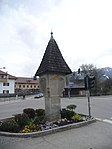
Wayside shrine on the road to St. Georgen ID: 14449 |
46 ° 48 ′ 11 ″ N, 11 ° 56 ′ 19 ″ E |
Aug. 24, 1987 (BLR-LAB 5082) |
late Gothic granite wayside shrine, probably built around 1600, originally possibly a plague stick |
KG: Bruneck land parcel: 460/1
|
|
Wayside shrine on the road to Taufers ID: 14450 |
46 ° 47 ′ 56 "N, 11 ° 56 ′ 18" E |
Aug. 24, 1987 (BLR-LAB 5082) |
Wayside shrine |
KG: Bruneck land parcel: 478
|
|
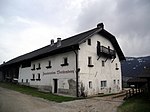
Breitenberger with chapel in Stegen ID: 14444 |
46 ° 47 ′ 49 "N, 11 ° 54 ′ 40" E |
Aug. 24, 1987 (BLR-LAB 5082) |
Rural house / farm |
KG: Bruneck building plot: 475/2, 476
|
|
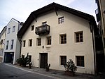
Bruder-Willram-Strasse 11 ID: 14422 |
Bruder-Willram-Strasse 11 46 ° 47 ′ 46 ″ N, 11 ° 56 ′ 28 ″ E |
Aug. 24, 1987 (BLR-LAB 5082) |
Rural house / farm |
KG: Bruneck building plot: 208/1
|

|
Brugger ID: 14480 |
46 ° 48 ′ 59 "N, 11 ° 55 ′ 59" E |
Aug. 24, 1987 (BLR-LAB 5081) |
Rural house / farm |
KG: Sankt Georgen Building plot: 3
|
|
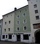
Former Gasthof Goldener Stern ID: 14390 |
46 ° 47 ′ 47 "N, 11 ° 56 ′ 17" E |
October 14, 1985 (BLR-LAB 5190) |
Rural house / farm |
KG: Bruneck building plot: 112
|

|
Florianitor ID: 14389 |
46 ° 47 ′ 46 "N, 11 ° 56 ′ 16" E |
Aug. 24, 1987 (BLR-LAB 5082) |
Fortifications |
KG: Bruneck building plot: 110, 111
|

|
Gasper-Stöckl in Stegen ID: 14445 |
46 ° 47 '51 "N, 11 ° 55' 37" E |
Aug. 24, 1987 (BLR-LAB 5082) |
Wayside shrine |
KG: Bruneck building plot: 510
|
|
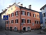
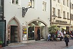
Gasthaus Lamm ID: 14424 |
46 ° 47 ′ 46 "N, 11 ° 56 ′ 26" E |
Aug. 24, 1987 (BLR-LAB 5082) |
Inn |
KG: Bruneck building plot: 224
|
|
Gasthof Goldener Hirsch ID: 14368 |
Stadtgasse 46 46 ° 47 ′ 45 ″ N, 11 ° 56 ′ 18 ″ E |
June 20, 1951 (MD) |
Inn |
KG: Bruneck building plot: 55
|
| Galler building ID: 50552 |
46 ° 47 ′ 53 "N, 11 ° 56 ′ 21" E |
July 25, 2011 (BLR-LAB 1133) |
Urban residential building |
KG: Bruneck building plot: 239, 241/1
|
|
|
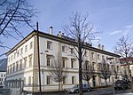
Courthouse ID: 14429 |
46 ° 47 ′ 45 "N, 11 ° 56 ′ 10" E |
Aug. 24, 1987 (BLR-LAB 5082) |
Administrative building |
KG: Bruneck building plot: 286
|

|
True stone ID: 14455 |
46 ° 48 ′ 12 "N, 11 ° 57 ′ 8" E |
Jan 13, 1951 (MD) |
Raised hide |
KG: Dietenheim building plot: 12
|

|
Giessbach ID: 14488 |
46 ° 49 ′ 4 "N, 11 ° 55 ′ 51" E |
Jan 13, 1951 (MD) |
Raised hide |
KG: Sankt Georgen Building plot: 47
|
|
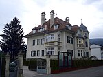
Giuseppe-Verdi-Straße 18 with garden ID: 14437 |
Giuseppe-Verdi-Strasse 18 46 ° 47 ′ 55 ″ N, 11 ° 56 ′ 2 ″ E |
Aug. 24, 1987 (BLR-LAB 5082) |
Villa / summer cottage |
KG: Bruneck building plot: 380
|

|
Trench 30 with garden ID: 14391 |
Dig 30 46 ° 47 ′ 47 ″ N, 11 ° 56 ′ 18 ″ E |
Aug. 24, 1987 (BLR-LAB 5082) |
Urban residential building |
KG: Bruneck building plot: 115
|

|
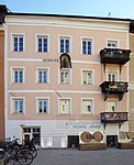
Trench 32 ID: 14392 |
Dig 32 46 ° 47 ′ 47 ″ N, 11 ° 56 ′ 19 ″ E |
Aug. 24, 1987 (BLR-LAB 5082) |
Urban residential building |
KG: Bruneck building plot: 116
|
|
Trench 34 ID: 14393 |
Dig 34 46 ° 47 ′ 47 ″ N, 11 ° 56 ′ 20 ″ E |
Nov 6, 1951 (MD) |
Urban residential building |
KG: Bruneck building plot: 117
|

|
Gremsen ID: 14489 |
46 ° 49 '3 "N, 11 ° 55' 51" E |
Jan 13, 1951 (MD) |
Rural house / farm |
KG: Sankt Georgen building plot: 50
|

|
Hanslmair ID: 14483 |
46 ° 48 ′ 55 "N, 11 ° 56 ′ 4" E |
Aug. 24, 1987 (BLR-LAB 5081) |
Rural house / farm |
KG: Sankt Georgen building plot: 12
|

|
Hattler in Giessbach ID: 14487 |
46 ° 49 ′ 8 "N, 11 ° 55 ′ 52" E |
Aug. 24, 1987 (BLR-LAB 5081) |
Rural house / farm |
KG: Sankt Georgen Building plot: 41
|

|
Hebenstreit ID: 14452 |
46 ° 48 ′ 15 "N, 11 ° 56 ′ 53" E |
Jan 13, 1951 (MD) |
Raised hide |
KG: Dietenheim building plot: 1/1, 1/2
|

|
Heroes' Cemetery and Chapel ID: 14447 |
46 ° 47 ′ 36 "N, 11 ° 56 ′ 16" E |
Aug. 24, 1987 (BLR-LAB 5082) |
graveyard |
KG: Bruneck Building plot: 1135 Base plot: 1799
|

|
Hofbauer ID: 14490 |
46 ° 49 ′ 2 "N, 11 ° 55 ′ 41" E |
Jan 13, 1951 (MD) |
Rural house / farm |
KG: Sankt Georgen building plot: 54
|

|
Hofer ID: 14469 |
46 ° 46 ′ 38 "N, 11 ° 57 ′ 27" E |
Jan 13, 1951 (MD) |
Rural house / farm |
KG: Reischach building plot: 26/1, 26/2
|

|
Kanins ID: 14481 |
46 ° 48 ′ 58 "N, 11 ° 56 ′ 3" E |
Feb. 5, 2001 (BLR-LAB 306) |
Rural house / farm |
KG: Sankt Georgen building plot: 4
|
| Chapel at Greiter ID: 14478 |
46 ° 46 ′ 43 "N, 11 ° 58 ′ 43" E |
Aug. 24, 1987 (BLR-LAB 5081) |
chapel |
KG: Reischach building plot: 190
|
|
| Chapel at Treyer ID: 14470 |
46 ° 46 ′ 10 ″ N, 11 ° 56 ′ 0 ″ E |
Aug. 24, 1987 (BLR-LAB 5081) |
chapel |
KG: Reischach building plot: 80
|
|

|
Kapplerstöckl ID: 14475 |
46 ° 46 ′ 55 "N, 11 ° 57 ′ 13" E |
Jan 13, 1951 (MD) |
chapel |
KG: Reischach building plot: 117
|

|
Capuchin Church of the Holy Trinity ID: 14426 |
46 ° 47 ′ 50 "N, 11 ° 56 ′ 26" E |
Aug. 24, 1987 (BLR-LAB 5082) |
church |
KG: Bruneck building plot: 232
|

|
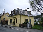
Karl Meusburger School ID: 14432 |
Dig 1 46 ° 47 ′ 44 ″ N, 11 ° 56 ′ 7 ″ E |
Aug. 24, 1987 (BLR-LAB 5082) |
school |
KG: Bruneck building plot: 314
|
|
Karl-Told-Straße 1A with garden ID: 14430 |
Karl-Told-Strasse 1A 46 ° 47 ′ 56 ″ N, 11 ° 56 ′ 14 ″ E |
Aug. 24, 1987 (BLR-LAB 5082) |
Villa / summer cottage |
KG: Bruneck building plot: 290/3 basic plot: 482/3
|

|
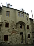
Katharinagasse 2 ID: 14379 |
Katharinagasse 2 46 ° 47 ′ 41 ″ N, 11 ° 56 ′ 13 ″ E |
Aug. 24, 1987 (BLR-LAB 5082) |
Urban residential building |
KG: Bruneck building plot: 74
|
|
Katharinagasse 6 ID: 14378 |
Katharinagasse 6 46 ° 47 ′ 41 ″ N, 11 ° 56 ′ 14 ″ E |
Jan 29, 1952 (MD) |
Urban residential building |
KG: Bruneck building plot: 71, 72, 73
|

|
Katharinagasse 8 ID: 14377 |
Katharinagasse 8 46 ° 47 ′ 41 ″ N, 11 ° 56 ′ 14 ″ E |
Jan 29, 1952 (MD) |
Urban residential building |
KG: Bruneck building plot: 70
|

|
Katharinagasse 8A-B ID: 18045 |
Katharinagasse 8A-B 46 ° 47 ′ 41 ″ N, 11 ° 56 ′ 15 ″ E |
Aug. 24, 1987 (BLR-LAB 5082) |
Urban residential building |
KG: Bruneck building plot: 68/2
|

|
Katharinagasse 10-14 ID: 14375 |
Katharinagasse 10-14 46 ° 47 ′ 42 "N, 11 ° 56 ′ 16" E |
Jan 29, 1952 (MD) |
Urban residential building |
KG: Bruneck building plot: 68/1
|
| Katharinagasse 16 ID: 14374 |
Katharinagasse 16 46 ° 47 ′ 42 ″ N, 11 ° 56 ′ 17 ″ E |
Aug. 24, 1987 (BLR-LAB 5082) |
Urban residential building |
KG: Bruneck building plot: 67
|
|
|
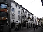
Kirchbergerhaus ID: 14373 |
Stadtgasse 62 46 ° 47 ′ 43 ″ N, 11 ° 56 ′ 15 ″ E |
Jan. 14, 1985 (BLR-LAB 121) |
Urban residential building |
KG: Bruneck building plot: 63
|
| Grain box at Haidacher ID: 14345 |
46 ° 48 ′ 55 "N, 11 ° 56 ′ 48" E |
Aug. 24, 1987 (BLR-LAB 5081) |
Grain box |
KG: Aufhofen building plot: 61/1
|
|
| Granary at the Salcher ID: 14471 |
46 ° 46 ′ 43 "N, 11 ° 55 ′ 55" E |
Aug. 24, 1987 (BLR-LAB 5081) |
Grain box |
KG: Reischach building plot: 100
|
|
| Grain box near Untermohrberg ID: 14472 |
46 ° 47 ′ 0 ″ N, 11 ° 56 ′ 12 ″ E |
Aug. 24, 1987 (BLR-LAB 5081) |
Grain box |
KG: Reischach building plot: 101
|
|

|
Kröll ID: 14454 |
46 ° 48 ′ 12 ″ N, 11 ° 56 ′ 59 ″ E |
Jan 13, 1951 (MD) |
Rural house / farm |
KG: Dietenheim building plot: 6/1, 6/2
|

|
Lamprechtsburg with chapel ID: 14476 |
46 ° 47 ′ 0 ″ N, 11 ° 57 ′ 53 ″ E |
Aug. 24, 1987 (BLR-LAB 5081) |
Castle |
KG: Reischach building plot: 119, 121
|

|
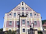
Lechner in Luns ID: 14463 |
46 ° 47 ′ 46 "N, 11 ° 58 ′ 12" E |
Aug. 24, 1987 (BLR-LAB 5081) |
Rural house / farm |
KG: Dietenheim building plot: 117
|
|
Mair am Hof ID: 14457 |
46 ° 48 ′ 11 "N, 11 ° 57 ′ 16" E |
Aug. 24, 1987 (BLR-LAB 5081) |
Residence, today the location of the South Tyrolean National Museum for Folklore |
KG: Dietenheim building plot: 15/1, 15/2
|
| Mairkircher ID: 14477 |
46 ° 46 ′ 52 "N, 11 ° 57 ′ 59" E |
Aug. 24, 1987 (BLR-LAB 5081) |
Rural house / farm |
KG: Reischach building plot: 123
|
|
| Maria-Hilf-Strasse 5 ID: 18188 |
Maria-Hilf-Straße 5 46 ° 47 ′ 45 ″ N, 11 ° 56 ′ 24 ″ E |
Sep 2 1996 (BLR-LAB 4113) |
Urban residential building |
KG: Bruneck building plot: 141
|
|

|
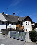
Mariahilfkapelle in Giessbach ID: 14484 |
46 ° 49 ′ 15 "N, 11 ° 55 ′ 41" E |
Aug. 24, 1987 (BLR-LAB 5081) |
chapel |
KG: Sankt Georgen building plot: 30
|
|
Sacrifice in Stegen ID: 14442 |
46 ° 47 ′ 47 "N, 11 ° 55 ′ 27" E |
Aug. 24, 1987 (BLR-LAB 5082) |
Rural house / farm |
KG: Bruneck building plot: 471
|
| Mitterhofer ID: 14340 |
46 ° 48 ′ 55 "N, 11 ° 56 ′ 38" E |
Jan 13, 1951 (MD) |
Rural house / farm |
KG: Aufhofen building plot: 43
|
|
| Moar am Graben ID: 14460 |
46 ° 48 ′ 7 ″ N, 11 ° 57 ′ 7 ″ E |
July 4, 1988 (BLR-LAB 4175) |
Rural house / farm |
KG: Dietenheim building plot: 28
|
|

|
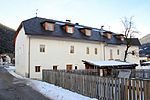
Morberg ID: 14458 |
46 ° 48 ′ 10 "N, 11 ° 57 ′ 20" E |
Aug. 24, 1987 (BLR-LAB 5081) |
Raised hide |
KG: Dietenheim building plot: 16
|
|
Mörl ID: 14491 |
46 ° 48 ′ 56 "N, 11 ° 55 ′ 51" E |
Jan 13, 1951 (MD) |
Rural house / farm |
KG: Sankt Georgen building plot: 65/1
|

|
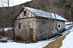
Mill ID: 14486 |
46 ° 49 '11 "N, 11 ° 55' 46" E |
Aug. 24, 1987 (BLR-LAB 5081) |
Mill |
KG: Sankt Georgen Building plot: 32
|
|
Mill at Garber ID: 14485 |
46 ° 49 '14 "N, 11 ° 55' 44" E |
Aug. 24, 1987 (BLR-LAB 5081) |
Mill |
KG: Sankt Georgen building plot: 31
|

|
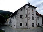
Mühlgasse 4 ID: 14421 |
Mühlgasse 4 46 ° 47 ′ 42 ″ N, 11 ° 56 ′ 37 ″ E |
Aug. 24, 1987 (BLR-LAB 5081) |
|
KG: Bruneck building plot: 186
|
|
Ober- and Unterpichler ID: 14464 |
46 ° 47 '46 "N, 11 ° 58' 8" E |
Aug. 24, 1987 (BLR-LAB 5081) |
Rural house / farm |
KG: Dietenheim building plot: 119/1
|

|
Oberhuber ID: 14474 |
46 ° 46 ′ 43 "N, 11 ° 56 ′ 50" E |
Aug. 24, 1987 (BLR-LAB 5081) |
Rural house / farm |
KG: Reischach building plot: 113, 116
|
|
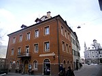
Tower 3 ID: 14406 |
Tower 3 46 ° 47 ′ 42 "N, 11 ° 56 ′ 27" O |
Aug. 24, 1987 (BLR-LAB 5082) |
Urban residential building |
KG: Bruneck building plot: 151, 152
|

|
Top 5 ID: 14407 |
Tower 5 46 ° 47 ′ 42 ″ N, 11 ° 56 ′ 28 ″ E |
Aug. 24, 1987 (BLR-LAB 5082) |
Urban residential building |
KG: Bruneck building plot: 153
|
|
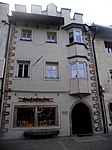
Top 6 ID: 14356 |
Tower 6 46 ° 47 ′ 42 ″ N, 11 ° 56 ′ 27 ″ O |
Jan 29, 1952 (MD) |
Urban residential building |
KG: Bruneck building plot: 25
|

|
Top 7 ID: 14408 |
Tower 7 46 ° 47 ′ 42 ″ N, 11 ° 56 ′ 28 ″ E |
Aug. 24, 1987 (BLR-LAB 5082) |
Urban residential building |
KG: Bruneck building plot: 156
|
|
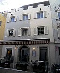
Top 10 ID: 18043 |
Tower 10 46 ° 47 ′ 41 ″ N, 11 ° 56 ′ 27 ″ E |
Nov 6, 1951 (MD) |
Urban residential building |
KG: Bruneck building plot: 21/2
|

|
Top 12 ID: 14355 |
Tower 12 46 ° 47 ′ 41 ″ N, 11 ° 56 ′ 28 ″ E |
Nov 6, 1951 (MD) |
Urban residential building |
KG: Bruneck building plot: 21/1
|

|
Top 13 ID: 14409 |
Tower 13 46 ° 47 ′ 42 ″ N, 11 ° 56 ′ 29 ″ E |
Nov 6, 1951 (MD) |
Urban residential building |
KG: Bruneck building plot: 159/1
|

|
Top 18 ID: 14354 |
Tower 18 46 ° 47 ′ 41 ″ N, 11 ° 56 ′ 29 ″ E |
Dec 28, 1970 (MD) |
Urban residential building |
KG: Bruneck building plot: 19
|

|
Top 19 ID: 14410 |
Tower 19 46 ° 47 ′ 42 ″ N, 11 ° 56 ′ 30 ″ E |
Nov 6, 1951 (MD) |
Urban residential building |
KG: Bruneck building plot: 165
|
|
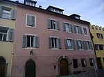
Top 21 ID: 14411 |
Tower 21 46 ° 47 ′ 42 ″ N, 11 ° 56 ′ 31 ″ E |
Nov 6, 1951 (MD) |
Urban residential building |
KG: Bruneck building plot: 168
|

|
Top 25 ID: 14412 |
Tower 25 46 ° 47 ′ 41 ″ N, 11 ° 56 ′ 32 ″ E |
Aug. 24, 1987 (BLR-LAB 5082) |
Urban residential building |
KG: Bruneck building plot: 171
|

|
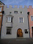
Oberauten 27 ID: 14413 |
Tower 27 46 ° 47 ′ 41 ″ N, 11 ° 56 ′ 32 ″ E |
Aug. 24, 1987 (BLR-LAB 5082) |
Urban residential building |
KG: Bruneck building plot: 172
|
|
Top 29 ID: 14414 |
Tower 29 46 ° 47 ′ 41 ″ N, 11 ° 56 ′ 33 ″ E |
Nov 6, 1951 (MD) |
Urban residential building |
KG: Bruneck building plot: 177
|

|
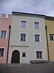
Top 31 ID: 14417 |
Overhang 31 46 ° 47 ′ 41 ″ N, 11 ° 56 ′ 33 ″ E |
Aug. 24, 1987 (BLR-LAB 5082) |
Urban residential building |
KG: Bruneck building plot: 178
|
|
Oberauten 33 ID: 14418 |
Overhang 33 46 ° 47 ′ 41 ″ N, 11 ° 56 ′ 33 ″ E |
Nov 6, 1951 (MD) |
Urban residential building |
KG: Bruneck building plot: 179
|

|
Top 41 ID: 14419 |
Overhang 41 46 ° 47 ′ 41 ″ N, 11 ° 56 ′ 35 ″ E |
Aug. 24, 1987 (BLR-LAB 5082) |
Urban residential building |
KG: Bruneck building plot: 184/1
|

|
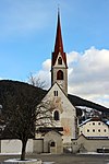
Palais Sternbach with Marian column and garden ID: 14353 |
46 ° 47 ′ 41 ″ N, 11 ° 56 ′ 31 ″ E |
Aug. 24, 1987 (BLR-LAB 5082) |
Palace |
KG: Bruneck building plot: 18 basic plot: 26
|
|
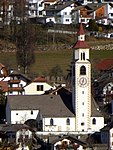
Parish church of St. Georg with cemetery chapel and cemetery ID: 14479 |
46 ° 48 ′ 57 ″ N, 11 ° 56 ′ 1 ″ E |
Aug. 24, 1987 (BLR-LAB 5081) |
church |
KG: Sankt Georgen building plot: 1, 2 basic plot: 1
|
|
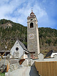
Parish Church of St. Jakob with cemetery chapel and cemetery ID: 14461 |
46 ° 48 ′ 9 ″ N, 11 ° 57 ′ 1 ″ E |
Aug. 24, 1987 (BLR-LAB 5081) |
church |
KG: Dietenheim building plot: 30 basic plot: 79
|
|
Parish Church of St. Katharina with cemetery chapel and cemetery ID: 14344 |
46 ° 48 ′ 53 "N, 11 ° 56 ′ 48" E |
Aug. 24, 1987 (BLR-LAB 5085) |
church |
KG: Aufhofen building plot: 57, 58 basic plot: 868
|

|
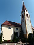
Parish church of St. Nikolaus with cemetery chapel and cemetery ID: 14443 |
46 ° 47 ′ 50 "N, 11 ° 55 ′ 25" E |
Aug. 24, 1987 (BLR-LAB 5082) |
church |
KG: Bruneck building plot: 473, 474 basic plot: 1241
|
|
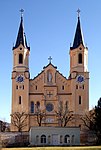
Parish church of St. Peter and Paul with cemetery ID: 14466 |
46 ° 46 ′ 37 "N, 11 ° 57 ′ 1" E |
Aug. 24, 1987 (BLR-LAB 5081) |
church |
KG: Reischach building plot: 1 basic plot: 1
|
|
Parish Church of Our Lady with cemetery chapel, arcades and cemetery ID: 14348 |
46 ° 47 ′ 40 "N, 11 ° 56 ′ 35" E |
Aug. 24, 1987 (BLR-LAB 5082) |
church |
KG: Bruneck building plots: 1, 2, 3, 339/1, 339/2, 4 basic plots : 1
|

|
Parish Deed ID: 14420 |
Tower 22 46 ° 47 ′ 41 ″ N, 11 ° 56 ′ 36 ″ E |
Aug. 24, 1987 (BLR-LAB 5082) |
Widum / Canon House |
KG: Bruneck building plot: 185
|
| Puenlander ID: 14465 |
46 ° 47 ′ 12 "N, 11 ° 57 ′ 54" E |
Aug. 24, 1987 (BLR-LAB 5081) |
Rural house / farm |
KG: Dietenheim building plot: 121/1
|
|
|
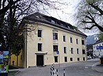
Ragenhaus ID: 14349 |
46 ° 47 ′ 39 "N, 11 ° 56 ′ 35" E |
Aug. 24, 1987 (BLR-LAB 5082) |
Urban residential building |
KG: Bruneck building plot: 5
|

|
Rienztor ID: 14405 |
46 ° 47 ′ 44 "N, 11 ° 56 ′ 24" E |
Aug. 24, 1987 (BLR-LAB 5082) |
Fortifications |
KG: Bruneck building plot: 142
|

|
Skate with oven and farm building in Stegen ID: 14440 |
46 ° 47 ′ 46 "N, 11 ° 55 ′ 30" E |
Aug. 24, 1987 (BLR-LAB 5082) |
Rural house / farm |
KG: Bruneck building plot: 454, 455
|

|
Round tower from Katharinagasse 8A – B ID: 14376 |
Katharinagasse 8A-B 46 ° 47 ′ 41 ″ N, 11 ° 56 ′ 15 ″ E |
Aug. 24, 1987 (BLR-LAB 5082) |
Urban residential building |
KG: Bruneck building plot: 69
|

|
Schächer-Stöckl on the Old Way to Percha ID: 14446 |
46 ° 47 ′ 51 ″ N, 11 ° 56 ′ 57 ″ E |
Aug. 24, 1987 (BLR-LAB 5082) |
Wayside shrine |
KG: Bruneck building plot: 748
|
|
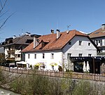
Schleishaus ID: 14427 |
46 ° 47 ′ 49 "N, 11 ° 56 ′ 22" E |
Aug. 24, 1987 (BLR-LAB 5082) |
Urban residential building |
KG: Bruneck building plot: 249/1
|

|
Bruneck Castle ID: 14358 |
46 ° 47 ′ 40 "N, 11 ° 56 ′ 22" E |
Aug 19, 1950 (MD) |
Castle |
KG: Bruneck building plots: 27, 28/1, 28/2, 28/3 basic plots: 50, 51, 52
|

|
School building at the Ursuline convent ID: 14381 |
46 ° 47 ′ 41 ″ N, 11 ° 56 ′ 12 ″ E |
Aug. 24, 1987 (BLR-LAB 5082) |
school |
KG: Bruneck building plot: 1681, 84 basic plot: 119/2
|

|
Seeböckhaus ID: 14357 |
Tower 4 46 ° 47 ′ 42 "N, 11 ° 56 ′ 26" E |
Aug. 24, 1987 (BLR-LAB 5082) |
Urban residential building |
KG: Bruneck building plot: 26
|
| Sonnegg ID: 14459 |
46 ° 48 ′ 9 ″ N, 11 ° 57 ′ 20 ″ E |
Jan 13, 1951 (MD) |
Raised hide |
KG: Dietenheim building plot: 20
|
|

|
Sparkasse building ID: 14428 |
46 ° 47 '48 "N, 11 ° 56" 19 "E |
Aug. 24, 1987 (BLR-LAB 5082) |
Administrative building |
KG: Bruneck building plot: 263/1
|
|
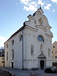
Hospital Church of the Holy Spirit with former sacristy ID: 14423 |
46 ° 47 ′ 47 "N, 11 ° 56 ′ 25" E |
Aug. 24, 1987 (BLR-LAB 5082) |
church |
KG: Bruneck building plot: 222, 223 basic plot: 898
|
|
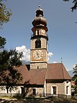
St. Katharina auf dem Rain ID: 14359 |
46 ° 47 ′ 43 "N, 11 ° 56 ′ 22" E |
Aug. 24, 1987 (BLR-LAB 5082) |
church |
KG: Bruneck building plot: 29
|

|
Stadtgasse 2 ID: 14360 |
Stadtgasse 2 46 ° 47 ′ 43 ″ N, 11 ° 56 ′ 25 ″ E |
Aug. 24, 1987 (BLR-LAB 5082) |
Urban residential building |
KG: Bruneck building plot: 30
|

|
Stadtgasse 7 ID: 50286 |
Stadtgasse 7 46 ° 47 ′ 44 ″ N, 11 ° 56 ′ 25 ″ E |
May 14, 2001 (BLR-LAB 1534) |
Rural house / farm |
KG: Bruneck building plot: 143
|

|
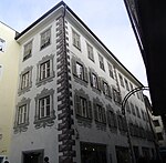
Stadtgasse 10 ID: 14361 |
Stadtgasse 10 46 ° 47 ′ 44 ″ N, 11 ° 56 ′ 24 ″ E |
Aug. 24, 1987 (BLR-LAB 5082) |
Urban residential building |
KG: Bruneck building plot: 36/1
|
|
Stadtgasse 11 ID: 50285 |
Stadtgasse 11 46 ° 47 ′ 45 ″ N, 11 ° 56 ′ 23 ″ E |
Oct. 27, 1992 (BLR-LAB 6529) |
Urban residential building |
KG: Bruneck building plot: 140
|

|
Stadtgasse 12 ID: 18233 |
Stadtgasse 12 46 ° 47 ′ 44 ″ N, 11 ° 56 ′ 23 ″ E |
December 15, 1997 (BLR-LAB 6714) |
Urban residential building |
KG: Bruneck building plot: 37
|

|
Stadtgasse 13 ID: 14404 |
Stadtgasse 13 46 ° 47 ′ 45 ″ N, 11 ° 56 ′ 23 ″ E |
November 14, 1983 (BLR-LAB 6573) |
Urban residential building |
KG: Bruneck building plot: 139
|

|
Stadtgasse 15 ID: 14403 |
Stadtgasse 15 46 ° 47 ′ 45 ″ N, 11 ° 56 ′ 23 ″ E |
Nov 6, 1951 (MD) |
Urban residential building |
KG: Bruneck building plot: 138
|

|
Stadtgasse 16 ID: 14362 |
Stadtgasse 16 46 ° 47 ′ 45 ″ N, 11 ° 56 ′ 23 ″ E |
Nov 6, 1951 (MD) |
Urban residential building |
KG: Bruneck building plot: 39
|

|
Stadtgasse 17 ID: 14402 |
Stadtgasse 17 46 ° 47 ′ 45 ″ N, 11 ° 56 ′ 22 ″ E |
Nov 6, 1951 (MD) |
Urban residential building |
KG: Bruneck building plot: 137
|

|
Stadtgasse 21 ID: 14401 |
Stadtgasse 21 46 ° 47 ′ 46 ″ N, 11 ° 56 ′ 21 ″ E |
June 20, 1951 (MD) |
Urban residential building |
KG: Bruneck building plot: 135
|

|
Stadtgasse 23 ID: 14400 |
Stadtgasse 23 46 ° 47 ′ 46 ″ N, 11 ° 56 ′ 21 ″ E |
June 20, 1951 (MD) |
Urban residential building |
KG: Bruneck building plot: 134
|

|
Stadtgasse 25 ID: 14399 |
Stadtgasse 25 46 ° 47 ′ 46 ″ N, 11 ° 56 ′ 21 ″ E |
June 20, 1951 (MD) |
Urban residential building |
KG: Bruneck building plot: 133
|

|
Stadtgasse 26 ID: 14363 |
Stadtgasse 26 46 ° 47 ′ 45 ″ N, 11 ° 56 ′ 21 ″ E |
Aug. 24, 1987 (BLR-LAB 5082) |
Urban residential building |
KG: Bruneck building plot: 44
|

|
Stadtgasse 27 ID: 14397 |
Stadtgasse 27 46 ° 47 ′ 46 ″ N, 11 ° 56 ′ 20 ″ E |
Aug. 24, 1987 (BLR-LAB 5082) |
Urban residential building |
KG: Bruneck building plot: 131
|

|
Stadtgasse 27B ID: 14398 |
Stadtgasse 27B 46 ° 47 ′ 46 ″ N, 11 ° 56 ′ 21 ″ E |
June 20, 1951 (MD) |
Urban residential building |
KG: Bruneck building plot: 132
|

|
Stadtgasse 29 ID: 14396 |
Stadtgasse 29 46 ° 47 ′ 46 ″ N, 11 ° 56 ′ 20 ″ E |
June 20, 1951 (MD) |
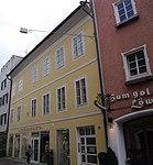
Urban residential building |
KG: Bruneck building plot: 130
|
|
Stadtgasse 30–30A ID: 14364 |
Stadtgasse 30–30A 46 ° 47 ′ 45 ″ N, 11 ° 56 ′ 21 ″ E |
July 4, 1988 (BLR-LAB 4175) |
Urban residential building |
KG: Bruneck building plot: 46
|
|
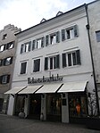
Stadtgasse 39 ID: 14395 |
Stadtgasse 39 46 ° 47 ′ 45 ″ N, 11 ° 56 ′ 18 ″ E |
Aug. 24, 1987 (BLR-LAB 5082) |
Urban residential building |
KG: Bruneck building plot: 124
|

|
Stadtgasse 40 ID: 14365 |
Stadtgasse 40 46 ° 47 ′ 45 ″ N, 11 ° 56 ′ 19 ″ E |
Aug. 24, 1987 (BLR-LAB 5082) |
Urban residential building |
KG: Bruneck building plot: 52
|
|
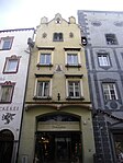
Stadtgasse 42 ID: 14366 |
Stadtgasse 42 46 ° 47 ′ 45 ″ N, 11 ° 56 ′ 19 ″ E |
June 16, 1986 (BLR-LAB 3122) |
Urban residential building |
KG: Bruneck building plot: 53
|
|
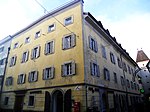
Stadtgasse 43 ID: 14388 |
Stadtgasse 43 46 ° 47 ′ 45 ″ N, 11 ° 56 ′ 17 ″ E |
Nov 6, 1951 (MD) |
Urban residential building |
KG: Bruneck building plot: 102
|

|
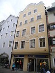
Stadtgasse 47-49-51 ID: 14387 |
Stadtgasse 47-49-51 46 ° 47 ′ 44 ″ N, 11 ° 56 ′ 15 ″ E |
Aug. 24, 1987 (BLR-LAB 5082) |
Urban residential building |
KG: Bruneck building plot: 100, 97, 98
|
|
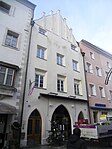
Stadtgasse 48 ID: 14369 |
Stadtgasse 48 46 ° 47 ′ 44 ″ N, 11 ° 56 ′ 17 ″ E |
Aug. 24, 1987 (BLR-LAB 5082) |
Urban residential building |
KG: Bruneck building plot: 56
|
|
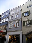
Stadtgasse 53 ID: 14386 |
Stadtgasse 53 46 ° 47 ′ 44 ″ N, 11 ° 56 ′ 15 ″ E |
Dec 12, 1951 (MD) |
Urban residential building |
KG: Bruneck building plot: 96
|
|
Stadtgasse 54 ID: 14371 |
Stadtgasse 54 46 ° 47 ′ 44 ″ N, 11 ° 56 ′ 16 ″ E |
May 28, 1985 (BLR-LAB 2377) |
Urban residential building |
KG: Bruneck building plot: 59
|

|
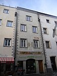
Stadtgasse 55 ID: 14385 |
Stadtgasse 55 46 ° 47 ′ 44 ″ N, 11 ° 56 ′ 14 ″ E |
Dec 12, 1951 (MD) |
Urban residential building |
KG: Bruneck building plot: 95
|
|
Stadtgasse 57 ID: 14384 |
Stadtgasse 57 46 ° 47 ′ 44 ″ N, 11 ° 56 ′ 14 ″ E |
Aug. 24, 1987 (BLR-LAB 5082) |
Urban residential building |
KG: Bruneck building plot: 94
|
|
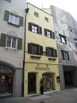
Stadtgasse 58 ID: 14372 |
Stadtgasse 58 46 ° 47 ′ 44 ″ N, 11 ° 56 ′ 16 ″ E |
Aug. 24, 1987 (BLR-LAB 5082) |
Urban residential building |
KG: Bruneck building plot: 61
|
|
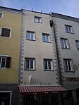
Stadtgasse 59 ID: 14383 |
Stadtgasse 59 46 ° 47 ′ 44 ″ N, 11 ° 56 ′ 14 ″ E |
Aug. 24, 1987 (BLR-LAB 5082) |
Urban residential building |
KG: Bruneck building plot: 93
|
|
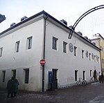
Stadtgasse 63 ID: 14382 |
Stadtgasse 63 46 ° 47 ′ 43 ″ N, 11 ° 56 ′ 13 ″ E |
Aug. 24, 1987 (BLR-LAB 5082) |
Urban residential building |
KG: Bruneck building plot: 91/1
|

|
Stadtgasse 68 ID: 14380 |
Stadtgasse 68 46 ° 47 ′ 43 ″ N, 11 ° 56 ′ 14 ″ E |
July 24, 1989 (BLR-LAB 4540) |
Urban residential building |
KG: Bruneck building plot: 77
|

|
City Tower ID: 14394 |
46 ° 47 ′ 47 "N, 11 ° 56 ′ 21" E |
Aug. 24, 1987 (BLR-LAB 5082) |
Fortifications |
KG: Bruneck building plot: 119
|

|
Steinburg ID: 14342 |
46 ° 48 ′ 54 "N, 11 ° 56 ′ 43" E |
Jan 13, 1951 (MD) |
Raised hide |
KG: Aufhofen building parcel : 49 basic parcel: 1774/1, 897
|
|
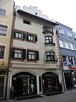
Stoffelehaus ID: 14370 |
Stadtgasse 50 46 ° 47 ′ 44 ″ N, 11 ° 56 ′ 17 ″ E |
June 20, 1951 (MD) |
Urban residential building |
KG: Bruneck building plot: 57
|

|
Strehlehaus ID: 14367 |
Stadtgasse 44 46 ° 47 ′ 45 ″ N, 11 ° 56 ′ 18 ″ E |
Nov 6, 1951 (MD) |
Urban residential building |
KG: Bruneck building plot: 54
|

|
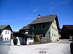
Teißegg with garden ID: 14351 |
46 ° 47 '37 "N, 11 ° 56" 35 "E |
May 3, 1989 (BLR-LAB 2449) |
Raised hide |
KG: Bruneck building plot: 11 basic plots: 34/1, 34/2
|
|
Tonnler with oven in Stegen ID: 14441 |
46 ° 47 ′ 47 "N, 11 ° 55 ′ 28" E |
Aug. 24, 1987 (BLR-LAB 5082) |
Rural house / farm |
KG: Bruneck building plot: 1865, 467, 468
|
| Overturning weir in the Ahr ID: 50614 |
46 ° 49 ′ 19 ″ N, 11 ° 56 ′ 10 ″ E |
April 24, 2018 (BLR-LAB 386) |
two dams built in the Ahr river bed between St. Georgen and Gais from the first half of the 20th century |
KG: Sankt Georgen Basic parcel: 1059/1
|
|

|
Unterhuber ID: 14473 |
46 ° 46 ′ 43 "N, 11 ° 56 ′ 50" E |
Aug. 24, 1987 (BLR-LAB 5081) |
Rural house / farm |
KG: Reischach building plot: 112
|

|
Unterrainertor ID: 18044 |
46 ° 47 ′ 43 "N, 11 ° 56 ′ 25" E |
Aug. 24, 1987 (BLR-LAB 5082) |
Fortifications |
KG: Bruneck building plot: 31
|
|
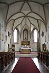
Ursuline Church of the Holy Savior, monastery and garden ID: 18047 |
46 ° 47 ′ 42 "N, 11 ° 56 ′ 11" E |
Aug. 24, 1987 (BLR-LAB 5082) |
church |
KG: Bruneck building plots: 87, 88, 89 basic plots: 131, 132
|

|
Ursuline Gate ID: 18046 |
46 ° 47 ′ 42 "N, 11 ° 56 ′ 12" E |
Aug. 24, 1987 (BLR-LAB 5082) |
Fortifications |
KG: Bruneck building plot: 86/2
|
|
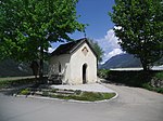
Fourteen Helpers Chapel on the way to St. Georgen-Aufhofen ID: 14347 |
46 ° 49 ′ 2 "N, 11 ° 56 ′ 32" E |
Aug. 24, 1987 (BLR-LAB 5081) |
chapel |
KG: Aufhofen basic parcel: 1759
|
|
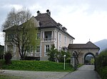
Villa Franzelin with park ID: 14439 |
46 ° 47 '37 "N, 11 ° 55' 51" E |
Aug. 24, 1987 (BLR-LAB 5082) |
Villa / summer cottage |
KG: Bruneck building plot : 420 basic plot: 545/2, 560/1, 560/2
|

|
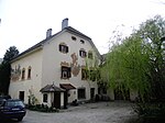
Villa Harrasser with garden ID: 14433 |
Michael-Pacher-Strasse 1 46 ° 47 ′ 42 ″ N, 11 ° 56 ′ 7 ″ E |
Aug. 24, 1987 (BLR-LAB 5082) |
Villa / summer cottage |
KG: Bruneck building plot: 320/1 basic plot: 565/2
|
|
Villa Marienhof with garden ID: 50291 |
46 ° 48 ′ 2 "N, 11 ° 56 ′ 16" E |
Jan. 25, 1993 (BLR-LAB 281) |
Villa / summer cottage |
KG: Bruneck building plot: 407/1 basic plot: 475/2, 479/13
|

|
Villa Moessmer with garden ID: 14434 |
46 ° 47 ′ 34 "N, 11 ° 56 ′ 57" E |
Aug. 24, 1987 (BLR-LAB 5082) |
Villa / summer cottage |
KG: Bruneck Building plot: 330 Base plot: 325
|

|
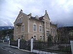
Villa Rabensteiner with garden ID: 14438 |
Bruder-Willram-Strasse 18 46 ° 47 ′ 44 ″ N, 11 ° 56 ′ 38 ″ E |
Aug. 24, 1987 (BLR-LAB 5082) |
Villa / summer cottage |
KG: Bruneck Building plot : 388 Base plot: 293/1
|
|
Villa Santer ID: 14436 |
46 ° 47 ′ 33 "N, 11 ° 56 ′ 48" E |
Aug. 24, 1987 (BLR-LAB 5082) |
Villa / summer cottage |
KG: Bruneck building plot: 354 basic plot: 1002
|
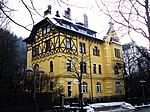
| Villa Walde with garden in Extraordinary ID: 50611 |
46 ° 47 ′ 40 "N, 11 ° 56 ′ 55" E |
27 Mar 2018 (BLR-LAB 284) |
Villa built by Alfons Walde in 1950 |
KG: Bruneck building plot: 638, 1523
|
|
|
Villa Walsthöny with garden ID: 14435 |
46 ° 47 ′ 41 ″ N, 11 ° 56 ′ 5 ″ E |
Aug. 24, 1987 (BLR-LAB 5082) |
Villa / summer cottage |
KG: Bruneck Building plot : 338 Base plot: 565/3
|

|
Vintler with garden ID: 14352 |
46 ° 47 ′ 40 "N, 11 ° 56 ′ 29" E |
June 20, 1951 (MD) |
Raised hide |
KG: Bruneck building plot: 15/1 basic plot: 39, 40
|

|
Walsermair ID: 14482 |
46 ° 48'59 "N, 11 ° 56'5" E |
Jan 13, 1951 (MD) |
Rural house / farm |
KG: Sankt Georgen Building plot: 6
|
| Weber ID: 14462 |
46 ° 47 ′ 47 "N, 11 ° 58 ′ 12" E |
Aug. 24, 1987 (BLR-LAB 5081) |
Raised hide |
KG: Dietenheim building plot: 116/1
|
|

|
Widum ID: 14341 |
46 ° 48 ′ 55 "N, 11 ° 56 ′ 43" E |
Aug. 24, 1987 (BLR-LAB 5081) |
Widum / Canon House |
KG: Aufhofen building plot: 47
|
| Winkler ID: 50518 |
46 ° 48 ′ 54 "N, 11 ° 56 ′ 48" E |
23 Mar 2009 (BLR-LAB 832) |
Rural house / farm |
KG: Aufhofen building plot: 60
|
|
| Zimmerhäusler ID: 14456 |
46 ° 48 ′ 11 "N, 11 ° 57 ′ 13" E |
Aug. 24, 1987 (BLR-LAB 5081) |
Rural house / farm |
KG: Dietenheim building plot: 13
|
|
| Two garden houses of the Villa Sonnwend (ex Villa Mahl) ID: 50473 |
46 ° 48 ′ 17 "N, 11 ° 57 ′ 0" E |
Jan. 28, 2008 (BLR-LAB 206) |
Villa / summer cottage |
KG: Dietenheim building plot: 150 |
If no coordinates are known for a monument, the cadastral data at the time it was placed under protection are given as a substitute. These are neither official nor necessarily up-to-date.
The addresses taken from the State Monuments Office may be out of date.
| Photo: | Photograph of the monument. Click the photo generates an enlarged view. There are also two symbols: |
| ID | Identifier at the South Tyrolean Monuments Office |
| KG | Cadastral parish |
| MD | Ministerial Decree |
| BLR-LAB | Decision of the state government - state committee decision |
Web links
- Monument browser of the South Tyrolean Monuments Office
Individual evidence
- ↑ Claudia Plaikner: Ansiedl / Aufhofen . In: Magdalena Hörmann-Weingartner (ed.), Tiroler Burgenbuch. IX. Volume: Val Pusteria . Athesia Publishing House, Bozen 2003, ISBN 978-88-8266-163-2 , pp. 249-250.
- ↑ The Bildstöckl is back in a worthy place . In: Dolomiten , September 26, 2017, p. 28