List of architectural monuments in Tyrol (South Tyrol)
The list of architectural monuments in Tyrol ( Italian: Tirolo ) contains the 31 objects designated as architectural monuments in the area of the municipality of Tyrol in South Tyrol .
The basis is the official directory of the monuments in South Tyrol, which can be viewed on the Internet. These can be, for example, sacred buildings , residential houses, farms and aristocratic residences. The order in this list is based on the designation, alternatively it can also be sorted according to the address or the date on which it was placed under protection.
list
| photo | designation | Location | registration | description | Metadata |
|---|---|---|---|---|---|
|
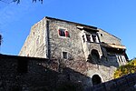
Auer ID: 17565 |
Seminarstrasse 38 46 ° 41 ′ 58 ″ N, 11 ° 9 ′ 40 ″ E |
May 9, 1950 (MD) |
Castle |
KG: Tyrol building plot: 104/1
|

|
Ausermelaun ID: 17567 |
46 ° 41 ′ 30 "N, 11 ° 10 ′ 17" E |
10 Mar 1978 (BLR-LAB 1572) |
Rural house / farm |
KG: Tyrol building plot: 123
|

|
Beatenhof ID: 17561 |
46 ° 41 ′ 25 ″ N, 11 ° 9 ′ 29 ″ E |
May 28, 1985 (BLR-LAB 2378) |
Rural house / farm |
KG: Tyrol building plot: 36, 758, 874
|
|
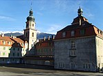
Episcopal Seminary Johanneum ID: 17585 |
46 ° 41 ′ 36 "N, 11 ° 9 ′ 39" E |
10 Mar 1978 (BLR-LAB 1572) |
Seminary |
KG: Tyrol building plot: 295/1
|

|
Brunnenburg ID: 17582 |
46 ° 41 ′ 31 ″ N, 11 ° 8 ′ 52 ″ E |
May 28, 1985 (BLR-LAB 2378) |
Castle |
KG: Tyrol building plot: 278
|

|
Dorfmühle (Waldengut) ID: 17563 |
46 ° 41 ′ 33 ″ N, 11 ° 9 ′ 16 ″ E |
10 Mar 1978 (BLR-LAB 1572) |
Mill |
KG: Tyrol building plot: 64
|

|
Epiphany Chapel near Königbauer ID: 17572 |
46 ° 40 ′ 31 ″ N, 11 ° 10 ′ 15 ″ E |
May 2, 1988 (BLR-LAB 2457) |
chapel |
KG: Tyrol building plot: 141
|

|
Erlacher ID: 17571 |
46 ° 40 ′ 31 ″ N, 11 ° 10 ′ 12 ″ E |
May 2, 1988 (BLR-LAB 2457) |
Rural house / farm |
KG: Tyrol building plot: 140/1
|

|
Gratschberg ID: 17575 |
Gnaidweg 18 46 ° 41 ′ 25 ″ N, 11 ° 8 ′ 39 ″ E |
3rd Mar 1951 (MD) |
Villa / summer cottage |
KG: Tyrol building plot: 158
|
|
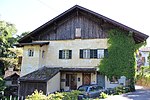
Zenoburg Manor ID: 18089 |
46 ° 40 ′ 27 "N, 11 ° 10 ′ 17" E |
May 9, 1950 (MD) |
Rural house / farm |
KG: Tyrol building plot: 143/1, 143/2
|

|
Innermelaun ID: 17566 |
46 ° 41 ′ 30 "N, 11 ° 10 ′ 17" E |
10 Mar 1978 (BLR-LAB 1572) |
Rural house / farm |
KG: Tyrol building plot: 122/1
|

|
Johannes Nepomuk Chapel (Lahnkapelle) ID: 17584 |
46 ° 41 ′ 47 "N, 11 ° 9 ′ 17" E |
May 2, 1988 (BLR-LAB 2457) |
chapel |
KG: Tyrol basic parcel: 290
|

|
Koehl ID: 17560 |
46 ° 41 ′ 20 "N, 11 ° 9 ′ 22" E |
May 28, 1985 (BLR-LAB 2378) |
Rural house / farm |
KG: Tyrol building plot: 847
|

|
Mair am Aich ID: 17568 |
46 ° 41 ′ 25 ″ N, 11 ° 10 ′ 4 ″ E |
10 Mar 1978 (BLR-LAB 1572) |
Residential building |
KG: Tyrol building plot: 127/1
|

|
Visitation of Mary in Finele ID: 17581 |
46 ° 41 ′ 44 ″ N, 11 ° 10 ′ 7 ″ E |
10 Mar 1978 (BLR-LAB 1572) |
chapel |
KG: Tyrol building plot: 250
|

|
Parish Church of St. John the Baptist with Cemetery ID: 17557 |
46 ° 41 ′ 25 ″ N, 11 ° 9 ′ 13 ″ E |
10 Mar 1978 (BLR-LAB 1572) |
church |
KG: Tyrol building plot: 1
|

|
Pfarrwidum ID: 17558 |
46 ° 41 ′ 25 ″ N, 11 ° 9 ′ 12 ″ E |
10 Mar 1978 (BLR-LAB 1572) |
Widum / Canon House |
KG: Tyrol building plot: 2/2
|

|
Sandgruber ID: 17574 |
46 ° 41 ′ 36 "N, 11 ° 8 ′ 57" E |
May 2, 1988 (BLR-LAB 2457) |
Rural house / farm |
KG: Tyrol building plot: 153
|

|
Tyrol Castle ID: 17576 |
46 ° 41 ′ 40 "N, 11 ° 8 ′ 42" E |
10 Mar 1978 (BLR-LAB 1572) |
Castle, seat of the South Tyrolean State Museum for Cultural and State History |
KG: Tyrol building parcel: 161 basic parcel: 1259, 1260, 1261
|
|
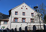
Scrap host ID: 17559 |
46 ° 41 ′ 25 ″ N, 11 ° 9 ′ 16 ″ E |
10 Mar 1978 (BLR-LAB 1572) |
Inn |
KG: Tyrol building plot: 27/1
|

|
Segenbühel Chapel ID: 17586 |
46 ° 40 ′ 42 "N, 11 ° 9 ′ 54" E |
May 2, 1988 (BLR-LAB 2457) |
chapel |
KG: Tyrol basic parcel: 998/1
|

|
St. Peter with cemetery chapel in Gratsch ID: 17577 |
46 ° 41 ′ 38 "N, 11 ° 8 ′ 24" E |
10 Mar 1978 (BLR-LAB 1572) |
church |
KG: Tyrol building plot: 165/1, 165/2
|

|
St. Ruprecht ID: 17570 |
46 ° 41 ′ 18 ″ N, 11 ° 9 ′ 35 ″ E |
10 Mar 1978 (BLR-LAB 1572) |
church |
KG: Tyrol building plot: 132
|

|
Staingütl ID: 17562 |
46 ° 41 ′ 30 ″ N, 11 ° 9 ′ 18 ″ E |
May 2, 1988 (BLR-LAB 2457) |
Rural house / farm |
KG: Tyrol building plot: 57/1
|

|
Strobl ID: 17569 |
46 ° 41 ′ 19 ″ N, 11 ° 9 ′ 44 ″ E |
Aug 28, 1990 (BLR-LAB 5133) |
Rural house / farm |
KG: Tyrol building plot: 131/1
|

|
Tritschermühle ID: 17564 |
46 ° 41 ′ 38 "N, 11 ° 9 ′ 15" E |
10 Mar 1978 (BLR-LAB 1572) |
Mill |
KG: Tyrol building plot: 75
|
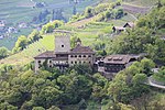
|
Turnstein ID: 17579 |
St. Peter No. 8 46 ° 41 ′ 30 ″ N, 11 ° 8 ′ 4 ″ E |
May 9, 1950 (MD) |
Castle |
KG: Tyrol building plot: 171/1
|

|
Villa Maria ID: 17580 |
46 ° 41 ′ 29 ″ N, 11 ° 9 ′ 5 ″ E |
May 2, 1988 (BLR-LAB 2457) |
Villa / summer cottage |
KG: Tyrol building plot: 236/1
|

|
Walkner ID: 17578 |
46 ° 41 ′ 28 "N, 11 ° 8 ′ 14" E |
May 28, 1985 (BLR-LAB 2378) |
Rural house / farm |
KG: Tyrol building plot: 170/1
|

|
Path chapel near the Traubenheim (Lindebauer chapel) ID: 17583 |
46 ° 40 '50 "N, 11 ° 9' 49" E |
May 2, 1988 (BLR-LAB 2457) |
chapel |
KG: Tyrol building plot: 280
|

|
Zenoburg ID: 17573 |
46 ° 40 ′ 25 ″ N, 11 ° 10 ′ 19 ″ E |
10 Mar 1978 (BLR-LAB 1572) |
Castle |
KG: Tyrol building plots: 144/1, 144/2, 144/3 basic plots : 841, 842, 843, 844, 845, 846 |
If no coordinates are known for a monument, the cadastral data at the time it was placed under protection are given as a substitute. These are neither official nor necessarily up-to-date.
The addresses taken from the State Monuments Office may be out of date.
| Photo: | Photograph of the monument. Click the photo generates an enlarged view. There are also two symbols: |
| ID | Identifier at the South Tyrolean Monuments Office |
| KG | Cadastral parish |
| MD | Ministerial Decree |
| BLR-LAB | Decision of the state government - state committee decision |
Web links
- Monument browser of the South Tyrolean Monuments Office