List of architectural monuments in Rodeneck
The list of architectural monuments in Rodeneck ( Rodengo in Italian ) contains the 25 objects designated as architectural monuments in the area of the municipality of Rodeneck in South Tyrol .
The basis is the official directory of the monuments in South Tyrol, which can be viewed on the Internet. These can be, for example, sacred buildings , residential houses, farms and aristocratic residences. The order in this list is based on the designation, alternatively it can also be sorted according to the address or the date on which it was placed under protection.
list
| photo | designation | Location | registration | description | Metadata |
|---|---|---|---|---|---|
|
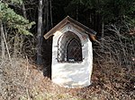
Baumannstöckl ID: 16855 |
46 ° 47 ′ 35 "N, 11 ° 40 ′ 35" E |
October 7, 1985 (BLR-LAB 5041) |
Wayside shrine |
KG: Rodeneck building plot: 635/2
|
|
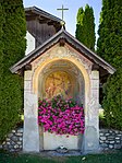
Wayside shrine at the parish church ID: 16835 |
46 ° 46 ′ 37 "N, 11 ° 41 ′ 25" E |
October 7, 1985 (BLR-LAB 5041) |
Wayside shrine |
KG: Rodeneck building plot: 32
|

|
Wayside shrine at the Mair zu Vill ID: 16833 |
46 ° 46 ′ 43 "N, 11 ° 41 ′ 30" E |
Nov 10, 1950 (MD) |
Wayside shrine |
KG: Rodeneck building plot: 19
|
|
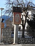
Wayside shrine in the parish garden ID: 16854 |
46 ° 46 ′ 42 "N, 11 ° 41 ′ 25" E |
October 7, 1985 (BLR-LAB 5041) |
Wayside shrine |
KG: Rodeneck basic parcel: 172
|

|
Haiden ID: 16836 |
46 ° 46 ′ 39 "N, 11 ° 40 ′ 58" E |
October 7, 1985 (BLR-LAB 5041) |
Rural house / farm |
KG: Rodeneck building plot: 36
|

|
Heart eggs ID: 16849 |
Nauders 98 46 ° 47 ′ 24 ″ N, 11 ° 41 ′ 57 ″ E |
October 7, 1985 (BLR-LAB 5041) |
Extensive courtyard area. Room with a field ceiling, flat bay facade. Granary: basement in wooden block construction, upper floor in bundwerk with boarding and open gable. Oven with a brick vault, framed gable and gable roof above. |
KG: Rodeneck building plot: 122
|
| Hospe with Florian Chapel and oven ID: 16850 |
46 ° 47 ′ 5 "N, 11 ° 42 ′ 1" E |
October 7, 1985 (BLR-LAB 5041) |
Rural house / farm |
KG: Rodeneck building plot: 132, 444
|
|
| Huber am Fröllerberg ID: 16853 |
46 ° 47 ′ 12 "N, 11 ° 42 ′ 59" E |
October 7, 1985 (BLR-LAB 5041) |
Rural house / farm |
KG: Rodeneck building plot: 190
|
|

|
Chapel near the Planatscher ID: 16837 |
46 ° 46 ′ 54 "N, 11 ° 40 ′ 44" E |
October 7, 1985 (BLR-LAB 5041) |
chapel |
KG: Rodeneck building plot: 37
|

|
Korburg ID: 16840 |
46 ° 48 ′ 0 "N, 11 ° 40 ′ 36" E |
October 7, 1985 (BLR-LAB 5041) |
Raised hide |
KG: Rodeneck building plot: 52, 53/1, 53/2
|
| Crane ID: 16847 |
46 ° 47 ′ 52 "N, 11 ° 41 ′ 54" E |
October 7, 1985 (BLR-LAB 5041) |
Rural house / farm |
KG: Rodeneck building plot: 98
|
|
| Liener with oven ID: 16839 |
46 ° 47 ′ 9 ″ N, 11 ° 40 ′ 22 ″ E |
October 7, 1985 (BLR-LAB 5041) |
Rural house / farm |
KG: Rodeneck building plot: 48, 49
|
|

|
Obergopperat ID: 16846 |
46 ° 47 ′ 18 "N, 11 ° 41 ′ 28" E |
October 7, 1985 (BLR-LAB 5041) |
Rural house / farm |
KG: Rodeneck building plot: 85
|
| Oberhauser am Fröllerberg ID: 16902 |
46 ° 47 ′ 19 "N, 11 ° 43 ′ 4" E |
October 7, 1985 (BLR-LAB 5041) |
Rural house / farm |
KG: Rodeneck building plot: 194
|
|

|
Ortner ID: 16843 |
46 ° 47 ′ 11 "N, 11 ° 41 ′ 17" E |
October 7, 1985 (BLR-LAB 5041) |
Rural house / farm |
KG: Rodeneck building plot: 71/1 basic plot: 793/1
|

|
Parish church Maria Himmelfahrt with cemetery chapel, cemetery and Wolkenstein family crypt ID: 16832 |
46 ° 46 ′ 29 "N, 11 ° 41 ′ 21" E |
October 7, 1985 (BLR-LAB 5041) |
church |
KG: Rodeneck building plot: 226, 4, 5 basic plot: 145
|

|
Parish dedication in Vill with St. Blasius Chapel ID: 16834 |
46 ° 46 ′ 42 "N, 11 ° 41 ′ 24" E |
October 7, 1985 (BLR-LAB 5041) |
Widum / Canon House |
KG: Rodeneck building plot: 27/1, 28
|
| Putzerkapelle ID: 16852 |
46 ° 47 ′ 8 "N, 11 ° 42 ′ 42" E |
October 7, 1985 (BLR-LAB 5041) |
chapel |
KG: Rodeneck building plot: 186
|
|

|
Rodenegg ID: 16829 |
46 ° 46 ′ 23 "N, 11 ° 41 ′ 13" E |
October 7, 1985 (BLR-LAB 5041) |
Castle |
KG: Rodeneck building plot: 1, 2 basic plot: 1, 2
|
| Scheiberkapelle ID: 16848 |
46 ° 47 ′ 28 "N, 11 ° 42 ′ 20" E |
October 7, 1985 (BLR-LAB 5041) |
chapel |
KG: Rodeneck building plot: 119
|
|

|
St. Benedict in Nauders ID: 16845 |
46 ° 47 ′ 16 "N, 11 ° 41 ′ 28" E |
October 7, 1985 (BLR-LAB 5041) |
church |
KG: Rodeneck building plot: 84
|

|
St. Ignatius in Bachgart ID: 16841 |
46 ° 48 ′ 10 "N, 11 ° 41 ′ 4" E |
May 18, 1951 (MD) |
church |
KG: Rodeneck building plot: 56
|
|
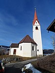
St. Paul ID: 16838 |
46 ° 47 ′ 9 "N, 11 ° 40 ′ 41" E |
October 7, 1985 (BLR-LAB 5041) |
church |
KG: Rodeneck building plot: 44
|

|
Unterhuber ID: 16844 |
46 ° 47 ′ 13 ″ N, 11 ° 41 ′ 20 ″ E |
October 7, 1985 (BLR-LAB 5041) |
Rural house / farm |
KG: Rodeneck building plot: 74
|
|
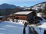
Widner ID: 16842 |
46 ° 47 ′ 15 "N, 11 ° 40 ′ 40" E |
October 7, 1985 (BLR-LAB 5041) |
Rural house / farm |
KG: Rodeneck building plot: 64 |
If no coordinates are known for a monument, the cadastral data at the time it was placed under protection are given as a substitute. These are neither official nor necessarily up-to-date.
The addresses taken from the State Monuments Office may be out of date.
| Photo: | Photograph of the monument. Click the photo generates an enlarged view. There are also two symbols: |
| ID | Identifier at the South Tyrolean Monuments Office |
| KG | Cadastral parish |
| MD | Ministerial Decree |
| BLR-LAB | Decision of the state government - state committee decision |
Web links
- Monument browser of the South Tyrolean Monuments Office