List of architectural monuments in Margreid
The list of architectural monuments in Margreid ( Magrè in Italian ) contains the 25 objects designated as architectural monuments in the area of the municipality of Margreid in South Tyrol .
The basis is the official directory of the monuments in South Tyrol, which can be viewed on the Internet. These can be, for example, sacred buildings , residential houses, farms and aristocratic residences. The order in this list is based on the designation, alternatively it can also be sorted according to the address or the date on which it was placed under protection.
list
| photo | designation | Location | registration | description | Metadata |
|---|---|---|---|---|---|

|
On the farmstead with Bartholomew's Chapel ID: 15835 |
46 ° 16 '16 "N, 11 ° 9' 56" E |
December 10, 1976 (BLR-LAB 7884) |
Raised hide |
KG: Unterfennberg building plot: 5/1, 6, 7
|

|
Benefit house ID: 15842 |
46 ° 16 '15 "N, 11 ° 11' 39" E |
December 10, 1976 (BLR-LAB 7884) |
Rural house / farm |
KG: Unterfennberg building plot: 40
|
|
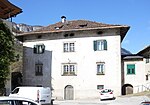
Brunner ID: 15828 |
46 ° 17 ′ 15 "N, 11 ° 12 ′ 43" E |
Sep 14 1949 (MD) |
Raised hide |
KG: Margreid building plot: 31
|

|
Gasthaus zur Kirche ID: 15839 |
46 ° 16 ′ 21 ″ N, 11 ° 10 ′ 54 ″ E |
December 10, 1976 (BLR-LAB 7884) |
Inn |
KG: Unterfennberg building plot: 26
|

|
Hasler ID: 15841 |
46 ° 15 ′ 52 "N, 11 ° 11 ′ 5" E |
December 10, 1976 (BLR-LAB 7884) |
Rural house / farm |
KG: Unterfennberg building plot: 31, 32, 33
|

|
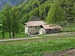
Hirschprunn ID: 18062 |
St.-Gertraud-Platz 12 46 ° 17 ′ 13 ″ N, 11 ° 12 ′ 34 ″ E |
December 10, 1976 (BLR-LAB 7884) |
Raised hide |
KG: Margreid building plot: 15, 16 basic plot: 3/1
|
|
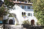
Hof unterm Berg ID: 15837 |
46 ° 16 ′ 23 "N, 11 ° 10 ′ 41" E |
December 10, 1976 (BLR-LAB 7884) |
Rural house / farm |
KG: Unterfennberg building plot: 19, 20
|
|
Josef-Alberti-Strasse 13 ID: 15831 |
Josef-Alberti-Strasse 13 46 ° 17 ′ 14 ″ N, 11 ° 12 ′ 31 ″ E |
Sep 14 1949 (MD) |
Rural house / farm |
KG: Margreid building plot: 51
|

|
Josef-Alberti-Strasse 21 ID: 15834 |
Josef-Alberti-Strasse 21 46 ° 17 ′ 15 ″ N, 11 ° 12 ′ 32 ″ E |
Sep 14 1949 (MD) |
Rural house / farm |
KG: Margreid building plot: 63
|

|
Cellar courtyard with Anna chapel ID: 15836 |
46 ° 16 ′ 13 ″ N, 11 ° 10 ′ 24 ″ E |
December 10, 1976 (BLR-LAB 7884) |
Rural house / farm |
KG: Unterfennberg building plot: 14, 15
|

|
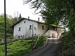
Königsegg ID: 15832 |
Josef-Alberti-Strasse 11 46 ° 17 ′ 13 ″ N, 11 ° 12 ′ 31 ″ E |
Sep 14 1949 (MD) |
Raised hide |
KG: Margreid building plot: 52/1, 52/2
|
|
Lindenhof ID: 15843 |
46 ° 16 '12 "N, 11 ° 11' 39" E |
December 10, 1976 (BLR-LAB 7884) |
Rural house / farm |
KG: Unterfennberg building plot: 39
|

|
Maria Schnee in Putzwald ID: 15844 |
46 ° 16 '18 "N, 11 ° 11' 38" E |
December 10, 1976 (BLR-LAB 7884) |
chapel |
KG: Unterfennberg building plot: 42
|

|
Lady Chapel ID: 15827 |
46 ° 17 ′ 14 "N, 11 ° 12 ′ 45" E |
December 10, 1976 (BLR-LAB 7884) |
chapel |
KG: Margreid building plot: 28
|
| Pfarrgasse 1-5 ID: 50148 |
Pfarrgasse 1-5 46 ° 17 ′ 13 ″ N, 11 ° 12 ′ 33 ″ E |
Sep 11 2000 (BLR-LAB 3346) |
Raised hide |
KG: Margreid building plot: 14
|
|

|
Pfarrgasse 10-14 ID: 15825 |
Pfarrgasse 10-14 46 ° 17 ′ 12 ″ N, 11 ° 12 ′ 31 ″ E |
Sep 14 1949 (MD) |
Rural house / farm |
KG: Margreid building plot: 10/1, 10/2, 10/3, 11/1
|

|
Pfarrgasse 16 ID: 15824 |
Pfarrgasse 16 46 ° 17 ′ 11 ″ N, 11 ° 12 ′ 31 ″ E |
Sep 14 1949 (MD) |
Rural house / farm |
KG: Margreid building plot: 9/1, 9/2, 9/3, 9/4
|

|
Parish church St. Gertraud with tower and cemetery ID: 15823 |
46 ° 17 ′ 9 ″ N, 11 ° 12 ′ 32 ″ E |
December 10, 1976 (BLR-LAB 7884) |
church |
KG: Margreid building plot: 5, 7/1
|

|
Parish church St. Leonhard with cemetery in Unterfennberg ID: 15838 |
46 ° 16 '23 "N, 11 ° 10' 48" E |
December 10, 1976 (BLR-LAB 7884) |
church |
KG: Unterfennberg building plot: 21 basic plot: 126
|

|
Pfarrwidum ID: 15822 |
46 ° 17 ′ 8 "N, 11 ° 12 ′ 32" E |
(Err: 502) |
Widum / Canon House |
KG: Margreid building plot: 1/2
|

|
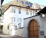
Town Hall ID: 15826 |
46 ° 17 ′ 12 "N, 11 ° 12 ′ 32" E |
December 10, 1976 (BLR-LAB 7884) |
Rural house / farm |
KG: Margreid building plot: 12/1 basic plot: 6
|
|
Salvadori with garden ID: 15829 |
46 ° 17 ′ 16 ″ N, 11 ° 12 ′ 38 ″ E |
Sep 14 1949 (MD) |
Raised hide |
KG: Margreid building parcel: 33/1, 33/3, 34/1, 34/2, 38/1 basic parcel : 33/1
|

|
St.-Gertraud-Platz 3 ID: 15830 |
St.-Gertraud-Platz 3 46 ° 17 ′ 15 ″ N, 11 ° 12 ′ 34 ″ E |
Sep 14 1949 (MD) |
Rural house / farm |
KG: Margreid building plot: 49/1
|
| Stetten ID: 15833 |
Josef-Alberti-Strasse 17 46 ° 17 ′ 14 ″ N, 11 ° 12 ′ 31 ″ E |
December 10, 1976 (BLR-LAB 7884) |
Raised hide |
KG: Margreid building plot: 59/1
|
|

|
Widum ID: 15840 |
46 ° 16 ′ 20 "N, 11 ° 10 ′ 53" E |
December 10, 1976 (BLR-LAB 7884) |
Widum / Canon House |
KG: Unterfennberg building plot: 27, 80 |
If no coordinates are known for a monument, the cadastral data at the time it was placed under protection are given as a substitute. These are neither official nor necessarily up-to-date.
The addresses taken from the State Monuments Office may be out of date.
| Photo: | Photograph of the monument. Click the photo generates an enlarged view. There are also two symbols: |
| ID | Identifier at the South Tyrolean Monuments Office |
| KG | Cadastral parish |
| MD | Ministerial Decree |
| BLR-LAB | Decision of the state government - state committee decision |
Web links
- Architecture in Margreid
- Monument browser of the South Tyrolean Monuments Office