List of architectural monuments in Velturno
The list of architectural monuments in Feldthurns ( Velturno in Italian ) contains the 33 objects identified as architectural monuments in the area of the municipality of Feldthurns in South Tyrol .
The basis is the official directory of the monuments in South Tyrol, which can be viewed on the Internet. These can be, for example, sacred buildings , residential houses, farms and aristocratic residences. The order in this list is based on the designation, alternatively it can also be sorted according to the address or the date on which it was placed under protection.
list
| photo | designation | Location | registration | description | Metadata |
|---|---|---|---|---|---|

|
Bachmann in Schrambach ID: 14786 |
46 ° 40 ′ 5 "N, 11 ° 36 ′ 37" E |
July 6, 1981 (BLR-LAB 3679) |
Rural house / farm |
KG: Feldthurns building plot: 75/2
|

|
Balgler in Unterum ID: 14781 |
46 ° 39 ′ 15 "N, 11 ° 35 ′ 25" E |
July 6, 1981 (BLR-LAB 3679) |
Rural house / farm |
KG: Feldthurns building plot: 46
|

|
Brugger in Unterum ID: 14782 |
46 ° 39 ′ 27 "N, 11 ° 35 ′ 42" E |
July 6, 1981 (BLR-LAB 3679) |
Rural house / farm |
KG: Feldthurns building plot: 51
|
|
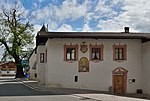
Early knife ID: 14792 |
46 ° 40 ′ 7 "N, 11 ° 35 ′ 54" E |
July 6, 1981 (BLR-LAB 3679) |
Rural house / farm |
KG: Feldthurns building plot: 100
|

|
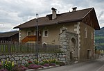
Fürholzer with wayside shrine in Unterum ID: 14785 |
46 ° 39 ′ 42 "N, 11 ° 36 ′ 27" E |
July 6, 1981 (BLR-LAB 3679) |
Rural house / farm |
KG: Feldthurns building plot: 67/1, 67/2, 68
|
|
House No. 5 ID: 14796 |
46 ° 40 ′ 9 ″ N, 11 ° 36 ′ 3 ″ E |
June 7, 1951 (MD) |
Rural house / farm |
KG: Feldthurns building plot: 114
|

|
Kier in yarn ID: 14778 |
46 ° 39 ′ 56 "N, 11 ° 34 ′ 35" E |
July 6, 1981 (BLR-LAB 3679) |
Rural house / farm |
KG: Feldthurns building plot: 15
|

|
Grain box at Zöl in Unterum ID: 18052 |
46 ° 39 ′ 32 "N, 11 ° 35 ′ 58" E |
May 27, 1991 (BLR-LAB 2809) |
Grain box |
KG: Feldthurns building plot: 58
|

|
Mair in Guln ID: 50549 |
46 ° 39 ′ 56 "N, 11 ° 35 ′ 26" E |
April 18, 2011 (BLR-LAB 615) |
Rural house / farm |
KG: Feldthurns building plot: 26
|

|
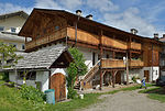
Mullngütl ID: 14800 |
46 ° 40 ′ 13 "N, 11 ° 35 ′ 54" E |
July 6, 1981 (BLR-LAB 3679) |
Rural house / farm |
KG: Feldthurns building plot: 128
|
|
Nagele ID: 14794 |
46 ° 40 ′ 9 "N, 11 ° 35 ′ 56" E |
July 6, 1981 (BLR-LAB 3679) |
Rural house / farm |
KG: Feldthurns building plot: 102
|

|
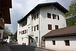
Parish Church of the Assumption with cemetery chapel and cemetery ID: 14795 |
46 ° 40 ′ 4 "N, 11 ° 36 ′ 5" E |
July 6, 1981 (BLR-LAB 3697) |
church |
KG: Feldthurns building plot: 113, 378 Basic plot: 822
|
|
Pfarrwidum ID: 14799 |
46 ° 40 ′ 7 "N, 11 ° 35 ′ 52" E |
July 6, 1981 (BLR-LAB 3679) |
Widum |
KG: Feldthurns building plot: 125
|

|
Platzer in Schrambach ID: 14787 |
46 ° 40 ′ 7 "N, 11 ° 36 ′ 38" E |
July 6, 1981 (BLR-LAB 3679) |
Rural house / farm |
KG: Feldthurns building plot: 76
|

|
Ploner in Obergarn ID: 50564 |
46 ° 40 ′ 1 ″ N, 11 ° 34 ′ 16 ″ E |
Jan. 21, 2013 (BLR-LAB 84) |
Rural house / farm |
KG: Feldthurns building plot: 217
|

|
Puntleider ID: 14803 |
46 ° 40 ′ 43 "N, 11 ° 37 ′ 16" E |
July 6, 1981 (BLR-LAB 3679) |
Rural house / farm |
KG: Feldthurns building plot: 185
|

|
Raffenberg (Teutenhofer) ID: 14797 |
46 ° 40 ′ 9 ″ N, 11 ° 36 ′ 2 ″ E |
July 6, 1981 (BLR-LAB 3679) |
Raised hide |
KG: Feldthurns building plot: 116
|

|
Rainer in Unterum ID: 14783 |
46 ° 39 ′ 37 "N, 11 ° 35 ′ 55" E |
July 6, 1981 (BLR-LAB 3679) |
Rural house |
KG: Feldthurns building plot: 53
|

|
Velthurns Castle ID: 14798 |
Dorfstrasse 3 46 ° 40 ′ 12 ″ N, 11 ° 36 ′ 1 ″ E |
July 6, 1981 (BLR-LAB 3679) |
Castle |
KG: Feldthurns building plot: 118/1, 118/2, 119 basic plot: 852/1, 852/2
|

|
Scrap with mill in Schrambach ID: 14788 |
46 ° 40 ′ 9 ″ N, 11 ° 36 ′ 40 ″ E |
July 6, 1981 (BLR-LAB 3679) |
Rural house / farm; the mill is situated at 46 ° 40 '11.3 " N , 11 ° 36' 39" O . |
KG: Feldthurns building plot: 83, 86
|

|
Sebastian Chapel at Unteregarter in Unterum ID: 14780 |
46 ° 39 ′ 17 "N, 11 ° 35 ′ 20" E |
July 6, 1981 (BLR-LAB 3679) |
chapel |
KG: Feldthurns building plot: 45
|

|
St. Andreas with cemetery in Garn ID: 14777 |
46 ° 39 ′ 51 ″ N, 11 ° 34 ′ 31 ″ E |
July 6, 1981 (BLR-LAB 3679) |
church |
KG: Feldthurns building plot: 1 basic plot: 50
|

|
St. Anton of Padua ID: 14791 |
46 ° 40 ′ 2 "N, 11 ° 35 ′ 44" E |
July 6, 1981 (BLR-LAB 3697) |
church |
KG: Feldthurns building plot: 97
|

|
St. Florian in the gorge ID: 14784 |
46 ° 39 ′ 31 ″ N, 11 ° 36 ′ 21 ″ E |
July 6, 1981 (BLR-LAB 3679) |
church |
KG: Feldthurns building plot: 64
|

|
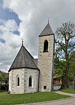
St. Georg in Schnauders ID: 14801 |
46 ° 40 ′ 36 "N, 11 ° 35 ′ 58" E |
July 6, 1981 (BLR-LAB 3679) |
church |
KG: Feldthurns building plot: 139
|
|
St. Lawrence ID: 14793 |
46 ° 40 ′ 7 "N, 11 ° 35 ′ 55" E |
July 6, 1981 (BLR-LAB 3679) |
church |
KG: Feldthurns building plot: 101
|

|
St. Peter in Schrambach with cemetery ID: 14789 |
46 ° 40 ′ 4 ″ N, 11 ° 36 ′ 30 ″ E |
July 6, 1981 (BLR-LAB 3679) |
church |
KG: Feldthurns building plot: 93 Basic plot: 701
|

|
Sullmann in Schrambach ID: 14790 |
46 ° 40 ′ 4 "N, 11 ° 36 ′ 29" E |
July 6, 1981 (BLR-LAB 3679) |
Rural house / farm |
KG: Feldthurns building plot: 94
|

|
Troger in Gulln ID: 14779 |
46 ° 39 ′ 57 "N, 11 ° 35 ′ 15" E |
December 29, 1978 (BLR-LAB 9425) |
Rural house / farm |
KG: Feldthurns building plot: 23
|

|
House Wöhrmann ID: 50576 |
46 ° 40 ′ 46 "N, 11 ° 36 ′ 43" E |
Sep 2 2013 (BLR-LAB 1268) |
Three-storey rural house with ridge in east-west direction. On the facade St. Florian, wall paintings from the 18th century. In the basement there is medieval masonry from the 13th / 14th centuries. Century. On the first floor there was a vaulted kitchen that was destroyed in a bomb attack in 1945. |
KG: Feldthurns building plot: 177
|
|
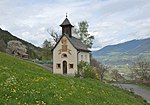
Wöhrerkapelle ID: 14804 |
46 ° 41 ′ 1 ″ N, 11 ° 37 ′ 3 ″ E |
July 6, 1981 (BLR-LAB 3679) |
chapel |
KG: Feldthurns building plot: 193
|

|
Ziernfeld ID: 14802 |
46 ° 40 ′ 15 "N, 11 ° 35 ′ 57" E |
June 7, 1951 (MD) |
Rural house / farm |
KG: Feldthurns building plot: 151/1, 151/2, 151/3, 151/4
|

|
Carpenter ID: 50594 |
46 ° 40 ′ 12 ″ N, 11 ° 36 ′ 2 ″ E |
22 Mar 2016 (BLR-LAB 324) |
built in the late 16th century as a horse stable and hay barn belonging to Velthurns Castle, converted into a residential building in the 19th century |
KG: Feldthurns building plot: 152 |
If no coordinates are known for a monument, the cadastral data at the time it was placed under protection are given as a substitute. These are neither official nor necessarily up-to-date.
The addresses taken from the State Monuments Office may be out of date.
| Photo: | Photograph of the monument. Click the photo generates an enlarged view. There are also two symbols: |
| ID | Identifier at the South Tyrolean Monuments Office |
| KG | Cadastral parish |
| MD | Ministerial Decree |
| BLR-LAB | Decision of the state government - state committee decision |
Web links
- Monument browser of the South Tyrolean Monuments Office