List of architectural monuments in Campo Tures
The list of architectural monuments in Campo Tures ( Italian: Campo Tures ) contains the 46 objects designated as architectural monuments in the area of the municipality of Sand in Taufers in South Tyrol .
The basis is the official directory of the monuments in South Tyrol, which can be viewed on the Internet. These can be, for example, sacred buildings , residential houses, farms and aristocratic residences. The order in this list is based on the designation, alternatively it can also be sorted according to the address or the date on which it was placed under protection.
list
| photo | designation | Location | registration | description | Metadata |
|---|---|---|---|---|---|
| Aschbach with grain bin and oven ID: 16910 |
46 ° 55 ′ 50 "N, 11 ° 56 ′ 38" E |
May 12, 1986 (BLR-LAB 2367) |
Rural house / farm |
KG: Ahornach building plot: 155
|
|
|
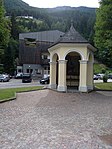
Wayside shrine at the Tauferer Bridge ID: 16945 |
46 ° 55 ′ 18 ″ N, 11 ° 56 ′ 59 ″ E |
May 12, 1986 (BLR-LAB 2367) |
Wayside shrine |
KG: Sand in Taufers building plot: 218
|
| Drassl ID: 16942 |
46 ° 55 ′ 51 ″ N, 11 ° 56 ′ 13 ″ E |
May 12, 1986 (BLR-LAB 2367) |
Rural house / farm |
KG: Sand in Taufers building plot: 175
|
|
| Garberstöckl (Weisner-) ID: 16944 |
46 ° 55 ′ 15 "N, 11 ° 57 ′ 4" E |
May 12, 1986 (BLR-LAB 2367) |
Wayside shrine |
KG: Sand in Taufers building plot: 206
|
|
| Grüner with St. Thomas Chapel ID: 16925 |
46 ° 53 ′ 34 "N, 11 ° 54 ′ 43" E |
May 12, 1986 (BLR-LAB 2367) |
Rural house / farm |
KG: Mühlen Building plot : 162 Base plot: 811/1
|
|

|
Holy Cross Chapel ID: 16908 |
46 ° 55 ′ 22 "N, 11 ° 56 ′ 59" E |
May 12, 1986 (BLR-LAB 2367) |
chapel |
KG: Ahornach building plot: 150
|
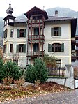
| Jägerhaus ID: 16933 |
46 ° 55 ′ 3 ″ N, 11 ° 57 ′ 9 ″ E |
May 12, 1986 (BLR-LAB 2367) |
Rural house / farm |
KG: Sand in Taufers building plot: 7
|
|
|
Josef-Jungmann-Strasse 2 ID: 16932 |
46 ° 55 ′ 4 ″ N, 11 ° 57 ′ 8 ″ E |
May 12, 1986 (BLR-LAB 2367) |
Rural house / farm |
KG: Sand in Taufers building plot: 6/1
|
| Chapel at the Auer ID: 16928 |
46 ° 56 ′ 40 "N, 12 ° 4 ′ 35" E |
May 12, 1986 (BLR-LAB 2367) |
chapel |
KG: Purely building plot: 43/2
|
|
| Chapel near Ebner ID: 16926 |
46 ° 57 ′ 11 "N, 12 ° 4 ′ 11" E |
May 12, 1986 (BLR-LAB 2367) |
chapel |
KG: Purely building plot: 5/2
|
|
| Chapel at Eppacher ID: 16929 |
46 ° 56 ′ 37 ″ N, 12 ° 5 ′ 13 ″ E |
May 12, 1986 (BLR-LAB 2367) |
chapel |
KG: Purely building plot: 52
|
|
| Chapel at Oberpichler ID: 16931 |
46 ° 57 ′ 11 "N, 12 ° 3 ′ 56" E |
May 12, 1986 (BLR-LAB 2367) |
chapel |
KG: Purely basic parcel: 82
|
|
| Chapel at the Rainer's in Oberpoyen ID: 16911 |
46 ° 56 ′ 27 "N, 11 ° 57 ′ 4" E |
May 12, 1986 (BLR-LAB 2367) |
chapel |
KG: Ahornach building plot: 177
|
|
| Chapel at the Sager ID: 16930 |
46 ° 55 '50 "N, 12 ° 2' 9" E |
May 12, 1986 (BLR-LAB 2367) |
chapel |
KG: Purely building plot: 149
|
|
| Box at Mittermoar ID: 16905 |
46 ° 55 ′ 33 "N, 11 ° 58 ′ 38" E |
May 12, 1986 (BLR-LAB 2367) |
Grain box |
KG: Ahornach building plot: 86
|
|
| Granary (parish museum) ID: 18085 |
46 ° 54 ′ 39 ″ N, 11 ° 56 ′ 56 ″ E |
May 12, 1986 (BLR-LAB 2357) |
Grain box |
KG: Mühlen building plot: 136
|
|
| Mesnerhaus ID: 16923 |
46 ° 54 ′ 37 "N, 11 ° 56 ′ 56" E |
May 12, 1986 (BLR-LAB 2367) |
Rural house / farm |
KG: Mühlen building plot: 131/1
|
|
| Mill at the Pranter ID: 16941 |
46 ° 55 ′ 39 ″ N, 11 ° 56 ′ 28 ″ E |
May 12, 1986 (BLR-LAB 2367) |
Mill |
KG: Sand in Taufers building plot: 172
|
|

|
Neumelan's ID: 16934 |
46 ° 55 ′ 1 ″ N, 11 ° 57 ′ 9 ″ E |
May 8, 1950 (MD) |
Raised hide |
KG: Sand in Taufers building plot: 11/1, 11/2, 11/3
|
| Oberkohlgruber ID: 16918 |
46 ° 54 ′ 0 ″ N, 11 ° 56 ′ 26 ″ E |
May 12, 1986 (BLR-LAB 2367) |
Rural house / farm |
KG: Mühlen building plot: 53/1
|
|
| Oberluckner ID: 16920 |
46 ° 54 ′ 3 ″ N, 11 ° 56 ′ 28 ″ E |
May 12, 1986 (BLR-LAB 2367) |
Rural house / farm, two-storey building with bundwerk gable. |
KG: Mühlen building plot: 77/2, (on Bp. 77/2 and Gp. 506 the DM link was lifted in 2013)
|
|
| Oberpichler with grain box ID: 16906 |
46 ° 55 ′ 37 "N, 11 ° 58 ′ 59" E |
May 12, 1986 (BLR-LAB 2367) |
Rural house / farm |
KG: Ahornach building plot: 102
|
|
| Upper floor with farm building and lower floor ID: 16922 |
46 ° 54 ′ 8 "N, 11 ° 56 ′ 31" E |
Nov 11, 1950 (MD) |
Raised hide |
KG: Mühlen building plot: 95, 97, 98
|
|
| Supervisor ID: 16943 |
46 ° 55 ′ 56 "N, 11 ° 55 ′ 40" E |
May 12, 1986 (BLR-LAB 2367) |
Rural house / farm |
KG: Sand in Taufers building plot: 191
|
|
| Perl ID: 16935 |
46 ° 54 ′ 57 "N, 11 ° 57 ′ 4" E |
May 9, 1950 (MD) |
Rural house / farm |
KG: Sand in Taufers building plot: 18, 624, 645, 661
|
|
| Pestkapelle ID: 16939 |
46 ° 54 ′ 55 "N, 11 ° 58 ′ 10" E |
May 12, 1986 (BLR-LAB 2367) |
Wayside shrine |
KG: Sand in Taufers building plot: 156
|
|

|
Parish church Maria Himmelfahrt with St. Michael, cemetery chapel and cemetery ID: 16924 |
46 ° 54 ′ 38 "N, 11 ° 56 ′ 57" E |
May 12, 1986 (BLR-LAB 2367) |
church |
KG: Mühlen building plot: 132, 134, 225 basic plot: 288
|

|
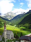
Parish church of St. Anna with cemetery ID: 16903 |
46 ° 55 ′ 33 "N, 11 ° 58 ′ 41" E |
May 12, 1986 (BLR-LAB 2367) |
church |
KG: Ahornach building plot: 73
|
|
Parish church St. Wolfgang with chapel and cemetery in Rein ID: 16927 |
46 ° 56 '52 "N, 12 ° 3' 42" E |
May 12, 1986 (BLR-LAB 2367) |
church |
KG: Purely building plot: 135, 30 basic plot: 158/2
|

|
Pfarrwidum ID: 16904 |
46 ° 55 ′ 33 "N, 11 ° 58 ′ 39" E |
May 12, 1986 (BLR-LAB 2367) |
Widum / Canon House |
KG: Ahornach building plot: 85
|
| Rainer (basin) ID: 16921 |
46 ° 54 ′ 6 ″ N, 11 ° 56 ′ 31 ″ E |
May 12, 1986 (BLR-LAB 2367) |
Rural house / farm |
KG: Mühlen building plot: 91
|
|
| Scrap angle ID: 16936 |
46 ° 55 ′ 6 ″ N, 11 ° 57 ′ 3 ″ E |
May 9, 1950 (MD) |
Rural residence / farm |
KG: Sand in Taufers building plot: 21/1
|
|
| St. Katharina and Florian ID: 16916 |
46 ° 54 ′ 0 ″ N, 11 ° 56 ′ 28 ″ E |
May 12, 1986 (BLR-LAB 2367) |
church |
KG: Mühlen building plot: 28
|
|

|
St. Mauritius with church square ID: 16938 |
46 ° 55 ′ 12 ″ N, 11 ° 57 ′ 24 ″ E |
May 12, 1986 (BLR-LAB 2367) |
church |
KG: Sand in Taufers building plot: 116 basic plot: 238
|

|
St. Nicholas with cemetery ID: 16913 |
46 ° 54 ′ 9 ″ N, 11 ° 57 ′ 28 ″ E |
May 12, 1986 (BLR-LAB 2367) |
church |
KG: Kematen building plot: 1
|

|
St. Walburg ID: 16915 |
46 ° 53 ′ 28 "N, 11 ° 57 ′ 38" E |
Nov 11, 1950 (MD) |
church |
KG: Kematen building plot: 71
|

|
St. Johannes Nepomuk Chapel with enclosure in Bad Winkel ID: 16940 |
46 ° 54 ′ 33 "N, 11 ° 58 ′ 0" E |
May 12, 1986 (BLR-LAB 2367) |
Chapel built in 1731 by Candidus von Zeiller. |
KG: Sand in Taufers building plot: 157 basic plot: 344
|
| Stone house (Kröll) ID: 50610 |
46 ° 53 ′ 57 "N, 11 ° 56 ′ 42" E |
20 Mar 2018 (BLR-LAB 254) |
Former forge, built in the 1920s |
KG: Mühlen building plot: 117, 118
|
|

|
Stockmair ID: 16914 |
46 ° 54 ′ 7 "N, 11 ° 57 ′ 28" E |
May 12, 1986 (BLR-LAB 2367) |
Rural house / farm |
KG: Kematen building plot: 17/1
|

|
Taufers ID: 16909 |
46 ° 55 '24 "N, 11 ° 56' 55" E |
Nov 11, 1950 (MD) |
Castle |
KG: Ahornach building plot: 151
|
|
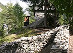
Toblburg (am Kofel) ID: 16912 |
46 ° 55 ′ 5 ″ N, 11 ° 59 ′ 23 ″ E |
July 24, 1989 (BLR-LAB 4541) |
Castle ruins |
KG: Ahornach basic parcel: 436/2
|
| Untergasteiger with mill and grain box ID: 16907 |
46 ° 55 ′ 48 ″ N, 11 ° 59 ′ 21 ″ E |
May 12, 1986 (BLR-LAB 2367) |
Rural house / farm |
KG: Ahornach building plot: 109
|
|
| Unterkohlgruber ID: 16917 |
46 ° 54 ′ 0 ″ N, 11 ° 56 ′ 26 ″ E |
May 12, 1986 (BLR-LAB 2367) |
Inn |
KG: Mühlen building plot: 443, 52
|
|
| Villa Frenes with garden and wayside shrine ID: 50448 |
46 ° 55 ′ 8 ″ N, 11 ° 57 ′ 9 ″ E |
May 22, 2006 (BLR-LAB 1767) |
Villa / summer cottage |
KG: Sand in Taufers building plot: 56 basic plot: 96
|
|
| Tenth ID: 16919 |
46 ° 54 ′ 2 ″ N, 11 ° 56 ′ 26 ″ E |
May 12, 1986 (BLR-LAB 2367) |
Rural house / farm |
KG: Mühlen building plot: 75/1
|
|
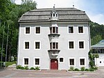
|
Zeilheim ID: 16937 |
Rathausstrasse 8 46 ° 55 ′ 11 ″ N, 11 ° 57 ′ 8 ″ E |
May 9, 1950 (MD) |
Residence built in the 17th century. |
KG: Sand in Taufers building plot: 48/1, 48/2 |
If no coordinates are known for a monument, the cadastral data at the time it was placed under protection are given as a substitute. These are neither official nor necessarily up-to-date.
The addresses taken from the State Monuments Office may be out of date.
| Photo: | Photograph of the monument. Click the photo generates an enlarged view. There are also two symbols: |
| ID | Identifier at the South Tyrolean Monuments Office |
| KG | Cadastral parish |
| MD | Ministerial Decree |
| BLR-LAB | Decision of the state government - state committee decision |
Web links
- Monument browser of the South Tyrolean Monuments Office
Individual evidence
- ^ Magdalena Hörmann-Weingartner: Kofel . In: Magdalena Hörmann-Weingartner (ed.), Tiroler Burgenbuch. IX. Volume: Val Pusteria . Athesia Publishing House, Bozen 2003, ISBN 978-88-8266-163-2 , pp. 317–322.