List of architectural monuments in Chienes
The list of architectural monuments in Kiens ( Italian : Chienes ) contains the 37 objects designated as architectural monuments in the area of the municipality of Kiens in South Tyrol .
The basis is the official directory of the monuments in South Tyrol, which can be viewed on the Internet. These can be, for example, sacred buildings , residential houses, farms and aristocratic residences. The order in this list is based on the designation, alternatively it can also be sorted according to the address or the date on which it was placed under protection.
list
| photo | designation | Location | registration | description | Metadata |
|---|---|---|---|---|---|

|
Bäckenhäusl ID: 15352 |
46 ° 48 ′ 22 "N, 11 ° 50 ′ 7" E |
April 22, 1987 (BLR-LAB 1993) |
Rural house / farm |
KG: Kiens building plot: 74
|

|
Ehrenburg station ID: 50092 |
46 ° 47 ′ 50 "N, 11 ° 50 ′ 40" E |
April 5, 2004 (BLR-LAB 1083) |
Train station / Remise |
KG: Ehrenburg building plot: 61, 62
|
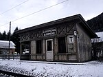
| Bahnwärterhaus ID: 50609 |
46 ° 47 ′ 55 "N, 11 ° 50 ′ 34" E |
Feb. 16, 2018 (BLR-LAB 147) |
Railway keeper's house in Ehrenburg with a saddle roof and facades made of hewn granite stone blocks, from the time the Pustertal Railway was built |
KG: Ehrenburg building plot: 64
|
|
|
Sankt Sigmund train station ID: 50402 |
46 ° 48 '35 "N, 11 ° 47' 50" E |
April 5, 2004 (BLR-LAB 1083) |
Train station / Remise |
KG: Sankt Sigmund building plot: 91
|

|
Image stock ID: 15340 |
46 ° 47 ′ 50 "N, 11 ° 50 ′ 10" E |
April 22, 1987 (BLR-LAB 1993) |
Wayside shrine |
KG: Ehrenburg basic parcel: 7/1
|
|
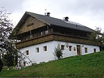
Fire with chapel in Kienberg ID: 15338 |
46 ° 47 ′ 10 "N, 11 ° 51 ′ 9" E |
April 22, 1987 (BLR-LAB 1993) |
Rural house / farm |
KG: Ehrenburg building plot: 55
|
| Brunner ID: 15361 |
46 ° 48 ′ 42 "N, 11 ° 48 ′ 19" E |
April 22, 1987 (BLR-LAB 1993) |
Rural house / farm |
KG: Sankt Sigmund building plot: 36
|
|
|
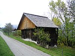
Ebner-Zuhäusl am Getzenberg ID: 15337 |
46 ° 47 ′ 27 "N, 11 ° 49 ′ 38" E |
April 22, 1987 (BLR-LAB 1993) |
Rural house / farm |
KG: Ehrenburg building plot: 47
|

|
Ehrenburg ID: 15331 |
46 ° 47 ′ 48 "N, 11 ° 50 ′ 10" E |
May 8, 1950 (MD) |
Castle |
KG: Ehrenburg building plot: 1
|

|
Hermitage near Getzenberger ID: 15341 |
46 ° 48 ′ 2 "N, 11 ° 49 ′ 22" E |
April 22, 1987 (BLR-LAB 1993) |
chapel |
KG: Getzenberg building plot: 12/2
|
| Gasthof Burger ID: 15334 |
46 ° 47 ′ 54 "N, 11 ° 50 ′ 4" E |
17 Sep 1984 (BLR-LAB 4791) |
Inn |
KG: Ehrenburg building plot: 6/1
|
|

|
Court House ID: 15351 |
46 ° 48 ′ 28 "N, 11 ° 50 ′ 16" E |
April 22, 1987 (BLR-LAB 1993) |
Rural house / farm |
KG: Kiens building plot: 41/1
|
| Grünbacher ID: 15347 |
46 ° 48 ′ 33 "N, 11 ° 50 ′ 28" E |
April 22, 1987 (BLR-LAB 1993) |
Rural house / farm |
KG: Kiens building plot: 11
|
|

|
Hanslmoar and Stöckl in Gruben ID: 15357 |
46 ° 48 ′ 49 "N, 11 ° 47 ′ 54" E |
April 22, 1987 (BLR-LAB 1993) |
Rural house / farm |
KG: Sankt Sigmund building plot: 4, 5
|

|
Hinteregger ID: 15350 |
46 ° 48 ′ 28 "N, 11 ° 50 ′ 17" E |
April 22, 1987 (BLR-LAB 1993) |
Rural house / farm |
KG: Kiens building plot: 40/1
|

|
Kahler ID: 15362 |
46 ° 48 ′ 44 "N, 11 ° 48 ′ 47" E |
April 22, 1987 (BLR-LAB 1993) |
Rural house / farm |
KG: Sankt Sigmund building plot: 42/1
|

|
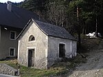
Chapel at Briggler ID: 15344 |
46 ° 49 ′ 41 "N, 11 ° 49 ′ 42" E |
April 22, 1987 (BLR-LAB 1993) |
chapel |
KG: Hofern building plot: 36
|
|
Chapel at Gerstl ID: 15354 |
46 ° 48 ′ 28 "N, 11 ° 49 ′ 54" E |
April 22, 1987 (BLR-LAB 1993) |
chapel |
KG: Kiens basic parcel: 82
|

|
Chapel at Kaltenhauser ID: 15353 |
46 ° 48 ′ 21 "N, 11 ° 50 ′ 11" E |
Dec 14, 1950 (MD) |
chapel |
KG: Kiens building plot: 89
|

|
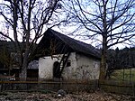
Chapel at Rastbichler ID: 15363 |
46 ° 48 ′ 30 "N, 11 ° 48 ′ 37" E |
July 24, 1950 (MD) |
chapel |
KG: Sankt Sigmund building plot: 47/1, 47/2
|
|
Granary at the Hittaler ID: 15342 |
46 ° 48'53 "N, 11 ° 49'39" E |
April 22, 1987 (BLR-LAB 1993) |
Grain box |
KG: Hofern building plot: 3
|

|
Granary at Huber am Getzenberg ID: 15336 |
46 ° 47 ′ 36 "N, 11 ° 49 ′ 51" E |
April 22, 1987 (BLR-LAB 1993) |
Grain box |
KG: Ehrenburg building plot: 42/1
|
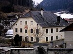
| Loacher ID: 15355 |
46 ° 48 ′ 43 "N, 11 ° 47 ′ 32" E |
April 22, 1987 (BLR-LAB 1993) |
Rural house / farm |
KG: Sankt Sigmund building plot: 1
|
|
|
Mair ID: 15335 |
46 ° 47 ′ 44 "N, 11 ° 50 ′ 10" E |
April 22, 1987 (BLR-LAB 1993) |
Rural house / farm |
KG: Ehrenburg building plot: 36
|

|
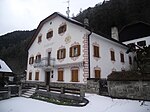
Mill in Oberdorf ID: 15346 |
46 ° 48 ′ 34 "N, 11 ° 50 ′ 25" E |
April 22, 1987 (BLR-LAB 1993) |
Mill |
KG: Kiens building plot: 10
|
|
Neuhaus with oven ID: 15358 |
46 ° 48 ′ 52 "N, 11 ° 48 ′ 19" E |
April 22, 1987 (BLR-LAB 1993) |
Rural house / farm |
KG: Sankt Sigmund building plot: 17/1, 17/2
|
| Neumair ID: 50098 |
46 ° 47 ′ 45 "N, 11 ° 50 ′ 11" E |
28 Sep 1992 (BLR-LAB 5742) |
Urban residential building |
KG: Ehrenburg building plot: 26/2
|
|
|
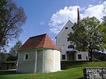
Parish Church of the Assumption of Mary with Magdalene Chapel and Cemetery ID: 15333 |
46 ° 47 ′ 52 "N, 11 ° 50 ′ 10" E |
April 22, 1987 (BLR-LAB 1993) |
church |
KG: Ehrenburg building parcel: 175, 3/1, 3/2 basic parcel: 7/2, 7/3
|

|
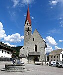
Parish church of St. Peter and Paul with cemetery chapel and cemetery ID: 15345 |
46 ° 48 ′ 33 "N, 11 ° 50 ′ 34" E |
April 22, 1987 (BLR-LAB 1993) |
church |
KG: Kiens building plot: 1 basic plot: 1
|
|
Parish church of St. Sigmund with cemetery ID: 15359 |
46 ° 48 ′ 51 ″ N, 11 ° 48 ′ 15 ″ E |
April 22, 1987 (BLR-LAB 1993) |
church |
KG: Sankt Sigmund building parcel: 22 basic parcel: 183
|

|
Parish Deed ID: 15332 |
46 ° 47 ′ 51 ″ N, 11 ° 50 ′ 12 ″ E |
April 22, 1987 (BLR-LAB 1993) |
Widum / Canon House |
KG: Ehrenburg building plot: 2
|

|
Pfarrwidum ID: 15349 |
46 ° 48 ′ 32 "N, 11 ° 50 ′ 30" E |
April 22, 1987 (BLR-LAB 1993) |
Widum / Canon House |
KG: Kiens building plot: 24/1
|

|
Pfleghaus ID: 15348 |
46 ° 48 ′ 33 "N, 11 ° 50 ′ 29" E |
April 22, 1987 (BLR-LAB 1993) |
Rural house / farm |
KG: Kiens building plot: 23/1
|

|
Pitterle ID: 15360 |
46 ° 48 ′ 44 "N, 11 ° 48 ′ 13" E |
April 22, 1987 (BLR-LAB 1993) |
Rural house / farm |
KG: Sankt Sigmund building plot: 34
|

|
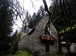
St. Martin ID: 15343 |
46 ° 49 ′ 14 "N, 11 ° 49 ′ 55" E |
April 22, 1987 (BLR-LAB 1993) |
church |
KG: Hofern building plot: 24
|
|
Ortisei in Ilstern ID: 15364 |
46 ° 48 ′ 25 ″ N, 11 ° 48 ′ 1 ″ E |
April 22, 1987 (BLR-LAB 1993) |
church |
KG: Sankt Sigmund building plot: 73
|

|
Our Lady in Stöckl ID: 15356 |
46 ° 48 ′ 44 "N, 11 ° 47 ′ 42" E |
April 22, 1987 (BLR-LAB 1993) |
church |
KG: Sankt Sigmund building plot: 2 |
If no coordinates are known for a monument, the cadastral data at the time it was placed under protection are given as a substitute. These are neither official nor necessarily up-to-date.
The addresses taken from the State Monuments Office may be out of date.
| Photo: | Photograph of the monument. Click the photo generates an enlarged view. There are also two symbols: |
| ID | Identifier at the South Tyrolean Monuments Office |
| KG | Cadastral parish |
| MD | Ministerial Decree |
| BLR-LAB | Decision of the state government - state committee decision |
Web links
- Monument browser of the South Tyrolean Monuments Office