List of architectural monuments in Eppan
The list of architectural monuments in Appiano ( Appiano in Italian ) contains the 214 objects identified as architectural monuments in the area of the municipality of Appiano in South Tyrol .
The basis is the official directory of the monuments in South Tyrol, which can be viewed on the Internet. These can be, for example, sacred buildings , residential houses, farms and aristocratic residences. The order in this list is based on the designation, alternatively it can also be sorted according to the address or the date on which it was placed under protection.
list
| photo | designation | Location | registration | description | Metadata |
|---|---|---|---|---|---|

|
Aichberg ID: 14653 |
Bergweg 31 46 ° 27 ′ 36 ″ N, 11 ° 15 ′ 10 ″ E |
22 Mar 1951 (MD) |
17th century residence. 19th century chapel with late 19th century paintings by J. Hintner. |
KG: Eppan building plot : 188 basic plot: 1441/5
|

|
Old pharmacy ID: 14579 |
Josef-Innerhofer-Strasse 35 46 ° 27 ′ 15 ″ N, 11 ° 15 ′ 34 ″ E |
May 18, 1951 (MD) |
Three-storey urban residential building with a half-hip roof. Oculi openings on the gable . Corner bay window with sundial, the year 1692. |
KG: Eppan building plot: 14
|
|
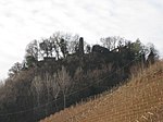
Altenburg ID: 14765 |
46 ° 28 ′ 10 ″ N, 11 ° 16 ′ 5 ″ E |
May 18, 1951 (MD) |
Remains of a high medieval castle complex. Tower converted into a residential building. Presumably remnants of the original Eppan castle. |
KG: Eppan building plot: 736
|

|
Altenburg with mill ID: 14617 |
Maderneidstrasse 19 46 ° 27 ′ 42 ″ N, 11 ° 15 ′ 37 ″ E |
July 25, 1977 (BLR-LAB 4984) |
The residence consists of two houses that are connected by a central wing. Functional masonry water mill. |
KG: Eppan building plot: 117, 118
|

|
Old shooting range ID: 14594 |
46 ° 27 '22 "N, 11 ° 15' 23" E |
July 25, 1977 (BLR-LAB 4984) |
Two-storey building. On its west side a shooting range with a profiled wooden ceiling, end of the 19th century. Keilstein with the year 1670. |
KG: Eppan building plot: 62
|

|
Alter Widum in St. Michael ID: 14601 |
46 ° 27 '24 "N, 11 ° 15' 28" E |
July 25, 1977 (BLR-LAB 4984) |
Widum / Canon House. The building consists of two wings, of which the eastern part has an older structure. |
KG: Eppan building plot: 83
|

|
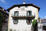
Old customs house in St. Pauls ID: 14686 |
Paulser Strasse 12-14 46 ° 28 ′ 17 ″ N, 11 ° 15 ′ 38 ″ E |
July 25, 1977 (BLR-LAB 4984) |
Urban residential building, eaves-standing building with a late Gothic core. Arched front door with beveled stone framing, next to it shop opening with stone bench. Until 1726 in the function of a princely customs post. |
KG: Eppan building plot: 268
|
|
Angerburg ID: 14582 |
Unteralberweg 16 46 ° 27 ′ 11 ″ N, 11 ° 15 ′ 40 ″ E |
July 25, 1977 (BLR-LAB 4984) |
Three-storey residence. Coat of arms painting on the west side. |
KG: Eppan building plot: 20/2
|
| On plate 12 ID: 14658 |
On the plates 12 46 ° 27 '31 "N, 11 ° 14' 51" O |
Jan 17, 1951 (MD) |
Rural house / farm, medieval courtyard |
KG: Eppan building plot: 204
|
|
| Bad Turmbach ID: 14660 |
46 ° 27 ′ 38 "N, 11 ° 14 ′ 55" E |
July 25, 1977 (BLR-LAB 4981) |
Rural house / farm. The building dates from the 17th century. In the west a mill with vaulted rooms was added. |
KG: Eppan building plot: 207/1
|
|

|
Badlweg 1-3 ID: 14642 |
Badlweg 1-3 46 ° 27 ′ 0 ″ N, 11 ° 15 ′ 18 ″ E |
July 25, 1977 (BLR-LAB 4984) |
Urban residential building. Regular renaissance building with corner bay and ocular openings. Wedge stone with pipe ornament and the year 1645. |
KG: Eppan building plot: 160/2
|

|
Bahnhofstrasse 2-4 ID: 14590 |
Bahnhofstrasse 2-4 46 ° 27 ′ 18 ″ N, 11 ° 15 ′ 34 ″ E |
July 25, 1977 (BLR-LAB 4984) |
Urban residential building. Three-storey renaissance building with double arches and rectangular windows in a stone frame. Courtyard wall with (later widened) rustication and the year 1639. |
KG: Eppan building plot : 47 basic plot: 110/1
|
|
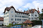
Bahnhofstrasse 7-8 ID: 14764 |
Bahnhofstrasse 7-8 46 ° 27 ′ 11 ″ N, 11 ° 16 ′ 3 ″ E |
December 4, 1989 (BLR-LAB 7817) |
Former "Hocheppan" grand hotel, built in 1890 in the form of late historicism . |
KG: Eppan building plot: 2672, 682/1, 682/2
|

|
Bahnhofstrasse 30 ID: 14587 |
Bahnhofstrasse 30 46 ° 27 ′ 17 ″ N, 11 ° 15 ′ 43 ″ E |
July 25, 1977 (BLR-LAB 4984) |
Three-story urban residential building with an open gable. On the facade there are remains of late medieval frescoes (checkerboard pattern with two heads). Shoulder arch door with the year 1524. Continuous central hall, partly with clay slab floor. |
KG: Eppan building plot: 34
|

|
Bahnhofstrasse 37-39 ID: 14588 |
Bahnhofstrasse 37-39 46 ° 27 ′ 18 ″ N, 11 ° 15 ′ 42 ″ E |
May 18, 1951 (MD) |
Three-storey former residence with a symmetrically designed double arch and coupled rectangular window. Corner turrets on the garden side. |
KG: Eppan building plot: 40
|

|
Bahnhofstrasse 44-46 ID: 14585 |
Bahnhofstrasse 44-46 46 ° 27 ′ 16 ″ N, 11 ° 15 ′ 48 ″ E |
July 25, 1977 (BLR-LAB 4984) |
Two-storey urban residential building with an open gable. Stone-framed rectangular windows, three-sided bay annex. Rusticator with coat of arms stone and arched passage. |
KG: Eppan building plot: 26/1, 26/2
|

|
Bahnhofstrasse 65-67 ID: 14586 |
Bahnhofstrasse 65-67 46 ° 27 ′ 17 ″ N, 11 ° 15 ′ 49 ″ E |
July 25, 1977 (BLR-LAB 4984) |
Elongated urban residential building with stone-framed rectangular windows, ocular openings in the attic. Stone-framed shoulder arch gate with the year 1524. |
KG: Eppan building plot: 29/1, 29/2, 29/3
|

|
Bastreinbach ID: 14574 |
St.-Anna-Weg 18 46 ° 27 ′ 12 ″ N, 11 ° 15 ′ 30 ″ E |
May 18, 1951 (MD) |
Unplastered hide with hipped roof. Original window reveals partially preserved. To the south, double arched window with rosette decoration. |
KG: Eppan building plot: 6
|

|
Benefit house in St. Justina ID: 14711 |
46 ° 28 '18 "N, 11 ° 15' 4" E |
July 25, 1977 (BLR-LAB 4984) |
Rural house / farm from the 17th century. |
KG: Eppan building plot: 315
|
|
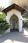
Wayside shrine on the road to Unterrain ID: 14776 |
46 ° 28 ′ 40 "N, 11 ° 15 ′ 32" E |
Apr. 17, 1978 (BLR-LAB 2526) |
Gothic chapel shrine with inscription and the year 1489. |
KG: Eppan base parcel: 6637/1
|

|
Wayside shrine in St. Michael ID: 14766 |
Bahnhofstrasse 46 ° 27 ′ 16 ″ N, 11 ° 15 ′ 54 ″ E |
Apr. 17, 1978 (BLR-LAB 2526) |
17th century wayside shrine. Brick shaft with four round arch niches and remains of frescoes. |
KG: Eppan basic parcel: 158
|

|
Wayside shrine in St. Pauls ID: 14774 |
46 ° 28 ′ 15 "N, 11 ° 15 ′ 41" E |
Feb 26, 1952 (MD) |
Wayside shrine with inscription on the base and the year 1627. Top with arched niches and reliefs. |
KG: Eppan base parcel: 6608/1
|

|
Boymont ID: 14771 |
46 ° 29 ′ 1 ″ N, 11 ° 14 ′ 44 ″ E |
May 18, 1951 (MD) |
Castle ruins, regular castle complex in Romanesque style, built in the first half of the 13th century. |
KG: Eppan base parcel: 3471
|

|
Breitenberg in Girlan ID: 14740 |
46 ° 27 ′ 47 "N, 11 ° 16 ′ 51" E |
Jan 17, 1951 (MD) |
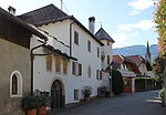
17th century residence. At the manor house open staircase with loggia and double arched window. The former farm building was expanded. |
KG: Eppan building plot: 449/1, 449/2
|
|
Carneri (Stainhof) in Frangart ID: 14730 |
46 ° 28 ′ 40 "N, 11 ° 17 ′ 55" E |
July 25, 1977 (BLR-LAB 4984) |
Rural house / farm, rusticator in the courtyard wall, above pinnacles with three frescoed niches. |
KG: Eppan building plot: 384
|

|
Dominican Church of St. Joseph with Monastery ID: 14762 |
46 ° 27 '18 "N, 11 ° 15' 39" E |
July 25, 1977 (BLR-LAB 4984) |
The church is a three-aisled romanizing structure and was designed by A. von Geppert and built from 1883 to 1886. The Dominican monastery dates from the 17th century. |
KG: Eppan building plot: 39, 630
|
| Egger ID: 14650 |
46 ° 27 ′ 21 ″ N, 11 ° 14 ′ 14 ″ E |
July 25, 1977 (BLR-LAB 4984) |
Rural house / farm from the 17th century |
KG: Eppan building plot: 183/1, 183/2, 183/3
|
|

|
Former Capuchin Church of the Visitation of the Virgin Mary with monastery ID: 14593 |
46 ° 27 ′ 19 ″ N, 11 ° 15 ′ 27 ″ E |
July 25, 1977 (BLR-LAB 4984) |
Church built around 1640. It was extended to the east in 1973/74 according to plans by K. Rifesser. |
KG: Eppan building plot: 60, 61
|

|
Former station building ID: 50623 |
46 ° 27 ′ 11 ″ N, 11 ° 16 ′ 7 ″ E |
May 12, 2020 (BLR-LAB 324) |
old train station of the Überetscher Bahn |
KG: Eppan building plot: 662
|
| Ice cellar ID: 14644 |
46 ° 26 ′ 59 "N, 11 ° 14 ′ 58" E |
May 18, 1951 (MD) |
Small rural house / farm built from porphyry stones. Natural cellar in the Gand landslide area. |
KG: Eppan building plot: 165/1, 165/2, 165/3
|
|

|
Engelmair in Girlan ID: 14731 |
46 ° 27 ′ 52 "N, 11 ° 16 ′ 53" E |
July 25, 1977 (BLR-LAB 4984) |
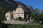
The rural house / farm is a medieval homestead and is surrounded by a wall. |
KG: Eppan building plot: 386/1, 386/2
|
|
Englar with Sebastian Chapel ID: 14645 |
46 ° 27 ′ 3 ″ N, 11 ° 15 ′ 2 ″ E |
Jan 17, 1951 (MD) |
The residence is a late Gothic building with an unusually high, hipped roof. The Sebastianskapelle located just north of 46 ° 27 '6.7 " N , 11 ° 15' 2" O . |
KG: Eppan building plot: 166/1, 166/2, 166/3, 167
|

|
Eppanerhof ID: 14609 |
J.-G.-Plazer-Strasse 50 46 ° 27 ′ 26 ″ N, 11 ° 15 ′ 33 ″ E |
May 18, 1951 (MD) |
Residence and inn. Former residence Hammersbach. |
KG: Eppan building plot: 99
|

|
Festenstein ID: 14768 |
46 ° 30 '43 "N, 11 ° 13' 8" E |
July 25, 1977 (BLR-LAB 4984) |
Castle ruins. Castle complex in a difficult to access and exposed location, first mentioned at the beginning of the 13th century. |
KG: Eppan basic parcel: 1809
|
|
Firmalein in Missian ID: 14724 |
46 ° 28 ′ 49 "N, 11 ° 14 ′ 52" E |
May 18, 1951 (MD) |
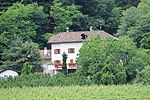
The rural house / farm is a medieval courtyard. It was rebuilt and increased in 1912. |
KG: Eppan building plot: 361/1, 361/2
|
|
Franzinhof ID: 14700 |
Unterrainer Strasse 10-12 46 ° 28 ′ 23 ″ N, 11 ° 15 ′ 41 ″ E |
July 6, 1951 (MD) |
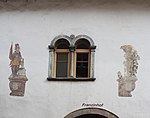
Two-storey urban residential building with double arched windows, bay windows and arched door. Wall painting (St. Florian, Sebastian, coat of arms of the Lords of Franzin), 17th century. |
KG: Eppan building plot: 292
|

|
Freudenstein with St. Andreas Chapel ID: 14666 |
46 ° 27 '47 "N, 11 ° 14' 50" E |
22 Mar 1951 (MD) |
Castle complex from the 13th century, was expanded and rebuilt in the 16th and 17th centuries. The St. Andrew's Chapel was built in 1519 and consecrated in 1532. |
KG: Eppan building plot: 230/1, 230/2, 231, 232
|
|
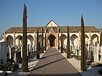
Cemetery chapel in Girlan ID: 14760 |
46 ° 27 ′ 49 ″ N, 11 ° 16 ′ 36 ″ E |
July 25, 1977 (BLR-LAB 4984) |
The chapel is a Gothic building and was built in 1877. |
KG: Eppan building plot: 605/1
|
| Frischhof in Schreckbichl ID: 14744 |
46 ° 27 ′ 28 "N, 11 ° 17 ′ 40" E |
Jan 17, 1951 (MD) |
Rural house / farm with two residential buildings, courtyard wall with arched gate. The younger building dates from 1893. |
KG: Eppan building plot: 481/1, 481/2
|
|
| Fuchsberg ID: 14770 |
46 ° 28 '51 "N, 11 ° 15' 38" E |
July 25, 1977 (BLR-LAB 4984) |
Castle ruins of the presumed ancestral seat of the Lords von Fuchs. |
KG: Eppan base parcel: 2906
|
|

|
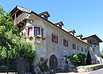
Gandegg with Maria-Schnee-Chapel and Park ID: 14643 |
46 ° 26 ′ 59 "N, 11 ° 15 ′ 11" E |
July 25, 1977 (BLR-LAB 4984) |
The residence of Blasius Khuen was rebuilt around the middle of the 16th century, with an older tower being used. Chapel: A previous building was expanded at the end of the 17th century. |
KG: Eppan building plot: 163, 164/1 Basic plot : 1169/1, 1172
|
|
Garber ID: 14626 |
46 ° 26 ′ 41 ″ N, 11 ° 15 ′ 42 ″ E |
July 25, 1977 (BLR-LAB 4984) |
Building with a residential character. Stone-framed rectangular windows, polygonal corner bay windows with frescoes and inscriptions. |
KG: Eppan building plot: 135/1, 135/2, 135/3
|

|
Gasshuber in St. Pauls ID: 14710 |
St.-Justina-Weg 20 46 ° 28 ′ 21 ″ N, 11 ° 15 ′ 34 ″ E |
July 25, 1977 (BLR-LAB 4984) |
Typical Überetscher wine farm with a crooked hip roof. Windows in deep soffits, some with bars. There is a coat of arms with the year 1600 on the Keilstein. |
KG: Eppan building plot: 314
|

|
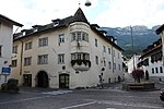
Gasthof Goldene Traube ID: 14591 |
46 ° 27 ′ 18 "N, 11 ° 15 ′ 32" E |
July 25, 1977 (BLR-LAB 4984) |
Two-storey former inn (today's bank building) with stone-framed rectangular windows. Rustic door to the street, next to it a large arched door with rosettes and arrows. |
KG: Eppan building plot: 49
|
|
Gasthof Schwarzer Adler in St. Pauls ID: 14690 |
46 ° 28 ′ 20 "N, 11 ° 15 ′ 40" E |
July 25, 1977 (BLR-LAB 4984) |
Three-storey building with an inn. Polygonal bay window with turret end. |
KG: Eppan building plot: 277/1, 3270
|

|
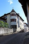
Gasthof Sonne ID: 14592 |
46 ° 27 ′ 19 ″ N, 11 ° 15 ′ 31 ″ E |
27 Mar 1995 (BLR-LAB 1480) |
Guest house with two facade cores, double arched windows and a vaulted central hall on the first floor. |
KG: Eppan building plot: 56/1, 56/7
|
|
Gasthof Weißes Rößl in Girlan ID: 14732 |
46 ° 27 ′ 48 "N, 11 ° 16 ′ 55" E |
July 25, 1977 (BLR-LAB 4984) |
Guest house with stone-framed windows, brick yard gate with the year 1658. On the first floor there is a hall with double arched windows. |
KG: Eppan building plot: 393
|

|
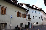
Gasthof Weißes Rößl in St. Michael ID: 14602 |
J.-G.-Plazer-Strasse 13-15 46 ° 27 ′ 24 ″ N, 11 ° 15 ′ 32 ″ E |
July 25, 1977 (BLR-LAB 4984) |
Three-storey town house with an inn and the year 1672 on the Keilstein. Polygonal corner bay with turret end. |
KG: Eppan building plot: 86
|
|
Gasthof zum Guten Drops in St. Pauls ID: 14689 |
46 ° 28 '19 "N, 11 ° 15' 38" E |
July 25, 1977 (BLR-LAB 4984) |
17th century inn. |
KG: Eppan building plot: 275
|

|
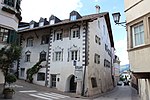
Gleifheim with chapel ID: 14632 |
St.-Anna-Weg 32 46 ° 27 ′ 6 ″ N, 11 ° 15 ′ 19 ″ E |
May 18, 1951 (MD) |
The residence is a Renaissance building from the 17th century. Chapel of St. John the Baptist: Simple construction from the first half of the 17th century. |
KG: Eppan building plot: 144, 145
|
|
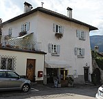
Goldgasse 2-4 ID: 14611 |
46 ° 27 '24 "N, 11 ° 15' 32" E |
July 25, 1977 (BLR-LAB 4984) |
The town house is a late Gothic building and was changed in the 17th century. |
KG: Eppan building plot: 102
|
|
Greifenburg in Girlan ID: 14741 |
46 ° 27 '45 "N, 11 ° 16' 52" E |
July 25, 1977 (BLR-LAB 4984) |
Simple hide on a regular floor plan. |
KG: Eppan building plot: 453/2
|

|
Gruonsberg ID: 14773 |
46 ° 27 ′ 58 ″ N, 11 ° 16 ′ 18 ″ E |
Apr. 17, 1978 (BLR-LAB 2526) |
Sparse wall remains of Gruonsberg Castle (Grumsberg, Greinsberg), which was first mentioned at the end of the 12th century. |
KG: Eppan building plot: 4647/1
|

|
Grustdorf ID: 14584 |
Unteralberweg 4 46 ° 27 ′ 16 ″ N, 11 ° 15 ′ 44 ″ E |
22 Mar 1951 (MD) |
Residence with arched courtyard gate and rectangular door with heraldic cartouche from the 16th / 17th century. Century. Late Gothic wooden ceiling with beveled beams and three beams on the ground floor. On the second floor there is a room with renaissance paneling. |
KG: Eppan building plot: 24
|

|
Hasenegg in Unterrain ID: 14715 |
46 ° 29 ′ 25 ″ N, 11 ° 15 ′ 29 ″ E |
Jan 17, 1951 (MD) |
Rural house / farm, medieval farm. |
KG: Eppan building plot: 327
|

|
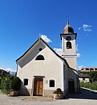
Hebenstreit (Wiesenegg) ID: 14634 |
Pigeno 20 46 ° 27 ′ 4 ″ N, 11 ° 15 ′ 16 ″ E |
July 25, 1977 (BLR-LAB 4984) |
Seat with a crooked hip roof and barred windows. Rustikator in the courtyard wall, above three square pinnacles with niches. The year 1669 is renewed on the fireplace. On the first floor there is an arched corridor. On the second floor beamed ceiling with profiled mirrors from the 16th century. |
KG: Eppan building plot: 149
|
|
Holy Cross in Schreckbichl ID: 14745 |
46 ° 27 ′ 27 "N, 11 ° 17 ′ 38" E |
July 25, 1977 (BLR-LAB 4984) |
Church, the simple structure was built in 1823. Rounded end of the choir and wall paintings by Albert Stolz . |
KG: Eppan building plot: 482
|
|
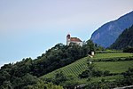
Holy Cross Church on the Gleif with nine Calvary chapels ID: 14652 |
46 ° 27 ′ 18 ″ N, 11 ° 15 ′ 7 ″ E |
July 25, 1977 (BLR-LAB 4984) |
The church and the seven simple chapels were built in 1716. Two chapel shrines from the 19th century. |
KG: Eppan building plot: 185, 186 basic plot: 6422/1, 6422/2
|
|
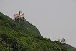
Hocheppan with St. Catherine's Chapel and Chalk Tower ID: 14759 |
46 ° 29 ′ 34 "N, 11 ° 14 ′ 32" E |
Jan 17, 1951 (MD) |
Extensive castle complex from the second half of the 12th century. Modifications in the 16th century. Chalk tower: The Vorwerk of Hocheppan was built in the 12th century. The chalk tower is located just north of the castle to 46 ° 29 '44.4 " N , 11 ° 14' 33.6" O . |
KG: Eppan building plot: 367, 599 basic plot: 3631, 3641/1, 3641/3, 3641/5, 3641/6
|
| Hueber in Missian ID: 14721 |
46 ° 29 ′ 3 ″ N, 11 ° 15 ′ 17 ″ E |
July 25, 1977 (BLR-LAB 4984) |
Farm where the house and the barn are connected by a courtyard arch. Stadel dates to 1696. |
KG: Eppan building plot: 344/1
|
|

|
Hungerhausen in Unterrain ID: 14718 |
46 ° 29 ′ 30 ″ N, 11 ° 15 ′ 32 ″ E |
July 6, 1951 (MD) |
Residence, two-storey building with open gable and hipped roof, 16th century. |
KG: Eppan building plot: 332
|

|
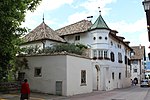
J.-G.-Plazer-Strasse 4-8 ID: 14605 |
J.-G.-Plazer-Strasse 4-8 46 ° 27 ′ 20 ″ N, 11 ° 15 ′ 32 ″ E |
July 25, 1977 (BLR-LAB 4984) |
Urban residential building, two-story construction. On the Keilstein the year and initials 1637 PF |
KG: Eppan building plot: 89/1
|
|
J.-G.-Plazer-Strasse 11 ID: 14603 |
J.-G.-Plazer-Strasse 11 46 ° 27 ′ 23 ″ N, 11 ° 15 ′ 32 ″ E |
May 18, 1951 (MD) |
Urban residential building, two-storey building with stone-framed rectangular windows. |
KG: Eppan building plot: 3105, 87
|

|
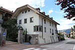
J.-G.-Plazer-Strasse 30-34 ID: 14607 |
J.-G.-Plazer-Strasse 30-34 46 ° 27 ′ 24 ″ N, 11 ° 15 ′ 33 ″ E |
July 25, 1977 (BLR-LAB 4984) |
Municipal house, coat of arms on the lintel and the year 1592. |
KG: Eppan building plot: 95
|
|
J.-G.-Plazer-Strasse 31 ID: 14610 |
J.-G.-Plazer-Strasse 31 46 ° 27 ′ 28 ″ N, 11 ° 15 ′ 33 ″ E |
July 25, 1977 (BLR-LAB 4984) |
Urban residential building, three-storey building with a crooked hip roof. |
KG: Eppan building plot: 100/1
|
|
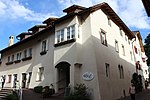
Josef-Innerhofer-Strasse 29-31 ID: 14578 |
Josef-Innerhofer-Strasse 29-31 46 ° 27 ′ 15 ″ N, 11 ° 15 ′ 35 ″ E |
July 25, 1977 (BLR-LAB 4984) |
Urban residential building. The current shape dates from the 17th century. Medieval exposed brickwork, on the first floor a stone-framed shoulder arch door. |
KG: Eppan building plot: 13/1
|
|
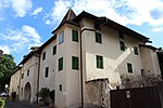
Josef-Innerhofer-Strasse 32-34 ID: 14577 |
Josef-Innerhofer-Strasse 32-34 46 ° 27 ′ 15 ″ N, 11 ° 15 ′ 33 ″ E |
July 25, 1977 (BLR-LAB 4984) |
Urban residential building from the 16th century with a protruding turret. |
KG: Eppan building plot: 12/2
|

|
Josef-Innerhofer-Strasse 44 ID: 50284 |
Josef-Innerhofer-Strasse 44 46 ° 27 ′ 14 ″ N, 11 ° 15 ′ 34 ″ E |
23 Aug 1994 (BLR-LAB 4494) |
Rural house / farm, large complex consisting of residential and farm buildings, 18th century. |
KG: Eppan building plot: 2837, 9 basic plot: 16
|

|
Kalterer Strasse 11 ID: 14581 |
Kalterer Strasse 11 46 ° 27 ′ 10 ″ N, 11 ° 15 ′ 38 ″ E |
22 Mar 1951 (MD) |
Rural house / farm, two-wing construction. Farm buildings converted for residential purposes, 18th century. |
KG: Eppan building plot: 19/1, 19/2
|
| Chapel at Hilberhof ID: 50620 |
46 ° 28 ′ 3 "N, 11 ° 14 ′ 35" E |
November 12, 2019 (BLR-LAB 952) |
chapel |
KG: Eppan basic parcel: 1614/2
|
|

|
Winery Lindner ID: 14614 |
46 ° 27 '43 "N, 11 ° 15' 23" E |
July 25, 1977 (BLR-LAB 4984) |
The older part of the former winery has a residence-like character and dates from the 17th century. |
KG: Eppan building plot: 111
|

|
Church of the Three Kings in Montiggl ID: 14747 |
46 ° 25 ′ 4 ″ N, 11 ° 16 ′ 38 ″ E |
July 25, 1977 (BLR-LAB 4984) |
Late Gothic church. Tower with pointed pyramid roof and stone-framed pointed arch door. Polygonal choir closure, star and net rib vaults, carved console stones. |
KG: Eppan building plot: 505
|

|
Köglburg ID: 14612 |
Krafussweg 8-10 46 ° 27 ′ 27 ″ N, 11 ° 15 ′ 29 ″ E |
22 Mar 1951 (MD) |
Ansitz, two-storey building with a hipped roof. |
KG: Eppan building plot: 107/2, 3492
|
| Kohlhof in Missian ID: 18095 |
46 ° 29 ′ 4 ″ N, 11 ° 15 ′ 15 ″ E |
Feb. 11, 1991 (BLR-LAB 534) |
Large rural house / farm. Basement rooms with barrel vaults on the ground floor. On the first floor the central hall with groined vaults and sandstone-framed rectangular doors. |
KG: Eppan building plot: 349/1
|
|

|
Basket ID: 14725 |
46 ° 28 ′ 56 "N, 11 ° 14 ′ 56" E |
Jan 17, 1951 (MD) |
Castle / palace, three-storey residential tower from the 13th century, expanded and rebuilt in 1835. |
KG: Eppan building plot: 362
|

|
Krafuss ID: 14613 |
Kafußweg 25 46 ° 27 ′ 38 ″ N, 11 ° 15 ′ 22 ″ E |
22 Mar 1951 (MD) |
Residence, regular Renaissance building. Round-arched courtyard gate with coat of arms and the year 1628. |
KG: Eppan building plot: 109
|
|
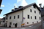
Krafussweg 7 ID: 14600 |
Krafussweg 7 46 ° 27 ′ 26 ″ N, 11 ° 15 ′ 29 ″ E |
July 25, 1977 (BLR-LAB 4984) |
Urban residential building with a crooked hip roof, polygonal bay annex and double arched windows. |
KG: Eppan building plot: 77
|

|
Kreit with St. Anton Abbot Chapel ID: 14624 |
46 ° 26 ′ 28 "N, 11 ° 15 ′ 57" E |
May 18, 1951 (MD) |
The residence was built in local Renaissance forms at the end of the 16th century. |
KG: Eppan building plot: 129, 130
|

|
Kreuzsteinweg 10 ID: 14677 |
Kreuzsteinweg 10 46 ° 28 ′ 6 ″ N, 11 ° 14 ′ 52 ″ E |
July 25, 1977 (BLR-LAB 4984) |
Rural house / farm, residential and farm buildings assembled. On the north facade of the residential building, the year 1548 with a handicraft mark and 1566 with the name Paul Muil. |
KG: Eppan building plot: 253
|

|
Way of the Cross ID: 14625 |
Sillweg 5 46 ° 26 ′ 40 ″ N, 11 ° 15 ′ 44 ″ E |
22 Mar 1951 (MD) |
Mansion, the medieval structure was changed in the 17th century. The farm building was expanded for residential purposes. |
KG: Eppan building plot: 134/1, 134/2, 2804
|

|
Kronhof ID: 14663 |
Kreuzsteinweg 18 46 ° 28 ′ 9 ″ N, 11 ° 14 ′ 47 ″ E |
July 6, 1951 (MD) |
Residence, three-storey building with corner bay window and small arched loggia. At its core a late medieval residential tower. |
KG: Eppan building plot: 221
|
|
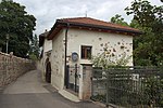
Kuensegg ID: 14629 |
46 ° 27 ′ 4 ″ N, 11 ° 15 ′ 21 ″ E |
May 18, 1951 (MD) |
Ansitz, an elongated building with battlements on both sides. The core is a late medieval building, rebuilt in the 17th century. |
KG: Eppan building plot: 141/1, 141/2, 141/3
|

|
Ladurner in Girlan ID: 14733 |
46 ° 27 ′ 48 ″ N, 11 ° 17 ′ 0 ″ E |
July 25, 1977 (BLR-LAB 4984) |
Rural house / farm, two-storey elongated building. |
KG: Eppan building plot: 397
|

|
Lanserhaus ID: 14606 |
J.-G.-Plazer-Strasse 24 46 ° 27 ′ 22 ″ N, 11 ° 15 ′ 32 ″ E |
May 18, 1951 (MD) |
Residence with hipped, late Gothic steep roof from the 16th century. In the core of the ministerial tower in Plag (around 1200) |
KG: Eppan building plot: 92
|

|
Liebenburg ID: 14633 |
Pigeno 22 46 ° 27 ′ 5 ″ N, 11 ° 15 ′ 15 ″ E |
22 Mar 1951 (MD) |
Ansitz, at the gate the year 1662. |
KG: Eppan building plot: 148/1, 148/2, 148/3, 2617
|

|
Liebenstein (Weißhaus) ID: 14742 |
Weißhausweg 4 46 ° 26 ′ 47 ″ N, 11 ° 16 ′ 35 ″ E |
22 Mar 1951 (MD) |
Manor, regular Renaissance building in balanced proportions built around 1600 by Christof von Lustrier from Innsbruck. Polygonal bay window on the northeast corner, double arched windows, stone-framed doors and windows. The southern part was added around 1700. In April 1977 the inner walls and roof of the north wing collapsed. |
KG: Eppan building plot: 465/1, 465/2
|

|
Lindenheim with park ID: 14636 |
Pigeno 7-9 46 ° 27 ′ 2 ″ N, 11 ° 15 ′ 17 ″ E |
22 Mar 1951 (MD) |
Residence, originally a simple building from the 17th century. The crenellated gable and the tower are from a renovation at the end of the 19th century. Former residence of Friedrich Teßmann . |
KG: Eppan building plot: 151
|

|
Maderneidstrasse 7-9 ID: 14620 |
46 ° 27 ′ 37 "N, 11 ° 15 ′ 34" E |
July 25, 1977 (BLR-LAB 4984) |
Urban residential building, two-storey building with corner bay window. |
KG: Eppan building plot: 123/1
|

|
Maderneidstrasse 16 ID: 14621 |
46 ° 27 '38 "N, 11 ° 15' 36" E |
July 25, 1977 (BLR-LAB 4984) |
Municipal house, three-storey building from the 17th century. |
KG: Eppan building plot: 124/1
|
| Maderneidstrasse 28 ID: 14618 |
46 ° 27 ′ 42 "N, 11 ° 15 ′ 40" E |
July 25, 1977 (BLR-LAB 4984) |
Urban residential building, three-storey building with a sloping, sloping roof. |
KG: Eppan building plot: 119
|
|

|
Mair in Gaid ID: 14754 |
46 ° 30 ′ 45 "N, 11 ° 12 ′ 36" E |
July 25, 1977 (BLR-LAB 4984) |
Rural house / farm, late medieval construction. |
KG: Eppan building plot: 531
|
|
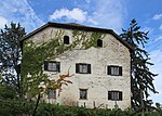
Mareit ID: 14670 |
Platzlweg 10 46 ° 27 ′ 59 ″ N, 11 ° 15 ′ 3 ″ E |
Feb 26, 1952 (MD) |
Residence with a crooked hip roof and medieval building core. Enlarged and redesigned in the 17th century. Bohlenstube dendrochronologically dated to 1338. |
KG: Eppan building plot: 242
|

|
Mareithof ID: 14596 |
St.-Michaels-Platz 10 46 ° 27 ′ 24 ″ N, 11 ° 15 ′ 26 ″ E |
July 25, 1977 (BLR-LAB 4984) |
Three-storey rural house / farm with a broken facade. Arched gate with heraldic shield on the Keilstein. Renaissance tiled stoves. |
KG: Eppan building plot: 69
|
|
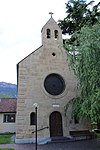
Maria Rast ID: 14758 |
46 ° 27 ′ 28 ″ N, 11 ° 16 ′ 2 ″ E |
July 25, 1977 (BLR-LAB 4984) |
Church in Romanising styles, built in 1874. Historicizing decorative painting. |
KG: Eppan building plot: 567
|

|
Mariengarten with Church of the Assumption of Mary in St. Pauls ID: 14695 |
46 ° 28 ′ 14 "N, 11 ° 15 ′ 54" E |
July 25, 1977 (BLR-LAB 4984) |
Monastery, chapel built in Romanising styles based on a design by Ferdinand Mungenast . The original Blaze (Curtis Blazes) was mentioned in a document as early as 1189. |
KG: Eppan building plot: 283/1, 283/2, 283/3, 717
|
| Matschatscher Strasse 8 ID: 14751 |
Matschatscher Strasse 8 46 ° 27 ′ 44 ″ N, 11 ° 14 ′ 44 ″ E |
22 Mar 1951 (MD) |
Elongated rural house / farm with vaulted cellars. |
KG: Eppan building plot: 514
|
|
| Matschatscher Strasse 10 ID: 14752 |
Matschatscher Strasse 10 46 ° 27 ′ 44 ″ N, 11 ° 14 ′ 43 ″ E |
July 25, 1977 (BLR-LAB 4984) |
Two-storey building with a residence-like character, the year 1672. |
KG: Eppan building plot: 515
|
|
|
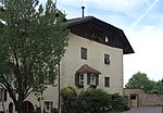
Mesnerhaus in St. Pauls ID: 14698 |
46 ° 28 ′ 21 ″ N, 11 ° 15 ′ 43 ″ E |
Jan. 9, 1989 (BLR-LAB 85) |
Urban residential building, two rooms with stucco ceilings on the second floor . |
KG: Eppan building plot: 286
|

|
Missianer Straße 12 ID: 14713 |
Missianer Straße 12 46 ° 28 ′ 48 ″ N, 11 ° 15 ′ 14 ″ E |
July 25, 1977 (BLR-LAB 4984) |
Rural house / farm, essentially a late Gothic building, was changed in the 17th century. |
KG: Eppan building plot: 318
|

|
Missianer Strasse 15 ID: 14723 |
Missianer Strasse 15 46 ° 28 ′ 48 ″ N, 11 ° 15 ′ 2 ″ E |
May 19, 1978 (BLR-LAB 3137) |
Two-storey rural house / farm, on the facade Madonna picture in stucco frame. |
KG: Eppan building plot: 356/1
|

|
Montan ID: 14664 |
Kreuzsteinweg 7 46 ° 28 ′ 7 ″ N, 11 ° 14 ′ 46 ″ E |
July 6, 1951 (MD) |
The current residence dates from the 16th and 17th centuries. Century. The original free-standing tower, with exposed brickwork and lower Palas from the 13th century, was expanded later. |
KG: Eppan building plot: 224
|

|
Montiggler Schlössl ID: 50573 |
46 ° 25 ′ 14 "N, 11 ° 17 ′ 13" E |
July 1, 2013 (BLR-LAB 987) |
Built by Count Josef von Zastrow between 1886 and 1898 in neo-Gothic style as a summer house with a boat mooring on the Great Montiggler Lake . The Schlössl was donated to the municipality of Appiano in 1902 by the owner. Then it was the residence of the Eppan painter Max Sparer († 1968). |
KG: Eppan building plot: 634
|

|
Moos (school house) with adjoining building and Katharinakapelle ID: 14646 |
46 ° 27 ′ 13 "N, 11 ° 14 ′ 51" E |
July 25, 1977 (BLR-LAB 4984) |
Residence / medieval residential tower, later changed and expanded several times. Elongated farm building with flat arch openings. Chapel: Romanesque building with a round apse, built at the beginning of the 17th century. |
KG: Eppan building plot: 169, 170, 171, 172, 173, 174, 176
|
| Muggenpichler in Frangart ID: 18051 |
46 ° 28 ′ 35 "N, 11 ° 17 ′ 35" E |
May 18, 1951 (MD) |
Rural house / farm, vineyard with corner bay on corbels . |
KG: Eppan building plot: 374
|
|

|
Nesselhof ID: 14589 |
Maria-Rast-Weg 3 46 ° 27 ′ 21 ″ N, 11 ° 15 ′ 44 ″ E |
22 Mar 1951 (MD) |
Three-storey residence (originally a two-storey building). On the Keilstein the year 1674 and Christ's monogram. |
KG: Eppan building plot: 2009, 2838, 41
|
|
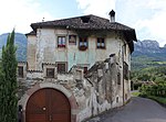
Neuberg ID: 14680 |
St.-Justina-Weg 63 46 ° 28 ′ 6 ″ N, 11 ° 14 ′ 58 ″ E |
July 6, 1951 (MD) |
Originally a medieval tower with later additions. The residence was changed in the 17th century in Renaissance forms. Parlor with pilaster panels and field ceiling. |
KG: Eppan building plot: 256/1, 256/3
|
| Nofner ID: 14648 |
46 ° 27 ′ 5 "N, 11 ° 14 ′ 40" E |
July 25, 1977 (BLR-LAB 4984) |
Former residence with farm building. Bay turrets in the south wing. |
KG: Eppan building plot: 178/1, 178/2, 178/3, 178/4, 178/5 basic plot : 1245
|
|
|
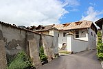
Upper Dornhof in Missian ID: 14719 |
46 ° 29 ′ 12 ″ N, 11 ° 15 ′ 17 ″ E |
Jan 17, 1951 (MD) |
Rural house / farm, extensive courtyard |
KG: Eppan building plot: 3344, 340/1
|
| Oberer Pillhof in Frangart ID: 14727 |
46 ° 28 ′ 39 "N, 11 ° 16 ′ 57" E |
July 25, 1977 (BLR-LAB 4987) |
Great wine farm. On the ground floor there is a tram ceiling, a deep cellar with a barrel vault. Arched door with inscribed. 1635. |
KG: Eppan building plot: 371
|
|
|
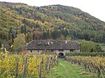
Oberhabsberger in Montiggl ID: 14746 |
46 ° 25 ′ 5 ″ N, 11 ° 16 ′ 40 ″ E |
July 25, 1977 (BLR-LAB 4984) |
Rural house / farm. The built-in medieval tower in exposed brickwork from the 13th century was expanded in the late Gothic period. |
KG: Eppan building plot: 500
|
|
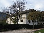
Obertissner in Montiggl ID: 14749 |
46 ° 25 ′ 5 ″ N, 11 ° 16 ′ 36 ″ E |
July 25, 1977 (BLR-LAB 4984) |
Medieval wine farm, today's shape was created in the 17th century. A sundial on the facade, a stone-framed arched door and stone-framed windows. |
KG: Eppan building plot: 507/1, 507/2, 508
|
|
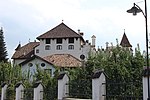
Paschbach with outbuildings ID: 14656 |
Bergweg 33 46 ° 27 ′ 38 ″ N, 11 ° 15 ′ 9 ″ E |
July 25, 1977 (BLR-LAB 4984) |
The residence was built in the 15th century and then rebuilt and expanded several times. |
KG: Eppan building plot: 191/1, 191/2
|

|
Paulser Dorfkeller ID: 14687 |
Paulser Strasse 6-10 46 ° 28 ′ 18 ″ N, 11 ° 15 ′ 38 ″ E |
May 18, 1951 (MD) |
Rural house / farm. Three-storey building with a continuous square bay window ending with a turret. The building has a courtyard wall with battlements and a stone-framed arched gate on each side. |
KG: Eppan building plot: 269/1, 269/2, 270
|

|
Paulser Strasse 1 ID: 14691 |
Paulser Strasse 1 46 ° 28 ′ 19 ″ N, 11 ° 15 ′ 40 ″ E |
July 25, 1977 (BLR-LAB 4984) |
Three-storey rural house / farm with a hipped roof and a round arched portal with cuboids, a coat of arms at the apex. |
KG: Eppan building plot: 278
|

|
Paulser Strasse 5 ID: 14688 |
Paulser Strasse 5 46 ° 28 ′ 19 ″ N, 11 ° 15 ′ 40 ″ E |
July 25, 1977 (BLR-LAB 4984) |
Rural house / farm with protruding sills , three coats of arms in relief on the southern part. Around 1500. |
KG: Eppan building plot: 274
|

|
Paulser Strasse 15-19 ID: 14685 |
Paulser Strasse 15-19 46 ° 28 ′ 17 ″ N, 11 ° 15 ′ 39 ″ E |
May 18, 1951 (MD) |
Broad urban house with square bay windows on volute consoles . The arched door has a coat of arms at the top. In the courtyard wall rustikator with battlements, re. 1799. |
KG: Eppan building plot: 267/1, 267/3
|

|
Paulser Strasse 16-18 ID: 14684 |
Paulser Strasse 16-18 46 ° 28 ′ 17 ″ N, 11 ° 15 ′ 38 ″ E |
May 18, 1951 (MD) |
Three-storey urban house with stone-framed windows. |
KG: Eppan building plot: 265
|

|
Paulser Strasse 20 ID: 14683 |
Paulser Strasse 20 46 ° 28 ′ 16 ″ N, 11 ° 15 ′ 38 ″ E |
July 25, 1977 (BLR-LAB 4984) |
Medieval town house, three-story, with a high pitched roof. The windows partly renewed. |
KG: Eppan building plot: 264
|

|
Perkheim (Massauer) ID: 14616 |
Reinspergweg 5 46 ° 27 ′ 41 ″ N, 11 ° 15 ′ 32 ″ E |
22 Mar 1951 (MD) |
The originally Gothic residence was redesigned in the 17th century in Renaissance forms. Pointed-arched courtyard gate. Two polygonal bay windows with turrets. In the courtyard wall the year 1623. |
KG: Eppan building plot: 115
|

|
Parish Church of St. Joseph in Frangart ID: 14763 |
46 ° 28 ′ 42 "N, 11 ° 17 ′ 48" E |
July 25, 1977 (BLR-LAB 4984) |
The church was built in the Gothic style in 1894/95 by Johann Huber based on plans by Ferdinand Mungenast. There is a side chapel on the east side. Wall painting by Albert Stolz , 1936. |
KG: Eppan building plot: 651
|

|
Parish Church of St. Martin in Girlan ID: 14735 |
46 ° 27 '48 "N, 11 ° 16" 51 "E |
July 25, 1977 (BLR-LAB 4984) |
The church was built in 1838 instead of the previous Gothic building. The ceiling paintings show the Assumption of the Virgin Mary, St. Martin and the beggar, St. Cäcilia, they are by Christoph Brandstätter, 1845. |
KG: Eppan building plot: 419
|

|
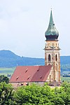
Parish Church of St. Michael ID: 14599 |
46 ° 27 '25 "N, 11 ° 15' 26" E |
July 25, 1977 (BLR-LAB 4984) |
Late Gothic church, nave walls were taken over from the previous Romanesque building. Gallery on pillars, 1610. The tower with a brick pyramid dates from the 16th century. Outside fresco remains, around 1380 (St. Leonhard, St. Sigmund) |
KG: Eppan building plot: 73
|
|
Parish Church of St. Pauls ID: 14697 |
46 ° 28 ′ 20 "N, 11 ° 15 ′ 41" E |
July 25, 1977 (BLR-LAB 4984) |
The three-aisled late Gothic church was built in several stages. Polygonal choir closure with ribbed vault (1490), three-aisled nave with pillars and ribbed vault (16th century). Side facade tower with onion on octagon. The wall paintings date from the 16th and 19th centuries. |
KG: Eppan building plot: 285
|

|
Parish church St. Vigil and Ulrich with parish dedication in Perdonig ID: 14757 |
46 ° 29 ′ 53 "N, 11 ° 13 ′ 45" E |
July 25, 1977 (BLR-LAB 4984) |
The church and parish was built in 1799. |
KG: Eppan building plot: 547
|
|
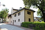
Parish dedication in Frangart ID: 14728 |
46 ° 28 ′ 40 "N, 11 ° 17 ′ 48" E |
Jan 17, 1951 (MD) |
Late Gothic widum / canon house, younger extension to the north. |
KG: Eppan building plot: 379
|
|
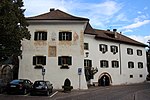
Parish dedication in St. Pauls ID: 14696 |
46 ° 28 ′ 19 "N, 11 ° 15 ′ 44" E |
July 25, 1977 (BLR-LAB 4984) |
Three-storey widum / canon house, the core is late Gothic masonry from the 17th century. Frescoes on the western front. |
KG: Eppan building plot: 284
|

|
Pigeno 3 ID: 14641 |
Pigeno 3 46 ° 27 ′ 1 ″ N, 11 ° 15 ′ 20 ″ E |
May 18, 1951 (MD) |
Urban residential building. The current shape dates from the 17th century. Polygonal corner bay. |
KG: Eppan building plot: 159
|

|
Pigeno 8-10 ID: 14628 |
Pigeno 8-10 46 ° 27 ′ 2 ″ N, 11 ° 15 ′ 22 ″ E |
22 Mar 1951 (MD) |
Rural house / farm with crenellated gable on the east side. In the west two symmetrical turrets. The year 1684 on the gate. |
KG: Eppan building plot: 139, 140/1, 140/2
|

|
Pigeno 11-13 ID: 14637 |
Pigeno 11-13 46 ° 27 ′ 2 ″ N, 11 ° 15 ′ 16 ″ E |
July 25, 1977 (BLR-LAB 4984) |
Three-storey urban residential building with stone-framed rectangular windows. |
KG: Eppan building plot: 152
|

|
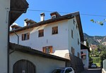
Pigeno 28-30 ID: 14638 |
Pigeno 28-30 46 ° 27 ′ 3 ″ N, 11 ° 15 ′ 16 ″ E |
July 25, 1977 (BLR-LAB 4984) |
Municipal house, the year 1762 on the lintel. |
KG: Eppan building plot: 153/1
|
|
Pigeno 36 ID: 14639 |
Pigeno 36 46 ° 27 ′ 2 ″ N, 11 ° 15 ′ 13 ″ E |
22 Mar 1951 (MD) |
Rural house / farm, originally part of the Rosenburg residence. |
KG: Eppan building plot: 157
|
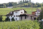
| Pillhof (Kreuzweger) in Frangart ID: 14726 |
46 ° 28 ′ 41 ″ N, 11 ° 16 ′ 49 ″ E |
Jan 17, 1951 (MD) |
Residence with a late Gothic square bay window on corbels. On the south side there is a sundial and above it a fresco (Nativity, Herod and Kings), around 1600. |
KG: Eppan building plot: 369
|
|
|
Plankeiner (Bernhard) in Frangart ID: 14729 |
46 ° 28 ′ 37 "N, 11 ° 17 ′ 49" E |
Jan 17, 1951 (MD) |
Rural house / farm. Stone-framed windows with beautiful wrought iron bars. |
KG: Eppan building plot: 383/2
|

|
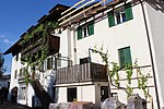
Place 6-9 in St. Pauls ID: 14708 |
Place 6-9 46 ° 28 ′ 21 ″ N, 11 ° 15 ′ 40 ″ E |
July 25, 1977 (BLR-LAB 4984) |
The town house is a three-storey corner building, the core of which is late Gothic. Two-storey bay window with turret closure, animal face at the foot. |
KG: Eppan building plot: 307
|
|
7th place in Girlan ID: 14736 |
Place 7 46 ° 27 ′ 49 ″ N, 11 ° 16 ′ 50 ″ E |
July 25, 1977 (BLR-LAB 4984) |
The urban residential building has an irregular facade design with a stone-framed rectangular window, a polygonal corner bay window and a round arched gate in a square frame from the 17th century. |
KG: Eppan building plot: 422
|

|
Place Bauer ID: 14692 |
Place 19 46 ° 28 ′ 19 ″ N, 11 ° 15 ′ 41 ″ E |
July 6, 1951 (MD) |
Rural house / farm, irregular construction, late Gothic core. Part of the house with four rectangular windows protruding from consoles, 17th century. |
KG: Eppan building plot: 279/1, 279/2, 279/3
|

|
Platzlweg 4 ID: 14668 |
Platzlweg 4 46 ° 27 ′ 53 ″ N, 11 ° 15 ′ 5 ″ E |
May 18, 1951 (MD) |
Elongated rural house / farm with stone-framed rectangular windows. A sundial on the south side. Paneling from 1848, on the first floor hall with stucco ceiling, room with coffered ceiling. Vaulted cellar. |
KG: Eppan building plot: 238
|

|
Platzlweg 9 ID: 14669 |
Platzlweg 9 46 ° 27 ′ 54 ″ N, 11 ° 15 ′ 4 ″ E |
July 6, 1951 (MD) |
Two-storey rural house / farm with stone-framed, partly barred rectangular windows. Arched rustic portal from 1653. |
KG: Eppan building plot: 241
|

|
Platzlweg 12 ID: 14671 |
Platzlweg 12 46 ° 28 ′ 2 ″ N, 11 ° 15 ′ 1 ″ E |
July 25, 1977 (BLR-LAB 4984) |
Building with a residence-like character, two square corner bay windows and stone-framed windows from the 17th century. |
KG: Eppan building plot: 243/1
|

|
Platzlweg 35 ID: 14672 |
Platzlweg 35 46 ° 28 ′ 2 ″ N, 11 ° 15 ′ 0 ″ E |
July 25, 1977 (BLR-LAB 4984) |
Simple rural house / farm with a simple facade design. Important for the overall view of the ensemble. |
KG: Eppan building plot: 245/1
|

|
Platzlweg 37 ID: 14673 |
Platzlweg 37 46 ° 28 ′ 3 ″ N, 11 ° 14 ′ 59 ″ E |
July 25, 1977 (BLR-LAB 4984) |
Characteristic two-storey courtyard with an open fret gable. |
KG: Eppan building plot: 246
|
| Pramol in Perdonig ID: 14662 |
46 ° 28 ′ 48 "N, 11 ° 14 ′ 25" E |
Jan 17, 1951 (MD) |
Former residence first mentioned in the 16th century. At the end of the 16th century it became the property of the Töpsl family. |
KG: Eppan building plot: 219
|
|
|
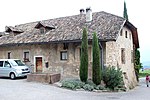
Prielhof ID: 14676 |
Kreuzsteinweg 12 46 ° 28 ′ 7 ″ N, 11 ° 14 ′ 52 ″ E |
July 25, 1977 (BLR-LAB 4984) |
Elongated rural house / farm with a north-facing pinnacle gable from the 17th century. |
KG: Eppan building plot: 252
|

|
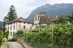
Town Hall ID: 14604 |
46 ° 27 ′ 20 "N, 11 ° 15 ′ 32" E |
May 18, 1951 (MD) |
Former residence Platzegg. Increased and rebuilt in the 1930s, greatly altering the original character. In 1984/85 the building was restored. Remains of late Gothic square painting on the ground floor. |
KG: Eppan building plot: 88/1
|
|
Reinsberg with the Holy Cross Chapel ID: 14667 |
46 ° 27 ′ 50 ″ N, 11 ° 15 ′ 12 ″ E |
22 Mar 1951 (MD) |
The residence is a renaissance building with two wings. Mentioned for the first time in 1210/24 as a fixed house (domus murata) Pitzol (Poçale) of an eponymous Hocheppan ministerial family attested since 1194. In the courtyard wall there is a round arched gate with coat of arms and the year 1661. Renaissance room from 1628. The chapel was built in 1676/77. |
KG: Eppan building plot: 234, 235
|

|
Reinspergweg 9 ID: 14615 |
Reinspergweg 9 46 ° 27 ′ 42 ″ N, 11 ° 15 ′ 32 ″ E |
July 25, 1977 (BLR-LAB 4984) |
Rural house / farm with crenellated gable. Barrel vault in the basement, kitchen with barrel vault and stitch caps on the first floor. |
KG: Eppan building plot: 114, 114/1, 114/2
|

|
Rosenburg ID: 14640 |
Pigeno 38 46 ° 27 ′ 2 ″ N, 11 ° 15 ′ 13 ″ E |
July 25, 1977 (BLR-LAB 4984) |
The town house was the former court dungeon with three vaulted cells. |
KG: Eppan building plot: 156
|
| Rosenfeld ID: 14627 |
Pigeno 2-6 46 ° 27 ′ 1 ″ N, 11 ° 15 ′ 25 ″ E |
July 25, 1977 (BLR-LAB 4984) |
Residence with two outbuildings. Arched gate from 1639 in the courtyard wall. |
KG: Eppan building plot: 136, 137/1, 138
|
|

|
Rose garden with chapel and park ID: 14657 |
46 ° 27 ′ 42 ″ N, 11 ° 15 ′ 2 ″ E |
July 25, 1977 (BLR-LAB 4984) |
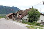
Raised hide. At the drive through Wappenstein with the year 1612. The chapel is from the second half of the 17th century. It has a ridge vault with stucco fields and paintings (childhood story of Christ). |
KG: Eppan building plot: 194, 195, 2401 Basic plot: 1465
|
|
Ruesen in Missian ID: 14714 |
46 ° 29 ′ 9 ″ N, 11 ° 15 ′ 56 ″ E |
Jan 17, 1951 (MD) |
Einhof from late medieval times. Upstairs there is a barrel-vaulted kitchen and room with a plank beam ceiling. |
KG: Eppan building plot: 324
|
| Ruin "Am Hangenden Stein" ID: 14772 |
46 ° 29 ′ 42 "N, 11 ° 14 ′ 56" E |
July 25, 1977 (BLR-LAB 4984) |
Wall remains of a very small, high medieval castle complex on a rock ledge northwest of Unterrain. |
KG: Eppan basic parcel: 3682
|
|
| Rungghof in Girlan ID: 14743 |
46 ° 27 ′ 0 ″ N, 11 ° 17 ′ 16 ″ E |
Jan 17, 1951 (MD) |
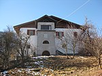
Medieval rural house / farm, built in 1524 by master Peter Maurer. Rebuilt in the 17th century. |
KG: Eppan building plot: 471, 472
|
|
|
Saltner in Gaid ID: 14753 |
46 ° 30 ′ 46 "N, 11 ° 12 ′ 27" E |
July 25, 1977 (BLR-LAB 4984) |
Large rural house / farm, to the east oriel loggia. Two sundials. |
KG: Eppan building plot: 530
|
|
Scherer ID: 14682 |
Paulser Strasse 22 - 24 46 ° 28 ′ 15 ″ N, 11 ° 15 ′ 37 ″ E |
July 25, 1977 (BLR-LAB 4984) |
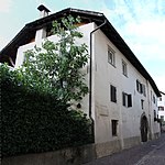
Long, two-story, rural house / farm with a hipped roof. Arched gate in sandstone rust with coat of arms from 1668, above wall niche with image of Mary. On the first floor two windows with late Gothic soffits. |
KG: Eppan building plot: 261
|
|
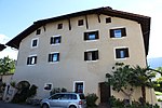
Schießstandweg 14 ID: 14595 |
Shooting range path 14 46 ° 27 ′ 24 ″ N, 11 ° 15 ′ 25 ″ E |
July 25, 1977 (BLR-LAB 4984) |
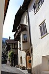
Narrow, gable-independent house / farm with a three-sided bay window. |
KG: Eppan building plot: 68, 68/1, 68/2
|
|
Schleierbrunnhof in Girlan ID: 14737 |
46 ° 27 ′ 51 ″ N, 11 ° 16 ′ 52 ″ E |
July 25, 1977 (BLR-LAB 4984) |
High rural house / farm with a crooked hip roof, late medieval masonry and arched doorway. The table was removed. |
KG: Eppan building plot: 425
|

|
Schneeberg ID: 14622 |
Maderneidstrasse 10 46 ° 27 ′ 35 ″ N, 11 ° 15 ′ 34 ″ E |
22 Mar 1951 (MD) |
Two-storey residence from the 16th century. |
KG: Eppan building plot: 125/1, 125/2
|

|
Terror Stone ID: 14702 |
Unterrainer Strasse 20 46 ° 28 ′ 26 ″ N, 11 ° 15 ′ 41 ″ E |
July 25, 1977 (BLR-LAB 4984) |
Three-storey urban residential building with stone-framed rectangular windows. |
KG: Eppan building plot: 296/1, 296/2, 296/3
|

|
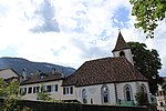
Sebastianstraße 3 in Girlan ID: 14738 |
Sebastianstrasse 3 46 ° 27 ′ 49 ″ N, 11 ° 16 ′ 49 ″ E |
July 25, 1977 (BLR-LAB 4984) |
Elongated rural house / farm with corner bay window on stone consoles. |
KG: Eppan building plot: 431/1
|
|
St. Anna with the monastery of the Terziars Sisters ID: 14571 |
46 ° 27 ′ 13 "N, 11 ° 15 ′ 34" E |
July 25, 1977 (BLR-LAB 4984) |
Late Gothic church, built in the early 16th century. Tower with a pointed pyramid, polygonal choir closure and asymmetrical ridge vault in the nave. The former residence Sprengheim became a monastery in 1842. |
KG: Eppan building plot: 1, 2
|

|
St. Apollonia in Missian ID: 14722 |
46 ° 29 ′ 1 ″ N, 11 ° 15 ′ 17 ″ E |
July 25, 1977 (BLR-LAB 4984) |
The church was built in place of the Gothic structure in 1841–1843 in a classicist style. |
KG: Eppan building plot: 346
|

|
St. Justina ID: 14712 |
46 ° 28 '18 "N, 11 ° 15' 4" E |
July 25, 1977 (BLR-LAB 4984) |
The originally Romanesque church with a round apse was enlarged in 1645–49. |
KG: Eppan building plot: 316
|

|
St. Luzia with cemetery in St. Pauls ID: 14693 |
46 ° 28 ′ 13 "N, 11 ° 15 ′ 47" E |
July 25, 1977 (BLR-LAB 4984) |
Uniform system from the second half of the 16th century with arched arcades. Wall painting (coat of arms, painted epitaphs), around 1590. Arcade extension at the end of the 19th century. |
KG: Eppan building plot: 281 Basic plot: 2549
|

|
St. Nikolaus in Unterrain ID: 14716 |
46 ° 29 ′ 29 ″ N, 11 ° 15 ′ 35 ″ E |
July 25, 1977 (BLR-LAB 4984) |
The late Gothic church with a straight choir closure was consecrated in 1512. Pointed arch portal in a profiled stone frame from the 17th century. |
KG: Eppan building plot: 330
|
| St. Valentin with Valentine's Chapel in Berg ID: 14750 |
46 ° 27 ′ 33 "N, 11 ° 14 ′ 22" E |
22 Mar 1951 (MD) |
The residence is a high building with a crooked hip roof and two oriel towers. Today's form comes from the 16./17. Century, it was first mentioned in 1382. Renaissance loggia with coat of arms paintings. Chapel: built around 1500. |
KG: Eppan building plot: 510, 511/1, 512
|
|

|
St.-Anna-Weg 16 ID: 14575 |
St.-Anna-Weg 16 46 ° 27 ′ 12 ″ N, 11 ° 15 ′ 31 ″ E |
July 25, 1977 (BLR-LAB 4984) |
Three-storey urban residential building with stone-framed rectangular windows. Illegible year on the Keilstein. |
KG: Eppan building plot: 2789, 7
|

|
St.-Anna-Weg 19-21 ID: 14630 |
St.-Anna-Weg 19-21 46 ° 27 ′ 6 ″ N, 11 ° 15 ′ 21 ″ E |
July 25, 1977 (BLR-LAB 4984) |
Urban residential building with an open gable and hipped roof. Torggelstein from 1606. |
KG: Eppan building lot: 142, 142/1, 142/2, 142/3 basic lot: 1062/7, 1062/9
|

|
St.-Anna-Weg 24 ID: 14631 |
St.-Anna-Weg 24 46 ° 27 ′ 7 ″ N, 11 ° 15 ′ 22 ″ E |
July 25, 1977 (BLR-LAB 4984) |
Three-storey urban residential building with stone-framed rectangular windows (partly renewed). |
KG: Eppan building plot: 143/1, 143/2
|

|
St.-Justina-Weg 2 ID: 14709 |
St.-Justina-Weg 2 46 ° 28 ′ 21 ″ N, 11 ° 15 ′ 39 ″ E |
July 25, 1977 (BLR-LAB 4984) |
Three-story urban residential building. Arched gate with beveled edges. Two windows in a Gothic stone frame have been preserved. |
KG: Eppan building plot: 308
|

|
St.-Justina-Weg 67 ID: 14678 |
St.-Justina-Weg 67 46 ° 28 ′ 7 ″ N, 11 ° 14 ′ 53 ″ E |
July 25, 1977 (BLR-LAB 4984) |
Two-storey eaves house / farm. Painted window frames and corner stones. |
KG: Eppan building plot: 254
|

|
St.-Martin-Strasse 28 in Girlan ID: 18154 |
St.-Martin-Strasse 28 46 ° 27 ′ 44 ″ N, 11 ° 16 ′ 53 ″ E |
Nov. 27, 1995 (BLR-LAB 6189) |
Three-storey urban residential building, the core from the 16th or 17th century, redesigned in the 19th century with a loggia as well as corner and storey bands. On the 1st and 2nd floors terrazzo floors and a staircase with a brick column, dated 1847. |
KG: Eppan building plot: 456/1
|

|
St.-Michaels-Platz 4-6 ID: 14598 |
St.-Michaels-Platz 4-6 46 ° 27 ′ 24 ″ N, 11 ° 15 ′ 26 ″ E |
July 25, 1977 (BLR-LAB 4984) |
Three-storey urban residential building with three to three window axes. |
KG: Eppan building plot: 72
|

|
St.-Michaels-Platz 12 ID: 14597 |
St. Michaels-Platz 12 46 ° 27 ′ 25 ″ N, 11 ° 15 ′ 25 ″ E |
July 25, 1977 (BLR-LAB 4984) |
Late medieval urban house with a pointed arched door in a square frame on the ground floor. |
KG: Eppan building plot: 70
|
| Steinmetzhäusl ID: 14649 |
46 ° 27 ′ 17 ″ N, 11 ° 14 ′ 16 ″ E |
July 25, 1977 (BLR-LAB 4984) |
Late Gothic house. Room with a plank beam ceiling from the early 16th century, the central beam with carved ornament. |
KG: Eppan building plot: 182
|
|
|
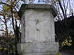
Stone pillar in Missian ID: 14775 |
46 ° 28 ′ 48 ″ N, 11 ° 15 ′ 7 ″ E |
Apr. 17, 1978 (BLR-LAB 2526) |
Wayside shrine consisting of a sandstone column with reliefs (crucifixion, carrying the cross) and an inscription from 1616. |
KG: Eppan building plot: 6625/1
|

|
Stromburg ID: 18108 |
46 ° 27 ′ 25 ″ N, 11 ° 15 ′ 33 ″ E |
May 24, 1993 (BLR-LAB 2887) |
Ansitz Newly built in place of the deleted Bp. 97/1. The material proportions 1-7 relate to the listed old building. |
KG: Eppan building plot: 2519
|

|
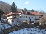
Thalegg with chapel, garden and park ID: 14619 |
Maderneidstrasse 11 46 ° 27 ′ 38 ″ N, 11 ° 15 ′ 35 ″ E |
July 25, 1977 (BLR-LAB 4984) |
Renaissance style residence on a symmetrical floor plan. Courtyard gate with pyramids from 1606. Inside wall paintings from the 17th century. The chapel has a straight end of the choir with a bell wall, rectangular door, square and flat arched windows. Pointed arch niche on the altar wall, built at the beginning of the 17th century. |
KG: Eppan building plot: 121, 122 Basic plot: 243, 244/1
|
|
Tinner ID: 50459 |
46 ° 31 ′ 2 "N, 11 ° 12 ′ 14" E |
Jan 17, 1951 (MD) |
Rural house / farm |
KG: Eppan building plot: 2364, 528 basic plot: 1686
|

|
Tratter in Gaid ID: 14756 |
46 ° 30 ′ 53 "N, 11 ° 12 ′ 39" E |
July 6, 1951 (MD) |
Rural house / farm with two symmetrically arranged oriel turrets. Formerly owned by Wilten Abbey . In the northern oriel tower there is a vault with remains of wall paintings. Smoky kitchen with arched vaulted cap. |
KG: Eppan building plot: 533
|

|
Tschogglhof ID: 14739 |
Kapellenweg 4 46 ° 27 ′ 45 ″ N, 11 ° 16 ′ 43 ″ E |
July 25, 1977 (BLR-LAB 4984) |
Medieval manor of the Sonnenburg monastery, first mentioned in 1181, raised by one floor in the 18th century. In the 18th / 19th In the 19th century the barn was built with a barrel vault; Remains of high medieval masonry in the barn. |
KG: Eppan building plot: 444/1
|

|
Tower at Schmalzer in Perdonig ID: 14661 |
Perdoniger Weg 17 46 ° 29 ′ 20 ″ N, 11 ° 14 ′ 1 ″ E |
July 25, 1977 (BLR-LAB 4984) |
Late medieval castle with a brick staircase. |
KG: Eppan building plot: 211
|
| Turmbachweg 15-17 ID: 14659 |
Turmbachweg 15-17 46 ° 27 ′ 38 ″ N, 11 ° 14 ′ 52 ″ E |
July 25, 1977 (BLR-LAB 4984) |
Medieval residential tower followed by a renovated residential building. Regular stonework from the 13th century. |
KG: Eppan building plot: 205, 206
|
|

|
Tower ruins near the Stroblhof ID: 14767 |
46 ° 26 ′ 59 "N, 11 ° 15 ′ 0" E |
May 18, 1951 (MD) |
About 10 meters high south wall of a residential tower from the 13th century with two walled up flat arched windows. |
KG: Eppan basic parcel: 1157, 1160, 1162/8
|
| Gym ID: 14651 |
46 ° 27 '26 "N, 11 ° 14' 14" E |
July 25, 1977 (BLR-LAB 4984) |
Medieval courtyard with strong retaining walls. Renaissance panels with beams in the living room. |
KG: Eppan building plot: 184
|
|
| Unteralbergweg 10 ID: 14583 |
Unteralbergweg 10 46 ° 27 ′ 13 ″ N, 11 ° 15 ′ 43 ″ E |
July 25, 1977 (BLR-LAB 4984) |
Large courtyard with an open gable. |
KG: Eppan building plot: 22
|
|

|
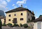
Lower Pardeniger in Montiggl ID: 14761 |
46 ° 25 ′ 3 ″ N, 11 ° 16 ′ 39 ″ E |
July 25, 1977 (BLR-LAB 4984) |
Group of buildings with high medieval building elements, partly in exposed brickwork. Arched gate, farm building with a crooked hip roof and boarded gable. |
KG: Eppan building plot: 627
|
|
Unterpaschbach (large house) ID: 14654 |
Bergweg 28-30 46 ° 27 ′ 36 ″ N, 11 ° 15 ′ 14 ″ E |
22 Mar 1951 (MD) |
Residence, regular Renaissance building with a round arch portal in the central axis. Stucco-framed panel with the year 1557. Central halls with stucco ceilings from the 17th century. |
KG: Eppan building plot: 189
|

|
Unterrainer Strasse 2-4 ID: 14699 |
Unterrainer Strasse 2-4 46 ° 28 ′ 22 ″ N, 11 ° 15 ′ 41 ″ E |
July 6, 1951 (MD) |
Three-storey urban residential building with a stone-framed arched gate. Two three-sided bay windows with a crucifixion image in the southern niche. |
KG: Eppan building plot: 290
|

|
Unterrainer Strasse 7-9 ID: 14707 |
Unterrainer Straße 7-9 46 ° 28 ′ 22 ″ N, 11 ° 15 ′ 41 ″ E |
July 25, 1977 (BLR-LAB 4984) |
Urban dwelling on the eaves with a large rustication, on the Keilstein empty heraldic cartouche. |
KG: Eppan building plot: 304/2, 304/3
|

|
Unterrainer Straße 11-13 ID: 14706 |
Unterrainer Straße 11-13 46 ° 28 ′ 23 ″ N, 11 ° 15 ′ 40 ″ E |
July 6, 1951 (MD) |
Three-storey town house with stone-framed windows in rectangle and double arch form from the 17th century. Goal heading 1583 |
KG: Eppan building plot: 303
|

|
Unterrainer Strasse 16 ID: 14701 |
Unterrainer Strasse 16 46 ° 28 ′ 24 ″ N, 11 ° 15 ′ 42 ″ E |
Nov. 11, 1985 (BLR-LAB 5867) |
Late medieval house, rebuilt in the 17th century. Façade with a late Gothic square bay window, arched courtyard gate, two-story bay window. |
KG: Eppan building plot: 294
|

|
Unterrainer Strasse 17 ID: 14705 |
Unterrainer Strasse 17 46 ° 28 ′ 24 ″ N, 11 ° 15 ′ 41 ″ E |
July 25, 1977 (BLR-LAB 4984) |
Two-storey urban residential building with an open gable. Late Gothic masonry with deep window reveals and chamfered edges. Three-sided bay window. |
KG: Eppan building plot: 1565, 301
|

|
Unterrainer Strasse 19 ID: 18050 |
Unterrainer Strasse 19 46 ° 28 ′ 25 ″ N, 11 ° 15 ′ 41 ″ E |
July 25, 1977 (BLR-LAB 4984) |
Two-storey residential house / farm with a hipped roof. Renewed window openings on the ground floor, profiled stone frames on the first floor. The late medieval building stock was changed in the 17th century. |
KG: Eppan building plot: 1565
|

|
Unterrainer Straße 30 ID: 14703 |
Unterrainer Strasse 30 46 ° 28 ′ 27 ″ N, 11 ° 15 ′ 40 ″ E |
July 6, 1951 (MD) |
Urban residential and farm building, with a round arched gate in between with a stone frame. A three-sided bay window on the house and an okuli on the gable. |
KG: Eppan building plot: 298/1, 298/2, 298/3
|

|
Unterrainer Strasse 32 ID: 14704 |
Unterrainer Strasse 32 46 ° 28 ′ 28 ″ N, 11 ° 15 ′ 39 ″ E |
July 6, 1951 (MD) |
Urban residential building with high arched gate, double arched window, polygonal bay window from the 17th century. |
KG: Eppan building plot: 299
|

|
Untertissner in Montiggl ID: 14748 |
46 ° 25 ′ 2 ″ N, 11 ° 16 ′ 36 ″ E |
July 25, 1977 (BLR-LAB 4984) |
Medieval courtyard. Arched gate, irregular exposed brickwork on the farm building. Stone slab floor and beamed ceiling in the hall. |
KG: Eppan building plot: 506
|

|
Vescovi (Pratzer) ID: 14675 |
Kreuzsteinweg 3 46 ° 28 ′ 7 ″ N, 11 ° 14 ′ 50 ″ E |
July 6, 1951 (MD) |
The residence is a tall building with a hipped roof, oriel tower, Gothic door and window frames. Pointed-arched courtyard gate with original square plaster. |
KG: Eppan building plot: 251
|

|
Fourteen emergency workers in Gaid ID: 14755 |
46 ° 30 ′ 45 "N, 11 ° 12 ′ 37" E |
July 25, 1977 (BLR-LAB 4984) |
The church was built in 1638. It has a three-sided choir closure, ridge vault and a rectangular door in a stone frame. |
KG: Eppan building plot: 532
|
|
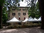
Villa Matschatsch with park ID: 14647 |
46 ° 26 ′ 19 ″ N, 11 ° 14 ′ 1 ″ E |
Jan. 9, 1989 (BLR-LAB 85) |
Villa / summer cottage in historicist style from the end of the 19th century. Neo-baroque chapel. Extensive park area. |
KG: Eppan building plot: 177 basic plots: 1189, 1190, 1191, 1193, 1196/1, 1196/2, 1201/1, 1201/2, 1202/1, 1202/2
|

|
Vintschger ID: 14681 |
St.-Justina-Weg 61 46 ° 28 ′ 7 ″ N, 11 ° 15 ′ 1 ″ E |
July 6, 1951 (MD) |
The residence as a cube-shaped Renaissance building with a symmetrical division of space. Room with pilaster panels from 1597. |
KG: Eppan building plot: 257
|

|
von Söll (An der Lacken) ID: 14623 |
Maderneidstrasse 3 46 ° 27 ′ 33 ″ N, 11 ° 15 ′ 33 ″ E |
22 Mar 1951 (MD) |
Three-storey mansion with a hipped roof. On the bay window the coat of arms stone with inscription and the year 1603. Window in stone frame with bars. |
KG: Eppan building plot: 126/1, 126/2 basic plot: 192/3
|

|
Warth ID: 14694 |
46 ° 28 ′ 14 "N, 11 ° 16 ′ 8" E |
July 6, 1951 (MD) |
Castle complex from the 13th century, later rebuilt several times. In the keep room with beamed ceiling and ashlar painting with battlements. Windows with side seats and decorative borders from the 14th century. Cabinet from 1613. |
KG: Eppan building plot: 282
|

|
Wegerhof ID: 14734 |
Jesuheimstrasse 8-10 46 ° 27 ′ 46 ″ N, 11 ° 16 ′ 59 ″ E |
July 25, 1977 (BLR-LAB 4984) |
Rural house / farm with adjoining courtyard wall and arched gate, late Gothic beam ceilings with minuscule inscription around 1500, rebuilt in the 17th century. |
KG: Eppan building plot: 403/1
|

|
Way chapel in Perdonig ID: 14769 |
46 ° 29 '48 "N, 11 ° 13' 51" E |
Apr. 17, 1978 (BLR-LAB 2526) |
Simple chapel shrine from the early 19th century with a straight end. |
KG: Eppan building plot: 1899/1
|

|
Vineyard ID: 14655 |
Bergweg 36 46 ° 27 ′ 42 ″ N, 11 ° 15 ′ 11 ″ E |
July 6, 1951 (MD) |
The three-storey residence from the 17th century was raised and rebuilt in the 19th century. Above the door there is a stucco fresco (Mariahilf, St. Florian, Georg), around 1600. |
KG: Eppan building plot: 190
|
|
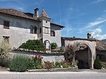
Weißenheim ID: 14674 |
Bergweg 4 46 ° 27 ′ 59 ″ N, 11 ° 14 ′ 51 ″ E |
July 6, 1951 (MD) |
At its core it is a medieval manor house, which was rebuilt towards the end of the 16th century. |
KG: Eppan building plot: 248/1
|
|
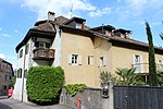
Wendelstein with outbuildings ID: 14573 |
St.-Anna-Weg 11 46 ° 27 ′ 11 ″ N, 11 ° 15 ′ 29 ″ E |
May 18, 1951 (MD) |
Originally a two-storey residence with coupled rectangular windows. In the courtyard wall a stone-framed round arch gate from 1625. On the outbuilding a round arch gate with the year 1711 and coat of arms (mill wheel). |
KG: Eppan building plot: 5
|

|
Wickenburg with Park ID: 14635 |
Pigeno 16 46 ° 27 ′ 3 ″ N, 11 ° 15 ′ 17 ″ E |
July 25, 1977 (BLR-LAB 4985) |
Residence built at the end of the 16th century with a tower-like wing on the north side with battlements (around 1900). Large walled park with conifers, late 19th century. |
KG: Eppan building plot: 150 basic plot: 1050
|

|
Windegg ID: 14576 |
Josef-Innerhofer-Strasse 40 46 ° 27 ′ 13 ″ N, 11 ° 15 ′ 32 ″ E |
May 18, 1951 (MD) |
The mansion is a regular Renaissance building with double arched windows and a flat polygonal bay window. Renaissance room from 1585. |
KG: Eppan building plot: 8
|

|
Wohlgemuth (Hammerstein) ID: 14580 |
Kalterer Strasse 1-3 46 ° 27 ′ 14 ″ N, 11 ° 15 ′ 35 ″ E |
22 Mar 1951 (MD) |
The residence from the 16./17. Century consists of two wings, which are connected by a courtyard wall with rustikator and loggia. Room with coffered ceiling and pilaster panels. Star-shaped coffered ceiling in the hall. |
KG: Eppan building plot: 16/1, 16/2 basic plot : 2439, 2440, 2442
|

|
Zinneberg ID: 14665 |
Bergweg 53 46 ° 27 ′ 58 ″ N, 11 ° 14 ′ 49 ″ E |
May 18, 1951 (MD) |
Residence-like building on a regular floor plan. On the north side a coat of arms painting, early 16th century. Courtyard gate with battlement niches (year 1626). |
KG: Eppan building plot: 228
|
|
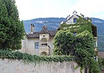
Zinnenberg ID: 14679 |
46 ° 28 ′ 7 "N, 11 ° 14 ′ 54" E |
Feb 26, 1952 (MD) |
Manor house with structures with crenellated gables protruding from the front corners. Expanded in the first half of the 17th century. |
KG: Eppan building plot: 255
|
|
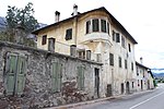
Customs house in Unterrain ID: 14717 |
46 ° 29 ′ 29 "N, 11 ° 15 ′ 34" E |
July 6, 1951 (MD) |
The customs house is a three-storey renaissance building with rustication, double arched windows with rosette decoration and polygonal corner bay windows from the 17th century. |
KG: Eppan building plot: 3065, 331
|

|
Cypress farm ID: 14572 |
St.-Anna-Weg 7 46 ° 27 ′ 12 ″ N, 11 ° 15 ′ 31 ″ E |
July 25, 1977 (BLR-LAB 4984) |
Elongated two-storey house / farm with stone-framed rectangular windows and rusticator. On the Keilstein heraldic shield with the year 1641. |
KG: Eppan building plot: 3 |
If no coordinates are known for a monument, the cadastral data at the time it was placed under protection are given as a substitute. These are neither official nor necessarily up-to-date.
The addresses taken from the State Monuments Office may be out of date.
| Photo: | Photograph of the monument. Click the photo generates an enlarged view. There are also two symbols: |
| ID | Identifier at the South Tyrolean Monuments Office |
| KG | Cadastral parish |
| MD | Ministerial Decree |
| BLR-LAB | Decision of the state government - state committee decision |
Web links
- Monument browser of the South Tyrolean Monuments Office
Individual evidence
- ^ Walter Landi: Fuchsberg. In: Magdalena Hörmann-Weingartner (Ed.): Tiroler Burgenbuch. Volume X: Überetsch and South Tyrolean Unterland . Athesia publishing house, Bozen 2011, ISBN 978-88-8266-780-1 , pp. 161–164.
- ↑ Alexander von Hohenbühel: Gruonsberg. In: Magdalena Hörmann-Weingartner (Ed.): Tiroler Burgenbuch. Volume X: Überetsch and South Tyrolean Unterland . Athesia publishing house, Bozen 2011, ISBN 978-88-8266-780-1 , pp. 219–222.
- ↑ Walter Landi, Jürgen Fricker, Meinhard Khuen-Belasi: The castle on the hanging stone (Gufele). In: Magdalena Hörmann-Weingartner (Ed.): Tiroler Burgenbuch. Volume X: Überetsch and South Tyrolean Unterland . Publishing house Athesia, Bozen 2011, ISBN 978-88-8266-780-1 , pp. 65–70.