List of protected ensembles in Eppan
The list of protected ensembles in Eppan shows the 47 ensembles protected in the municipality of Eppan (Italian Appiano ), South Tyrol .
list
| image | No | Surname | address | Construction year | Project engineer | Further information |
|---|---|---|---|---|---|---|
| 01 | Ensemble Gaid |
Data sheet (PDF) Area 18.9 ha |
||||
| 01.01 | 14 Church of the Holy Helper | 46 ° 30 '44.6 " N , 11 ° 12' 37.3" E | 1638 | The church has a three-sided choir closure, ridge vaults and a rectangular door in a stone frame. Entry in the monument browser on the website of the South Tyrolean Monuments Office |
||
| 01.02 | Mayrhof | 46 ° 30 '45.1 " N , 11 ° 12' 35.9" E | Rural house / farm, late medieval construction. Entry in the monument browser on the website of the South Tyrolean Monuments Office |
|||
| 01.03 | Tratterhof | 46 ° 30 '52.4 " N , 11 ° 12' 39.3" E | Rural house / farm with two symmetrically arranged oriel turrets. Formerly owned by Wilten Abbey. In the northern oriel tower there is a vault with remains of wall paintings. Smoky kitchen with arched vaulted cap. Entry in the monument browser on the website of the South Tyrolean Monuments Office |
|||
| 04/01 | Saltnerhof | 46 ° 30 ′ 46.5 ″ N , 11 ° 12 ′ 27 ″ E | Large rural house / farm, to the east oriel loggia. Two sundials. Entry in the monument browser on the website of the South Tyrolean Monuments Office |
|||
| 01.05 | Tinnerhof | 46 ° 31 '1.3 " N , 11 ° 12' 15.3" E | Rural house / farm Entry in the monument browser on the website of the South Tyrolean Monuments Office |
|||
| 01.06 | Cultivated and forest areas in the area of the courtyards, including all buildings | |||||
| 02 | Ensemble Perdonig |
Data sheet (PDF) Area 2.9 ha |
||||
| 02.01 | Wieserhof | |||||

|
02.02 | Church of St. Vigilius | 46 ° 29 '52.8 " N , 11 ° 13' 44.6" E | 1799 | Entry in the monument browser on the website of the South Tyrolean Monuments Office | |
| 02.03 | Widum | 1799 | ||||
| 02.03 | graveyard | |||||
| 04/02 | Section of the Perdonigerweg including wayside shrine and wayside cross on the edge of the road | Entry in the monument browser on the website of the South Tyrolean Monuments Office | ||||
| 02.05 | Cultural and forest areas in the area of the settlement core, including all buildings. | |||||
|
03 | Ensemble Hocheppan |
Data sheet (PDF) Area 14.6 ha |
|||

|
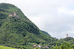
03.01 | Hocheppan Castle and Castle Hill | 46 ° 29 ′ 33.9 " N , 11 ° 14 ′ 31.7" E | second half of the 12th century | The remains of the Hocheppan castle complex represent significant evidence of medieval Tyrolean castle construction and provide information about the power position of the Counts of Eppan at that time.
The well-preserved Hocheppan castle chapel with its valuable Romanesque frescoes is an essential part . |
|

|
03.02 | Chalk tower and castle hill | 46 ° 29 '44.4 " N , 11 ° 14' 33.6" E | around 1200 | ||
| 03.03 | Surrounding forest and meadows | |||||

|
04/03 | ruin | ||||
| 04 | Ensemble of Hocheppaner wine yards |
Data sheet (PDF) Area: 4.5 ha |
||||
| 04.01 | Pichlhof | |||||
| 04.02 | Unterhausen | |||||
| 04.03 | Oberhausen | |||||
| 04/04 | Culture area in the area of the courtyards, including all buildings | |||||
| 05 | Ensemble Unterrain |
Data sheet (PDF) Area: 1.2 ha |
||||

|
05.01 | St. Nicholas Church with attached courtyard | 46 ° 29 '28.8 " N , 11 ° 15' 35.1" E | 1512 | Late Gothic church with a straight choir closure. The pointed arch portal in a profiled stone frame dates from the 17th century. Entry in the monument browser on the website of the South Tyrolean Monuments Office |
|
|
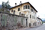
05.02 | Gasthof "Zum Zoll" | 46 ° 29 '29.4 " N , 11 ° 15' 33.6" E | 17th century | The customs house is a three-storey renaissance building with rustication, double arched window with rose decoration and polygonal corner bay window. Entry in the monument browser on the website of the South Tyrolean Monuments Office |
|

|
05.03 | Hungerhausen residence | 46 ° 29 ′ 30 " N , 11 ° 15 ′ 32.3" E | 16th Century | Two-storey building with an open gable and a hipped roof. Entry in the monument browser on the website of the South Tyrolean Monuments Office |
|
| 05.04 | Junction Unterrainerstraße / Pillhofstraße with surrounding buildings and orchards | |||||
| 06 | Ensemble Etschgraben and Damwege |
Data sheet (PDF) Area: 6.5 ha |
||||
| 07 | Ensemble Missian - Church Hill |
Data sheet (PDF) Area: 3 ha |
||||
| 07.01 | Historic town center southwest of the school | |||||

|
St. Apolonia in Missian | 46 ° 29 '1.4 " N , 11 ° 15' 17.2" E | 1841-1843 | The church was built in the classical style instead of the previous Gothic building. Entry in the monument browser on the website of the South Tyrolean Monuments Office |
||
| Hueber | Barn 1696 | 46 ° 29 '2.6 " N , 11 ° 15' 16.6" E | Farm where the house and the barn are connected by a courtyard arch. Entry in the monument browser on the website of the South Tyrolean Monuments Office |
|||
| Kohlhof | 46 ° 29 '4.2 " N , 11 ° 15' 15.2" E | Large rural house / farm. Basement rooms with barrel vaults on the ground floor. On the first floor the central hall with groined vaults and sandstone-framed rectangular doors. Entry in the monument browser on the website of the South Tyrolean Monuments Office |
||||
| 07.02 | school | |||||
| 07.03 | Vineyards on the slopes of the hill | |||||
| 08 | Ensemble Missian |
Data sheet (PDF) Area: 2 ha |
||||
| 08.01 | Section of the Missianerweg with adjacent courtyards and associated cultivation areas | These are individual farms (mainly wine farms) along the Missianerweg near the center. | ||||
|
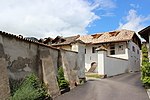
Upper Dornhof | 46 ° 29 '12.5 " N , 11 ° 15' 17.2" E | Rural house / farm, extensive courtyard Entry in the monument browser on the website of the South Tyrolean Monuments Office |
|||
| Lower Dornhof | ||||||
| 09 | Ensemble Weißenbach |
Data sheet (PDF) Area: 4 ha |
||||
| 09.01 | Section of the Weißenbach | |||||
| 02/09 | Courtyards and the associated cultivation area on both sides of the stream | |||||
|
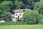
Firmaleinhof | 46 ° 28 '48.5 " N , 11 ° 14' 52.3" E | Rebuilt and increased in 1912. | Medieval courtyard entry in the monument browser on the website of the South Tyrolean Monuments Office
|
||

|
Missianer Strasse 15 | 46 ° 28 '47.6 " N , 11 ° 15' 2.3" E | Two-storey rural vineyard with a picture of the Madonna in stucco frames on the facade. Entry in the monument browser on the website of the South Tyrolean Monuments Office |
|||
| 10 | Ensemble Nussbaumer |
Data sheet (PDF) Area: 0.9 ha |
||||
| 10.01 | Section of the Nussbaumerweg with adjacent courtyards and associated cultivation areas. | |||||

|
Missianer Strasse 12 | 46 ° 28 '48.1 " N , 11 ° 15' 14.1" E | Rebuilt in the 17th century |
Entry in the monument browser on the website of the South Tyrolean Monuments Office |
||

|
Nussbamer Hof | 46 ° 28 '45.9 " N , 11 ° 15' 16.2" E | ||||
| 11 | Ensemble Frangart |
Data sheet (PDF) Area: 3.2 ha |
||||
| 11.01 | Historic town center | |||||

|
02/11 | Parish Church of St. Joseph | 46 ° 28 ′ 41.6 " N , 11 ° 17 ′ 48.2" E | 1894/95 | Johann Huber based on plans by Ferdinand Mungenast | The church was built in the Gothic style. There is a side chapel on the east side. Wall painting by Albert Stolz , 1936. Entry in the monument browser on the website of the South Tyrolean Monuments Office |
| 11.03 | school | |||||
| 04/11 | Surrounding agricultural area | |||||
| 05/11 | Section of Siegmundskronerstraße and Sepp-Kerschbaumer-Straße | |||||
|
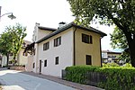
Parish dedication | 46 ° 28 '19.3 " N , 11 ° 15' 43.6" E | Late Gothic widum, younger extension to the north. Entry in the monument browser on the website of the South Tyrolean Monuments Office |
|||
|
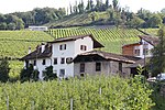
Plankeiner (Bernhard) | 46 ° 28 '37.4 " N , 11 ° 17' 48.6" E |
Entry in the monument browser on the website of the South Tyrolean Monuments Office |
|||
| 12 | Altenburg ensemble |
Data sheet (PDF) Area: 7.9 ha |
||||
| 12.01 | Altenburg | 46 ° 28 '10.2 " N , 11 ° 16' 4.8" E | Remains of a high medieval castle complex. Tower converted into a residential building.
Presumably remnants of the original Eppan castle. |
|||
|
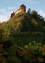
02/12 | Warth Castle | 46 ° 28 '14.2 " N , 11 ° 16' 8.4" E | In the keep room with beamed ceiling and ashlar painting with battlements. Windows with side seats and decorative borders from the 14th century. Parlor panel from 1613. Entry in the monument browser on the website of the South Tyrolean Monuments Office |
||
| 03/12 | Castle hill | The castle hill is subject to a special landscape protection bond (ban zone). Parts of the hill are also designated as a protected area of archaeological interest. | ||||
| 13 | Ensemble St. Pauls - Paulser Platz |
Data sheet (PDF) area 1.4 ha |
||||
|
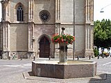
13.01 | Paulser Platz with its fountain and old cemetery wall | ||||

|
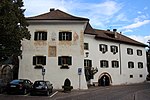
02/13 | Parish church | 46 ° 28 '20.1 " N , 11 ° 15' 41.2" E | Completed between the 15th century and 1647. |
Entry in the monument browser on the website of the South Tyrolean Monuments Office |
|
|
13.03 | Parish dedication | 46 ° 28 '19.3 " N , 11 ° 15' 43.6" E | 17th century | Three-storey widum, the core is late Gothic masonry. Frescoes on the western front. Entry in the monument browser on the website of the South Tyrolean Monuments Office |
|
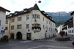
| April 13th | Edge development on the square including the corner buildings on Paulser Strasse, Unterreiner Strasse and St.-Justina-Weg | |||||
|
Gasthof Schwarzer Adler | 46 ° 28 '19.7 " N , 11 ° 15' 39.5" E |
Entry in the monument browser on the website of the South Tyrolean Monuments Office |
|||

|
St.-Justina-Weg 2 | 46 ° 28 '20.6 " N , 11 ° 15' 38.7" E |
Entry in the monument browser on the website of the South Tyrolean Monuments Office |
|||
|
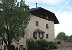
Sacristan's house | 46 ° 28 '21.3 " N , 11 ° 15' 42.6" E | Urban residential building, two rooms with stucco ceilings on the second floor. Entry in the monument browser on the website of the South Tyrolean Monuments Office |
|||

|
Paulser Strasse 1 | 46 ° 28 '19.3 " N , 11 ° 15' 40.1" E | Three-storey house with a hipped roof and a round arched portal with cuboids, with a coat of arms at the apex. Entry in the monument browser on the website of the South Tyrolean Monuments Office |
|||

|
Placer | Place 19 46 ° 28 ′ 19.2 ″ N , 11 ° 15 ′ 40.9 ″ E | 17th century | Rural house, irregular construction, late Gothic in essence. Part of the house with four rectangular windows protruding from consoles. Entry in the monument browser on the website of the South Tyrolean Monuments Office |
||

|
Place 6–9 | 46 ° 28 ′ 20.5 " N , 11 ° 15 ′ 39.9" E | The town house is a three-storey corner building, the core of which is late Gothic. Entry in the monument browser on the website of the South Tyrolean Monuments Office |
|||
| 14th | Ensemble St. Pauls - Oberdorf | Data sheet (PDF) Area: 4 ha | ||||
| 14.01 | Section of Paulsner Strasse with buildings on both sides | |||||

|
Wayside shrine | 46 ° 28 '15.2 " N , 11 ° 15' 40.7" E | 1627 | Wayside shrine with inscription on the base. Top with arched niches and reliefs. Entry in the monument browser on the website of the South Tyrolean Monuments Office |
||
|
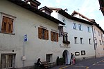
Gasthof zum Guten Drop | 46 ° 28 '18.9 " N , 11 ° 15' 37.9" E | 17th century |
Entry in the monument browser on the website of the South Tyrolean Monuments Office |
||

|
Paulser Strasse 5 | 46 ° 28 ′ 18.8 " N , 11 ° 15 ′ 39.6" E | Around 1500 | Rural house with protruding sills, on the southern three coats of arms in relief. Entry in the monument browser on the website of the South Tyrolean Monuments Office |
||

|
Paulser Dorfkeller | Paulser road 06-10 46 ° 28 '17.8 " N , 11 ° 15' 38.2" O | The building has a courtyard wall with battlements and a stone-framed arched gate on each side. Entry in the monument browser on the website of the South Tyrolean Monuments Office |
|||

|
Old customs house | Paulser Strasse 12-14 46 ° 28 ′ 17 ″ N , 11 ° 15 ′ 38 ″ E | Urban residential building, eaves-standing building with a late Gothic core. Arched front door with beveled stone framing, next to it shop opening with stone bench.
Until 1726 in the function of a princely customs post. |
|||

|
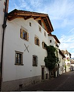
Paulser Strasse 15-19 | 46 ° 28 '17.1 " N , 11 ° 15' 38.8" E | 1799 | Broad urban house with square bay windows on volute consoles. The arched door has a coat of arms at the top. Rustikator with battlements in the courtyard wall. Entry in the monument browser on the website of the South Tyrolean Monuments Office |
||
|
Paulser Strasse 16-18 | 46 ° 28 '16.6 " N , 11 ° 15' 37.8" E | Three-storey urban house with stone-framed windows. Entry in the monument browser on the website of the South Tyrolean Monuments Office |
|||

|
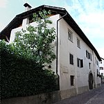
Paulser Strasse 20 | 46 ° 28 '16 " N , 11 ° 15' 37.8" E | Medieval town house, three-story, with a high pitched roof. The windows partly renewed. Entry in the monument browser on the website of the South Tyrolean Monuments Office |
|||
|
clipper | Paulser Strasse 22 46 ° 28 ′ 15.1 ″ N , 11 ° 15 ′ 37.4 ″ E | Long, two-storey, rural house with a hipped roof. Arched gate in sandstone rust with coat of arms from 1668, above wall niche with image of Mary. On the first floor two windows with late Gothic soffits. Entry in the monument browser on the website of the South Tyrolean Monuments Office |
|||
| 15th | Ensemble St. Pauls - Unterdorf |
Data sheet (PDF) Area: 2.1 ha |
||||
| 15.01 | Section of Unterrainer Straße with buildings on both sides | |||||

|
Unterrainer Strasse 2-4 | 46 ° 28 ′ 21.7 " N , 11 ° 15 ′ 41.2" E | Three-storey urban residential building with a stone-framed arched gate. Two three-sided bay windows with a crucifixion image in the southern niche. Entry in the monument browser on the website of the South Tyrolean Monuments Office |
|||

|
Unterrainer Strasse 7-9 | 46 ° 28 '22.1 " N , 11 ° 15' 40.5" E | Urban dwelling on the eaves with a large rustication, on the Keilstein empty heraldic cartouche. Entry in the monument browser on the website of the South Tyrolean Monuments Office |
|||
 | |
|
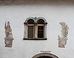
Franzinhof | Unterrainer Strasse 10-12 46 ° 28 ′ 22.7 " N , 11 ° 15 ′ 41.3" E | 17th century. | Two-storey urban residential building with double arched windows, bay windows and arched door. Wall painting (St. Florian, Sebastian, coat of arms of the Lords of Franzin) Entry in the monument browser on the website of the South Tyrolean Monuments Office |
||

|
Altenburg residence | Unterrainer Strasse 11-13 46 ° 28 ′ 22.8 " N , 11 ° 15 ′ 40.3" E | 17th century 1583 gate heading | Three-storey urban residential building with stone-framed windows in a rectangle and double arch form Entry in the monument browser on the website of the South Tyrolean Monuments Office |
||

|
Unterrainer Strasse 16 | 46 ° 28 ′ 23.8 " N , 11 ° 15 ′ 41.5" E | rebuilt in the 17th century | Late medieval house. Facade with late Gothic two-storey square bay window, round-arched courtyard gate. Entry in the monument browser on the website of the South Tyrolean Monuments Office |
||

|
Unterrainer Strasse 17 | 46 ° 28 '24 " N , 11 ° 15' 40.8" E | Two-storey urban residential building with an open gable. Late Gothic masonry with deep window reveals and chamfered edges. Three-sided bay window. Entry in the monument browser on the website of the South Tyrolean Monuments Office |
|||

|
Unterrainer Strasse 19 | 46 ° 28 '24.6 " N , 11 ° 15' 40.5" E | Two-storey rural house / farm with a hipped roof. Renewed window openings on the ground floor, profiled stone frames on the first floor. The late medieval building stock was changed in the 17th century. Entry in the monument browser on the website of the South Tyrolean Monuments Office |
|||

|
Horror stone | Unterrainerstraße 20 46 ° 28 ′ 25.1 ″ N , 11 ° 15 ′ 41.2 ″ E | Three-storey urban residential building with stone-framed rectangular windows. Entry in the monument browser on the website of the South Tyrolean Monuments Office |
|||

|
Unterrainer Strasse 30 | 46 ° 28 '26.6 " N , 11 ° 15' 39.6" E | Urban residential and farm building, with a round arched gate in between with a stone frame. A three-sided bay window on the house and an okuli on the gable. Entry in the monument browser on the website of the South Tyrolean Monuments Office |
|||

|
Unterrainer Strasse 32 | 46 ° 28 '28 " N , 11 ° 15' 38.7" E | 17th century | Urban residential building with high arched gate, double arched window, polygonal bay window. Entry in the monument browser on the website of the South Tyrolean Monuments Office |
||
| 16 | Ensemble St. Pauls - St.-Justina-Weg |
Data sheet (PDF) Area: 0.5 ha |
||||
| 16.01 | Section of St.-Justina-Weg with adjacent buildings | |||||

|
Gasshuberhof | St.-Justina-Weg 20 46 ° 28 ′ 20.7 ″ N , 11 ° 15 ′ 33.5 ″ E | The year 1600 on the Keilstein | Typical Überetscher wine farm with a crooked hip roof. Windows in deep soffits, some with bars. There is a coat of arms on the Keilstein. Entry in the monument browser on the website of the South Tyrolean Monuments Office |
||
| 17th | Ensemble St. Pauls - cemetery |
Data sheet (PDF) Area: 0.5 ha |
||||

|
January 17 | graveyard | 46 ° 28 '14.9 " N , 11 ° 15' 47.6" E | Uniform system from the second half of the 16th century with arched arcades. Arcade extension, end of the 19th century. Entry in the monument browser on the website of the South Tyrolean Monuments Office |
||

|
02/17 | St. Luzia cemetery church | 46 ° 28 '13.4 " N , 11 ° 15' 47.2" E | Facade tower with pyramid roof, polygonal choir closure, groin vault, Renaissance portal and pointed arched windows. Wall painting (coat of arms, painted epitaphs), around 1590. Entry in the monument browser on the website of the South Tyrolean Monuments Office |
||
| 18th | Ensemble St. Pauls - Mariengarten |
Data sheet (PDF) Area: 3.2 ha |
||||

|
January 18 | Cistercian convent Mariengarten , including park, garden, vineyards and new courtyard buildings | 46 ° 28 '14.4 " N , 11 ° 15' 54.1" E | Mentioned in a document in 1189 | Joseph Munggenast | The original Hof Blaze (Curtis Blazes) came into the possession of Wilten Abbey. Later it became the manorial residence of Eppan aristocratic families and finally a Cistercian convent with a girls' school and boarding school, in which function it still stands today. Entry in the monument browser on the website of the South Tyrolean Monuments Office |
| 19th | Ensemble St. Justina |
Data sheet (PDF) Area: 6.9 ha |
||||
| 19.01 | Church and charity house St. Justina including paths leading by | |||||

|
St. Justina Church | 46 ° 28 '18.3 " N , 11 ° 15' 3.9" E | Mid 17th century | The originally Romanesque church with a round apse was enlarged in 1645–49. Entry in the monument browser on the website of the South Tyrolean Monuments Office |
||

|
Benefit house in St. Justina | 46 ° 28 '17.8 " N , 11 ° 15' 4.3" E | End of the 16th century | Former residence of the Perdonig priests. Entry in the monument browser on the website of the South Tyrolean Monuments Office |
||
| 20th | Ensemble Freudenstein |
Data sheet (PDF) Area: 10.2 ha |
||||

|
January 20 | Freudenstein Castle | 46 ° 27 '46.8 " N , 11 ° 14' 50.4" E | 13th Century | The castle complex was expanded and rebuilt in the 16th and 17th centuries and renovated in the 1960s. Entry in the monument browser on the website of the South Tyrolean Monuments Office |
|
| February 20 | St. Andrew's Chapel | 46 ° 27 '44.8 " N , 11 ° 14' 51" E | 1519 | It was built in place of a pre-existing medieval chapel in the late Gothic style. Entry in the monument browser on the website of the South Tyrolean Monuments Office |
||
| March 20 | Castle hill | Partly agricultural area and golf course. Significant view of St. Pauls, the Girlaner Plateau and the Bozen Basin. | ||||
| April 20 | Sections of the Bergstrasse and the Matschatscher Weg with adjacent buildings | |||||
| Muddy way 8 | 46 ° 27 '43.8 " N , 11 ° 14' 44.3" E | Elongated rural house / farm with vaulted cellars. Entry in the monument browser on the website of the South Tyrolean Monuments Office |
||||
| Muddy way 10 | 46 ° 27 '43.9 " N , 11 ° 14' 43.1" E | Year 1672 | Two-storey building with a residence-like character. Entry in the monument browser on the website of the South Tyrolean Monuments Office |
|||
| 21st | Ensemble Berg - Platzl |
Data sheet (PDF) Area: 6.2 ha |
||||
| 01/21 | Platzlweg, St.-Justina-Weg and / or sections of the same including accompanying buildings and accessory areas | |||||

|
Platzlweg 4 | 46 ° 27 '53 " N , 11 ° 15' 5.2" E | Elongated rural house / farm with stone-framed rectangular windows. A sundial on the south side. Paneling from 1848, on the first floor hall with stucco ceiling, room with coffered ceiling. Vaulted cellar. Entry in the monument browser on the website of the South Tyrolean Monuments Office |
|||

|
Platzlweg 9 | 46 ° 27 '54.3 " N , 11 ° 15' 4.4" E | Two-storey rural house / farm with stone-framed, partly barred rectangular windows. Arched rustikaportal from the year 1653. Entry in the monument browser on the website of the South Tyrolean Monuments Office |
|||
|
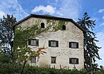
Mareit | Platzlweg 10 46 ° 27 '58.7 " N , 11 ° 15' 2.4" O | Residence with a crooked hip roof and medieval building core. Enlarged and redesigned in the 17th century. Entry in the monument browser on the website of the South Tyrolean Monuments Office |
|||

|
Platzlweg 12 | 46 ° 28 '1.4 " N , 11 ° 15' 0.8" E | 17th century | Building with a residence-like character, two square corner bay windows and stone-framed windows. Entry in the monument browser on the website of the South Tyrolean Monuments Office |
||

|
Platzlweg 35 | 46 ° 28 ′ 2 " N , 11 ° 14 ′ 59.6" E | Simple rural house / farm with a simple facade design. It is important for the overall view of the ensemble. Entry in the monument browser on the website of the South Tyrolean Monuments Office |
|||

|
Platzlweg 37 | 46 ° 28 '2.7 " N , 11 ° 14" 58.9 " E | Characteristic two-storey courtyard with an open fret gable. Entry in the monument browser on the website of the South Tyrolean Monuments Office |
|||
|
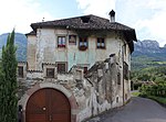
Neuberg | St.-Justina-Weg 63 46 ° 28 ′ 5.5 ″ N , 11 ° 14 ′ 57.6 ″ E | Originally a medieval tower with later additions. The residence was changed into Renaissance forms in the 17th century. Parlor with pilaster panels and field ceiling. Entry in the monument browser on the website of the South Tyrolean Monuments Office |
|||

|
Vintschger | St.-Justina-Weg 61 46 ° 28 ′ 6.4 ″ N , 11 ° 15 ′ 0.2 ″ E | The residence as a cube-shaped Renaissance building with a symmetrical division of space. Parlor with pilaster panel from 1597 Entry in the monument browser on the website of the South Tyrolean Monuments Office |
|||
| 22nd | Ensemble Berg - Melag |
Data sheet (PDF) Area: 7.3 ha |
||||
| 22.01 | St.-Justina-Weg, Kreuzsteinweg, Bergweg or sections of the same including accompanying buildings and accessory areas | |||||

|
Kronhof | Kreuzsteinstrasse 18 46 ° 28 ′ 8.9 ″ N , 11 ° 14 ′ 47.3 ″ E | Three-storey residence with corner bay window and small arched loggia. At its core a late medieval residential tower. Entry in the monument browser on the website of the South Tyrolean Monuments Office |
|||
| Montan | Kreuzsteinstrasse 7 46 ° 28 ′ 6.5 ″ N , 11 ° 14 ′ 46.4 ″ E | The originally free-standing defense tower, with exposed brickwork and a lower hall from the 13th century, was later expanded. The current residence dates from the 16th and 17th centuries. Century. Entry in the monument browser on the website of the South Tyrolean Monuments Office |
||||
| Vescovi (Pratzer) | Kreuzsteinstrasse 3 46 ° 28 ′ 7.2 ″ N , 11 ° 14 ′ 50.2 ″ E | The residence is a tall building with a hipped roof, oriel tower, Gothic door and window frames. Pointed-arched courtyard gate with original square plaster. Entry in the monument browser on the website of the South Tyrolean Monuments Office |
||||
| Prielhof | Kreuzsteinstrasse 12 46 ° 28 ′ 7.4 ″ N , 11 ° 14 ′ 52.3 ″ E | Elongated rural house / farm with a north-facing pinnacle gable from the 17th century. Entry in the monument browser on the website of the South Tyrolean Monuments Office |
||||
| Kreuzsteinstrasse 10 | Kreuzsteinstrasse 10 46 ° 28 ′ 6.2 ″ N , 11 ° 14 ′ 51.6 ″ E | Rural house / farm, residential and farm buildings assembled. On the north facade of the residential building, the year 1548 with a handicraft mark and 1566 with the name Paul Muil . Entry in the monument browser on the website of the South Tyrolean Monuments Office |
||||
| St.-Justina-Weg 67 | St.-Justina-Weg 67 46 ° 28 ′ 6.6 ″ N , 11 ° 14 ′ 52.5 ″ E | Two-storey eaves house / farm. Painted window frames and corner stones. Entry in the monument browser on the website of the South Tyrolean Monuments Office |
||||

|
Zinnenberg | 46 ° 28 ′ 6.7 " N , 11 ° 14 ′ 54" E | Manor house with structures with crenellated gables protruding from the front corners. Expanded in the first half of the 17th century. Entry in the monument browser on the website of the South Tyrolean Monuments Office
|
|||
|
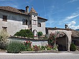
Weissenheim | Bergstrasse 4 46 ° 27 ′ 58.5 ″ N , 11 ° 14 ′ 50.3 ″ E | At its core it is a medieval manor house, which was rebuilt towards the end of the 16th century. Entry in the monument browser on the website of the South Tyrolean Monuments Office |
|||
| Zinneberg | Bergstrasse 53 46 ° 27 ′ 57.7 ″ N , 11 ° 14 ′ 48.9 ″ E | Residence-like building on a regular floor plan. On the north side a coat of arms painting, early 16th century. Courtyard gate with battlement niches (year 1626). Entry in the monument browser on the website of the South Tyrolean Monuments Office |
||||
| 23 | Ensemble Berg - Turmbach |
Data sheet (PDF) Area: 92 ha |
||||
| 23.01 | Bergweg, Turmbachweg and / or sections of the same including accompanying buildings and accessory areas | |||||
| Rose garden with chapel and park | 46 ° 27 '42.3 " N , 11 ° 15' 2.1" E | At the drive through Wappenstein with the year 1612. The chapel is from the second half of the 17th century. It has a ridge vault with stucco fields and paintings (childhood story of Christ). Entry in the monument browser on the website of the South Tyrolean Monuments Office |
||||
| Bad Turmbach | 46 ° 27 '38.4 " N , 11 ° 14' 55.3" E | Rural house / farm. The building dates from the 17th century. In the west a mill with vaulted rooms was added. Entry in the monument browser on the website of the South Tyrolean Monuments Office |
||||
| Turmbachweg 15-17 | Turmbachweg 15-17 46 ° 27 '37.6 " N , 11 ° 14' 51.8" O | Medieval residential tower followed by a renovated residential building. Regular stonework from the 13th century. Entry in the monument browser on the website of the South Tyrolean Monuments Office |
||||
| On the plate 12 | On plates 12 46 ° 27 '31.1 " N , 11 ° 14' 51.5" O | Medieval courtyard entry in the monument browser on the website of the South Tyrolean Monuments Office |
||||
| 24 | Ensemble Berg - Moos |
Data sheet (PDF) Area: 2.5 ha |
||||

|
24.01 | Moos Castle | 46 ° 27 '12.9 " N , 11 ° 14' 51.1" E | Manor house / medieval residential tower, later changed and expanded several times, with a rich array of wall paintings. Entry in the monument browser on the website of the South Tyrolean Monuments Office |
||
| 24.02 | School building complex | 46 ° 27 '14.2 " N , 11 ° 14' 52.3" E | Elongated farm building with flat arch openings. | |||
| 24.03 | Catherine Chapel | 46 ° 27 '13.3 " N , 11 ° 14' 54" E | Chapel with round apse, built around 1636 on a Romanesque pre-existing structure. (1987 restored) | |||
| 25th | Ensemble Maderneid |
Data sheet (PDF) Area: 4.2 ha |
||||
| 25.01 | Maderneidstraße and Reinsbergweg or parts of the same including adjacent buildings and accessory areas | |||||
| Reinsbergstrasse 9 | Reinsbergstrasse 9 46 ° 27 ′ 42.3 ″ N , 11 ° 15 ′ 31.4 ″ E | Rural house / farm with crenellated gable. Barrel vault in the basement, kitchen with barrel vault and stitch caps on the first floor. Entry in the monument browser on the website of the South Tyrolean Monuments Office |
||||
| Maderneidstrasse 7-9 | Maderneid 7-9 46 ° 27 '36.9 " N , 11 ° 15' 34" O | Urban residential building, two-storey building with corner bay window. Entry in the monument browser on the website of the South Tyrolean Monuments Office |
||||
| Maderneidstrasse 16 | Maderneid Straße 16 46 ° 27 '37.1 " N , 11 ° 15' 34.9" O | Municipal house, three-storey building from the 17th century. Entry in the monument browser on the website of the South Tyrolean Monuments Office |
||||
| Maderneidstrasse 28 | Maderneid Straße 28 46 ° 27 '41.7 " N , 11 ° 15' 39.7" O | Urban residential building, three-storey building with a sloping, sloping roof. Entry in the monument browser on the website of the South Tyrolean Monuments Office |
||||
| 25.02 | Altenburg residence | Maderneid Straße 19 46 ° 27 '41.7 " N , 11 ° 15' 37" O | The residence consists of two houses that are connected by a central wing. Functional masonry water mill. Entry in the monument browser on the website of the South Tyrolean Monuments Office |
|||
| 25.03 | Thalegg residence | Maderneid Straße 11 46 ° 27 '38.5 " N , 11 ° 15' 34.5" O | Renaissance style residence on a symmetrical floor plan. Courtyard gate with pyramids from 1606. Inside wall paintings from the 17th century. The chapel has a straight end of the choir with a bell wall, rectangular door, square and flat arched windows. Pointed arch niche on the altar wall, built at the beginning of the 17th century. Entry in the monument browser on the website of the South Tyrolean Monuments Office |
|||
| 04/25 | Perkheim residence | Reinsbergstrasse 5 46 ° 27 ′ 40.9 ″ N , 11 ° 15 ′ 31.7 ″ E | The originally Gothic residence was redesigned in the 17th century in Renaissance forms. Pointed-arched courtyard gate. Two polygonal bay windows with turrets. The year 1623 is in the courtyard wall. Entry in the monument browser on the website of the South Tyrolean Monuments Office |
|||
| 25.05 | Schneeberg residence | Maderneid Straße 10 46 ° 27 '35.1 " N , 11 ° 15' 34.4" O | Two-storey residence from the 16th century. Entry in the monument browser on the website of the South Tyrolean Monuments Office |
|||
| 25.06 | Ansiz v. Söll (An der Lacken) | Maderneid street 3 46 ° 27 '33.3 " N , 11 ° 15' 33.1" O | Three-storey mansion with a hipped roof. On the bay window the coat of arms stone with inscription and the year 1603. Window in stone frame with bars. Entry in the monument browser on the website of the South Tyrolean Monuments Office |
|||
| 26th | Ensemble Gleifhügel |
Data sheet (PDF) Area: 9.2 ha |
||||

|
01/26 | Slip hill | The Gleifhügel is a mountain promontory that rises to the west of Eppan and represents an impressive background for the local settlement area. On it is the Holy Cross Church with the former hermitage, the seven Calvary chapels and a glacier cut (protected natural monument). | |||
| 02/26 | Holy Cross Church with a former hermitage | 46 ° 27 '18.3 " N , 11 ° 15' 6.9" E | The church was built in 1716. The former hermitage of St. Valentin is attached to the church. Entry in the monument browser on the website of the South Tyrolean Monuments Office |
|||
| 26.03 | Calvary chapels | The seven simple chapels were built in 1716 together with the church.
|
||||
| 27 | Ensemble St. Michael - St. Michael Square |
Data sheet (PDF) Area: 3.8 ha |
||||

|
01/27 | Parish Church of St. Michael | 46 ° 27 '24.7 " N , 11 ° 15' 26.2" E | Late Gothic church, nave walls were taken over from the previous Romanesque building. Gallery on pillars, 1610. The tower with a brick pyramid dates from the 16th century. Remains of frescoes outside, around 1380 (St. Leonhard, St. Sigmund) Entry in the monument browser on the website of the South Tyrolean Monuments Office |
||

|
02/27 | Parish dedication | 46 ° 27 '24.3 " N , 11 ° 15' 27.8" E | Widum consists of two tracts, of which the eastern part has older holdings. Entry in the monument browser on the website of the South Tyrolean Monuments Office |
||
| 27.03 | St.-Michaels-Platz including fountain and surrounding buildings | |||||

|
St. Michaels Square 4-6 | St. Michaels-Platz 4–6 46 ° 27 ′ 23.5 ″ N , 11 ° 15 ′ 26.2 ″ E | Three-storey urban residential building with three to three window axes. Entry in the monument browser on the website of the South Tyrolean Monuments Office |
|||

|
Mareithof | St. Michaels-Platz 10 46 ° 27 ′ 24 ″ N , 11 ° 15 ′ 25.5 ″ E | Three-storey rural house / farm with a broken facade. Arched gate with heraldic shield on the Keilstein. Renaissance tiled stoves. Entry in the monument browser on the website of the South Tyrolean Monuments Office |
|||
|
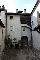
St. Michaels Square 12 | St. Michaels-Platz 12 46 ° 27 ′ 24.6 ″ N , 11 ° 15 ′ 25.2 ″ E | Late medieval urban house with a pointed arched door in a square frame on the ground floor. Entry in the monument browser on the website of the South Tyrolean Monuments Office |
|||

|
Schießstandweg 14 | Shooting range path 14 46 ° 27 ′ 23.8 ″ N , 11 ° 15 ′ 25 ″ E | Narrow, gable-independent house / farm with a three-sided bay window. Entry in the monument browser on the website of the South Tyrolean Monuments Office |
|||
| 04/27 | Goldgasse, Bergweg, Krafussweg, Kapuzinerstraße, Schießstandweg, J.-G.-Platzer-Straße or sections of the same including peripheral buildings and accessory areas. | |||||

|
Köglburg | Krafußweg 8-1 46 ° 27 '27.1 " N , 11 ° 15' 29.5" O | Ansitz, two-storey building with a hipped roof. Entry in the monument browser on the website of the South Tyrolean Monuments Office |
|||

|
Krafussweg 7 | Krafußweg 7 46 ° 27 '26.1 " N , 11 ° 15' 28.8" O | Urban residential building with a crooked hip roof, polygonal bay annex and double arched windows. Entry in the monument browser on the website of the South Tyrolean Monuments Office |
|||

|
Goldgasse 2-4 | Goldgasse 2-4 46 ° 27 '24.5 " N , 11 ° 15' 31.8" E | The town house is a late Gothic building and was changed in the 17th century. Entry in the monument browser on the website of the South Tyrolean Monuments Office |
|||

|
J.-G.-Plazer-Strasse 11 | J.-G.-Plazer-Strasse 11 46 ° 27 ′ 23.4 ″ N , 11 ° 15 ′ 31.6 ″ E | Urban residential building, two-storey building with stone-framed rectangular windows. Entry in the monument browser on the website of the South Tyrolean Monuments Office |
|||

|
Gasthof Weißes Rößl | J.-G.-Plazer-Strasse 13-15 46 ° 27 ′ 24 " N , 11 ° 15 ′ 31.9" E | Three-storey town house with an inn and the year 1672 on the Keilstein. Polygonal corner bay with turret end. Entry in the monument browser on the website of the South Tyrolean Monuments Office |
|||
|
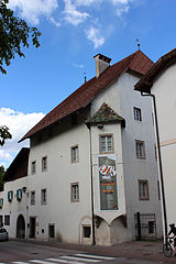
Lanserhaus | J.-G.-Plazer-Strasse 24 46 ° 27 ′ 22.1 ″ N , 11 ° 15 ′ 32.4 ″ E | Residence with hipped, late Gothic steep roof from the 16th century. Entry in the monument browser on the website of the South Tyrolean Monuments Office |
|||
|
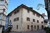
J.-G.-Plazer-Strasse 30-34 | J.-G.-Plazer-Strasse 30-34 46 ° 27 ′ 23.6 " N , 11 ° 15 ′ 32.6" E | Municipal house, coat of arms on the lintel and the year 1592. Entry in the monument browser on the website of the South Tyrolean Monuments Office |
|||
| Stromburg | 46 ° 27 '24.6 " N , 11 ° 15' 32.8" E | Ansitz, newly built in place of the deleted Bp. 97/1. The material proportions 1–7 relate to the listed old building. Entry in the monument browser on the website of the South Tyrolean Monuments Office |
||||

|
Eppanerhof | J.-G.-Plazer-Strasse 50 46 ° 27 ′ 26.1 ″ N , 11 ° 15 ′ 33.1 ″ E | Residence and inn. Former residence Hammersbach. Entry in the monument browser on the website of the South Tyrolean Monuments Office |
|||

|
05/27 | Old shooting range | 46 ° 27 '22.5 " N , 11 ° 15' 23.3" E | Two-storey building. On its west side a shooting range with a profiled wooden ceiling, end of the 19th century. Keilstein with the year 1670. Entry in the monument browser on the website of the South Tyrolean Monuments Office |
||
| 28 | Ensemble St. Michael - Rathausplatz |
Data sheet (PDF) Area: 2.2 ha |
||||
| 28.01 | Town Hall Square | |||||
| 28.02 | Junction at J.-G.-Plazer-Straße, Bahnhofstraße, J.-Innerhofer-Straße, Kapuzinerstraße or sections of the same streets | |||||
| 28.03 | All buildings in the intersection area including accessory areas | |||||
|
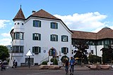
town hall | 46 ° 27 '19.6 " N , 11 ° 15' 32.1" E | Former residence Platzegg. Increased and rebuilt in the 1930s, greatly altering the original character. In 1984/85 the building was restored. Remains of late Gothic square painting on the ground floor. Entry in the monument browser on the website of the South Tyrolean Monuments Office |
|||

|
J.-G.-Plazer-Strasse 4-8 | J.-G.-Plazer-Strasse 4-8 46 ° 27 ′ 20.2 " N , 11 ° 15 ′ 32.3" E | Urban residential building, two-story construction. On the Keilstein, year and initials 1637 PF Entry in the monument browser on the website of the South Tyrolean Monuments Office |
|||

|
Gasthof Sonne | 46 ° 27 '18.6 " N , 11 ° 15' 31.4" E | Guest house with two facade cores, double arched windows and a vaulted central hall on the first floor. Entry in the monument browser on the website of the South Tyrolean Monuments Office |
|||
|
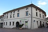
Goldene Traube inn | 46 ° 27 '18.2 " N , 11 ° 15' 32.4" E | Two-storey former inn (today's bank building) with stone-framed rectangular windows. Rustic door to the street, next to it a large arched door with rosettes and arrows. Entry in the monument browser on the website of the South Tyrolean Monuments Office |
|||

|
Bahnhofstrasse 2-4 | 46 ° 27 '18.3 " N , 11 ° 15' 34.1" E | Urban residential building. Three-storey renaissance building with double arches and rectangular windows in a stone frame. Courtyard wall with rustication (later enlarged) and the year 1639. Entry in the monument browser on the website of the South Tyrolean Monuments Office |
|||
| 29 | Ensemble St. Michael - Ex Capuchins |
Data sheet (PDF) Area: 1 ha |
||||

|
29.01 | Former Capuchin Church of the Visitation of the Virgin Mary with monastery | 46 ° 27 ′ 19 ″ N , 11 ° 15 ′ 27 ″ E | The ensemble comprises an enclosed area in the middle of the village of St. Michael. The traditional simplicity of the Capuchin church buildings enabled a harmonious transformation into a contemporary, modern religious community center. Entry in the monument browser on the website of the South Tyrolean Monuments Office
|
||
| 30th | Ensemble St. Michael - St. Anna |
Data sheet (PDF) Area: 2.9 ha |
||||
| 01/30 | Junction Josef-Innerhofer-Straße / St.-Anna-Weg | |||||

|
02/30 | St. Anne's Church and Monastery | 46 ° 27 '13.1 " N , 11 ° 15' 34.1" E | Early 16th century | Late Gothic church with the former residence Sprengheim which became a monastery in 1842. Entry in the monument browser on the website of the South Tyrolean Monuments Office |
|
| 30.03 | All buildings in the intersection area including accessory areas. | The stately buildings in the intersection area and along St.-Anna-Weg, including the "Alte Apotheke" and the Wohlgemuth, Windegg, Wendelstein and Bastreinbach residences, create a special backdrop between public traffic and private cultural areas. | ||||

|
Josef-Innerhofer-Strasse 29-31 | 46 ° 27 '15.3 " N , 11 ° 15' 35" E |
Entry in the monument browser on the website of the South Tyrolean Monuments Office |
|||

|
Josef-Innerhofer-Strasse 32-34 | 46 ° 27 '15.1 " N , 11 ° 15' 33.1" E |
Entry in the monument browser on the website of the South Tyrolean Monuments Office |
|||
|
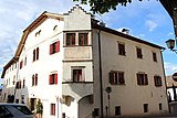
Old pharmacy | Josef-Innerhofer-Strasse 35 | 46 ° 27 '14.5 " N , 11 ° 15' 34.5" E |
Entry in the monument browser on the website of the South Tyrolean Monuments Office |
||

|
Josef-Innerhofer-Strasse 44 | 46 ° 27 '13.6 " N , 11 ° 15' 33.9" E |
Entry in the monument browser on the website of the South Tyrolean Monuments Office |
|||

|
Wohlgemuth (Hammerstein) | Kalterer Strasse 1–3 46 ° 27 ′ 13.8 " N , 11 ° 15 ′ 35.4" E |
Entry in the monument browser on the website of the South Tyrolean Monuments Office |
|||

|
Windegg | Verdistrasse 40 |
Entry in the monument browser on the website of the South Tyrolean Monuments Office |
|||

|
Cypress yard | St.-Anna-Weg 7 |
Entry in the monument browser on the website of the South Tyrolean Monuments Office |
|||

|
Wendelstein with outbuildings | St. Anna Way 11 |
Entry in the monument browser on the website of the South Tyrolean Monuments Office |
|||
|
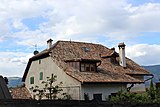
St.-Anna-Weg 16 | 46 ° 27 '12.4 " N , 11 ° 15' 30.9" E |
Entry in the monument browser on the website of the South Tyrolean Monuments Office |
|||

|
Bastreinbach | St.-Anna-Weg 18 46 ° 27 ′ 11.7 ″ N , 11 ° 15 ′ 29.9 ″ E |
Entry in the monument browser on the website of the South Tyrolean Monuments Office |
|||
| 31 | Ensemble St. Michael - Bahnhofstrasse |
Data sheet (PDF) Area: 3.4 ha |
||||
|
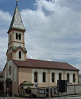
31/01 | Dominican Church of St. Joseph with a former monastery | 46 ° 27 '17.6 " N , 11 ° 15' 38.8" E |
Entry in the monument browser on the website of the South Tyrolean Monuments Office |
||
| 02/31 | Bahnhofsstraße, Unteralberweg, Maria-Rast-Straße, St.-Anna-Weg or sections of the same including peripheral buildings and accessory areas. | |||||

|
Bahnhofstrasse 30 | 46 ° 27 '16.6 " N , 11 ° 15' 43.3" E |
Entry in the monument browser on the website of the South Tyrolean Monuments Office |
|||

|
Bahnhofstrasse 37-39 | 46 ° 27 '17.9 " N , 11 ° 15' 41.7" E |
Entry in the monument browser on the website of the South Tyrolean Monuments Office |
|||
|
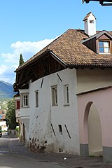
Bahnhofstrasse 44-46 | 46 ° 27 '16.5 " N , 11 ° 15' 47.8" E |
Entry in the monument browser on the website of the South Tyrolean Monuments Office |
|||

|
Bahnhofstrasse 65-67 | 46 ° 27 '16.9 " N , 11 ° 15' 48.9" E |
Entry in the monument browser on the website of the South Tyrolean Monuments Office |
|||

|
Grustdorf | Unteralberweg 4 46 ° 27 ′ 16.1 ″ N , 11 ° 15 ′ 43.8 ″ E |
Entry in the monument browser on the website of the South Tyrolean Monuments Office |
|||
| 32 | Ensemble St. Michael - Ex train station |
Data sheet (PDF) Area: 2 ha |
||||

|
32.01 | Former train station of the Überetscher Bahn | 46 ° 27 '11.2 " N , 11 ° 16' 9.3" E | around 1898 | ||

|
32.02 | Former sanatorium "Hocheppan" | Bahnhofstrasse 7-8 46 ° 27 ′ 11.1 ″ N , 11 ° 16 ′ 3.4 ″ E |
Entry in the monument browser on the website of the South Tyrolean Monuments Office |
||
| 32.03 | St. Michael winery cooperative | 46 ° 27 '9.4 " N , 11 ° 16' 8.6" E | ||||
| 33 | Ensemble Maria Rast |
Data sheet (PDF) Area: 0.6 ha |
||||

|
33.01 | Maria Rast church | 46 ° 27 '28.3 " N , 11 ° 16' 1.5" E | around 1875 |
Entry in the monument browser on the website of the South Tyrolean Monuments Office |
|
| 33.02 | Surrounding agricultural area | |||||
|
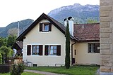
33.03 | Sacristan's house | ||||
| 34 | Ensemble Pigeno |
Data sheet (PDF) Area: 6.6 ha |
||||
| 34.01 | St.-Anna-Weg, Pigenoweg, Badlweg or sections of the same including adjacent buildings and accessory areas | |||||
| St. Anna Weg 19–21 | 46 ° 27 '5.8 " N , 11 ° 15' 20.7" E |
Entry in the monument browser on the website of the South Tyrolean Monuments Office |
||||
| St.-Anna-Weg 24 | 46 ° 27 '7.4 " N , 11 ° 15' 22.1" E |
Entry in the monument browser on the website of the South Tyrolean Monuments Office |
||||
| Rose field | Pigeno 2-6 | 46 ° 27 '1 " N , 11 ° 15' 24.7" E |
Entry in the monument browser on the website of the South Tyrolean Monuments Office |
|||
| Pigeno 3 | 46 ° 27 '1.2 " N , 11 ° 15" 19.4 " E |
Entry in the monument browser on the website of the South Tyrolean Monuments Office
|
||||
| Lindenheim with park | Pigeno 7-9 46 ° 27 '2.3 " N , 11 ° 15' 17.3" O | 17th century | Former residence of Friedrich Teßmann . Entry in the monument browser on the website of the South Tyrolean Monuments Office |
|||
| Pigeno 8-10 | 46 ° 27 '1.5 " N , 11 ° 15' 22.3" E | The year 1684 on the gate |
Entry in the monument browser on the website of the South Tyrolean Monuments Office |
|||
| Pigeno 11-13 | 46 ° 27 '2.1 " N , 11 ° 15' 16.6" E |
Entry in the monument browser on the website of the South Tyrolean Monuments Office |
||||
| Rosenburg | Pigeno 28 46 ° 27 '2 " N , 11 ° 15' 13.4" O | Former court dungeon Entry in the monument browser on the website of the South Tyrolean Monuments Office |
||||
| Pigeno 28-30 | 46 ° 27 '2.9 " N , 11 ° 15' 15.7" E | The year 1762 on the lintel |
Entry in the monument browser on the website of the South Tyrolean Monuments Office |
|||
| Pigeno 36 | 46 ° 27 ′ 1.8 ″ N , 11 ° 15 ′ 12.8 ″ E |
Entry in the monument browser on the website of the South Tyrolean Monuments Office |
||||
| Badlweg 1–3 | 46 ° 27 '0.1 " N , 11 ° 15' 17.9" E | Keilstein with the year 1645 |
Entry in the monument browser on the website of the South Tyrolean Monuments Office |
|||

|
34.02 | Gleifheim with chapel | St.-Anna-Weg 40 46 ° 27 ′ 6.5 ″ N , 11 ° 15 ′ 19.4 ″ E | 17th century |
Entry in the monument browser on the website of the South Tyrolean Monuments Office |
|
| 34.03 | Liebenburg | Pigeno 26 46 ° 27 '5.5 " N , 11 ° 15' 14.6" O |
Entry in the monument browser on the website of the South Tyrolean Monuments Office |
|||
| 34.04 | Hebenstreit (Wiesenegg) | Pigeno 20 46 ° 27 '4.2 " N , 11 ° 15' 15.2" O |
Entry in the monument browser on the website of the South Tyrolean Monuments Office |
|||
| 34.05 | Kuensegg | 46 ° 27 '3.8 " N , 11 ° 15' 20.9" E |
Entry in the monument browser on the website of the South Tyrolean Monuments Office |
|||
| 34.06 | Wickenburg with park | Pigeno 16 46 ° 27 '3.2 " N , 11 ° 15' 17" O | 16th Century |
Entry in the monument browser on the website of the South Tyrolean Monuments Office |
||
| 35 | Ensemble Englar - Gandegg |
Data sheet (PDF) Area: 13.4 ha |
||||
|
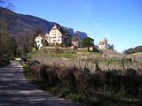
January 35 | Englar Castle | 46 ° 27 ′ 3 ″ N , 11 ° 15 ′ 2 ″ E | 16./17. century |
Entry in the monument browser on the website of the South Tyrolean Monuments Office |
|

|
35.02 | Sebastian Chapel | 46 ° 27 ′ 6.7 " N , 11 ° 15 ′ 2" E | 16th Century | ||
| 35.03 | Castle hill | |||||
| April 35 | Gandegg Castle | 46 ° 26 '58.8 " N , 11 ° 15' 10.7" E |
Entry in the monument browser on the website of the South Tyrolean Monuments Office |
|||
| 35.05 | Stroblhof including Altfirmian and Eiskeller | 46 ° 26 '58.7 " N , 11 ° 14' 58.1" E | Eiskeller, entry in the monument browser on the website of the South Tyrolean Monuments Office |
|||
| 36 | Ensemble Girlan - center of the village |
Data sheet (PDF) Area: 8.4 ha |
||||
| 36.01 | Girlanerplatz including the parish church of St. Martin and surrounding buildings | |||||
|
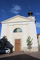
Parish Church of St. Martin in Girlan | 46 ° 27 '47.9 " N , 11 ° 16' 51.4" E |
Entry in the monument browser on the website of the South Tyrolean Monuments Office |
|||

|
7th place in Girlan | 46 ° 27 '48.8 " N , 11 ° 16' 50.4" E |
Entry in the monument browser on the website of the South Tyrolean Monuments Office |
|||
| 36.02 | Marktstraße, Lammweg, St. Martin-Straße, Girlanerstraße, Mühlweg, Bildstöcklweg, St. Sebastian-Straße, St. Florian-Straße, Pfarrgasse and Naunweg and / or sections of the same including adjacent buildings and accessory areas | |||||

|
Breitenberg in Girlan | 46 ° 27 '47.1 " N , 11 ° 16' 51.5" E |
Entry in the monument browser on the website of the South Tyrolean Monuments Office |
|||
| Greifenburg in Girlan | 46 ° 27 '44.8 " N , 11 ° 16'51.6" E |
Entry in the monument browser on the website of the South Tyrolean Monuments Office |
||||

|
St.-Martin-Strasse 28 in Girlan | 46 ° 27 '43.5 " N , 11 ° 16'53.2" E |
Entry in the monument browser on the website of the South Tyrolean Monuments Office |
|||
|
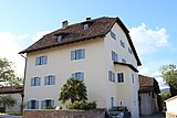
Tschogglhof | Kapellenweg 4 in Girlan 46 ° 27 ′ 45.1 ″ N , 11 ° 16 ′ 42.9 ″ E |
Entry in the monument browser on the website of the South Tyrolean Monuments Office |
|||

|
Sebastianstrasse 3 in Girlan | 46 ° 27 '48.7 " N , 11 ° 16" 48.7 " E |
Entry in the monument browser on the website of the South Tyrolean Monuments Office |
|||

|
Gasthof Weißes Rößl in Girlan | 46 ° 27 '48 " N , 11 ° 16" 54.8 " E |
Entry in the monument browser on the website of the South Tyrolean Monuments Office |
|||
|
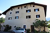
Schleierbrunnhof in Girlan | 46 ° 27 '50.6 " N , 11 ° 16'52.1" E |
Entry in the monument browser on the website of the South Tyrolean Monuments Office |
|||

|
Engelmair in Girlan | 46 ° 27 '52.4 " N , 11 ° 16' 52.5" E |
Entry in the monument browser on the website of the South Tyrolean Monuments Office |
|||
| 37 | Ensemble Girlan - village center east |
Data sheet (PDF) Area: 2.9 ha |
||||
| 37.01 | Jesuheimstrasse and St.-Martin-Strasse or sections of the same with adjacent buildings and accessory areas |
Entry in the monument browser on the website of the South Tyrolean Monuments Office |
||||

|
Weger-Hof | Jesuheimstrasse 8-1 in Girlan 46 ° 27 ′ 45.9 ″ N , 11 ° 16 ′ 58.8 ″ E |
Entry in the monument browser on the website of the South Tyrolean Monuments Office |
|||

|
Ladurner in Girlan | 46 ° 27 '48.3 " N , 11 ° 16' 59.9" E |
Entry in the monument browser on the website of the South Tyrolean Monuments Office |
|||
| 37.02 | Historical part of the Girlan winery cooperative | 46 ° 27 '42.5 " N , 11 ° 16" 59.9 " E | ||||
| 38 | Ensemble Girlan - village center northwest |
Data sheet (PDF) Area: 4 ha |
||||
| 38.01 | Settlement area northwest of St.-Sebastian-Straße | |||||
| 38.02 | Scattered settlement between the village center and the cemetery | |||||
| 39 | Ensemble Girlan - Cemetery |
Data sheet (PDF) Area: 1.4 ha |
||||

|
39.01 | Cemetery with chapel and arcades | 46 ° 27 '49.1 " N , 11 ° 16'35.9" E | Second half of the 19th century. Chapel was built in 1877. |
Entry in the monument browser on the website of the South Tyrolean Monuments Office |
|
| 39.02 | Surrounding vineyards | |||||
| 39.03 | Access road with wayside shrines | |||||
| 40 | Schreckbichl Ensemble |
Data sheet (PDF) Area: 7.5 ha |
||||
| 40.01 | Construction on Schreckbichler Weg | |||||
| Frischhof in Schreckbichl | 46 ° 27 '28.2 " N , 11 ° 17' 39.7" E | younger construction 1893 |
Entry in the monument browser on the website of the South Tyrolean Monuments Office |
|||
| 40.02 | Holy Cross Chapel | 46 ° 27 '26.6 " N , 11 ° 17' 38.2" E | 1823 |
Entry in the monument browser on the website of the South Tyrolean Monuments Office |
||
| 41 | Rungghof ensemble |
Data sheet (PDF) Area: 1.1 ha |
||||
| 41.01 | Gasthof "Rungghof" including accessories | 46 ° 26 '59.7 " N , 11 ° 17'15.8" E | Erected in 1524, remodeled in the 17th century |
Entry in the monument browser on the website of the South Tyrolean Monuments Office |
||
| 42 | Ensemble Kreuzweg |
Data sheet (PDF) Area: 2.5 ha |
||||

|
42.01 | Ansitz Kreuzweg | Sillweg 5 46 ° 26 ′ 40 ″ N , 11 ° 15 ′ 44.3 ″ E |
Entry in the monument browser on the website of the South Tyrolean Monuments Office |
||

|
42.02 | Garber | 46 ° 26 '40.9 " N , 11 ° 15' 42.1" E |
Entry in the monument browser on the website of the South Tyrolean Monuments Office |
||
| 42.03 | Road sections in Kreuzweg | |||||
| 42.04 | Gasthof Kreuzwegerhof | 46 ° 26 '44 " N , 11 ° 15' 44.2" E | ||||
| 43 | Ensemble Kreit |
Data sheet (PDF) Area: 19.6 ha |
||||

|
43.01 | Kreit residence and St. Anton Abt chapel including surrounding cultural grounds and access roads | 46 ° 26 '28.5 " N , 11 ° 15' 57.3" E | End of the 16th century |
Entry in the monument browser on the website of the South Tyrolean Monuments Office |
|
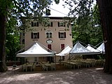
| 44 | Ensemble Matschatsch |
Data sheet (PDF) Area: 3.8 ha |
||||
|
44.01 | Castle Matschatsch with park | 46 ° 26 '18.7 " N , 11 ° 14' 0.6" E | Late 19th century |
Entry in the monument browser on the website of the South Tyrolean Monuments Office |
|
| 44.02 | Gasthof Matschatsch | 46 ° 26 '22.6 " N , 11 ° 13' 55.5" E | ||||
| 45 | Ensemble Montiggl |
Data sheet (PDF) Area: 8.8 ha |
||||
| 45.01 | Historic town center | |||||
|
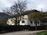
Obertissner in Montiggl | 46 ° 25 '4.9 " N , 11 ° 16" 36.2 " E | 17th century |
Entry in the monument browser on the website of the South Tyrolean Monuments Office |
||
|
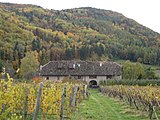
Oberhabsberger in Montiggl | 46 ° 25 ′ 5.3 " N , 11 ° 16 ′ 40.2" E | 13th century, later expanded |
Entry in the monument browser on the website of the South Tyrolean Monuments Office |
||

|
Lower Pardeniger in Montiggl | 46 ° 25 '2.9 " N , 11 ° 16" 39.4 " E |
Entry in the monument browser on the website of the South Tyrolean Monuments Office |
|||

|
Untertissner in Montiggl | 46 ° 25 '1.7 " N , 11 ° 16" 35.8 " E |
Entry in the monument browser on the website of the South Tyrolean Monuments Office |
|||

|
45.02 | Church of the Magi and fire station | 46 ° 25 ′ 3.8 " N , 11 ° 16 ′ 37.6" E | 15th century |
Entry in the monument browser on the website of the South Tyrolean Monuments Office |
|
| 45.03 | Surrounding agricultural area | |||||
| 46 | Ensemble Girlan - Villa Tabarelli |
Data sheet (PDF) Area: 0.8 ha |
||||
| 46.01 | Villa Tabarelli with garden and surrounding hilly landscape | 46 ° 27 '50.5 " N , 11 ° 17' 27.9" E | 1967/1969 | Carlo Scarpa | The architect's concept was to use a pergola as a module for the shape of the villa and, based on these modules, to embed the villa in the terraced vineyard landscape. | |
| 47 | Ensemble Girlan - Marklhof |
Data sheet (PDF) Area: 5 ha |
||||
| 47.01 | Gasthof “Marklhof” with farm and surrounding vineyards | 46 ° 27 '55.5 " N , 11 ° 17" 44.3 " E | The accumulation of the architectural design elements in the area of the entrance give the building complex a particularly elegant character. |
Individual evidence
- ↑ Ensemble protection plan on gis-eppan.gvcc.net of the municipality of Eppan
- ↑ in the monument browser