List of architectural monuments in Rasen-Antholz
The list of architectural monuments in Rasen-Antholz ( Rasun Anterselva in Italian ) contains the 45 objects designated as architectural monuments in the area of the municipality of Rasen-Antholz in South Tyrol .
The basis is the official directory of the monuments in South Tyrol, which can be viewed on the Internet. These can be, for example, sacred buildings , residential houses, farms and aristocratic residences. The order in this list is based on the designation, alternatively it can also be sorted according to the address or the date on which it was placed under protection.
list
| photo | designation | Location | registration | description | Metadata |
|---|---|---|---|---|---|
| Aberle ID: 16604 |
46 ° 46 ′ 54 "N, 12 ° 2 ′ 48" E |
Feb. 16, 1987 (BLR-LAB 606) |
Rural house / farm |
KG: Niederrasen building plot: 75
|
|

|
Old sod ID: 16613 |
46 ° 46 ′ 37 "N, 12 ° 3 ′ 20" E |
Feb. 16, 1987 (BLR-LAB 606) |
Castle ruins |
KG: Niederrasen basic plot: 2195
|
| Antenhofer with oven and mill in Obertal ID: 16595 |
46 ° 52 ′ 25 "N, 12 ° 7 ′ 42" E |
Feb. 16, 1987 (BLR-LAB 606) |
Rural house / farm |
KG: Antholz building plot: 243/1
|
|

|
Anthony's Chapel ID: 18076 |
46 ° 46 '23 "N, 12 ° 2' 26" E |
Feb. 16, 1987 (BLR-LAB 606) |
chapel |
KG: Niederrasen building plot: 62
|

|
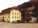
Baumgartnerwirt ID: 16602 |
46 ° 46 ′ 40 ″ N, 12 ° 3 ′ 0 ″ E |
Feb. 16, 1987 (BLR-LAB 606) |
Rural house / farm |
KG: Niederrasen building plot: 40/1 Baumgartner host |
|
Bruggerwirt ID: 18075 |
46 ° 51 ′ 34 ″ N, 12 ° 6 ′ 0 ″ E |
Jan 13, 1951 (MD) |
Rural house / farm |
KG: Antholz building plot: 59/1
|
| Burgfrieden ID: 16616 |
46 ° 47 ′ 37 "N, 12 ° 2 ′ 30" E |
Feb. 16, 1987 (BLR-LAB 606) |
Rural house / farm |
KG: Oberrasen building plot: 120
|
|

|
Garber ID: 16598 |
46 ° 46 '44 "N, 12 ° 2' 54" E |
Feb. 16, 1987 (BLR-LAB 606) |
Rural house / farm |
KG: Niederrasen building plot: 25
|

|
Goller an der Linde ID: 16603 |
46 ° 46 ′ 50 "N, 12 ° 2 ′ 44" E |
Feb. 16, 1987 (BLR-LAB 606) |
Raised hide |
KG: Niederrasen building plot: 66
|

|
Count's house with clerk's house ID: 16597 |
46 ° 46 ′ 46 "N, 12 ° 2 ′ 56" E |
Jan 13, 1951 (MD) |
Residence of the Counts of Welsperg; the clerk's house is a little north at 46 ° 46 ′ 47.1 ″ N , 12 ° 2 ′ 56.5 ″ E |
KG: Niederrasen building plot: 22, 23/1, 23/4
|
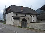
| Gruber Chapel ID: 16587 |
46 ° 51 '17 "N, 12 ° 5' 46" E |
Jan 13, 1951 (MD) |
chapel |
KG: Antholz building plot: 94
|
|
|
Hauser ID: 16615 |
46 ° 47 '10 "N, 12 ° 3' 18" E |
Jan 13, 1951 (MD) |
Rural house / farm |
KG: Oberrasen building plot: 1
|

|
Heufler ID: 16617 |
46 ° 47 ′ 27 "N, 12 ° 3 ′ 20" E |
May 18, 1951 (MD) |
Raised hide |
KG: Oberrasen building plot: 170
|
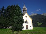
| Imbergkapelle ID: 16608 |
46 ° 47 ′ 0 ″ N, 12 ° 4 ′ 54 ″ E |
Feb. 16, 1987 (BLR-LAB 606) |
chapel |
KG: Niederrasen building plot: 201
|
|
|
Innersießlkapelle ID: 16588 |
46 ° 50 '48 "N, 12 ° 5' 45" E |
Jan 13, 1951 (MD) |
chapel |
KG: Antholz building plot: 118
|

|
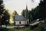
Joggilerstöckl ID: 16614 |
46 ° 46 ′ 40 "N, 12 ° 2 ′ 53" E |
Feb. 16, 1987 (BLR-LAB 606) |
chapel |
KG: Niederrasen ground plot: 2256/8
|
|
Josefskapelle bei Burgfrieden ID: 16620 |
46 ° 47 ′ 35 "N, 12 ° 2 ′ 30" E |
Feb. 16, 1987 (BLR-LAB 606) |
chapel |
KG: Oberrasen building plot: 246
|
| Kaltenhauserkapelle ID: 16590 |
46 ° 50 ′ 20 "N, 12 ° 5 ′ 15" E |
Jan 13, 1951 (MD) |
chapel |
KG: Antholz building plot: 147
|
|
| Chapel at Mair am Ried ID: 16610 |
46 ° 46 ′ 45 ″ N, 12 ° 0 ′ 20 ″ E |
Feb. 16, 1987 (BLR-LAB 606) |
chapel |
KG: Niederrasen ground parcel: 912
|
|
| Chapel near Unterrauth ID: 16609 |
46 ° 46 ′ 54 ″ N, 12 ° 2 ′ 0 ″ E |
Feb. 16, 1987 (BLR-LAB 606) |
chapel |
KG: Niederrasen ground parcel: 649, 673/1, 674/7
|
|
| Chapel in Bad Salomonsbrunn ID: 16593 |
46 ° 49 ′ 22 "N, 12 ° 4 ′ 50" E |
Jan 13, 1951 (MD) |
chapel |
KG: Antholz building plot: 201
|
|
| Cellar at the Bruggerwirt in Mittertal ID: 16586 |
46 ° 51 ′ 36 ″ N, 12 ° 6 ′ 0 ″ E |
Feb. 16, 1987 (BLR-LAB 606) |
Rural house / farm |
KG: Antholz building plot: 4/1
|
|
| Kramer ID: 16585 |
46 ° 51 ′ 37 ″ N, 12 ° 6 ′ 5 ″ E |
Feb. 16, 1987 (BLR-LAB 606) |
Rural house / farm |
KG: Antholz building plot: 53
|
|

|
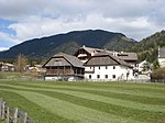
Quieter ID: 16596 |
46 ° 46 ′ 51 ″ N, 12 ° 3 ′ 1 ″ E |
Feb. 16, 1987 (BLR-LAB 606) |
Rural house / farm |
KG: Niederrasen building plot: 8
|
|
Lienharter and Joggiler ID: 16600 |
46 ° 46 ′ 41 ″ N, 12 ° 2 ′ 55 ″ E |
Feb. 16, 1987 (BLR-LAB 606) |
Rural house / farm |
KG: Niederrasen building plot: 37
|

|
Marienkapelle zu Neunhäusern ID: 16606 |
46 ° 46 '29 "N, 12 ° 1' 22" E |
Jan 13, 1951 (MD) |
chapel |
KG: Niederrasen building plot: 85
|

|
Meizger Chapel ID: 16589 |
46 ° 50 ′ 22 "N, 12 ° 5 ′ 39" E |
Jan 13, 1951 (MD) |
chapel |
KG: Antholz building plot: 135
|

|
Neurasen ID: 16622 |
46 ° 47 ′ 28 "N, 12 ° 2 ′ 27" E |
Feb. 16, 1987 (BLR-LAB 606) |
Castle ruins |
KG: Oberrasen basic parcel: 1146/1, 1146/2
|
| Obermair ID: 16592 |
46 ° 49 '24 "N, 12 ° 5' 23" E |
Feb. 16, 1987 (BLR-LAB 606) |
Rural house / farm |
KG: Antholz building plot: 197
|
|
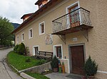
| Oberstallerkapelle ID: 16612 |
46 ° 47 ′ 1 ″ N, 12 ° 3 ′ 56 ″ E |
Feb. 16, 1987 (BLR-LAB 606) |
chapel |
KG: Niederrasen ground parcel: 2153
|
|
|
Peter ID: 16605 |
46 ° 46 ′ 52 "N, 12 ° 2 ′ 47" E |
December 30, 1988 (BLR-LAB 9005) |
Rural house / farm |
KG: Niederrasen building plot: 77
|

|
Pfaffing Chapel ID: 16611 |
46 ° 47 '2 "N, 12 ° 2' 58" E |
Feb. 16, 1987 (BLR-LAB 606) |
chapel |
KG: Niederrasen basic plot: 1216
|

|
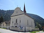
Parish church St. Georg with cemetery chapel and cemetery in Mittertal ID: 16583 |
46 ° 51 '33 "N, 12 ° 5' 57" E |
Feb. 16, 1987 (BLR-LAB 606) |
church |
KG: Antholz building plot: 1, 2 basic plot: 1
|
|
Parish church of St. John the Evangelist with wayside shrine and cemetery ID: 16601 |
46 ° 46 ′ 41 ″ N, 12 ° 2 ′ 59 ″ E |
Feb. 16, 1987 (BLR-LAB 606) |
church |
KG: Niederrasen building plot: 227, 38 basic plot: 1
|

|
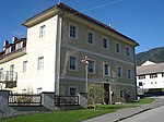
Parish church St. Walburg with cemetery and church square in Niedertal ID: 16591 |
46 ° 49 ′ 52 "N, 12 ° 5 ′ 16" E |
Feb. 16, 1987 (BLR-LAB 606) |
church |
KG: Antholz building plot : 163 basic plot: 946/3, 949
|
|
Pfarrwidum ID: 16599 |
46 ° 46 ′ 42 ″ N, 12 ° 3 ′ 0 ″ E |
Feb. 16, 1987 (BLR-LAB 606) |
Widum / Canon House |
KG: Niederrasen building plot: 31
|

|
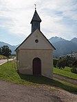
Parish dedication in Mittertal ID: 16584 |
46 ° 51 ′ 35 "N, 12 ° 5 ′ 58" E |
Feb. 16, 1987 (BLR-LAB 606) |
Widum / Canon House |
KG: Antholz building plot: 3/1
|
|
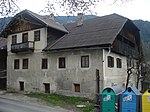
Schiller Chapel ID: 16607 |
46 ° 46 ′ 51 ″ N, 12 ° 0 ′ 51 ″ E |
Feb. 16, 1987 (BLR-LAB 606) |
chapel |
KG: Niederrasen building plot: 96
|
|
Schmieder ID: 16619 |
46 ° 47 '27 "N, 12 ° 3' 25" E |
Feb. 16, 1987 (BLR-LAB 606) |
Rural house / farm |
KG: Oberrasen building plot: 193, 194
|
| Seventh ID: 50396 |
46 ° 50 ′ 20 "N, 12 ° 5 ′ 13" E |
June 22, 2005 (BLR-LAB 2214) |
Rural house / farm |
KG: Antholz building plot: 145/1
|
|

|
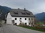
St. Joseph's Chapel in Obertal ID: 16594 |
46 ° 52 ′ 30 "N, 12 ° 7 ′ 35" E |
Oct 15, 1951 (MD) |
chapel |
KG: Antholz building plot: 235
|
|
Storfer ID: 16618 |
46 ° 47 '33 "N, 12 ° 3' 24" E |
Jan 13, 1951 (MD) |
Rural house / farm |
KG: Oberrasen building plot: 181
|

|
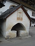
Wiesemannstöckl ID: 50191 |
46 ° 50 ′ 42 "N, 12 ° 5 ′ 21" E |
22 Mar 2004 (BLR-LAB 918) |
chapel |
KG: Antholz base parcel: 705
|
|
Wirtherkapelle ID: 16621 |
46 ° 47 '31 "N, 12 ° 3' 23" E |
Feb. 16, 1987 (BLR-LAB 606) |
chapel |
KG: Oberrasen building plot: 258
|

|
At home at Wegerwirt ID: 18084 |
46 ° 51 ′ 33 "N, 12 ° 5 ′ 56" E |
October 15, 1951 (BLR-LAB 606) |
Rural house / farm |
KG: Antholz building plot: 70/1 |
If no coordinates are known for a monument, the cadastral data at the time it was placed under protection are given as a substitute. These are neither official nor necessarily up-to-date.
The addresses taken from the State Monuments Office may be out of date.
| Photo: | Photograph of the monument. Click the photo generates an enlarged view. There are also two symbols: |
| ID | Identifier at the South Tyrolean Monuments Office |
| KG | Cadastral parish |
| MD | Ministerial Decree |
| BLR-LAB | Decision of the state government - state committee decision |
Web links
- Monument browser of the South Tyrolean Monuments Office