List of architectural monuments in Toblach
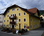
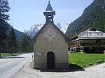
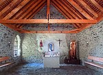
The list of architectural monuments in Toblach (Italian Dobbiaco ) contains the 52 objects designated as architectural monuments in the area of the municipality of Toblach in South Tyrol .
The basis is the official directory of the monuments in South Tyrol, which can be viewed on the Internet. These can be, for example, sacred buildings , residential houses, farms and aristocratic residences. The order in this list is based on the designation, alternatively it can also be sorted according to the address or the date on which it was placed under protection.
list
| photo | designation | Location | registration | description | Metadata |
|---|---|---|---|---|---|
| Altschluderbach ID: 17644 |
46 ° 44 ′ 8 ″ N, 12 ° 13 ′ 12 ″ E |
May 29, 1951 (MD) |
Rural house / farm |
KG: Toblach building plot: 90
|
|
| Back shoemaker- Rogger ID: 17642 |
46 ° 44 ′ 9 ″ N, 12 ° 13 ′ 15 ″ E |
May 29, 1951 (MD) |
Rural house / farm |
KG: Toblach building plot: 84
|
|

|
Toblach railway station ID: 50239 |
46 ° 43 ′ 29 ″ N, 12 ° 13 ′ 32 ″ E |
April 5, 2004 (BLR-LAB 1083) |
Toblach railway station; the coordinates on the left in the Location column refer to the main building; the depot located on 46 ° 43 '28.8 " N , 12 ° 13' 35.1" O . |
KG: Toblach building plot: 320, 321 basic plot: 2721/1
|
| Biedenegg ID: 17640 |
46 ° 44 ′ 7 ″ N, 12 ° 13 ′ 18 ″ E |
Feb. 22, 1988 (BLR-LAB 878) |
Rural house / farm |
KG: Toblach building plot: 72
|
|
| Birgler ID: 17645 |
46 ° 44 ′ 7 ″ N, 12 ° 13 ′ 9 ″ E |
Feb. 22, 1988 (BLR-LAB 878) |
Rural house / farm |
KG: Toblach building plot: 94
|
|

|
Former post office building ID: 50520 |
46 ° 44 ′ 9 ″ N, 12 ° 13 ′ 22 ″ E |
May 11, 2009 (BLR-LAB 1298) |
Administrative building |
KG: Toblach building plot: 67
|

|
Former Grand Hotel with Park ID: 17668 |
46 ° 43 ′ 23 "N, 12 ° 13 ′ 32" E |
Feb. 22, 1988 (BLR-LAB 878) |
hotel |
KG: Toblach building plot : 322/2 Basic plot: 1460/1, 1461, 4808
|

|
Englös (Mutschlechnerhaus) ID: 17641 |
46 ° 44 ′ 9 ″ N, 12 ° 13 ′ 19 ″ E |
Feb. 22, 1988 (BLR-LAB 878) |
Rural house / farm |
KG: Toblach building plot: 73/1
|
| Holiday house ID: 50595 |
46 ° 44 ′ 2 "N, 12 ° 12 ′ 47" E |
May 3, 2016 (BLR-LAB 468) |
Main house in the rural home style, to the north a small timber frame building with a bowling alley, on the west side a former feeding house, which was converted for residential purposes in the 1920s; The client was Gisela Glauber , née von Ruttersheim. the adjacent coordinates refer to the main building to the east; the former feeder is situated at 46 ° 44 '1.6 " N , 12 ° 12' 45.6" O . |
KG: Toblach building plot: 417, 418, 422
|
|

|
Cemetery chapel in Wahlen ID: 17678 |
46 ° 44 ′ 46 ″ N, 12 ° 14 ′ 1 ″ E |
Feb. 22, 1988 (BLR-LAB 878) |
chapel |
KG: Building plot elections : 75
|
| Gatterer ID: 17649 |
Schrafflstrasse 2-4 46 ° 44 ′ 11 ″ N, 12 ° 13 ′ 24 ″ E |
Feb. 22, 1988 (BLR-LAB 878) |
Rural house / farm |
KG: Toblach building plot: 117
|
|

|
Herbstenburg with Park ID: 17638 |
46 ° 44 ′ 9 ″ N, 12 ° 13 ′ 29 ″ E |
Feb. 22, 1988 (BLR-LAB 878) |
Raised hide |
KG: Toblach building plot: 52, 53/1, 53/3 Basic plot : 2, 3/4
|

|
Hotel Baur am See ID: 50389 |
46 ° 42 ′ 22 ″ N, 12 ° 13 ′ 12 ″ E |
June 13, 2005 (BLR-LAB 2087) |
hotel |
KG: Toblach building plot: 347
|
| Innermoar in Aufkirchen ID: 17651 |
46 ° 44 ′ 38 "N, 12 ° 12 ′ 18" E |
Feb. 22, 1988 (BLR-LAB 878) |
Rural house / farm |
KG: Toblach building plot: 131
|
|

|
J.-Walch-Strasse 3 ID: 50232 |
46 ° 44 '12 "N, 12 ° 13' 28" E |
June 30, 2003 (BLR-LAB 2219) |
Rural house / farm |
KG: Toblach building plot: 388
|
| Chapel at Anderter am Haselsberg ID: 17660 |
46 ° 44 ′ 5 "N, 12 ° 15 ′ 37" E |
Feb. 22, 1988 (BLR-LAB 878) |
chapel |
KG: Toblach building plot: 216
|
|
| Chapel at Mitterfeichter am Haselsberg ID: 17673 |
46 ° 44 ′ 0 ″ N, 12 ° 15 ′ 21 ″ E |
Feb. 22, 1988 (BLR-LAB 878) |
chapel |
KG: Toblach basic parcel: 640
|
|
| Chapel in Gratsch ID: 17657 |
46 ° 43 ′ 51 ″ N, 12 ° 12 ′ 16 ″ E |
May 29, 1951 (MD) |
chapel |
KG: Toblach building plot: 156
|
|

|
Chapel in the saw ID: 17671 |
46 ° 42 ′ 54 ″ N, 12 ° 13 ′ 19 ″ E |
Feb. 22, 1988 (BLR-LAB 878) |
chapel |
KG: Toblach building plot: 445
|

|
Chapel in Kandellen ID: 17662 |
46 ° 45 ′ 42 "N, 12 ° 15 ′ 5" E |
Feb. 22, 1988 (BLR-LAB 878) |
chapel |
KG: Toblach building plot: 253
|

|
Chapel in Landro ID: 50455 |
46 ° 38 ′ 31 ″ N, 12 ° 13 ′ 56 ″ E |
Oct. 30, 2006 (BLR-LAB 3929) |
chapel |
KG: Toblach building plot: 197
|

|
Chapel of the Assumption of Mary in Stadlern ID: 17677 |
46 ° 45 ′ 13 ″ N, 12 ° 13 ′ 50 ″ E |
Feb. 22, 1988 (BLR-LAB 878) |
chapel |
KG: Building plot elections : 30
|
| Chapel of St. Peter and Paul in Mellaten ID: 17667 |
46 ° 44 ′ 57 "N, 12 ° 11 ′ 44" E |
Feb. 22, 1988 (BLR-LAB 878) |
chapel |
KG: Toblach building plot: 297
|
|

|
Chapel for the Passion of Christ in Wahlen ID: 17669 |
46 ° 44 '33 "N, 12 ° 13' 43" E |
Feb. 22, 1988 (BLR-LAB 878) |
chapel |
KG: Toblach building plot: 338
|

|
Chapel of the Holy Family in Frondeigen ID: 17664 |
46 ° 45 ′ 50 ″ N, 12 ° 13 ′ 52 ″ E |
Feb. 22, 1988 (BLR-LAB 878) |
chapel |
KG: Toblach building plot: 270
|
| Kirchplatz 8 ID: 50233 |
46 ° 44 ′ 7 ″ N, 12 ° 13 ′ 26 ″ E |
October 12, 1998 (BLR-LAB 4645) |
Urban residential building |
KG: Toblach building plot: 61
|
|
| Klammschlößl with garden ID: 17670 |
46 ° 44 ′ 7 "N, 12 ° 15 ′ 56" E |
Feb. 22, 1988 (BLR-LAB 878) |
Raised hide |
KG: Toblach Building plot: 358 Base plot: 572
|
|
| Granary at the Faust ID: 17636 |
46 ° 44 '22 "N, 12 ° 13' 39" E |
Feb. 22, 1988 (BLR-LAB 878) |
Grain box |
KG: Toblach building plot: 22
|
|

|
Naßwand War Cemetery ID: 17674 |
46 ° 40 ′ 34 "N, 12 ° 13 ′ 16" E |
Feb. 22, 1988 (BLR-LAB 878) |
graveyard |
KG: Toblach land parcel: 2256/2, 2257/2
|
| Mariahilfkapelle am Ratsberg ID: 17665 |
46 ° 44 ′ 50 ″ N, 12 ° 13 ′ 5 ″ E |
Feb. 22, 1988 (BLR-LAB 878) |
chapel |
KG: Toblach building plot: 279
|
|

|
Lady Chapel in Frondeigen ID: 17663 |
46 ° 45 ′ 42 "N, 12 ° 14 ′ 4" E |
Feb. 22, 1988 (BLR-LAB 878) |
chapel |
KG: Toblach building plot: 268
|
| Ox layer (seakeeper) ID: 17659 |
46 ° 42 ′ 55 ″ N, 12 ° 13 ′ 18 ″ E |
Feb. 22, 1988 (BLR-LAB 878) |
Rural house / farm |
KG: Toblach building plot: 188
|
|
| Petertony house with garden ID: 17647 |
46 ° 44 ′ 6 ″ N, 12 ° 13 ′ 7 ″ E |
May 29, 1951 (MD) |
Rural house / farm |
KG: Toblach building plot: 99 basic plot: 202
|
|

|
Parish church of St. John the Baptist with tower, cemetery chapel and cemetery ID: 17635 |
46 ° 44 '8 "N, 12 ° 13' 27" E |
Dec. 4, 1962 (MD) |
church |
KG: Toblach building plot: 1, 2, 3 basic plot: 1
|

|
Parish church of St. Nicholas with cemetery ID: 17675 |
46 ° 44 ′ 46 ″ N, 12 ° 14 ′ 1 ″ E |
Feb. 22, 1988 (BLR-LAB 878) |
church |
KG: elections building plot: 1
|
| Parish registry and former hospital ID: 17676 |
46 ° 44 ′ 45 "N, 12 ° 14 ′ 0" E |
Feb. 22, 1988 (BLR-LAB 878) |
Widum / Canon House |
KG: elections building plot: 3, 4
|
|

|
Town Hall (Old Court House ) ID: 17639 |
46 ° 44 ′ 7 ″ N, 12 ° 13 ′ 22 ″ E |
Feb. 22, 1988 (BLR-LAB 878) |
Administrative building |
KG: Toblach building plot: 65/1
|
| Riedler ID: 17646 |
46 ° 44 ′ 6 ″ N, 12 ° 13 ′ 9 ″ E |
May 29, 1951 (MD) |
Rural house / farm |
KG: Toblach building plot: 96
|
|

|
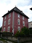
Red tower with outbuildings ID: 17650 |
46 ° 44 ′ 13 ″ N, 12 ° 13 ′ 26 ″ E |
May 29, 1951 (MD) |
Raised hide |
KG: Toblach building plot: 119/1, 119/2, 120, 121, 123
|
| Summer house at Trenkerhof ID: 50241 |
46 ° 43 ′ 42 "N, 12 ° 11 ′ 55" E |
Nov. 30, 1998 (BLR-LAB 5633) |
Villa / summer cottage |
KG: Toblach building plot: 727
|
|

|
St. Joseph in Lehrschach with Calvary Chapel ID: 17661 |
46 ° 43 '48 "N, 12 ° 13' 56" E |
Feb. 22, 1988 (BLR-LAB 878) |
church |
KG: Toblach building plot: 231 Basic plot: 1, 1398, 4679/2, 922
|

|
St. Peter am Kofl ID: 17654 |
46 ° 44 ′ 52 "N, 12 ° 12 ′ 18" E |
Feb. 22, 1988 (BLR-LAB 878) |
Church ruin |
KG: Toblach building plot: 139/2
|
| Stoffer am Radsberg ID: 17666 |
46 ° 44 ′ 51 ″ N, 12 ° 13 ′ 3 ″ E |
Feb. 22, 1988 (BLR-LAB 878) |
Rural house / farm |
KG: Toblach building plot: 285
|
|
| Strobl ID: 17648 |
46 ° 44 ′ 10 ″ N, 12 ° 13 ′ 20 ″ E |
Feb. 22, 1988 (BLR-LAB 878) |
Rural house / farm |
KG: Toblach building plot: 112/1
|
|
| Taschler ID: 17637 |
46 ° 44 ′ 16 ″ N, 12 ° 13 ′ 31 ″ E |
April 18, 1990 (BLR-LAB 2187) |
Rural house / farm |
KG: Toblach building plot: 28
|
|
| Trenker ID: 17658 |
46 ° 43 ′ 39 ″ N, 12 ° 12 ′ 5 ″ E |
Feb. 22, 1988 (BLR-LAB 878) |
Rural house / farm |
KG: Toblach building plot: 163/1
|
|
| Trojer ID: 17656 |
46 ° 44 ′ 38 "N, 12 ° 12 ′ 6" E |
Feb. 22, 1988 (BLR-LAB 878) |
Raised hide |
KG: Toblach building plot: 144
|
|
| Tower near Unterenglmair in Aufkirchen ID: 17655 |
46 ° 44 ′ 37 "N, 12 ° 12 ′ 10" E |
May 29, 1951 (MD) |
Castle |
KG: Toblach building plot: 140
|
|

|
Pilgrimage church to Our Lady of Sorrows with cemetery in Aufkirchen ID: 17652 |
46 ° 44 ′ 39 ″ N, 12 ° 12 ′ 16 ″ E |
Feb. 22, 1988 (BLR-LAB 878) |
church |
KG: Toblach building plot: 132 basic plot: 3730
|

|
Plätzwiese plant ID: 50452 |
46 ° 38 ′ 30 "N, 12 ° 11 ′ 43" E |
Aug 28, 2006 (BLR-LAB 3046) |
Fortifications; the building is located exactly on the municipal boundary between Toblach and Braies , where it is registered as building lot 482 and placed under protection. |
KG: Toblach / Prags building plot: 1026
|
| Widum in Aufkirchen ID: 17653 |
46 ° 44 ′ 40 "N, 12 ° 12 ′ 13" E |
Feb. 22, 1988 (BLR-LAB 878) |
Widum / Canon House |
KG: Toblach building plot: 133
|
|
| Wiesenegg ID: 17643 |
46 ° 44 ′ 9 ″ N, 12 ° 13 ′ 14 ″ E |
May 29, 1951 (MD) |
Rural house / farm |
KG: Toblach building plot: 85 |
If no coordinates are known for a monument, the cadastral data at the time it was placed under protection are given as a substitute. These are neither official nor necessarily up-to-date.
The addresses taken from the State Monuments Office may be out of date.
| Photo: | Photograph of the monument. Click the photo generates an enlarged view. There are also two symbols: |
| ID | Identifier at the South Tyrolean Monuments Office |
| KG | Cadastral parish |
| MD | Ministerial Decree |
| BLR-LAB | Decision of the state government - state committee decision |
Web links
- Monument browser of the South Tyrolean Monuments Office