List of architectural monuments in Tesimo
The list of architectural monuments in Tesimo (Italian : Tesimo ) contains the 49 objects designated as architectural monuments in the area of the municipality of Tesimo in South Tyrol .
The basis is the official directory of the monuments in South Tyrol, which can be viewed on the Internet. These can be, for example, sacred buildings , residential houses, farms and aristocratic residences. The order in this list is based on the designation, alternatively it can also be sorted according to the address or the date on which it was placed under protection.
list
| photo | designation | Location | registration | description | Metadata |
|---|---|---|---|---|---|

|
Poorhouse ID: 17601 |
46 ° 33 ′ 45 "N, 11 ° 10 ′ 16" E |
Oct. 5, 1981 (BLR-LAB 5768) |
Rural house / farm |
KG: Tisens building plot: 40
|

|
Baumann ID: 17613 |
46 ° 33 ′ 12 "N, 11 ° 10 ′ 47" E |
3rd Mar 1951 (MD) |
Rural house / farm |
KG: Tisens building plot : 110 Basic plots: 418/1, 420/3, 420/8
|

|
Bergfried, "Pfister" and castle grounds with enclosing wall of the Zwingenburg ID: 50569 |
46 ° 32 ′ 54 "N, 11 ° 10 ′ 5" E |
Feb. 11, 2013 (BLR-LAB 212) |
Castle complex |
KG: Tisens building plot: 680, 681 Basic plot: 332/2
|

|
Berl ID: 17622 |
46 ° 32 '31 "N, 11 ° 7' 57" E |
Oct. 5, 1981 (BLR-LAB 5768) |
Residential building |
KG: Tisens building plot: 215 at the time of the protection, currently (2014) Bp. 705
|

|
Wayside shrine near St. Jakob in Grissian ID: 17633 |
46 ° 31 '57 "N, 11 ° 10' 43" E |
Oct. 5, 1981 (BLR-LAB 5768) |
Wayside shrine |
KG: Tisen's basic parcel: 1797
|

|
Castle ruins in the wood ID: 17632 |
46 ° 32 ′ 28 "N, 11 ° 10 ′ 10" E |
Oct. 5, 1981 (BLR-LAB 5768) |
Castle ruins |
KG: Tisens basic parcel: 1775
|

|
Casatsch (Pfeffersburg) ID: 17630 |
46 ° 32 ′ 51 ″ N, 11 ° 11 ′ 52 ″ E |
Oct. 5, 1981 (BLR-LAB 5768) |
Castle ruins |
KG: Tisens building plot: 560
|

|
Fahlburg ID: 17612 |
46 ° 33 '13 "N, 11 ° 10' 49" E |
3rd Mar 1951 (MD) |
Raised hide |
KG: Tisens building plot : 109 Basic plot: 420/7
|

|
Faznager ID: 17590 |
46 ° 33 ′ 51 ″ N, 11 ° 10 ′ 10 ″ E |
Oct. 5, 1981 (BLR-LAB 5768) |
Rural house / farm |
KG: Tisens building plot: 18
|

|
Fieger ID: 17615 |
46 ° 33 '15 "N, 11 ° 10' 36" E |
Oct. 5, 1981 (BLR-LAB 5768) |
Rural house / farm |
KG: Tisens building plot: 131/1
|

|
Gardener ID: 17589 |
46 ° 33 ′ 52 ″ N, 11 ° 10 ′ 9 ″ E |
Oct. 5, 1981 (BLR-LAB 5768) |
Rural house / farm |
KG: Tisens building plot: 14/1, 14/2
|

|
Gaßbauer ID: 17596 |
46 ° 33 ′ 49 ″ N, 11 ° 10 ′ 15 ″ E |
Oct. 5, 1981 (BLR-LAB 5768) |
Rural house / farm |
KG: Tisens building plot: 31
|

|
Gasthof zum Adler ID: 17599 |
46 ° 33 '47 "N, 11 ° 10' 10" E |
Oct. 5, 1981 (BLR-LAB 5768) |
Inn |
KG: Tisens building plot: 48/1
|

|
Gasthof zum Löwen ID: 17600 |
46 ° 33 ′ 45 ″ N, 11 ° 10 ′ 12 ″ E |
Oct. 5, 1981 (BLR-LAB 5768) |
Inn |
KG: Tisens building plot: 50/1
|

|
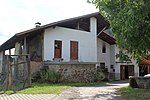
Greifenegg ID: 17603 |
46 ° 33 ′ 1 ″ N, 11 ° 10 ′ 28 ″ E |
Oct. 5, 1981 (BLR-LAB 5768) |
Raised hide |
KG: Tisens building plot: 78
|
|
Hasler ID: 17619 |
46 ° 34 ′ 27 "N, 11 ° 9 ′ 46" E |
Oct. 5, 1981 (BLR-LAB 5768) |
Rural house / farm |
KG: Tisens building plot: 152
|

|
Holer ID: 17588 |
46 ° 33 ′ 55 ″ N, 11 ° 10 ′ 12 ″ E |
Oct. 5, 1981 (BLR-LAB 5768) |
Rural house / farm |
KG: Tisens building plot: 7
|

|
Chapel at Gfrillner Badl ID: 17628 |
46 ° 32 ′ 18 "N, 11 ° 7 ′ 40" E |
Oct. 5, 1981 (BLR-LAB 5768) |
chapel |
KG: Tisens building plot: 297/2
|

|
Chapel at the Stuber ID: 17634 |
46 ° 32 '18 "N, 11 ° 10' 33" E |
5th Mar 1990 (BLR-LAB 1195) |
Wayside shrine |
KG: Tisens basic parcel: 1829
|

|
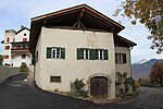
Cat's Tongues ID: 17606 |
46 ° 33 '14 "N, 11 ° 11' 5" E |
3rd Mar 1951 (MD) |
Castle |
KG: Tisens building plot: 95
|
|
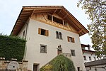
Kessler ID: 17595 |
46 ° 33 '50 "N, 11 ° 10' 14" E |
Oct. 5, 1981 (BLR-LAB 5768) |
Rural house / farm |
KG: Tisens building plot: 29
|
|
Klingler ID: 17610 |
46 ° 33 ′ 13 "N, 11 ° 10 ′ 46" E |
Oct. 5, 1981 (BLR-LAB 5768) |
Rural house / farm |
KG: Tisens building plot: 105/1
|

|
Liedl ID: 17604 |
46 ° 33 '8 "N, 11 ° 10' 47" E |
June 3, 1965 (MD) |
Rural house / farm |
KG: Tisens building plot: 87/1, 87/2
|

|
Mair at the tower in Grissian ID: 17626 |
46 ° 32 ′ 27 "N, 11 ° 11 ′ 14" E |
3rd Mar 1951 (MD) |
Rural house / farm |
KG: Tisens building plot: 249
|

|
Mairhäusl ID: 17594 |
46 ° 33 ′ 51 ″ N, 11 ° 10 ′ 14 ″ E |
Oct. 5, 1981 (BLR-LAB 5768) |
Rural house / farm |
KG: Tisens building plot: 28
|

|
Nals Cross Chapel ID: 17629 |
46 ° 32 '36 "N, 11 ° 11' 39" E |
Oct. 5, 1981 (BLR-LAB 5768) |
chapel |
KG: Tisens building plot: 357
|
| Perdonig (Heufler) ID: 17616 |
46 ° 33 ′ 15 "N, 11 ° 10 ′ 29" E |
Oct. 5, 1981 (BLR-LAB 5768) |
Raised hide |
KG: Tisens building plot: 136/1
|
|

|
Parish Church of the Assumption of Mary with cemetery chapel and cemetery ID: 17592 |
46 ° 33 ′ 49 ″ N, 11 ° 10 ′ 12 ″ E |
Oct. 5, 1981 (BLR-LAB 5768) |
church |
KG: Tisens building plot: 23, 59 Basic plot: 85
|

|
Pfarrwidum ID: 17593 |
46 ° 33 ′ 51 ″ N, 11 ° 10 ′ 13 ″ E |
Oct. 5, 1981 (BLR-LAB 5768) |
Widum / Canon House |
KG: Tisens building plot: 27
|

|
Place Bauer ID: 17611 |
46 ° 33 '14 "N, 11 ° 10' 45" E |
Oct. 5, 1981 (BLR-LAB 5768) |
Rural house / farm |
KG: Tisens building plot: 106
|

|
Town hall (Frankenberg) ID: 17591 |
46 ° 33 ′ 49 ″ N, 11 ° 10 ′ 10 ″ E |
Oct. 5, 1981 (BLR-LAB 5768) |
Raised hide |
KG: Tisens building plot: 19
|

|
Resch ID: 17587 |
46 ° 33 ′ 55 ″ N, 11 ° 10 ′ 9 ″ E |
Oct. 5, 1981 (BLR-LAB 5768) |
Rural house / farm |
KG: Tisens building plot: 5
|

|
Richterhäusl ID: 17598 |
Richterhaus 33 46 ° 33 ′ 46 ″ N, 11 ° 10 ′ 18 ″ E |
Oct. 5, 1981 (BLR-LAB 5768) |
Residential building |
KG: Tisens building plot: 39/1
|
| Saltenbichl ID: 17607 |
Prissian 109 46 ° 33 '24 "N, 11 ° 10' 49" E |
Oct. 5, 1981 (BLR-LAB 5768) |
Residential building |
KG: Tisens building plot: 96
|
|

|
Schmiedhaus ID: 17597 |
46 ° 33 ′ 47 "N, 11 ° 10 ′ 14" E |
Oct. 5, 1981 (BLR-LAB 5768) |
Rural house / farm |
KG: Tisens building plot: 38
|

|
St. Anton Abbot ID: 17631 |
46 ° 33 '30 "N, 11 ° 10' 53" E |
Oct. 5, 1981 (BLR-LAB 5768) |
Church ruin |
KG: Tisens basic parcel: 662
|

|
St. Christoph ID: 17617 |
46 ° 34 ′ 3 "N, 11 ° 10 ′ 49" E |
Oct. 5, 1981 (BLR-LAB 5768) |
church |
KG: Tisens building plot: 140
|

|
St. Hippolytus in Naraun ID: 17618 |
46 ° 34 ′ 52 "N, 11 ° 9 ′ 41" E |
Oct. 5, 1981 (BLR-LAB 5768) |
church |
KG: Tisens building plot: 148
|

|
St. Jakob in Grissian ID: 17625 |
46 ° 31 '57 "N, 11 ° 10' 43" E |
Oct. 5, 1981 (BLR-LAB 5768) |
church |
KG: Tisens building plot: 241
|

|
St. Martin in Prissian ID: 17605 |
46 ° 33 ′ 12 ″ N, 11 ° 11 ′ 1 ″ E |
Oct. 5, 1981 (BLR-LAB 5768) |
church |
KG: Tisens building plot: 92
|

|
St. Nicholas in Gfrill ID: 17624 |
46 ° 33 ′ 3 ″ N, 11 ° 8 ′ 39 ″ E |
Oct. 5, 1981 (BLR-LAB 5768) |
church |
KG: Tisens building plot: 233
|

|
St. Sebastian in Platzers ID: 17621 |
46 ° 33 '24 "N, 11 ° 7' 14" E |
Oct. 5, 1981 (BLR-LAB 5768) |
church |
KG: Tisens building plot: 196
|
| Steinmann ID: 17620 |
46 ° 35 ′ 12 ″ N, 11 ° 9 ′ 24 ″ E |
Oct. 5, 1981 (BLR-LAB 5768) |
Rural house / farm |
KG: Tisens building plot: 168/3
|
|

|
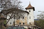
Unter-Haslraster ID: 17623 |
46 ° 32 ′ 50 ″ N, 11 ° 8 ′ 24 ″ E |
Oct. 5, 1981 (BLR-LAB 5768) |
Rural house / farm |
KG: Tisens building plot: 222
|
|
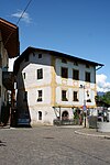
Unterbäck ID: 17614 |
46 ° 33 ′ 12 "N, 11 ° 10 ′ 51" E |
Oct. 5, 1981 (BLR-LAB 5768) |
Rural house / farm |
KG: Tisens building plot: 111
|
|
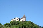
Untertreibgasser ID: 17608 |
46 ° 33 ′ 16 "N, 11 ° 10 ′ 45" E |
October 12, 1987 (BLR-LAB 6181) |
Rural house / farm |
KG: Tisens building plot: 97
|
|
Fortified castle ID: 17627 |
Prissian 7 46 ° 32 '56 "N, 11 ° 11' 9" E |
June 26, 1956 (MD) |
Castle |
KG: Tisens building parcel: 255, 256 basic parcel: 1975, 1976, 1977, 1978, 1979, 1980, 1981/1, 1981/2, 1981/3
|

|
Tenth ID: 17609 |
46 ° 33 '14 "N, 11 ° 10' 43" E |
Oct. 5, 1981 (BLR-LAB 5768) |
Rural house / farm |
KG: Tisens building plot: 100
|

|
Zwingenburg ID: 17602 |
46 ° 32 ′ 55 "N, 11 ° 10 ′ 3" E |
Oct. 5, 1981 (BLR-LAB 5768) |
Part of the castle ruins and nearby farm; this monument only includes a small part of the castle ruins, the main part is protected under the name Bergfried, "Pfister" and castle grounds with the surrounding wall of the Zwingenburg (ID: 50569); the associated farm located at 46 ° 32 '54.9 " N , 11 ° 10' 1.2" O . |
KG: Tisens building plot: 75, 76 |
If no coordinates are known for a monument, the cadastral data at the time it was placed under protection are given as a substitute. These are neither official nor necessarily up-to-date.
The addresses taken from the State Monuments Office may be out of date.
| Photo: | Photograph of the monument. Click the photo generates an enlarged view. There are also two symbols: |
| ID | Identifier at the South Tyrolean Monuments Office |
| KG | Cadastral parish |
| MD | Ministerial Decree |
| BLR-LAB | Decision of the state government - state committee decision |
Web links
- Monument browser of the South Tyrolean Monuments Office