List of architectural monuments in Malles
The list of architectural monuments in Mals ( Malles in Italian ) contains the 110 objects designated as architectural monuments in the area of the municipality of Mals in South Tyrol .
The basis is the official directory of the monuments in South Tyrol, which can be viewed on the Internet. These can be, for example, sacred buildings , residential houses, farms and aristocratic residences. The order in this list is based on the designation, alternatively it can also be sorted according to the address or the date on which it was placed under protection.
list
| photo | designation | Location | registration | description | Metadata |
|---|---|---|---|---|---|
|
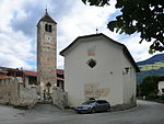
Old cemetery chapel ID: 15740 |
46 ° 40 ′ 49 ″ N, 10 ° 32 ′ 3 ″ E Fraction: Laatsch |
Dec. 15, 1978 (BLR-LAB 8861) |
chapel |
KG: Laatsch building plot: 6
|

|
Old Widum ID: 15811 |
46 ° 40 ′ 50 ″ N, 10 ° 33 ′ 33 ″ E Fraction: Tartsch |
Dec. 15, 1978 (BLR-LAB 8861) |
Widum / Canon House |
KG: Tartsch building plot: 7
|
|
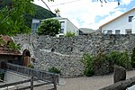
Annaburg ID: 15747 |
46 ° 40 ′ 46 ″ N, 10 ° 31 ′ 59 ″ E Fraction: Laatsch |
Dec. 15, 1978 (BLR-LAB 8861) |
Castle ruins |
KG: Laatsch building plot: 29, 30 basic plot: 1336
|
| Ausserglieshof ID: 50619 |
46 ° 43 ′ 25 "N, 10 ° 40 ′ 53" E |
Nov 12, 2019 (BLR-LAB 951) |
farm |
KG: mud Bauparzelle: 147/1
|
|
|
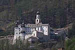
Marienberg Benedictine Abbey ID: 15806 |
46 ° 42 ′ 22 ″ N, 10 ° 31 ′ 14 ″ E Fraction: Burgeis |
Dec. 15, 1978 (BLR-LAB 8861) |
monastery |
KG: Schlinig building plot: 1, 2, 3
|

|
Wayside shrine on the way to Marienberg ID: 15737 |
46 ° 42 ′ 30 ″ N, 10 ° 31 ′ 22 ″ E |
Dec. 15, 1978 (BLR-LAB 8861) |
Wayside shrine |
KG: Burgeis land parcel: 162/1
|
|
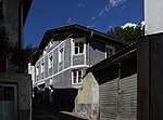
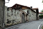
Dr.-Heinrich-Flora-Strasse 2A-B ID: 15759 |
Dr.-Heinrich-Flora-Strasse 2A-B 46 ° 41 ′ 29 ″ N, 10 ° 32 ′ 39 ″ E |
24 Mar 1980 (BLR-LAB 1589) |
Rural house / farm |
KG: Mal building plot: 48
|
|
Dr.-Heinrich-Flora-Strasse 41 ID: 15762 |
Dr.-Heinrich-Flora-Strasse 41 46 ° 41 ′ 36 ″ N, 10 ° 32 ′ 34 ″ E |
15th Mar 1971 (MD) |
Rural house / farm |
KG: Mal building plot: 69
|

|
Drossturm ID: 18061 |
46 ° 41 ′ 24 "N, 10 ° 32 ′ 41" E |
Nov 25, 1951 (MD) |
Castle |
KG: Mal building plot: 91/2
|

|
Former Pforzheimer Hut ID: 50517 |
46 ° 44 ′ 4 "N, 10 ° 26 ′ 16" E |
April 6, 2009 (BLR-LAB 988) |
Refuge |
KG: Schlinig building plot: 73
|

|
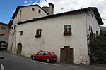
Fröhlichgasse 9 ID: 15775 |
Fröhlichgasse 9 46 ° 41 ′ 22 ″ N, 10 ° 32 ′ 32 ″ E |
24 Mar 1980 (BLR-LAB 1589) |
Rural house / farm |
KG: Mal building plot: 136, 137
|
|
Fröhlichgasse 11 ID: 15774 |
Fröhlichgasse 11 46 ° 41 ′ 21 ″ N, 10 ° 32 ′ 32 ″ E |
24 Mar 1980 (BLR-LAB 1589) |
Rural house / farm |
KG: Mal building plot: 135
|

|
Fröhlichsburg with courtyard ID: 15773 |
46 ° 41 ′ 22 "N, 10 ° 32 ′ 33" E |
Nov 25, 1951 (MD) |
Castle ruins |
KG: Mal building plot : 134 Base plot: 122/1, 122/2, 124, 127
|

|
Early measurement ID: 15739 |
46 ° 40 ′ 51 ″ N, 10 ° 32 ′ 6 ″ E |
6th Mar 1989 (BLR-LAB 1262) |
Rural house / farm |
KG: Laatsch building plot: 1/1, 1/2
|

|
Fürstenburg ID: 15733 |
46 ° 42 ′ 26 "N, 10 ° 31 ′ 34" E |
Dec. 15, 1978 (BLR-LAB 8861) |
Castle |
KG: Burgeis building plot: 139
|

|
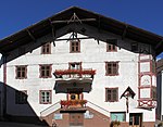
Gasthof Edelweiss ID: 15755 |
46 ° 41 ′ 18 ″ N, 10 ° 32 ′ 52 ″ E |
Oct 20, 1955 (MD) |
Inn |
KG: Mal building plot: 3
|
|
Gasthof Einhorn ID: 15758 |
Hauptplatz 4 46 ° 41 ′ 27 ″ N, 10 ° 32 ′ 40 ″ E |
24 Mar 1980 (BLR-LAB 1589) |
Inn |
KG: Mal building plot: 46
|

|
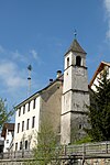
Gasthof Lamm ID: 15760 |
46 ° 41 ′ 29 ″ N, 10 ° 32 ′ 39 ″ E |
24 Mar 1980 (BLR-LAB 1589) |
Inn |
KG: Mal building plot: 49/1
|
|
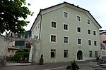
Parish Tower ID: 15782 |
46 ° 41 ′ 35 "N, 10 ° 36 ′ 57" E |
Dec. 15, 1978 (BLR-LAB 8861) |
tower |
KG: Mud building plot: 84
|
|
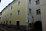
General-Ignaz-Verdroß-Strasse 45A-B ID: 15765 |
General-Ignaz-Verdroß-Strasse 45A-B 46 ° 41 ′ 25 ″ N, 10 ° 32 ′ 41 ″ E |
Nov 25, 1951 (MD) |
Rural house / farm |
KG: Mal building plot: 91/1
|
|
General-Ignaz-Verdroß-Strasse 26 ID: 15757 |
General-Ignaz-Verdroß-Strasse 26 46 ° 41 ′ 23 ″ N, 10 ° 32 ′ 46 ″ E |
6th Mar 1989 (BLR-LAB 1262) |
Rural house / farm |
KG: Mal building plot: 14/1
|

|
Gerbergasse 12 ID: 15776 |
Gerbergasse 12 46 ° 41 ′ 17 ″ N, 10 ° 32 ′ 31 ″ E |
24 Mar 1980 (BLR-LAB 1589) |
Rural house / farm |
KG: Mal building plot: 143
|

|
Greilhof with Anger ID: 15777 |
Spitalstrasse 12 46 ° 41 ′ 21 ″ N, 10 ° 32 ′ 24 ″ E |
13 Mar 1971 (MD) |
Rural house / farm |
KG: Mal building plot: 149 basic plot: 114, 115
|
|
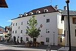
Hauptplatz 1 ID: 15764 |
Hauptplatz 1 46 ° 41 ′ 26 ″ N, 10 ° 32 ′ 39 ″ E |
Nov 25, 1951 (MD) |
Rural house / farm |
KG: Mal building plot: 88/1
|

|
House No. 2 ID: 15794 |
46 ° 43 ′ 18 ″ N, 10 ° 34 ′ 41 ″ E Fraction: Planeil |
Dec. 15, 1978 (BLR-LAB 8861) |
Rural house / farm |
KG: Planeil building plot: 30
|

|
House No. 4 ID: 15802 |
46 ° 41 ′ 33 ″ N, 10 ° 31 ′ 23 ″ E Fraction: Schleis |
24 Mar 1980 (BLR-LAB 1589) |
Rural house / farm |
KG: Schleis building plot: 10/1, 10/2, 185 basic plot: 4/1
|

|
House No. 5 ID: 15801 |
46 ° 41 ′ 33 ″ N, 10 ° 31 ′ 23 ″ E Fraction: Schleis |
Dec. 1, 1980 (BLR-LAB 7651) |
Rural house / farm |
KG: Schleis building plot: 8
|

|
House No. 6 ID: 15818 |
46 ° 40 ′ 59 ″ N, 10 ° 33 ′ 35 ″ E Fraction: Tartsch |
Dec. 15, 1978 (BLR-LAB 8861) |
Rural house / farm |
KG: Tartsch building plot: 60
|

|
House No. 7 ID: 15742 |
46 ° 40 ′ 45 ″ N, 10 ° 32 ′ 10 ″ E Fraction: Laatsch |
Dec. 15, 1978 (BLR-LAB 8861) |
Rural house / farm |
KG: Laatsch building plot: 12/1
|

|
House No. 8 ID: 15743 |
46 ° 40 ′ 45 ″ N, 10 ° 32 ′ 10 ″ E Fraction: Laatsch |
Dec. 15, 1978 (BLR-LAB 8861) |
Rural house / farm |
KG: Laatsch building plot: 14
|

|
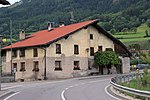
House No. 8 ID: 15793 |
46 ° 43 ′ 19 ″ N, 10 ° 34 ′ 43 ″ E Fraction: Planeil |
Dec. 15, 1978 (BLR-LAB 8861) |
Rural house / farm |
KG: Planeil building plot: 97
|
|
House No. 13 ID: 15816 |
46 ° 40 ′ 55 ″ N, 10 ° 33 ′ 31 ″ E Fraction: Tartsch |
Dec. 15, 1978 (BLR-LAB 8861) |
Rural house / farm |
KG: Tartsch building plot: 43
|

|
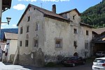
House No. 14 ID: 15819 |
46 ° 40 ′ 52 ″ N, 10 ° 33 ′ 33 ″ E Fraction: Tartsch |
Dec. 15, 1978 (BLR-LAB 8861) |
Rural house / farm |
KG: Tartsch building plot: 71
|
|
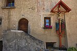
House No. 17 ID: 15730 |
46 ° 42 ′ 37 ″ N, 10 ° 31 ′ 37 ″ E Fraction: Burgeis |
Dec. 15, 1978 (BLR-LAB 8861) |
Urban residential building |
KG: Burgeis building plot: 113
|
|
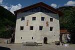
House No. 25 ID: 15812 |
46 ° 40 ′ 51 ″ N, 10 ° 33 ′ 32 ″ E Fraction: Tartsch |
Dec. 15, 1978 (BLR-LAB 8861) |
Rural house / farm |
KG: Tartsch building plot: 16, 186, 187
|
|
House No. 26 ID: 15805 |
46 ° 41 ′ 35 ″ N, 10 ° 31 ′ 17 ″ E Fraction: Schleis |
24 Mar 1980 (BLR-LAB 1589) |
Rural house / farm |
KG: Schleis building plot: 63
|

|
House No. 29 ID: 15729 |
46 ° 42 ′ 39 ″ N, 10 ° 31 ′ 39 ″ E Fraction: Burgeis |
Aug 13, 1971 (MD) |
Rural house / farm |
KG: Burgeis building plot: 94
|

|
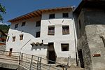
House No. 33 ID: 15814 |
46 ° 40 ′ 53 ″ N, 10 ° 33 ′ 29 ″ E Fraction: Tartsch |
Dec. 15, 1978 (BLR-LAB 8861) |
Rural house / farm |
KG: Tartsch building plot: 36
|
|
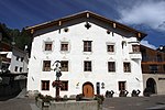
House No. 39-40 ID: 15804 |
46 ° 41 ′ 41 ″ N, 10 ° 31 ′ 18 ″ E Fraction: Schleis |
24 Mar 1980 (BLR-LAB 1589) |
Rural house / farm |
KG: Schleis building plot: 36/1, 36/3
|
|
House No. 46 ID: 15726 |
46 ° 42 ′ 40 ″ N, 10 ° 31 ′ 42 ″ E Fraction: Burgeis |
Aug 13, 1971 (MD) |
Rural house / farm |
KG: Burgeis building plot: 59
|

|
House No. 62 ID: 15725 |
46 ° 42 ′ 46 ″ N, 10 ° 31 ′ 50 ″ E Fraction: Burgeis |
Dec. 15, 1978 (BLR-LAB 8861) |
Rural house / farm |
KG: Burgeis building plot: 34
|

|
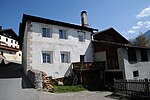
House No. 66 ID: 15724 |
46 ° 42 ′ 43 ″ N, 10 ° 31 ′ 48 ″ E Fraction: Burgeis |
Dec. 15, 1978 (BLR-LAB 8861) |
Rural house / farm |
KG: Burgeis building plot: 29
|
|
House No. 70 ID: 15723 |
46 ° 42 ′ 42 ″ N, 10 ° 31 ′ 47 ″ E Fraction: Burgeis |
Aug 13, 1971 (MD) |
Rural house / farm |
KG: Burgeis building plot: 25
|

|
House No. 72 ID: 15727 |
46 ° 42 ′ 40 ″ N, 10 ° 31 ′ 43 ″ E Fraction: Burgeis |
Aug 13, 1971 (MD) |
Rural house / farm |
KG: Burgeis building plot: 62
|

|
House number 73 ID: 15728 |
46 ° 42 ′ 40 ″ N, 10 ° 31 ′ 42 ″ E Fraction: Burgeis |
Aug 13, 1971 (MD) |
Rural house / farm |
KG: Burgeis building plot: 66
|

|
House No. 88 ID: 15749 |
46 ° 40 ′ 42 ″ N, 10 ° 31 ′ 52 ″ E Fraction: Laatsch |
Jan. 15, 1982 (BLR-LAB 303) |
Rural house / farm |
KG: Laatsch building plot: 68
|

|
House No. 98 ID: 15722 |
46 ° 42 ′ 38 ″ N, 10 ° 31 ′ 49 ″ E Fraction: Burgeis |
Dec. 15, 1978 (BLR-LAB 8861) |
Rural house / farm |
KG: Burgeis building plot: 14
|
|
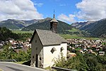
Holy Cross in Pillesait ID: 15736 |
46 ° 42 ′ 31 ″ N, 10 ° 31 ′ 29 ″ E |
Dec. 15, 1978 (BLR-LAB 8861) |
church |
KG: Burgeis building plot: 168
|

|
Farm in Muntetschinig ID: 50171 |
46 ° 41 ′ 0 ″ N, 10 ° 34 ′ 45 ″ E |
July 22, 2002 (BLR-LAB 2657) |
Rural house / farm |
KG: Tartsch building plot: 81
|

|
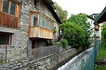
Jägerhaus at Glieshof ID: 15789 |
46 ° 43 ′ 31 ″ N, 10 ° 41 ′ 5 ″ E |
6th Mar 1989 (BLR-LAB 1262) |
Rural house / farm |
KG: Mud plot: 164
|
|
Johannes Mill ID: 50153 |
46 ° 41 ′ 19 ″ N, 10 ° 32 ′ 33 ″ E |
Nov. 24, 2003 (BLR-LAB 4242) |
Mill |
KG: Mal building plot: 128/1
|

|
Joseph Chapel ID: 15790 |
46 ° 41 ′ 18 ″ N, 10 ° 36 ′ 40 ″ E Fraction: mud |
Dec. 15, 1978 (BLR-LAB 8861) |
chapel |
KG: Mud plot: 169
|

|
Joseph Chapel ID: 15817 |
46 ° 40 ′ 56 ″ N, 10 ° 33 ′ 31 ″ E Fraction: Tartsch |
Dec. 15, 1978 (BLR-LAB 8861) |
chapel |
KG: Tartsch building plot: 47
|
|
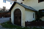
Chapel ID: 15744 |
46 ° 40 ′ 46 ″ N, 10 ° 32 ′ 0 ″ E |
Dec. 15, 1978 (BLR-LAB 8861) |
chapel |
KG: Laatsch building plot: 19
|
|
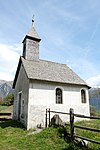
Chapel at Fischgaderhof ID: 50164 |
46 ° 44 ′ 11 "N, 10 ° 31 ′ 41" E |
21 Sep 1998 (BLR-LAB 4242) |
chapel |
KG: Burgeis building plot: 145
|
|
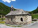
Chapel at Glieshof ID: 15792 |
46 ° 43 ′ 33 "N, 10 ° 41 ′ 5" E |
Dec. 15, 1978 (BLR-LAB 8861) |
chapel |
KG: Matsch land parcel: 2169
|
| Chapel at the Lechtl ID: 15821 |
46 ° 41 ′ 18 "N, 10 ° 34 ′ 31" E |
6th Mar 1989 (BLR-LAB 1262) |
chapel |
KG: Tartsch building plot: 92
|
|
|
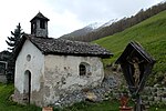
Chapel at Thanei ID: 15788 |
46 ° 43 ′ 26 "N, 10 ° 40 ′ 26" E |
Dec. 15, 1978 (BLR-LAB 8861) |
chapel |
KG: mud Bauparzelle: 144/1
|

|
Capuchin monastery and church ID: 15767 |
46 ° 41 ′ 20 "N, 10 ° 32 ′ 41" E |
24 Mar 1980 (BLR-LAB 1589) |
monastery |
KG: Mal building plot: 104, 105
|

|
Kastellatz ID: 15810 |
46 ° 42 ′ 23 "N, 10 ° 30 ′ 36" E |
Dec. 15, 1978 (BLR-LAB 8861) |
Castle ruins |
KG: Schlinig land parcel: 69
|
|
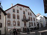
Lichtenegg ID: 15763 |
46 ° 41 ′ 27 "N, 10 ° 32 ′ 38" E |
Nov 25, 1951 (MD) |
Raised hide |
KG: Mal building plot: 83/1
|

|
Malsegg ID: 15756 |
46 ° 41 ′ 21 ″ N, 10 ° 32 ′ 49 ″ E |
24 Mar 1980 (BLR-LAB 1589) |
Raised hide |
KG: Mal building plot: 5
|

|
Visitation of the Virgin Mary ID: 15797 |
46 ° 44 '35 "N, 10 ° 33' 46" E |
21 Sep 1971 (MD) |
church |
KG: Plawenn building plot: 1
|

|
Lady Chapel in Prämajur ID: 15808 |
46 ° 42 ′ 5 ″ N, 10 ° 30 ′ 25 ″ E |
Dec. 15, 1978 (BLR-LAB 8861) |
chapel |
KG: Schlinig building plot: 27
|

|
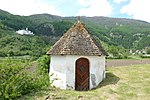
Martin's Chapel ID: 15781 |
46 ° 41 ′ 38 "N, 10 ° 36 ′ 57" E |
Dec. 15, 1978 (BLR-LAB 8861) |
chapel |
KG: Mud building plot: 74
|
|
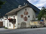
Martin's Chapel ID: 15738 |
46 ° 42 ′ 19 ″ N, 10 ° 31 ′ 50 ″ E |
24 Mar 1980 (BLR-LAB 1589) |
chapel |
KG: Burgeis land parcel: 353
|
|
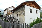
Mesnerhaus ID: 15745 |
46 ° 40 ′ 48 ″ N, 10 ° 32 ′ 1 ″ E |
Dec. 15, 1978 (BLR-LAB 8861) |
Rural house / farm |
KG: Laatsch building plot: 20
|
|
Mill ID: 50421 |
46 ° 40 ′ 46 ″ N, 10 ° 31 ′ 52 ″ E |
16 Sep 2002 (BLR-LAB 3326) |
Rural house / farm |
KG: Laatsch building plot: 51/1
|

|
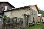
Must be ID: 50543 |
46 ° 41 ′ 32 "N, 10 ° 32 ′ 35" E |
6 Sep 2010 (BLR-LAB 1405) |
Rural house / farm |
KG: Mal building plot: 72
|
|
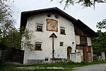
Outbuilding of house no.32 ID: 15815 |
46 ° 40 ′ 52 "N, 10 ° 33 ′ 28" E |
Dec. 15, 1978 (BLR-LAB 8861) |
Rural house / farm |
KG: Tartsch building plot: 41/1
|
|
Pardellesweg 8 ID: 15772 |
Pardellesweg 8 46 ° 41 ′ 15 ″ N, 10 ° 32 ′ 36 ″ E |
May 21, 1982 (BLR-LAB 3073) |
Rural house / farm |
KG: Mal building plot: 120
|

|
Parkgasse 1 ID: 50553 |
Parkgasse 1 46 ° 41 ′ 28 ″ N, 10 ° 32 ′ 41 ″ E |
December 19, 2011 (BLR-LAB 1961) |
Rural house / farm |
KG: Mal building plot: 45
|

|
Parish Church of the Conception of Mary with St. Michael cemetery chapel and cemetery in Burgeis ID: 15732 |
46 ° 42 ′ 38 "N, 10 ° 31 ′ 33" E |
Dec. 15, 1978 (BLR-LAB 8861) |
church |
KG: Burgeis building plot: 121, 122 basic plot: 82
|

|
Parish church Maria Himmelfahrt with cemetery chapel St. Michael and cemetery in Mals ID: 15769 |
46 ° 41 ′ 22 "N, 10 ° 32 ′ 36" E |
24 Mar 1980 (BLR-LAB 1589) |
church |
KG: Mal building plot: 110, 111 basic plot: 237
|

|
Parish church St. Andreas with cemetery ID: 15813 |
46 ° 40 ′ 52 "N, 10 ° 33 ′ 32" E |
Dec. 15, 1978 (BLR-LAB 8861) |
church |
KG: Tartsch building plot: 32 Basic plot: 38
|
|
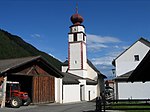
Parish Church of St. Anton Abbot ID: 15809 |
46 ° 42 ′ 19 ″ N, 10 ° 28 ′ 26 ″ E |
24 Mar 1980 (BLR-LAB 1589) |
church |
KG: Schlinig building plot: 49
|

|
Parish church of St. Florin with cemetery ID: 15784 |
46 ° 41 ′ 24 "N, 10 ° 36 ′ 52" E |
Dec. 15, 1978 (BLR-LAB 8861) |
church |
KG: Matsch building plot: 110 Basic plot: 471
|

|
Parish Church of St. Laurentius with cemetery chapel and cemetery ID: 15800 |
46 ° 41 ′ 33 "N, 10 ° 31 ′ 22" E |
24 Mar 1980 (BLR-LAB 1589) |
church |
KG: Schleis building plot: 1, 2 basic plot: 3
|

|
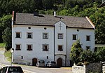
Parish Church of St. Lucius ID: 15741 |
46 ° 40 ′ 48 ″ N, 10 ° 32 ′ 3 ″ E |
Dec. 15, 1978 (BLR-LAB 8861) |
church |
KG: Laatsch building plot: 7
|
|
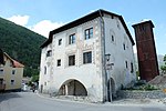
Pfarrwidum ID: 15731 |
46 ° 42 ′ 36 ″ N, 10 ° 31 ′ 32 ″ E Fraction: Burgeis |
Aug 13, 1971 (MD) |
Widum / Canon House |
KG: Burgeis building plot: 120
|
|
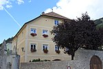
Pfarrwidum ID: 15746 |
46 ° 40 ′ 49 ″ N, 10 ° 32 ′ 1 ″ E Fraction: Laatsch |
Dec. 15, 1978 (BLR-LAB 8861) |
Widum / Canon House |
KG: Laatsch building plot: 22
|
|
Pfarrwidum ID: 15768 |
46 ° 41 ′ 23 ″ N, 10 ° 32 ′ 38 ″ E Fraction: Mals |
24 Mar 1980 (BLR-LAB 1589) |
Widum / Canon House |
KG: Mal building plot: 109/1
|

|
Pfarrwidum ID: 15783 |
46 ° 41 ′ 31 ″ N, 10 ° 36 ′ 55 ″ E Fraction: mud |
6th Mar 1989 (BLR-LAB 1262) |
Widum / Canon House |
KG: Mud plot: 94
|

|
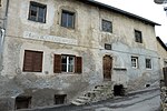
Plawenn ID: 15798 |
46 ° 44 ′ 33 "N, 10 ° 33 ′ 48" E |
21 Sep 1971 (MD) |
Raised hide |
KG: Plawenn building plot: 6
|
|
Punistraße 3 ID: 50482 |
Punistraße 3 46 ° 41 ′ 29 ″ N, 10 ° 32 ′ 31 ″ E |
3rd Mar 2008 (BLR-LAB 672) |
Urban residential building |
KG: Mal building plot: 201
|

|
Schlosserhof ID: 15751 |
46 ° 40 ′ 34 "N, 10 ° 31 ′ 49" E |
Dec. 15, 1978 (BLR-LAB 8861) |
Rural house / farm |
KG: Laatsch building plot: 103/1, 103/2
|

|
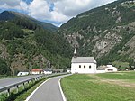
Spitalstrasse 5 ID: 15770 |
Spitalstrasse 5 46 ° 41 ′ 20 ″ N, 10 ° 32 ′ 35 ″ E |
Dec. 1, 1980 (BLR-LAB 7651) |
Rural house / farm |
KG: Mal building plot: 113, 114, 115
|
|
St. Anton ID: 15803 |
46 ° 41 ′ 31 ″ N, 10 ° 31 ′ 35 ″ E |
May 21, 1971 (MD) |
church |
KG: Schleis building plot: 19
|

|
St. Benedict ID: 15779 |
46 ° 41 ′ 25 ″ N, 10 ° 32 ′ 22 ″ E |
24 Mar 1980 (BLR-LAB 1589) |
church |
KG: Mal building plot: 166
|

|
St. Caesarius in Flutsch ID: 15752 |
46 ° 40 ′ 29 "N, 10 ° 31 ′ 32" E |
Dec. 15, 1978 (BLR-LAB 8861) |
church |
KG: Laatsch building plot: 123
|

|
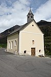
St. Cosmas and Damian ID: 15753 |
46 ° 40 ′ 29 ″ N, 10 ° 31 ′ 31 ″ E |
Dec. 15, 1978 (BLR-LAB 8861) |
church |
KG: Laatsch building plot: 124
|
|
St. Florin ID: 15787 |
46 ° 41 ′ 50 "N, 10 ° 37 ′ 14" E |
Dec. 15, 1978 (BLR-LAB 8861) |
church |
KG: Mud plot: 142
|

|
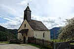
St. Johann ID: 15771 |
46 ° 41 ′ 19 ″ N, 10 ° 32 ′ 35 ″ E |
24 Mar 1980 (BLR-LAB 1589) |
church |
KG: Mal building plot: 116
|
|
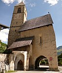
St. Josef in Ulten ID: 15780 |
46 ° 43 ′ 23 "N, 10 ° 33 ′ 27" E |
Oct. 22, 1984 (BLR-LAB 5794) |
church |
KG: Mal building plot: 206
|
|
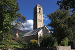
St. Leonhard ID: 15750 |
46 ° 40 ′ 36 "N, 10 ° 31 ′ 49" E |
Dec. 15, 1978 (BLR-LAB 8861) |
church |
KG: Laatsch building plot: 94
|
|
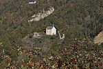
St. Martin ID: 15778 |
46 ° 41 '22 "N, 10 ° 32' 24" E |
Nov 25, 1951 (MD) |
church |
KG: Mal building plot: 154
|
|
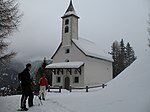
St. Martin in Obermatsch ID: 15785 |
46 ° 40 ′ 59 "N, 10 ° 36 ′ 42" E |
Dec. 15, 1978 (BLR-LAB 8861) |
church |
KG: Mud building plot: 111
|
|
St. Martin in Zerz ID: 15735 |
46 ° 44 ′ 59 ″ N, 10 ° 31 ′ 16 ″ E |
Dec. 15, 1978 (BLR-LAB 8861) |
church |
KG: Burgeis building plot: 146
|

|
St. Michael ID: 15721 |
46 ° 42 ′ 29 ″ N, 10 ° 31 ′ 44 ″ E |
Dec. 15, 1978 (BLR-LAB 8861) |
church |
KG: Burgeis building plot: 1
|

|
St. Nicholas ID: 15796 |
46 ° 43 ′ 18 ″ N, 10 ° 34 ′ 44 ″ E Fraction: Planeil |
Dec. 15, 1978 (BLR-LAB 8861) |
church |
KG: Planeil building plot: 42
|

|
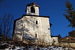
St. Nicholas ID: 15734 |
46 ° 42 ′ 46 ″ N, 10 ° 31 ′ 56 ″ E Fraction: Burgeis |
Dec. 15, 1978 (BLR-LAB 8861) |
church |
KG: Burgeis building plot: 140
|
|
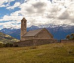
St. Stephan ID: 15807 |
46 ° 42 ′ 5 ″ N, 10 ° 31 ′ 13 ″ E |
Dec. 15, 1978 (BLR-LAB 8861) |
church |
KG: Schlinig building plot: 6
|
|
St. Veit am Bichl ID: 15820 |
46 ° 40 ′ 44 "N, 10 ° 33 ′ 42" E |
Dec. 15, 1978 (BLR-LAB 8861) |
church |
KG: Tartsch building plot: 74
|

|
Tower of the old parish church ID: 15754 |
46 ° 40 ′ 50 ″ N, 10 ° 32 ′ 2 ″ E |
Dec. 15, 1978 (BLR-LAB 8861) |
Romanesque tower |
KG: Laatsch building plot: 134
|

|
Our Lady in Kurtatsch ID: 15786 |
46 ° 41 ′ 19 ″ N, 10 ° 37 ′ 5 ″ E |
Dec. 15, 1978 (BLR-LAB 8861) |
church |
KG: Mud building plot: 130
|

|
Unter- and Obermatsch ID: 15791 |
46 ° 40 ′ 58 "N, 10 ° 36 ′ 42" E |
Dec. 15, 1978 (BLR-LAB 8861) |
Castle ruins; the coordinates on the left in the Location column refer to Obermatsch; Under mud is situated at 46 ° 40 '52.3 " N , 10 ° 36' 34.7" O . |
KG: Matsch plot: 366, 366/1, 366/2
|
|
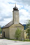
Church of the Fourteen Holy Helpers ID: 15761 |
46 ° 41 ′ 40 "N, 10 ° 32 ′ 31" E |
24 Mar 1980 (BLR-LAB 1589) |
church |
KG: Mal building plot: 61
|
|
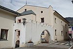
Elementary school ID: 15766 |
Schulgasse 3 46 ° 41 ′ 21 ″ N, 10 ° 32 ′ 48 ″ E |
24 Mar 1980 (BLR-LAB 1589) |
school |
KG: Mal building plot: 100/1
|

|
Wolf ID: 15748 |
46 ° 40 ′ 52 "N, 10 ° 31 ′ 56" E |
16 Sep 1986 (BLR-LAB 5103) |
Building built around 1300
The tower in Wall, late medieval residence of the Scheck family. Research dates the oldest parts of the masonry to the 13th and 14th centuries. Century. |
KG: Laatsch building plot: 37 |
If no coordinates are known for a monument, the cadastral data at the time it was placed under protection are given as a substitute. These are neither official nor necessarily up-to-date.
The addresses taken from the State Monuments Office may be out of date.
| Photo: | Photograph of the monument. Click the photo generates an enlarged view. There are also two symbols: |
| ID | Identifier at the South Tyrolean Monuments Office |
| KG | Cadastral parish |
| MD | Ministerial Decree |
| BLR-LAB | Decision of the state government - state committee decision |
Former architectural monuments
| photo | designation | Location | registration | description | Metadata |
|---|---|---|---|---|---|
| House No. 36-37 ID: 15795 |
46 ° 43 ′ 17 ″ N, 10 ° 34 ′ 42 ″ E Fraction: Planeil |
Jan. 29, 1996 (BLR-LAB 257) |
Rural house / farm; According to the land registry office of Schlanders, the monument protection has been lifted. |
KG: Planeil building plot: 31 |
If no coordinates are known for a monument, the cadastral data at the time it was placed under protection are given as a substitute. These are neither official nor necessarily up-to-date.
The addresses taken from the State Monuments Office may be out of date.
| Photo: | Photograph of the monument. Click the photo generates an enlarged view. There are also two symbols: |
| ID | Identifier at the South Tyrolean Monuments Office |
| KG | Cadastral parish |
| MD | Ministerial Decree |
| BLR-LAB | Decision of the state government - state committee decision |
Web links
- Monument browser of the South Tyrolean Monuments Office
Individual evidence
- ^ Oswald Trapp : Tiroler Burgenbuch. Volume I: Vinschgau . Verlagsanstalt Athesia, Bozen 1972, pp. 33–35.