List of architectural monuments in Neumarkt (South Tyrol)
The list of architectural monuments in Neumarkt ( Egna in Italian ) contains the 71 objects designated as architectural monuments in the area of the municipality of Neumarkt in South Tyrol .
The basis is the official directory of the monuments in South Tyrol, which can be viewed on the Internet. These can be, for example, sacred buildings , residential houses, farms and aristocratic residences. The order in this list is based on the designation, alternatively it can also be sorted according to the address or the date on which it was placed under protection.
list
| photo | designation | Location | registration | description | Metadata |
|---|---|---|---|---|---|

|
Old parish church St. Lorenz ID: 16270 |
46 ° 16 ′ 12 ″ N, 11 ° 14 ′ 21 ″ E Fraction: Laag |
June 11, 1976 (BLR-LAB 3551) |
church |
KG: Laag building plot: 13
|

|
Old elementary school ID: 16330 |
Fleimstaler Strasse 8-9 46 ° 18 ′ 48 ″ N, 11 ° 16 ′ 26 ″ E |
Aug. 29, 1983 (BLR-LAB 4992) |
school |
KG: Neumarkt building plot: 303
|

|
Old Widum ID: 16300 |
Arbors 26-28 46 ° 18 ′ 46 ″ N, 11 ° 16 ′ 18 ″ E |
June 11, 1976 (BLR-LAB 3551) |
Widum / rectory |
KG: Neumarkt building plot: 103
|
| Old sacristan house in Vill ID: 16325 |
46 ° 19 ′ 23 ″ N, 11 ° 16 ′ 48 ″ E Fraction: Vill |
June 11, 1976 (BLR-LAB 3551) |
Widum / rectory |
KG: Neumarkt building plot: 219
|
|

|
Old school house ID: 16299 |
Arbors 22-24 46 ° 18 ′ 46 ″ N, 11 ° 16 ′ 18 ″ E |
June 11, 1976 (BLR-LAB 3551) |
school |
KG: Neumarkt building plot: 102
|

|
Andreas-Hofer-Strasse 1-7 ID: 16279 |
Andreas-Hofer-Strasse 1-7 46 ° 18 ′ 45 ″ N, 11 ° 16 ′ 16 ″ E |
December 5, 1988 (BLR-LAB 7990) |
Urban residential building |
KG: Neumarkt building plot: 44
|

|
Andreas-Hofer-Strasse 2 ID: 16304 |
Andreas-Hofer-Strasse 2 46 ° 18 ′ 46 ″ N, 11 ° 16 ′ 15 ″ E |
May 9, 1950 (MD) |
Urban residential building |
KG: Neumarkt building plot: 114
|

|
Andreas-Hofer-Strasse 4-6 ID: 16305 |
Andreas-Hofer-Strasse 4-6 46 ° 18 ′ 46 ″ N, 11 ° 16 ′ 15 ″ E |
Sep 14 1949 (MD) |
Inn |
KG: Neumarkt building plot: 120
|

|
Andreas-Hofer-Strasse 8-14 ID: 16306 |
Andreas-Hofer-Strasse 8-14 46 ° 18 ′ 45 ″ N, 11 ° 16 ′ 14 ″ E |
May 3, 1982 (BLR-LAB 2457) |
Urban residential building |
KG: Neumarkt building plot: 123
|
| Andreas-Hofer-Strasse 9-13 ID: 16278 |
Andreas-Hofer-Strasse 9-13 46 ° 18 ′ 45 ″ N, 11 ° 16 ′ 16 ″ E |
December 5, 1988 (BLR-LAB 7990) |
Urban residential building |
KG: Neumarkt building plot: 43
|
|
| Andreas-Hofer-Strasse 15-17 ID: 18135 |
Andreas-Hofer-Strasse 15-17 46 ° 18 ′ 45 ″ N, 11 ° 16 ′ 15 ″ E |
October 23, 1995 (BLR-LAB 5477) |
Urban residential building |
KG: Neumarkt building plot: 36
|
|

|
Andreas-Hofer-Strasse 18-20 ID: 16307 |
Andreas-Hofer-Strasse 18-20 46 ° 18 ′ 45 ″ N, 11 ° 16 ′ 14 ″ E |
Aug. 24, 1987 (BLR-LAB 5086) |
Urban residential building |
KG: Neumarkt building plot: 125
|
| Andreas-Hofer-Strasse 19 ID: 16277 |
Andreas-Hofer-Strasse 19 46 ° 18 ′ 45 ″ N, 11 ° 16 ′ 15 ″ E |
May 9, 1950 (MD) |
Urban residential building |
KG: Neumarkt building plot: 29
|
|
| Andreas-Hofer-Strasse 21-29 ID: 50435 |
Andreas-Hofer-Strasse 21-29 46 ° 18 ′ 44 ″ N, 11 ° 16 ′ 14 ″ E |
April 18, 2006 (BLR-LAB 1319) |
Urban residential building |
KG: Neumarkt building plot: 28/1
|
|

|
Andreas-Hofer-Strasse 22 ID: 16308 |
Andreas-Hofer-Strasse 22 46 ° 18 ′ 45 ″ N, 11 ° 16 ′ 14 ″ E |
May 9, 1950 (MD) |
Urban residential building |
KG: Neumarkt building plot: 130/1, 130/2
|

|
Andreas-Hofer-Strasse 30 ID: 16309 |
Andreas-Hofer-Strasse 30 46 ° 18 ′ 45 ″ N, 11 ° 16 ′ 13 ″ E |
May 9, 1950 (MD) |
Urban residential building |
KG: Neumarkt building plot: 135/1
|

|
Andreas-Hofer-Strasse 32 ID: 16310 |
Andreas-Hofer-Strasse 32 46 ° 18 ′ 44 ″ N, 11 ° 16 ′ 12 ″ E |
May 9, 1950 (MD) |
Urban residential building |
KG: Neumarkt building plot: 136
|
| Andreas-Hofer-Strasse 37 ID: 18202 |
Andreas-Hofer-Strasse 37 46 ° 18 ′ 44 ″ N, 11 ° 16 ′ 13 ″ E |
May 9, 1950 (MD) |
Urban residential building |
KG: Neumarkt building plot: 21, 22, 23
|
|

|
Andreas-Hofer-Strasse 44 ID: 16311 |
Andreas-Hofer-Strasse 44 46 ° 18 ′ 44 ″ N, 11 ° 16 ′ 11 ″ E |
May 9, 1950 (MD) |
Urban residential building |
KG: Neumarkt building plot: 154
|

|
Andreas-Hofer-Strasse 52-54 ID: 16312 |
Andreas-Hofer-Strasse 52-54 46 ° 18 ′ 43 ″ N, 11 ° 16 ′ 10 ″ E |
May 9, 1950 (MD) |
Urban residential building |
KG: Neumarkt building plot: 161/1, 161/2
|

|
Andreas-Hofer-Strasse 56-58 ID: 16313 |
Andreas-Hofer-Strasse 56-58 46 ° 18 ′ 43 ″ N, 11 ° 16 ′ 9 ″ E |
June 11, 1976 (BLR-LAB 3551) |
Urban residential building |
KG: Neumarkt building plot: 162, 163
|

|
Andreas-Hofer-Strasse 57 ID: 16275 |
Andreas-Hofer-Strasse 57 46 ° 18 ′ 43 ″ N, 11 ° 16 ′ 12 ″ E |
Aug. 29, 1983 (BLR-LAB 4992) |
Urban residential building |
KG: Neumarkt building plot: 16
|

|
Andreas-Hofer-Strasse 60-64 ID: 16314 |
Andreas-Hofer-Strasse 60-64 46 ° 18 ′ 42 ″ N, 11 ° 16 ′ 9 ″ E |
Aug. 29, 1983 (BLR-LAB 4992) |
Urban residential building |
KG: Neumarkt building plot: 164/1
|

|
Andreas-Hofer-Strasse 65-69 ID: 16274 |
Andreas-Hofer-Strasse 65-69 46 ° 18 ′ 43 ″ N, 11 ° 16 ′ 11 ″ E |
May 9, 1950 (MD) |
Urban residential building |
KG: Neumarkt building plot: 10/1, 10/2
|

|
Andreas-Hofer-Strasse 73 ID: 16273 |
Andreas-Hofer-Strasse 73 46 ° 18 ′ 42 ″ N, 11 ° 16 ′ 10 ″ E |
June 11, 1976 (BLR-LAB 3551) |
Urban residential building |
KG: Neumarkt building plot: 5
|
| Trientner Strasse 31-33 ID: 16286 |
Trientner Strasse 31-33 46 ° 18 ′ 46 ″ N, 11 ° 16 ′ 22 ″ E |
May 27, 1963 (MD) |
Urban residential building |
KG: Neumarkt building plot: 63/1, 63/2
|
|
|
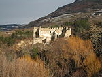
Caldiff ID: 16331 |
46 ° 18 ′ 52 ″ N, 11 ° 17 ′ 8 ″ E Fraction: Mazon |
Sep 14 1949 (MD) |
Castle ruins |
KG: Neumarkt land parcel: 386/1
|

|
Fleimstaler Strasse 2-4 ID: 16287 |
Fleimstaler Strasse 2-4 46 ° 18 ′ 46 ″ N, 11 ° 16 ′ 23 ″ E |
May 27, 1963 (MD) |
Urban residential building |
KG: Neumarkt building plot: 64/1, 64/2
|

|
Fleimstaler Straße 3-5 ID: 16294 |
Fleimstaler Strasse 3-5 46 ° 18 ′ 47 ″ N, 11 ° 16 ′ 24 ″ E |
June 11, 1976 (BLR-LAB 3551) |
Urban residential building |
KG: Neumarkt building plot: 84
|

|
Fleimstaler Strasse 6-12 ID: 16288 |
Fleimstaler Strasse 6-12 46 ° 18 ′ 46 ″ N, 11 ° 16 ′ 25 ″ E |
Sep 14 1949 (MD) |
Rural house / farm |
KG: Neumarkt building plot: 66
|

|
Fleimstaler Straße 7 ID: 16291 |
Fleimstaler Strasse 7 46 ° 18 ′ 49 ″ N, 11 ° 16 ′ 27 ″ E |
Sep 14 1949 (MD) |
Urban residential building |
KG: Neumarkt building plot: 76
|
|
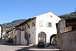
Fleimstaler Straße 14-22 ID: 16289 |
Fleimstaler Strasse 14-22 46 ° 18 ′ 47 ″ N, 11 ° 16 ′ 27 ″ E |
June 11, 1976 (BLR-LAB 3551) |
Urban residential building |
KG: Neumarkt building plot: 67
|

|
Fleimstaler Straße 27 ID: 16315 |
Fleimstaler Strasse 27 46 ° 18 ′ 50 ″ N, 11 ° 16 ′ 32 ″ E |
June 11, 1976 (BLR-LAB 3551) |
Urban residential building |
KG: Neumarkt building plot: 172
|
|
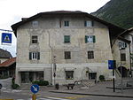
Freiheitsplatz 1-2 ID: 16266 |
Freiheitsplatz 1-2 46 ° 16 ′ 19 ″ N, 11 ° 14 ′ 21 ″ E Fraction: Laag |
June 11, 1976 (BLR-LAB 3551) |
Urban residential building |
KG: Laag building plot: 5
|
|
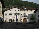
Freiheitsplatz 3-5 ID: 16268 |
Freiheitsplatz 3-5 46 ° 16 ′ 18 ″ N, 11 ° 14 ′ 21 ″ E Fraction: Laag |
June 11, 1976 (BLR-LAB 3551) |
Urban residential building |
KG: Laag building plot: 8/10, 8/5
|
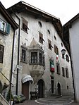
| Gallushof ID: 16271 |
Romstrasse 1 46 ° 18 ′ 38 ″ N, 11 ° 16 ′ 8 ″ E |
May 9, 1950 (MD) |
Rural house / farm |
KG: Neumarkt building plot: 2
|
|
|
Gfrillner Weg 1-5 ID: 16267 |
Gfrillner Weg 1-5 46 ° 16 ′ 19 ″ N, 11 ° 14 ′ 22 ″ E Fraction: Laag |
Sep 14 1949 (MD) |
Urban residential building |
KG: Laag building plot: 6/3
|

|
Gfrillner Weg 31-35 ID: 16269 |
Gfrillner Weg 31-35 46 ° 16 ′ 18 ″ N, 11 ° 14 ′ 24 ″ E Fraction: Laag |
June 11, 1976 (BLR-LAB 3551) |
Urban residential building |
KG: Laag
|

|
Glener Weg 9-11 ID: 16322 |
Glener Weg 9-11 46 ° 19 ′ 0 ″ N, 11 ° 16 ′ 59 ″ E Fraction: Vill |
Sep 14 1949 (MD) |
Rural house / farm |
KG: Neumarkt building plot: 200/2
|

|
Griesfeld ID: 16316 |
46 ° 18 ′ 52 "N, 11 ° 16 ′ 35" E |
June 11, 1976 (BLR-LAB 3551) |
Urban residential building |
KG: Neumarkt building plot: 176
|

|
Hotel Post ID: 16295 |
46 ° 18 ′ 47 "N, 11 ° 16 ′ 23" E |
June 11, 1976 (BLR-LAB 3551) |
hotel |
KG: Neumarkt building plot: 87/1
|

|
Capuchin monastery and church of the fourteen helpers in need ID: 16292 |
46 ° 18 ′ 52 ″ N, 11 ° 16 ′ 24 ″ E |
June 11, 1976 (BLR-LAB 3551) |
monastery |
KG: Neumarkt building plot: 78/1, 79
|

|
Monastery courtyard in the Vill ID: 16328 |
46 ° 19 ′ 23 ″ N, 11 ° 16 ′ 51 ″ E Fraction: Vill |
June 11, 1976 (BLR-LAB 3551) |
Rural house / farm |
KG: Neumarkt building plot: 228
|

|
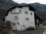
Klösterle ID: 16264 |
46 ° 17 ′ 22 ″ N, 11 ° 14 ′ 45 ″ E Fraction: Laag |
June 11, 1976 (BLR-LAB 3551) |
hospital |
KG: Laag building plot: 1 basic plot: 36
|
|
Kohler in Mazon ID: 16320 |
46 ° 18 ′ 44 ″ N, 11 ° 16 ′ 50 ″ E Fraction: Mazon |
June 11, 1976 (BLR-LAB 3551) |
Rural house / farm |
KG: Neumarkt building plot: 186
|
| Körber in the Vill ID: 16323 |
46 ° 19 ′ 24 ″ N, 11 ° 16 ′ 47 ″ E Fraction: Vill |
June 11, 1976 (BLR-LAB 3551) |
Rural house / farm |
KG: Neumarkt building plot: 217
|
|

|
Arbors 6-8 ID: 16296 |
Arbors 6-8 46 ° 18 ′ 46 ″ N, 11 ° 16 ′ 21 ″ E |
Sep 14 1949 (MD) |
Urban residential building |
KG: Neumarkt building plot: 93
|
| Arbors 9 ID: 16285 |
Arbors 9 46 ° 18 ′ 45 ″ N, 11 ° 16 ′ 21 ″ E |
Sep 14 1949 (MD) |
Urban residential building |
KG: Neumarkt building plot: 56, 58
|
|

|
Arbors 10-14 ID: 16297 |
Arbors 10-14 46 ° 18 ′ 46 ″ N, 11 ° 16 ′ 20 ″ E |
June 11, 1976 (BLR-LAB 3551) |
Urban residential building |
KG: Neumarkt building plot: 100
|

|
Arbors 11-17 ID: 16284 |
Arbors 11-17 46 ° 18 ′ 45 ″ N, 11 ° 16 ′ 20 ″ E |
Sep 14 1949 (MD) |
Urban residential building |
KG: Neumarkt building plot: 52/1, 52/2, 750
|

|
Arbors 16-20 ID: 16298 |
Arbors 16-20 46 ° 18 ′ 46 ″ N, 11 ° 16 ′ 19 ″ E |
Sep 14 1949 (MD) |
Palace |
KG: Neumarkt building plot: 101/1, 101/2, 101/3
|
| Arbors 19-21 ID: 16283 |
Arbors 19-21 46 ° 18 ′ 45 ″ N, 11 ° 16 ′ 19 ″ E |
Sep 14 1949 (MD) |
Urban residential building |
KG: Neumarkt building plot: 51/1, 51/2
|
|

|
Arbors 23-25 ID: 16282 |
Arbors 23-25 46 ° 18 ′ 45 ″ N, 11 ° 16 ′ 19 ″ E |
Aug. 29, 1983 (BLR-LAB 4992) |
Urban residential building |
KG: Neumarkt building plot: 50
|

|
Arbors 27-29 ID: 16281 |
Arbors 27-29 46 ° 18 ′ 45 ″ N, 11 ° 16 ′ 18 ″ E |
June 11, 1976 (BLR-LAB 3551) |
Urban residential building |
KG: Neumarkt building plot: 49
|

|
Arbors 30-32 ID: 16301 |
Arbors 30-32 46 ° 18 ′ 47 ″ N, 11 ° 16 ′ 17 ″ E |
Sep 14 1949 (MD) |
Urban residential building |
KG: Neumarkt building plot: 105
|

|
Arbors 31 ID: 16280 |
Arbors 31 46 ° 18 ′ 45 ″ N, 11 ° 16 ′ 18 ″ E |
June 11, 1976 (BLR-LAB 3551) |
Urban residential building |
KG: Neumarkt building plot: 48
|

|
Arbors 34-36 ID: 16302 |
Arbors 34-36 46 ° 18 ′ 47 ″ N, 11 ° 16 ′ 17 ″ E |
June 11, 1976 (BLR-LAB 3551) |
Urban residential building |
KG: Neumarkt building plot: 106
|

|
Arbors 38-40 ID: 16303 |
Arbors 38-40 46 ° 18 ′ 47 ″ N, 11 ° 16 ′ 16 ″ E |
Sep 14 1949 (MD) |
Urban residential building |
KG: Neumarkt building plot: 107
|

|
Mesnerhaus in the Vill ID: 16324 |
46 ° 19 ′ 20 ″ N, 11 ° 16 ′ 47 ″ E Fraction: Vill |
June 11, 1976 (BLR-LAB 3551) |
Widum / Canon House |
KG: Neumarkt building plot: 218
|

|
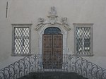
Upper Yngram ID: 16319 |
46 ° 18 ′ 45 ″ N, 11 ° 16 ′ 50 ″ E |
June 11, 1976 (BLR-LAB 3551) |
Rural house / farm |
KG: Neumarkt building plot: 184
|
|
Palais Longo ID: 16290 |
Fleimstaler Strasse 30-32 46 ° 18 ′ 48 ″ N, 11 ° 16 ′ 30 ″ E |
Sep 14 1949 (MD) |
Raised hide |
KG: Neumarkt building plot: 68
|

|
Parish Church of St. Nicholas with Cemetery ID: 16272 |
46 ° 18 ′ 41 ″ N, 11 ° 16 ′ 10 ″ E |
June 11, 1976 (BLR-LAB 3551) |
church |
KG: Neumarkt building lot: 3, 4 basic lot: 7
|
|
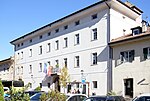
Town hall ID: 16293 |
46 ° 18 ′ 50 ″ N, 11 ° 16 ′ 23 ″ E |
June 11, 1976 (BLR-LAB 3551) |
Administrative building |
KG: Neumarkt building plot: 80/1, 80/3
|
| Castle courtyard in the Vill ID: 16327 |
46 ° 19 ′ 18 ″ N, 11 ° 16 ′ 56 ″ E Fraction: Vill |
June 11, 1976 (BLR-LAB 3551) |
Rural house / farm |
KG: Neumarkt building plot: 222
|
|

|
St. Florian ID: 16265 |
46 ° 17 ′ 10 ″ N, 11 ° 14 ′ 26 ″ E Fraction: Laag |
June 11, 1976 (BLR-LAB 3551) |
church |
KG: Laag building plot: 4
|
|
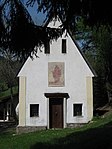
St. Leonhard bei Leitgeb in Gfrill ID: 18070 |
46 ° 16 ′ 45 ″ N, 11 ° 17 ′ 18 ″ E Fraction: Gfrill |
June 16, 1975 (BLR-LAB 2907) |
chapel |
KG: Neumarkt building plot: 258
|

|
St. Michael in Mazon ID: 16317 |
46 ° 18 ′ 42 ″ N, 11 ° 16 ′ 46 ″ E Fraction: Mazon |
June 11, 1976 (BLR-LAB 3551) |
church |
KG: Neumarkt building plot: 181
|

|
Trattmann in Mazon ID: 16321 |
46 ° 18 ′ 44 ″ N, 11 ° 16 ′ 51 ″ E Fraction: Mazon |
June 11, 1976 (BLR-LAB 3551) |
Rural house / farm |
KG: Neumarkt building plot: 187
|
|
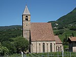
Our Lady in the Vill ID: 16326 |
46 ° 19 ′ 22 ″ N, 11 ° 16 ′ 48 ″ E Fraction: Vill |
June 11, 1976 (BLR-LAB 3551) |
church |
KG: Neumarkt building lot: 220 basic lots: 583, 584, 624
|

|
Lower Yngram ID: 16318 |
46 ° 18 ′ 46 ″ N, 11 ° 16 ′ 49 ″ E Fraction: Mazon |
June 11, 1976 (BLR-LAB 3551) |
Urban residential building |
KG: Neumarkt building plot: 183
|

|
Viller Schlössl ID: 18069 |
46 ° 19 ′ 20 ″ N, 11 ° 16 ′ 59 ″ E Fraction: Vill |
Sep 14 1949 (MD) |
Rural house / farm |
KG: Neumarkt building plot: 223 |
If no coordinates are known for a monument, the cadastral data at the time it was placed under protection are given as a substitute. These are neither official nor necessarily up-to-date.
The addresses taken from the State Monuments Office may be out of date.
| Photo: | Photograph of the monument. Click the photo generates an enlarged view. There are also two symbols: |
| ID | Identifier at the South Tyrolean Monuments Office |
| KG | Cadastral parish |
| MD | Ministerial Decree |
| BLR-LAB | Decision of the state government - state committee decision |
Web links
- Monument browser of the South Tyrolean Monuments Office