List of architectural monuments in Vahrn
The list of architectural monuments in Vahrn ( Italian Varna ) contains the 49 objects designated as architectural monuments in the area of the municipality of Vahrn in South Tyrol .
The basis is the official directory of the monuments in South Tyrol, which can be viewed on the Internet. These can be, for example, sacred buildings , residential houses, farms and aristocratic residences. The order in this list is based on the designation, alternatively it can also be sorted according to the address or the date on which it was placed under protection.
list
| photo | designation | Location | registration | description | Metadata |
|---|---|---|---|---|---|

|
Residence garden with chapel ID: 17794 |
46 ° 44 ′ 44 "N, 11 ° 37 ′ 46" E |
Apr 14, 1950 (MD) |
Raised hide; the chapel is located a little southeast at 46 ° 44 '39.8 " N , 11 ° 37" 49.9 " E |
KG: Vahrn I building plot: 87, 88
|
|
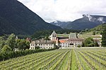
Augustinian Canons' Monastery with Church of the Assumption of Mary, Marienkapelle, Parish Church of St.Margareth with cemetery, Nikolauskapelle, Viktorskapelle, cloister and monastery mill ID: 17760 |
46 ° 44 ′ 39 "N, 11 ° 38 ′ 54" E |
May 12, 1986 (BLR-LAB 2364) |
monastery |
KG: Neustift I building lot: 1, 172, 173, 174, 2, 200, 3, 4/1, 5 basic lot: 1, 12, 3, 4, 5
|

|
Bachbauer ID: 17793 |
46 ° 44 ′ 41 ″ N, 11 ° 37 ′ 46 ″ E |
May 12, 1986 (BLR-LAB 2364) |
Rural house / farm |
KG: Vahrn I building plot: 85
|
| Bacher ID: 17771 |
Pacherweg 1 46 ° 44 ′ 29 ″ N, 11 ° 39 ′ 20 ″ E |
May 12, 1986 (BLR-LAB 2364) |
Rural house / farm |
KG: Neustift I building plot: 46/1
|
|

|
Bernhardt-Ziegl ID: 17780 |
46 ° 44 ′ 33 "N, 11 ° 37 ′ 58" E |
Apr 14, 1950 (MD) |
Rural house / farm |
KG: Vahrn I building plot: 20
|

|
Wayside shrine at Bad Schalders ID: 17776 |
46 ° 44 ′ 17 "N, 11 ° 35 ′ 34" E |
May 12, 1986 (BLR-LAB 2364) |
Wayside shrine |
KG: Schalders building plot: 218
|
|
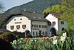
Bridge host ID: 17764 |
Stiftstrasse 2 46 ° 44 ′ 29 ″ N, 11 ° 38 ′ 50 ″ E |
May 12, 1986 (BLR-LAB 2364) |
Rural house / farm, now a hotel / restaurant |
KG: Neustift I Building plot: 13
|

|
Clementenhof-Villa Mayr ID: 17781 |
46 ° 44 ′ 32 "N, 11 ° 37 ′ 57" E |
Apr 14, 1950 (MD) |
Villa / summer cottage |
KG: Vahrn I building plot: 23/1, 23/5
|
| Edenhauser ID: 17770 |
Oberdorf 9 46 ° 44 ′ 25 ″ N, 11 ° 39 ′ 17 ″ E |
May 12, 1986 (BLR-LAB 2364) |
Rural house / farm |
KG: Neustift I Building plot: 45
|
|
|
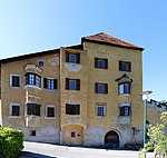
Gallhof ID: 17782 |
46 ° 44 ′ 29 "N, 11 ° 37 ′ 54" E |
May 12, 1986 (BLR-LAB 2346) |
Raised hide |
KG: Vahrn I building plot: 26/1
|

|
Gasthof Goldener Adler (Peintner) ID: 17784 |
Brennerstr. 92 46 ° 44 '18 "N, 11 ° 38' 26" E |
Apr 14, 1950 (MD) |
Inn |
KG: Vahrn I building plot: 52/1
|
|
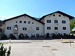
Gasthof Lamm ID: 17783 |
Brennerstrasse 17 46 ° 44 ′ 19 ″ N, 11 ° 38 ′ 25 ″ E |
Apr 14, 1950 (MD) |
Inn |
KG: Vahrn I building plot: 49/1
|
| Grieser ID: 17799 |
Griessweg 5 46 ° 44 '23 "N, 11 ° 38' 35" E |
May 12, 1986 (BLR-LAB 2364) |
Rural house / farm |
KG: Vahrn I building plot: 118
|
|
| Gschlössler ID: 17792 |
Schalderer Strasse 46 ° 44 ′ 35 ″ N, 11 ° 37 ′ 31 ″ E |
May 12, 1986 (BLR-LAB 2364) |
Rural house / farm |
KG: Vahrn I building plot: 84/1, 84/2
|
|
| Hasler ID: 17791 |
46 ° 44 ′ 12 "N, 11 ° 38 ′ 0" E |
May 12, 1986 (BLR-LAB 2364) |
Rural house / farm |
KG: Vahrn I Building plot: 81
|
|
| Holy Cross Chapel at the Hinterrigger ID: 17797 |
46 ° 45 ′ 33 "N, 11 ° 38 ′ 41" E |
May 12, 1986 (BLR-LAB 2364) |
chapel |
KG: Vahrn I building plot: 108
|
|

|
Hofstätter ID: 17769 |
46 ° 44 ′ 22 "N, 11 ° 39 ′ 10" E |
May 12, 1986 (BLR-LAB 2364) |
Raised hide |
KG: Neustift I Building plot: 40
|

|
Hubenbauer ID: 17787 |
Schattengasse 19 46 ° 44 ′ 16 ″ N, 11 ° 38 ′ 8 ″ E |
Apr 14, 1950 (MD) |
Rural house / farm |
KG: Vahrn I building plot: 72
|
| Chapel at Oberseeber ID: 17796 |
46 ° 45 ′ 41 ″ N, 11 ° 38 ′ 4 ″ E |
May 12, 1986 (BLR-LAB 2364) |
chapel |
KG: Vahrn I building plot: 101
|
|
| Chapel at Strasser ID: 17768 |
46 ° 44 ′ 43 "N, 11 ° 39 ′ 17" E |
May 12, 1986 (BLR-LAB 2364) |
chapel |
KG: Neustift I Building plot: 34
|
|

|
Chapel in Spiluck ID: 17802 |
46 ° 45 ′ 18 "N, 11 ° 36 ′ 50" E |
May 12, 1986 (BLR-LAB 2364) |
chapel |
KG: Vahrn I Building plot: 267
|

|
Klosterschmiede ID: 17763 |
46 ° 44 ′ 32 "N, 11 ° 38 ′ 54" E |
May 12, 1986 (BLR-LAB 2364) |
Rural house / farm |
KG: Neustift I Building plot: 10
|

|
War cemetery 1914–1918 with chapel ID: 17805 |
46 ° 43 '38 "N, 11 ° 38' 44" E |
May 12, 1986 (BLR-LAB 2364) |
graveyard |
KG: Vahrn I building plot: 329 basic plot: 1443
|

|
Lidlhof with extension and gardens ID: 17785 |
46 ° 44 ′ 20 "N, 11 ° 38 ′ 11" E |
May 12, 1986 (BLR-LAB 2364) |
Rural house / farm |
KG: Vahrn I building plot: 69, 69/1, 694, 695, 696 basic plot: 183, 183/1, 183/3
|

|
Mesnerhäusl ID: 17788 |
46 ° 44 ′ 16 "N, 11 ° 38 ′ 10" E |
May 12, 1986 (BLR-LAB 2364) |
Rural house / farm |
KG: Vahrn I building plot: 73
|

|
Moar in Sack ID: 17800 |
46 ° 44 '16 "N, 11 ° 38' 49" E |
May 12, 1986 (BLR-LAB 2364) |
Rural house / farm |
KG: Vahrn I building plot: 128
|
|
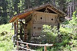
Mill in Spiluck ID: 17801 |
46 ° 45 ′ 24 "N, 11 ° 36 ′ 33" E |
May 12, 1986 (BLR-LAB 2364) |
Mill |
KG: Vahrn I building plot: 259
|
|
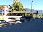
Neustift Bridge ID: 17808 |
46 ° 44 ′ 29 "N, 11 ° 38 ′ 49" E |
May 12, 1986 (BLR-LAB 2364) |
bridge |
KG: Vahrn I land parcel: 3395
|

|
Nigglgasser ID: 17789 |
46 ° 44 ′ 14 "N, 11 ° 38 ′ 12" E |
May 12, 1986 (BLR-LAB 2364) |
Rural house / farm |
KG: Vahrn I building plot: 76/1
|
| Oberplaickner ID: 17774 |
46 ° 45 ′ 18 "N, 11 ° 38 ′ 51" E |
May 12, 1986 (BLR-LAB 2364) |
Rural house / farm |
KG: Neustift I Building plot: 62
|
|

|
Paulgasser ID: 17790 |
46 ° 44 ′ 13 "N, 11 ° 38 ′ 14" E |
May 12, 1986 (BLR-LAB 2346) |
Rural house / farm |
KG: Vahrn I building plot: 78
|
|
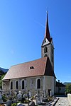
Parish church St. Georg with cemetery chapel and cemetery in Vahrn ID: 17786 |
46 ° 44 ′ 17 "N, 11 ° 38 ′ 9" E |
May 12, 1986 (BLR-LAB 2364) |
church |
KG: Vahrn I Building plot: 71, 330, 331 Base plot: 210
|
|
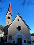
Parish church of St. Wolfgang with cemetery chapel and cemetery in Schalders ID: 17777 |
46 ° 44 ′ 22 "N, 11 ° 35 ′ 48" E |
May 12, 1986 (BLR-LAB 2364) |
church |
KG: Schalders building plot: 227 Base plot: 2376
|
| Plattner ID: 17767 |
46 ° 44 ′ 19 ″ N, 11 ° 39 ′ 9 ″ E |
May 12, 1986 (BLR-LAB 2364) |
Rural house / farm |
KG: Neustift I Building plot: 33
|
|
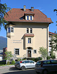
|
Town Hall ID: 17804 |
46 ° 44 ′ 18 "N, 11 ° 38 ′ 13" E |
May 12, 1986 (BLR-LAB 2364) |
Administrative building |
KG: Vahrn I building plot: 328
|
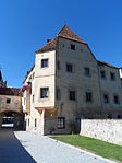
|
Judge's House ID: 17765 |
46 ° 44 ′ 32 "N, 11 ° 38 ′ 56" E |
Sep 15 1980 (BLR-LAB 5260) |
Rural house / farm |
KG: Neustift I Building plot: 14
|

|
Salern ID: 17806 |
46 ° 44 ′ 36 "N, 11 ° 37 ′ 44" E |
Apr 14, 1950 (MD) |
Castle ruins |
KG: Vahrn I Basic parcel: 366
|
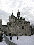
|
St. Michael (Castel Sant'Angelo) ID: 17762 |
46 ° 44 ′ 32 "N, 11 ° 38 ′ 55" E |
May 12, 1986 (BLR-LAB 2364) |
chapel |
KG: Neustift I building plot: 9/2
|
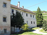
|
Stone cutting house ID: 17766 |
46 ° 44 ′ 33 "N, 11 ° 38 ′ 57" E |
May 12, 1986 (BLR-LAB 2364) |
Rural house / farm |
KG: Neustift I building plot: 15
|
|
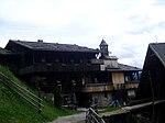
Steinwendhof with chapel ID: 17775 |
46 ° 44 ′ 11 ″ N, 11 ° 33 ′ 6 ″ E |
May 12, 1986 (BLR-LAB 2364) |
Rural house / farm |
KG: Schalders building plot: 155, 156
|

|
Stieglhof ID: 17778 |
46 ° 44 ′ 30 "N, 11 ° 37 ′ 59" E |
Apr 14, 1950 (MD) |
Raised hide |
KG: Vahrn I building plot: 1
|
| Strasser ID: 17772 |
46 ° 44 ′ 42 "N, 11 ° 39 ′ 17" E |
May 12, 1986 (BLR-LAB 2364) |
Rural house / farm |
KG: Neustift I Building plot: 56
|
|
| Unterseeber with chapel and oven ID: 17795 |
46 ° 45 ′ 17 "N, 11 ° 38 ′ 3" E |
May 12, 1986 (BLR-LAB 2364) |
Rural house / farm |
KG: Vahrn I building plot: 95, 97, 98
|
|

|
Villa Lasser ID: 17779 |
46 ° 44 ′ 37 "N, 11 ° 37 ′ 58" E |
Apr 14, 1950 (MD) |
Villa / summer cottage |
KG: Vahrn I building plot: 19
|
| Villa Randeck ID: 17803 |
46 ° 44 ′ 41 ″ N, 11 ° 37 ′ 31 ″ E |
May 12, 1986 (BLR-LAB 2364) |
Villa / summer cottage |
KG: Vahrn I building plot: 292
|
|
|
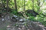
Voitsberg ID: 17807 |
46 ° 44 ′ 48 "N, 11 ° 37 ′ 40" E |
Apr 14, 1950 (MD) |
Castle ruins |
KG: Vahrn I land parcel: 3011
|
| Front trigger with home ID: 17798 |
46 ° 45 ′ 12 "N, 11 ° 38 ′ 20" E |
Apr 14, 1950 (MD) |
Rural house / farm |
KG: Vahrn I building plot: 112
|
|
| Water locks at Neustift Monastery ID: 17761 |
46 ° 44 ′ 38 "N, 11 ° 38 ′ 48" E |
May 12, 1986 (BLR-LAB 2364) |
Water lock |
KG: Neustift I Building plot: 7, 8
|
|
| Ziegler ID: 17773 |
46 ° 44 ′ 52 "N, 11 ° 38 ′ 50" E |
May 12, 1986 (BLR-LAB 2364) |
Rural house / farm |
KG: Neustift I Building plot: 58 |
If no coordinates are known for a monument, the cadastral data at the time it was placed under protection are given as a substitute. These are neither official nor necessarily up-to-date.
The addresses taken from the State Monuments Office may be out of date.
| Photo: | Photograph of the monument. Click the photo generates an enlarged view. There are also two symbols: |
| ID | Identifier at the South Tyrolean Monuments Office |
| KG | Cadastral parish |
| MD | Ministerial Decree |
| BLR-LAB | Decision of the state government - state committee decision |
Web links
- Monument browser of the South Tyrolean Monuments Office
Individual evidence
- ^ Martin Bitschnau , Oswald Trapp : Salern . In: Oswald Trapp (ed.), Tiroler Burgenbuch. IV. Volume: Eisacktal . Publishing house Athesia, Bozen 1977, pp. 16-22.
- ^ Martin Bitschnau , Oswald Trapp : Voitsberg . In: Oswald Trapp (ed.), Tiroler Burgenbuch. IV. Volume: Eisacktal . Publishing house Athesia, Bozen 1977, pp. 14-16.