List of architectural monuments in Auer (South Tyrol)
The list of architectural monuments in Auer (Italian Ora ) contains the 25 objects designated as architectural monuments in the area of the municipality of Auer (South Tyrol) .
The basis is the official directory of the monuments in South Tyrol, which can be viewed on the Internet. These can be, for example, sacred buildings , residential houses, farms and aristocratic residences. The order in this list is based on the designation, alternatively it can also be sorted according to the address or the date on which it was placed under protection.
list
| photo | designation | Location | registration | description | Metadata |
|---|---|---|---|---|---|

|
Abraham ID: 13572 |
Bahnhofstrasse 12 46 ° 20 ′ 56 ″ N, 11 ° 17 ′ 57 ″ E |
June 9, 1975 (BLR-LAB 2764) |
|
KG: Auer building plot: 93/1
|

|
Alte Landstrasse 16 ID: 13573 |
Alte Landstrasse 16 46 ° 20 ′ 51 ″ N, 11 ° 17 ′ 46 ″ E |
June 9, 1975 (BLR-LAB 2764) |
|
KG: Auer building plot: 99
|
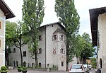
|
Fioreschy residence ID: 13568 |
Kirchplatz 11 46 ° 20 ′ 46 ″ N, 11 ° 18 ′ 6 ″ E |
Jan 13, 1951 (MD) |
|
KG: Auer building plot: 60/1, 60/2, 986
|
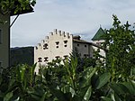
|
Baumgarten ID: 13557 |
Schlossweg 10 46 ° 20 ′ 47 ″ N, 11 ° 18 ′ 12 ″ E |
June 9, 1975 (BLR-LAB 2764) |
Residence with farm and outbuildings. Medieval complex, later enlarged, brought into its present form at the beginning of the 17th century |
KG: Auer building plot: 11/1, 11/2, 11/3, 11/4
|
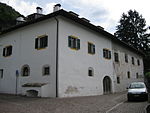
|
Cazan ID: 13559 |
Fuchsloch 2 46 ° 20 ′ 46 ″ N, 11 ° 18 ′ 16 ″ E |
Jan. 22, 1990 (BLR-LAB 249) |
|
KG: Auer building plot: 21/1, 21/2
|

|
Former St. Columban's Chapel ID: 13560 |
Columbangasse 3 46 ° 20 ′ 41 ″ N, 11 ° 18 ′ 12 ″ E |
May 9, 1950 (MD) |
|
KG: Auer building plot: 23
|

|
Fiemme Valley Railway Station ID: 50012 |
46 ° 21 ′ 38 "N, 11 ° 17 ′ 51" E |
October 9, 2000 (BLR-LAB 3786) |
|
KG: Auer building plot: 214
|
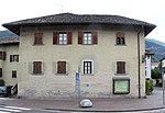
|
Gasthof Rose ID: 13571 |
46 ° 20 ′ 54 "N, 11 ° 17 ′ 59" E |
May 9, 1950 (MD) |
|
KG: Auer building plot: 90/2, 90/3 Basic plot : 1/3
|

|
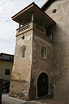
Greiff ID: 13574 |
Alte Landstrasse 13 46 ° 20 ′ 50 ″ N, 11 ° 17 ′ 45 ″ E |
June 9, 1975 (BLR-LAB 2764) |
|
KG: Auer building plot: 105/2
|
|
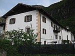
Gschachnes ID: 13569 |
Bildstöcklweg 2 46 ° 20 ′ 47 ″ N, 11 ° 17 ′ 56 ″ E |
June 9, 1975 (BLR-LAB 2764) |
|
KG: Auer building plot: 1095, 71/2, 71/3 Basic plot : 47/4
|
|
Happacher ID: 13558 |
Fuchsloch 1 46 ° 20 ′ 50 ″ N, 11 ° 18 ′ 18 ″ E |
May 9, 1950 (MD) |
|
KG: Auer building plot: 12/1, 12/2, 13, 14, 16/1
|

|
Karnol (Leiterburg) ID: 13578 |
46 ° 20 ′ 46 "N, 11 ° 18 ′ 48" E |
Jan 13, 1951 (MD) |
Wall remains of a castle called Karnol or Leiterburg, possibly dating to the second half of the 13th century |
KG: Auer parcel: 1280
|

|
Kiechelberghof with St. Daniel ID: 13577 |
46 ° 20 ′ 25 ″ N, 11 ° 18 ′ 1 ″ E |
Jan 13, 1951 (MD) |
|
KG: Auer building plot: 129, 130/1
|

|
Kirchplatz 3 ID: 13556 |
Kirchplatz 3 46 ° 20 ′ 47 ″ N, 11 ° 18 ′ 7 ″ E |
June 9, 1975 (BLR-LAB 2764) |
|
KG: Auer building plot: 2/3
|

|
Nardin ID: 13561 |
Wasserfallstrasse 11-13 46 ° 20 ′ 39 ″ N, 11 ° 18 ′ 7 ″ E |
May 9, 1950 (MD) |
|
KG: Auer building plot: 28/1, 28/2, 28/3
|

|
Parish church of St. Peter with cemetery chapel and cemetery ID: 13576 |
46 ° 20 ′ 36 "N, 11 ° 17 ′ 28" E |
June 9, 1975 (BLR-LAB 2764) |
|
KG: Auer building plot: 121/1, 127/2 basic plot : 176
|

|
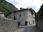
Parish dedication with St. John Nepomuk Chapel ID: 13570 |
46 ° 20 ′ 51 "N, 11 ° 17 ′ 53" E |
June 9, 1975 (BLR-LAB 2764) |
|
KG: Auer building plot: 80, 868 Basic plot: 51
|
|
Pock ID: 13564 |
Wasserfallstrasse 1 46 ° 20 ′ 43 ″ N, 11 ° 18 ′ 10 ″ E |
May 9, 1950 (MD) |
|
KG: Auer building plot: 31/1
|

|
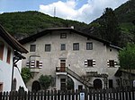
Creator ID: 13565 |
Clauserweg 3 46 ° 20 ′ 44 ″ N, 11 ° 18 ′ 5 ″ E |
May 9, 1950 (MD) |
|
KG: Auer building plot: 46/1
|
|
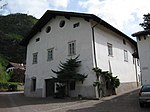
Staffler ID: 13562 |
Wasserfallstrasse 7 46 ° 20 ′ 40 ″ N, 11 ° 18 ′ 11 ″ E |
June 9, 1975 (BLR-LAB 2764) |
|
KG: Auer building plot: 29
|
|
Stone cellar ID: 13566 |
Wasserfallstrasse 2 46 ° 20 ′ 45 ″ N, 11 ° 18 ′ 9 ″ E |
June 9, 1975 (BLR-LAB 2764) |
|
KG: Auer building plot: 54/1
|

|
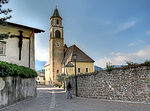
Stieler ID: 13567 |
Kirchplatz 7 46 ° 20 ′ 46 ″ N, 11 ° 18 ′ 7 ″ E |
June 9, 1975 (BLR-LAB 2764) |
|
KG: Auer building plot: 56
|
|
Our Lady of the Rosary ID: 13555 |
46 ° 20 ′ 46 ″ N, 11 ° 18 ′ 8 ″ E |
June 9, 1975 (BLR-LAB 2764) |
|
KG: Auer building plot: 1
|

|
Villa Auerheim with Park ID: 50013 |
Alte Landstrasse 9 46 ° 20 ′ 50 ″ N, 11 ° 17 ′ 47 ″ E |
Jan. 22, 1990 (BLR-LAB 249) |
|
KG: Auer building plot: 106, 108, 109, 946 Basic plot: 95/1, 95/3, 95/4
|

|
Wasserfallstrasse 5 ID: 13563 |
Wasserfallstrasse 5 46 ° 20 ′ 42 ″ N, 11 ° 18 ′ 10 ″ E |
May 9, 1950 (MD) |
|
KG: Auer building plot: 30
|
If no coordinates are known for a monument, the cadastral data at the time it was placed under protection are given as a substitute. These are neither official nor necessarily up-to-date.
The addresses taken from the State Monuments Office may be out of date.
| Photo: | Photograph of the monument. Click the photo generates an enlarged view. There are also two symbols: |
| ID | Identifier at the South Tyrolean Monuments Office |
| KG | Cadastral parish |
| MD | Ministerial Decree |
| BLR-LAB | Decision of the state government - state committee decision |
Web links
- Monument browser of the South Tyrolean Monuments Office
Individual evidence
- ^ Magdalena Hörmann-Weingartner: Leiterburg . In: Magdalena Hörmann-Weingartner (ed.), Tiroler Burgenbuch. Volume X: Überetsch and South Tyrolean Unterland . Athesia publishing house, Bozen 2011, ISBN 978-88-8266-780-1 , pp. 322–326.