List of architectural monuments in Falzes
The list of architectural monuments in Pfalzen ( Falzes in Italian ) contains the 37 objects designated as architectural monuments in the area of the municipality of Pfalzen in South Tyrol .
The basis is the official directory of the monuments in South Tyrol, which can be viewed on the Internet. These can be, for example, sacred buildings , residential houses, farms and aristocratic residences. The order in this list is based on the designation, alternatively it can also be sorted according to the address or the date on which it was placed under protection.
list
| photo | designation | Location | registration | description | Metadata |
|---|---|---|---|---|---|
|
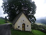
Aichner Stoeckl ID: 16421 |
46 ° 49 ′ 21 ″ N, 11 ° 51 ′ 51 ″ E |
April 10, 1989 (BLR-LAB 1863) |
Wayside shrine |
KG: Issing building plot: 95
|

|
Bachstöckl ID: 16441 |
46 ° 49 ′ 18 ″ N, 11 ° 53 ′ 12 ″ E |
December 22, 1986 (BLR-LAB 7862) |
Wayside shrine |
KG: Pfalzen building plot: 94
|

|
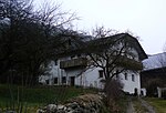
Baumann ID: 16417 |
46 ° 49 ′ 3 "N, 11 ° 50 ′ 56" E |
Oct 5, 1949 (MD) |
Rural house / farm |
KG: Issing building plot: 47
|
|
Elzenbaumer ID: 16442 |
46 ° 49 ′ 7 ″ N, 11 ° 53 ′ 10 ″ E |
December 22, 1986 (BLR-LAB 7862) |
Rural house / farm |
KG: Pfalzen building plot: 98
|

|
Haselrieder ID: 16420 |
46 ° 49 ′ 5 ″ N, 11 ° 51 ′ 25 ″ E |
December 22, 1986 (BLR-LAB 7862) |
Rural house / farm |
KG: Issing building plot: 76
|
|
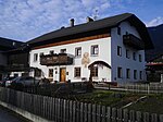
Hilber ID: 16429 |
46 ° 48 '35 "N, 11 ° 52' 54" E |
December 22, 1986 (BLR-LAB 7862) |
Rural house / farm |
KG: Pfalzen building plot: 20
|

|
Höllensteiner ID: 16428 |
46 ° 48 ′ 42 "N, 11 ° 53 ′ 0" E |
December 22, 1986 (BLR-LAB 7862) |
Rural house / farm |
KG: Pfalzen building plot: 13, 480 basic plot: 1223/1, 1223/4
|
|
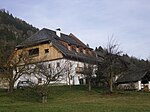
Kaiser ID: 16410 |
46 ° 49 ′ 6 ″ N, 11 ° 54 ′ 3 ″ E |
December 22, 1986 (BLR-LAB 7862) |
Rural house / farm |
KG: Greinwalden building plot: 14
|

|
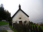
Chapel at Hauser ID: 16409 |
46 ° 48 ′ 42 "N, 11 ° 54 ′ 22" E |
December 22, 1986 (BLR-LAB 7862) |
chapel |
KG: Greinwalden building plot: 1
|
|
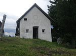
Chapel at Innerhuber ID: 16411 |
46 ° 49 ′ 13 "N, 11 ° 54 ′ 38" E |
December 22, 1986 (BLR-LAB 7862) |
chapel |
KG: Greinwalden building plot: 20
|
|
Chapel at Kofler am Kofl ID: 16413 |
Koflerweg 46 ° 49 ′ 30 ″ N, 11 ° 54 ′ 19 ″ E |
December 22, 1986 (BLR-LAB 7862) |
chapel |
KG: Greinwalden building plot: 29
|

|
Chapel at the Unterehrer ID: 16412 |
46 ° 49 ′ 26 "N, 11 ° 54 ′ 50" E |
December 22, 1986 (BLR-LAB 7862) |
chapel |
KG: Greinwalden building plot: 25
|

|
Granary at Gasser ID: 16433 |
46 ° 48 ′ 47 "N, 11 ° 53 ′ 2" E |
December 22, 1986 (BLR-LAB 7862) |
Grain box |
KG: Pfalzen building plot: 41/2
|

|
Granary near Unterhauser ID: 16431 |
Michael-Pacher-Strasse 14 46 ° 48 ′ 38 ″ N, 11 ° 53 ′ 1 ″ E |
December 22, 1986 (BLR-LAB 7862) |
|
KG: Pfalzen building plot: 26 (at the time of placing under protection) currently 473
|

|
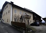
Luttach with garden ID: 16426 |
46 ° 48 '46 "N, 11 ° 52' 57" E |
Oct 5, 1949 (MD) |
Rural house / farm |
KG: Pfalzen building plot: 2 basic plots: 4, 5
|
|
Mairambach ID: 16435 |
46 ° 48 ′ 51 ″ N, 11 ° 53 ′ 7 ″ E |
December 22, 1986 (BLR-LAB 7862) |
Rural house / farm |
KG: Pfalzen building plot: 50
|

|
Maria-Hilf-Chapel near Rohrer ID: 16446 |
46 ° 49 '8 "N, 11 ° 53' 35" E |
December 22, 1986 (BLR-LAB 7862) |
|
KG: Pfalzen basic parcel: 983
|

|
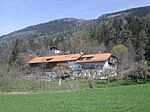
Martinskapelle at the Unteriederhäuserer ID: 16422 |
46 ° 49 ′ 28 "N, 11 ° 50 ′ 58" E |
December 22, 1986 (BLR-LAB 7862) |
chapel |
KG: Issing building plot: 117
|
|
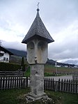
Mason ID: 16439 |
46 ° 49 '8 "N, 11 ° 52' 39" E |
December 22, 1986 (BLR-LAB 7862) |
Rural house / farm |
KG: Pfalzen building plot: 72
|
|
Peststöckl on the road to St. Valentin ID: 16445 |
46 ° 48 ′ 40 "N, 11 ° 53 ′ 13" E |
December 22, 1986 (BLR-LAB 7862) |
Wayside shrine |
KG: Pfalzen basic parcel: 674
|

|
Parish Church of St. Cyriakus with cemetery chapel and cemetery ID: 16425 |
46 ° 48 ′ 44 "N, 11 ° 53 ′ 0" E |
December 22, 1986 (BLR-LAB 7862) |
church |
KG: Pfalzen building plot: 1 basic plot: 1
|

|
Parish dedication with chapel ID: 16432 |
46 ° 48 ′ 44 "N, 11 ° 53 ′ 2" E |
December 22, 1986 (BLR-LAB 7862) |
Widum / Canon House |
KG: Pfalzen building plot: 31, 32/1
|

|
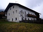
Pramstaller ID: 16438 |
46 ° 49 ′ 5 ″ N, 11 ° 53 ′ 4 ″ E |
December 22, 1986 (BLR-LAB 7862) |
Rural house / farm |
KG: Pfalzen building plot: 68
|
|
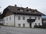
Rainer ID: 16437 |
46 ° 48 ′ 57 ″ N, 11 ° 53 ′ 7 ″ E |
December 22, 1986 (BLR-LAB 7862) |
Rural house / farm |
KG: Pfalzen building plot: 57
|
|
Rantner ID: 16415 |
46 ° 48 ′ 58 "N, 11 ° 51 ′ 44" E |
December 22, 1986 (BLR-LAB 7862) |
Rural house / farm |
KG: Issing building plot: 6/1
|

|
Schöneck ID: 16418 |
46 ° 49 ′ 13 "N, 11 ° 50 ′ 53" E |
Castle |
KG: Issing building plot: 57.58
|
|

|
Ladle with grain bin and oven ID: 16427 |
46 ° 48 ′ 45 "N, 11 ° 52 ′ 57" E |
December 22, 1986 (BLR-LAB 7862) |
|
KG: Pfalzen building plot: 5, 6, 7
|

|
Sichelburg ID: 16436 |
46 ° 48 '53 "N, 11 ° 52' 58" E |
23 Sep 1949 (MD) |
Castle |
KG: Pfalzen building plot: 54
|

|
St. Johann in Hasenried with well chapel ID: 16419 |
46 ° 49 ′ 6 ″ N, 11 ° 51 ′ 25 ″ E |
December 22, 1986 (BLR-LAB 7862) |
church |
KG: Issing building plot: 74, 75
|

|
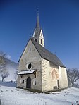
St. Nicholas ID: 16414 |
46 ° 48 '54 "N, 11 ° 51' 46" E |
December 22, 1986 (BLR-LAB 7862) |
church |
KG: Issing building plot: 1
|
|
St. Valentin ID: 16443 |
46 ° 48 ′ 33 "N, 11 ° 53 ′ 35" E |
December 22, 1986 (BLR-LAB 7862) |
church |
KG: Pfalzen building plot: 105
|
|
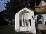
Stöckl at Hilber ID: 16444 |
46 ° 48 ′ 36 "N, 11 ° 52 ′ 49" E |
December 22, 1986 (BLR-LAB 7862) |
Wayside shrine |
KG: Pfalzen basic parcel: 34/3
|

|
Stöckl and Kornkasten at Huber am Georgenberg ID: 16423 |
46 ° 49 ′ 44 "N, 11 ° 50 ′ 59" E |
December 22, 1986 (BLR-LAB 7862) |
chapel |
KG: Issing building plot: 122, 123
|

|
Tanzer Stöckl ID: 16424 |
46 ° 48 ′ 51 ″ N, 11 ° 52 ′ 10 ″ E |
December 22, 1986 (BLR-LAB 7862) |
Wayside shrine |
KG: Issing parcel: 1670
|

|
Teifental ID: 16440 |
46 ° 49 ′ 6 ″ N, 11 ° 52 ′ 19 ″ E |
December 22, 1986 (BLR-LAB 7862) |
Rural house / farm |
KG: Pfalzen building plot: 75
|

|
Carpenter ID: 16434 |
46 ° 48 ′ 49 ″ N, 11 ° 53 ′ 3 ″ E |
December 22, 1986 (BLR-LAB 7862) |
Rural house / farm |
KG: Pfalzen building plot: 42 |
If no coordinates are known for a monument, the cadastral data at the time it was placed under protection are given as a substitute. These are neither official nor necessarily up-to-date.
The addresses taken from the State Monuments Office may be out of date.
| Photo: | Photograph of the monument. Click the photo generates an enlarged view. There are also two symbols: |
| ID | Identifier at the South Tyrolean Monuments Office |
| KG | Cadastral parish |
| MD | Ministerial Decree |
| BLR-LAB | Decision of the state government - state committee decision |
Former architectural monuments
| photo | designation | Location | registration | description | Metadata |
|---|---|---|---|---|---|
|
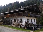
Müller in Mühlen ID: 16416 |
46 ° 49 '3 "N, 11 ° 50' 51" E |
December 22, 1986 (BLR-LAB 7862) |
Rural house / farm; Monument protection canceled with BLR-LAB 246 from March 11, 2014. |
KG: Issing building plot: 38 |
If no coordinates are known for a monument, the cadastral data at the time it was placed under protection are given as a substitute. These are neither official nor necessarily up-to-date.
The addresses taken from the State Monuments Office may be out of date.
| Photo: | Photograph of the monument. Click the photo generates an enlarged view. There are also two symbols: |
| ID | Identifier at the South Tyrolean Monuments Office |
| KG | Cadastral parish |
| MD | Ministerial Decree |
| BLR-LAB | Decision of the state government - state committee decision |
Web links
- Monument browser of the South Tyrolean Monuments Office