List of architectural monuments in Kaltern
The list of architectural monuments in Kaltern ( Italian Caldaro ) contains the 119 objects designated as architectural monuments in the area of the municipality of Kaltern in South Tyrol .
The basis is the official directory of the monuments in South Tyrol, which can be viewed on the Internet. These can be, for example, sacred buildings , residential houses, farms and aristocratic residences. The order in this list is based on the designation, alternatively it can also be sorted according to the address or the date on which it was placed under protection.
list
| photo | designation | Location | registration | description | Metadata |
|---|---|---|---|---|---|

|
Altenburg ID: 15229 |
46 ° 22 ′ 41 ″ N, 11 ° 14 ′ 24 ″ E |
Oct. 20, 1975 (BLR-LAB 5634) |
Castle ruins, completely disappeared above ground |
KG: Kaltern basic parcel: 130/1, 130/2
|

|
Andergassen in Oberplanitzing ID: 15203 |
46 ° 26 '12 "N, 11 ° 14' 53" E |
June 24, 1972 (MD) |
Raised hide |
KG: Caldaro building plot: 447/1, 447/2, 447/3, 447/4, 447/5, 447/6, 447/7, 447/8
|

|
Andreas-Hofer-Strasse 13 ID: 15183 |
Andreas-Hofer-Strasse 13 46 ° 24 ′ 51 ″ N, 11 ° 14 ′ 47 ″ E |
Jan 17, 1951 (MD) |
Urban residential building |
KG: Kaltern building plot: 346
|

|
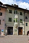
Andreas-Hofer-Strasse 16 ID: 50141 |
Andreas-Hofer-Strasse 16 46 ° 24 ′ 52 ″ N, 11 ° 14 ′ 46 ″ E |
December 21, 1998 (BLR-LAB 6118) |
Rural house / farm |
KG: Kaltern building plot: 359
|
|
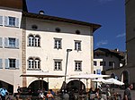
Andreas-Hofer-Strasse 18 ID: 15187 |
Andreas-Hofer-Strasse 18 46 ° 24 ′ 52 ″ N, 11 ° 14 ′ 45 ″ E |
December 17, 1990 (BLR-LAB 8108) |
Urban residential building |
KG: Kaltern building plot: 358
|

|
Andreas-Hofer-Strasse 20 ID: 15186 |
Andreas-Hofer-Strasse 20 46 ° 24 ′ 51 ″ N, 11 ° 14 ′ 46 ″ E |
Jan 17, 1951 (MD) |
Urban residential building |
KG: Kaltern building plot: 355
|
|
Andreas-Hofer-Strasse 34 ID: 15175 |
Andreas-Hofer-Strasse 34 46 ° 24 ′ 49 ″ N, 11 ° 14 ′ 46 ″ E |
Oct. 20, 1975 (BLR-LAB 5634) |
Urban residential building |
KG: Kaltern building plot: 335
|

|
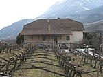
Kaltern train station ID: 50511 |
46 ° 25 ′ 5 ″ N, 11 ° 15 ′ 3 ″ E |
June 3, 2008 (BLR-LAB 1870) |
Train station / Remise |
KG: Kaltern building plot: 551
|
|
Battistihof ID: 15219 |
46 ° 24 ′ 4 "N, 11 ° 15 ′ 33" E |
December 17, 1990 (BLR-LAB 8108) |
Rural house / farm |
KG: Kaltern building plot: 483, 484, 485, 486
|
| Brunnenstrasse 8-9 ID: 15102 |
Brunnenstrasse 8-9 46 ° 25 ′ 0 ″ N, 11 ° 13 ′ 57 ″ E |
Oct. 20, 1975 (BLR-LAB 5634) |
Rural house / farm |
KG: Kaltern building plot: 101, 102, 103
|
|

|
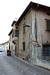
Bühel 1-2 (Torgglkeller) ID: 15191 |
Bichl 2 46 ° 24 '52 "N, 11 ° 14' 48" E |
Oct. 20, 1975 (BLR-LAB 5634) |
Rural house / farm |
KG: Kaltern building plot: 376, 377, 378, 379, 380, 381
|
|
Buol with outbuildings ID: 15192 |
46 ° 24 ′ 55 "N, 11 ° 14 ′ 50" E |
Oct. 20, 1975 (BLR-LAB 5634) |
Raised hide |
KG: Kaltern building plot: 400, 401, 402/2, 403
|

|
Ebenheim ID: 15138 |
Major-von-Morandell-Platz 24 46 ° 24 ′ 52 ″ N, 11 ° 14 ′ 8 ″ E |
July 6, 1951 (MD) |
Urban residential building |
KG: Kaltern building plot: 215/1
|

|
Franciscan monastery with St. Claudia Church ID: 15157 |
Rottenburgplatz 3 46 ° 24 ′ 46 ″ N, 11 ° 14 ′ 38 ″ E |
Oct. 20, 1975 (BLR-LAB 5634) |
monastery |
KG: Kaltern building plot: 294, 295/1
|
|
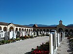
Cemetery ID: 15221 |
46 ° 24 ′ 36 "N, 11 ° 14 ′ 45" E |
December 17, 1990 (BLR-LAB 8108) |
graveyard |
KG: Kaltern building plot: 493, 600, 894 Base plot: 2905
|

|
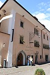
Gasthof Goldener Stern ID: 15184 |
Andreas-Hofer-Strasse 28 46 ° 24 ′ 50 ″ N, 11 ° 14 ′ 45 ″ E |
Jan 17, 1951 (MD) |
Inn |
KG: Kaltern building plot: 348
|
|
Gasthof Turm ID: 15185 |
Andreas-Hofer-Strasse 32 46 ° 24 ′ 49 ″ N, 11 ° 14 ′ 46 ″ E |
Jan 17, 1951 (MD) |
Inn |
KG: Kaltern building plot: 350/1
|

|
Gasthof Weißes Rößl ID: 15170 |
Marktplatz 11 46 ° 24 ′ 47 ″ N, 11 ° 14 ′ 46 ″ E |
Jan 17, 1951 (MD) |
Inn |
KG: Kaltern building plot: 323
|

|
Giovanelli with outbuilding and garden ID: 15129 |
46 ° 24 ′ 39 ″ N, 11 ° 14 ′ 3 ″ E |
June 4, 1985 (BLR-LAB 2514) |
Raised hide |
KG: Kaltern building plot: 178, 179, 180 Basic plot: 802, 805
|

|
Goldgasse 2 ID: 18160 |
Goldgasse 2 46 ° 24 ′ 46 ″ N, 11 ° 14 ′ 45 ″ E |
June 13, 1994 (BLR-LAB 3301) |
Urban residential building |
KG: Kaltern building plot: 322
|

|
Goldgasse 3 ID: 15178 |
Goldgasse 3 46 ° 24 ′ 46 ″ N, 11 ° 14 ′ 46 ″ E |
Oct. 20, 1975 (BLR-LAB 5634) |
Urban residential building |
KG: Kaltern building plot: 338/1, 338/2
|
|
Goldgasse 5 ID: 15179 |
Goldgasse 5 46 ° 24 ′ 45 ″ N, 11 ° 14 ′ 46 ″ E |
Oct. 20, 1975 (BLR-LAB 5634) |
Urban residential building |
KG: Kaltern building plot: 339
|

|
Goldgasse 6 ID: 15169 |
Goldgasse 6 46 ° 24 ′ 46 ″ N, 11 ° 14 ′ 45 ″ E |
Jan 17, 1951 (MD) |
Urban residential building |
KG: Kaltern building plot: 320
|

|
Goldgasse 7 ID: 15166 |
Goldgasse 7 46 ° 24 ′ 45 ″ N, 11 ° 14 ′ 46 ″ E |
Jan 17, 1951 (MD) |
Urban residential building |
KG: Kaltern building plot: 317
|

|
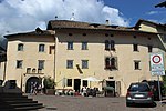
Goldgasse 8 ID: 15168 |
Goldgasse 8 46 ° 24 ′ 45 ″ N, 11 ° 14 ′ 45 ″ E |
Jan 17, 1951 (MD) |
Urban residential building |
KG: Kaltern building plot: 319
|
|
Goldgasse 10 ID: 15167 |
Goldgasse 10 46 ° 24 ′ 45 ″ N, 11 ° 14 ′ 45 ″ E |
Jan 17, 1951 (MD) |
Urban residential building |
KG: Kaltern building plot: 318
|
|
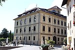
Goldgasse 11 ID: 15164 |
Goldgasse 11 46 ° 24 ′ 44 ″ N, 11 ° 14 ′ 44 ″ E |
Oct. 20, 1975 (BLR-LAB 5634) |
Urban residential building |
KG: Kaltern building plot: 312/1, 754, 757 Basic plot: 1010/4
|

|
Goldgasse 13 ID: 15163 |
Goldgasse 13 46 ° 24 ′ 44 ″ N, 11 ° 14 ′ 44 ″ E |
Oct. 20, 1975 (BLR-LAB 5634) |
Urban residential building |
KG: Kaltern building plot: 311
|

|
Goldgasse 15 ID: 15162 |
Goldgasse 15 46 ° 24 ′ 43 ″ N, 11 ° 14 ′ 43 ″ E |
May 28, 1979 (BLR-LAB 3106) |
Urban residential building |
KG: Kaltern building plot: 310/1, 310/2
|

|
Goldgasse 21 ID: 15160 |
Goldgasse 21 46 ° 24 ′ 43 ″ N, 11 ° 14 ′ 41 ″ E |
Oct. 20, 1975 (BLR-LAB 5634) |
Urban residential building |
KG: Kaltern building plot: 303
|
|
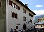
Goldgasse 23 ID: 15158 |
Goldgasse 23 46 ° 24 ′ 43 ″ N, 11 ° 14 ′ 40 ″ E |
Jan 17, 1951 (MD) |
Urban residential building |
KG: Kaltern building plot: 301/1, 301/5, 301/7
|

|
Greifenburg ID: 15226 |
46 ° 22 '35 "N, 11 ° 15' 3" E |
May 18, 1951 (MD) |
Raised hide |
KG: Kaltern building plot: 516
|

|
Gungano 5 ID: 15195 |
Gungano 5 46 ° 24 ′ 56 "N, 11 ° 14 ′ 47" E |
Oct. 20, 1975 (BLR-LAB 5634) |
Urban residential building |
KG: Kaltern building plot: 424, 426
|
|
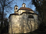
Holy Cross on Calvary with chapels ID: 15218 |
46 ° 25 ′ 15 "N, 11 ° 15 ′ 14" E |
May 18, 1951 (MD) |
Baroque church and eight chapels, built around 1720; the adjacent coordinates refer to the church, the chapels are located on Paul-Troger-Weg, which leads to the south |
KG: Kaltern building plot: 478, 479/2, 479/3, 479/4, 479/5, 479/6, 479/7, 479/8, 479/9
|

|
Kaltenburg ID: 15223 |
46 ° 23 ′ 21 ″ N, 11 ° 15 ′ 24 ″ E |
May 18, 1951 (MD) |
Raised hide |
KG: Kaltern building plot: 499
|
|
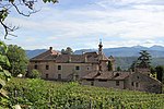
Campan with park ID: 15141 |
46 ° 24 ′ 56 "N, 11 ° 14 ′ 11" E |
Oct. 20, 1975 (BLR-LAB 5634) |
Raised hide |
KG: Kaltern building plot: 225, 226 basic plot: 893
|

|
Katharinaweg 1 ID: 15133 |
Katharinaweg 1 46 ° 24 ′ 54 ″ N, 11 ° 14 ′ 15 ″ E |
Oct. 20, 1975 (BLR-LAB 5634) |
Urban residential building |
KG: Kaltern building plot: 205/2, 2243
|

|
Katharinaweg 2 ID: 15134 |
Katharinaweg 2 46 ° 24 ′ 55 ″ N, 11 ° 14 ′ 15 ″ E |
Oct. 20, 1975 (BLR-LAB 5634) |
Urban residential building |
KG: Kaltern building plot: 206
|

|
Katharinaweg 3 ID: 15135 |
Katharinaweg 3 46 ° 24 ′ 55 ″ N, 11 ° 14 ′ 14 ″ E |
Oct. 20, 1975 (BLR-LAB 5634) |
Urban residential building |
KG: Kaltern building plot: 207
|
| Krumbachweg 9 ID: 15132 |
Krumbachweg 9 46 ° 24 ′ 54 ″ N, 11 ° 14 ′ 16 ″ E |
Oct. 20, 1975 (BLR-LAB 5634) |
Urban residential building |
KG: Kaltern building plot: 204
|
|

|
Krumbachweg 10 ID: 15136 |
Krumbachweg 10 46 ° 24 ′ 54 ″ N, 11 ° 14 ′ 14 ″ E |
Oct. 20, 1975 (BLR-LAB 5634) |
Urban residential building |
KG: Kaltern building plot: 208
|

|
Krumbachweg 16 ID: 15131 |
Krumbachweg 16 46 ° 24 ′ 52 ″ N, 11 ° 14 ′ 11 ″ E |
5th Mar 1990 (BLR-LAB 1196) |
Rural house / farm |
KG: Kaltern building plot: 195/1, 195/3
|
| Lahnbauerweg 3 ID: 15130 |
Lahnbauerweg 3 46 ° 24 ′ 48 ″ N, 11 ° 14 ′ 7 ″ E |
Oct. 20, 1975 (BLR-LAB 5634) |
|
KG: Kaltern building plot: 188/2, 188/3
|
|

|
Major-von-Morandell-Platz 8-9 ID: 15137 |
Major-von-Morandell-Platz 8-9 46 ° 24 ′ 53 ″ N, 11 ° 14 ′ 10 ″ E |
Oct. 20, 1975 (BLR-LAB 5634) |
Urban residential building |
KG: Kaltern building plot: 214
|

|
Manincor (Ehrenhausen) ID: 15222 |
St. Josef am See 4 46 ° 23 ′ 29 ″ N, 11 ° 15 ′ 20 ″ E |
May 18, 1951 (MD) |
Raised hide |
KG: Kaltern building plot: 498
|
|
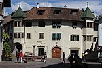
Maria-von-Buol-Platz 2-2A ID: 15194 |
Maria-von-Buol-Platz 2-2A 46 ° 24 ′ 54 ″ N, 11 ° 14 ′ 47 ″ E |
Jan 17, 1951 (MD) |
Urban residential building |
KG: Kaltern building plot: 418, 419/2
|

|
Maria-von-Buol-Platz 4 ID: 15188 |
Maria-von-Buol-Platz 4 46 ° 24 ′ 53 ″ N, 11 ° 14 ′ 46 ″ E |
Oct. 20, 1975 (BLR-LAB 5634) |
Urban residential building |
KG: Kaltern building plot: 373
|
|
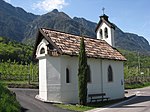
Marienkapelle in Altenburg ID: 15098 |
46 ° 22 ′ 29 ″ N, 11 ° 14 ′ 20 ″ E Fraction: Altenburg |
Oct. 20, 1975 (BLR-LAB 5634) |
chapel |
KG: Kaltern building plot: 10
|

|
Marketplace 6 ID: 18113 |
Marktplatz 6 46 ° 24 ′ 49 ″ N, 11 ° 14 ′ 44 ″ E |
May 24, 1993 (BLR-LAB 2888) |
Urban residential building |
KG: Kaltern building plot: 332
|

|
Marketplace 7 ID: 15174 |
Marktplatz 7 46 ° 24 ′ 48 ″ N, 11 ° 14 ′ 44 ″ E |
July 6, 1951 (MD) |
Urban residential building |
KG: Kaltern building plot: 331/2
|

|
Marketplace 9 ID: 15172 |
Marktplatz 9 46 ° 24 ′ 47 ″ N, 11 ° 14 ′ 44 ″ E |
July 6, 1951 (MD) |
Urban residential building |
KG: Kaltern building plot: 325
|

|
Marketplace 10 ID: 15171 |
Marktplatz 10 46 ° 24 ′ 47 ″ N, 11 ° 14 ′ 45 ″ E |
Oct. 20, 1975 (BLR-LAB 5634) |
Urban residential building |
KG: Kaltern building plot: 324
|

|
Mühlburg in Pfuss ID: 15104 |
46 ° 24 '42 "N, 11 ° 13' 54" E |
Aug 24, 1972 (MD) |
Raised hide |
KG: Caldaro building plot: 118, 119, 120/1, 120/2, 121/1, 121/2, 121/3, 584 plot: 713/1, 713/2
|

|
Mühlenweg 1 ID: 15150 |
Mühlenweg 1 46 ° 24 ′ 52 ″ N, 11 ° 14 ′ 32 ″ E |
Oct. 20, 1975 (BLR-LAB 5634) |
Urban residential building |
KG: Kaltern building plot: 266
|

|
Mühlenweg 11-13 ID: 18056 |
Mühlenweg 11-13 46 ° 24 ′ 54 ″ N, 11 ° 14 ′ 27 ″ E |
Oct. 20, 1975 (BLR-LAB 5634) |
Urban residential building |
KG: Kaltern building plot: 261, 262, 264/1
|

|
Oberplanitz in Oberplanitzing ID: 15198 |
46 ° 26 ′ 7 "N, 11 ° 14 ′ 52" E |
May 18, 1951 (MD) |
Raised hide |
KG: Kaltern building plot: 2182, 2183, 436
|

|
Oberplanitzing 8 ID: 15209 |
Oberplanitzing 8 46 ° 26 ′ 7 ″ N, 11 ° 14 ′ 58 ″ E |
May 18, 1951 (MD) |
Rural house / farm |
KG: Kaltern building plot: 459/1
|

|
Oberplanitzing 10-11 ID: 15208 |
Oberplanitzing 10-11 46 ° 26 ′ 8 ″ N, 11 ° 14 ′ 58 ″ E |
Oct. 20, 1975 (BLR-LAB 5634) |
Rural house / farm |
KG: Kaltern building plot: 458/1, 458/4
|

|
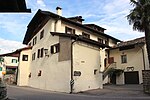
Oberplanitzing 13 ID: 15207 |
Oberplanitzing 13 46 ° 26 ′ 10 ″ N, 11 ° 14 ′ 58 ″ E |
Oct. 20, 1975 (BLR-LAB 5634) |
Rural house / farm |
KG: Kaltern building plot: 456/1
|
|
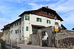
Oberplanitzing 16 ID: 15206 |
Oberplanitzing 16 46 ° 26 ′ 11 ″ N, 11 ° 14 ′ 58 ″ E |
May 18, 1951 (MD) |
Rural house / farm |
KG: Kaltern building plot: 455/1
|
|
Oberplanitzing 18 ID: 15205 |
Oberplanitzing 18 46 ° 26 ′ 12 ″ N, 11 ° 14 ′ 58 ″ E |
Oct. 20, 1975 (BLR-LAB 5634) |
Rural house / farm |
KG: Kaltern building plot: 453/1
|

|
Oberplanitzing 47 ID: 15204 |
Oberplanitzing 47 46 ° 26 ′ 13 ″ N, 11 ° 14 ′ 54 ″ E |
May 18, 1951 (MD) |
Rural house / farm |
KG: Kaltern building plot: 448/1, 449
|

|
Oberplanitzing 56 ID: 15201 |
Oberplanitzing 56 46 ° 26 ′ 12 ″ N, 11 ° 14 ′ 54 ″ E |
Oct. 20, 1975 (BLR-LAB 5634) |
Rural house / farm |
KG: Kaltern building plot: 443
|

|
Oberplanitzing 57 ID: 15232 |
Oberplanitzing 57 46 ° 26 ′ 11 ″ N, 11 ° 14 ′ 54 ″ E |
May 18, 1951 (MD) |
Rural house / farm |
KG: Kaltern building plot: 442/1, 442/2
|

|
Oberplanitzing 60 ID: 15200 |
Oberplanitzing 60 46 ° 26 ′ 8 ″ N, 11 ° 14 ′ 51 ″ E |
May 18, 1951 (MD) |
Rural house / farm |
KG: Kaltern building plot: 1964, 439/1
|

|
Oberplanitzing 61 ID: 15199 |
Oberplanitzing 61 46 ° 26 ′ 8 ″ N, 11 ° 14 ′ 51 ″ E |
Oct. 20, 1975 (BLR-LAB 5634) |
Rural house / farm |
KG: Kaltern building plot: 2291, 437/1
|
|
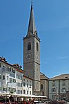
Parish Church of the Assumption with tower ID: 15181 |
46 ° 24 ′ 49 "N, 11 ° 14 ′ 48" E |
Oct. 20, 1975 (BLR-LAB 5634) |
church |
KG: Kaltern building plot: 341/1, 342
|
|
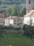
Pfarrwidum ID: 15180 |
46 ° 24 '48 "N, 11 ° 14' 48" E |
Oct. 20, 1975 (BLR-LAB 5634) |
Widum / Canon House |
KG: Kaltern building plot: 340/1
|

|
Pflegangerweg 5-8 ID: 15196 |
Pflegangerweg 5-8 46 ° 24 ′ 57 ″ N, 11 ° 14 ′ 44 ″ E |
Oct. 20, 1975 (BLR-LAB 5634) |
Urban residential building |
KG: Kaltern building plot: 433, 435/1
|
|
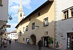
Nursing home ID: 15177 |
46 ° 24 ′ 46 "N, 11 ° 14 ′ 47" E |
Oct. 20, 1975 (BLR-LAB 5634) |
Municipal house, seat of the South Tyrolean Wine Museum |
KG: Kaltern building plot: 337
|

|
Nursing halls ID: 15156 |
Rottenburgerplatz 4 46 ° 24 ′ 45 ″ N, 11 ° 14 ′ 37 ″ E |
July 6, 1951 (MD) |
old barn, possibly formerly part of the old Kaltern-Rottenburg Castle |
KG: Kaltern building plot: 291
|

|
Preyhof ID: 15142 |
Preyweg 8 46 ° 24 ′ 59 ″ N, 11 ° 14 ′ 19 ″ E |
Oct. 20, 1975 (BLR-LAB 5634) |
Rural house / farm |
KG: Kaltern building plot: 231
|
|
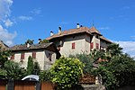
Preyweg 5-7 ID: 15144 |
Preyweg 5-7 46 ° 24 ′ 57 ″ N, 11 ° 14 ′ 21 ″ E |
July 6, 1951 (MD) |
Rural house / farm |
KG: Kaltern building plot: 246/1, 246/2
|

|
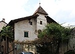
Town Hall ID: 15176 |
46 ° 24 ′ 48 "N, 11 ° 14 ′ 47" E |
Oct. 20, 1975 (BLR-LAB 5634) |
Administrative building |
KG: Kaltern building plot: 336
|
|
Reich am Platz ID: 15189 |
Maria-von-Buol-Platz 3 46 ° 24 ′ 54 ″ N, 11 ° 14 ′ 45 ″ E |
Jan 17, 1951 (MD) |
Urban residential building |
KG: Kaltern building plot: 374
|

|
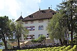
Remichhof ID: 15224 |
46 ° 23 ′ 3 ″ N, 11 ° 15 ′ 21 ″ E |
Oct. 20, 1975 (BLR-LAB 5634) |
Rural house / farm |
KG: Kaltern building plot: 503
|
|
Ringberg ID: 15220 |
46 ° 23 '39 "N, 11 ° 15' 14" E |
May 18, 1951 (MD) |
Urban residential building |
KG: Kaltern building plot: 497, 497/1, 497/2, 497/3
|
|
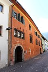
Red House ID: 15161 |
Goldgasse 17 46 ° 24 ′ 43 ″ N, 11 ° 14 ′ 42 ″ E |
Jan 17, 1951 (MD) |
Urban residential building |
KG: Kaltern building plot: 309
|

|
Sallegg with Park ID: 15148 |
46 ° 24 ′ 52 "N, 11 ° 14 ′ 21" E |
Oct. 20, 1975 (BLR-LAB 5634) |
Raised hide |
KG: Kaltern building plot: 252, 254 basic plot: 929
|

|
Schlosshotel Aehrental ID: 15159 |
Goldgasse 19 46 ° 24 ′ 41 ″ N, 11 ° 14 ′ 41 ″ E |
Jan 17, 1951 (MD) |
hotel |
KG: Kaltern building plot: 302
|
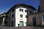
| Seehof ID: 15225 |
St. Josef am See 32 46 ° 22 ′ 52 ″ N, 11 ° 15 ′ 9 ″ E |
June 5, 1989 (BLR-LAB 3408) |
Rural house / farm |
KG: Kaltern building plot: 508
|
|
|
Hospital with Holy Spirit Chapel ID: 15182 |
46 ° 24 ′ 49 "N, 11 ° 14 ′ 47" E |
Oct. 20, 1975 (BLR-LAB 5634) |
hospital |
KG: Kaltern building plot: 343
|

|
St. Anton Abbot in St. Anton ID: 15128 |
46 ° 24 ′ 33 ″ N, 11 ° 14 ′ 2 ″ E Fraction: St. Anton |
Oct. 20, 1975 (BLR-LAB 5634) |
church |
KG: Kaltern building plot: 174
|

|
St. Georg in Oberplanitzing ID: 15230 |
46 ° 26 ′ 26 ″ N, 11 ° 14 ′ 54 ″ E Fraction: Oberplanitzing |
Oct. 20, 1975 (BLR-LAB 5634) |
church |
KG: Kaltern basic parcel: 1450
|

|
St. John the Baptist in Oberplanitzing ID: 15202 |
46 ° 26 ′ 11 ″ N, 11 ° 14 ′ 52 ″ E Fraction: Oberplanitzing |
Oct. 20, 1975 (BLR-LAB 5634) |
church |
KG: Kaltern building plot: 444
|

|
St. Josef am See ID: 15228 |
46 ° 22 ′ 34 ″ N, 11 ° 15 ′ 8 ″ E Fraction: St. Josef am See |
Oct. 20, 1975 (BLR-LAB 5634) |
church |
KG: Kaltern building plot: 525
|

|
St. Josef am See No. 11 ID: 15227 |
St. Josef am See No. 11 46 ° 22 ′ 34 ″ N, 11 ° 15 ′ 4 ″ E |
December 17, 1990 (BLR-LAB 8108) |
Raised hide |
KG: Kaltern building plot: 518
|

|
St. Katharina in Mitterdorf ID: 15143 |
46 ° 24 ′ 55 ″ N, 11 ° 14 ′ 21 ″ E Fraction: Mitterdorf |
Oct. 20, 1975 (BLR-LAB 5634) |
church |
KG: Kaltern building plot: 244
|

|
St. Leonhard in Unterplanitzing ID: 15217 |
46 ° 25 ′ 45 ″ N, 11 ° 15 ′ 13 ″ E Fraction: Unterplanitzing |
Oct. 20, 1975 (BLR-LAB 5634) |
church |
KG: Kaltern building plot: 474
|

|
St. Nikolaus with bell tower and churchyard in St. Nikolaus ID: 15101 |
46 ° 25 ′ 5 ″ N, 11 ° 13 ′ 58 ″ E Fraction: St. Nicholas |
Oct. 20, 1975 (BLR-LAB 5634) |
church |
KG: Kaltern building plot: 790, 86 basic plot: 510, 537/2
|

|
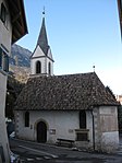
St. Peter in Altenburg ID: 15231 |
46 ° 22 ′ 45 "N, 11 ° 14 ′ 28" E |
Oct. 20, 1975 (BLR-LAB 5634) |
Church ruin |
KG: Kaltern basic parcel: 4209/2
|
|
St. Rochus in Pfuss ID: 15103 |
46 ° 24 ′ 48 ″ N, 11 ° 13 ′ 54 ″ E Fraction: Pfuss |
Oct. 20, 1975 (BLR-LAB 5634) |
church |
KG: Kaltern building plot: 106
|

|
St. Vigil in Altenburg ID: 15099 |
46 ° 22 ′ 39 "N, 11 ° 14 ′ 23" E |
Oct. 20, 1975 (BLR-LAB 5634) |
church |
KG: Kaltern building plot: 12
|

|
Strict 3-5 ID: 15139 |
Strict 3-5 46 ° 24 ′ 54 ″ N, 11 ° 14 ′ 7 ″ E |
Oct. 20, 1975 (BLR-LAB 5634) |
Urban residential building |
KG: Kaltern building plot: 217, 218, 222
|

|
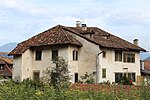
Strict 7-8 ID: 15140 |
Strict 7-8 46 ° 24 ′ 55 ″ N, 11 ° 14 ′ 5 ″ E |
Oct. 20, 1975 (BLR-LAB 5634) |
Urban residential building |
KG: Kaltern building plot: 223
|
|
Tafonatti ID: 15197 |
46 ° 24 ′ 58 "N, 11 ° 14 ′ 43" E |
Jan 17, 1951 (MD) |
Raised hide |
KG: Kaltern building plot: 434
|

|
Tertiary monastery with Church of the Immaculate Conception and garden ID: 15155 |
46 ° 24 ′ 47 "N, 11 ° 14 ′ 24" E |
Oct. 20, 1975 (BLR-LAB 5634) |
monastery |
KG: Kaltern building plot: 285, 286/1 basic plot : 825
|

|
Tonvin ID: 15190 |
46 ° 24 ′ 52 "N, 11 ° 14 ′ 47" E |
Jan 17, 1951 (MD) |
Raised hide |
KG: Kaltern building plot: 375
|

|
Tschiderer with outbuildings in Unterplanitzing ID: 15210 |
46 ° 25 ′ 51 ″ N, 11 ° 15 ′ 15 ″ E |
May 18, 1951 (MD) |
Raised hide |
KG: Kaltern building plot: 461/1, 461/2, 462, 464, 465, 466
|

|
Unterplanitzing 27 ID: 15215 |
Unterplanitzing 27 46 ° 25 ′ 47 ″ N, 11 ° 15 ′ 13 ″ E |
Oct. 20, 1975 (BLR-LAB 5634) |
Rural house / farm |
KG: Kaltern building plot: 472/3, 472/4
|

|
Unterplanitzing 28 ID: 15214 |
Unterplanitzing 28 46 ° 25 ′ 47 ″ N, 11 ° 15 ′ 13 ″ E |
Oct. 20, 1975 (BLR-LAB 5634) |
Rural house / farm |
KG: Kaltern building plot: 472/1, 472/2
|

|
Unterplanitzing 29 ID: 15213 |
Unterplanitzing 29 46 ° 25 ′ 47 ″ N, 11 ° 15 ′ 13 ″ E |
Oct. 20, 1975 (BLR-LAB 5634) |
Rural house / farm |
KG: Kaltern building plot: 471/1, 471/2, 471/3
|

|
Unterplanitzing 30 ID: 15212 |
Unterplanitzing 30 46 ° 25 ′ 48 ″ N, 11 ° 15 ′ 13 ″ E |
Oct. 20, 1975 (BLR-LAB 5634) |
Rural house / farm |
KG: Kaltern building plot: 469, 470
|

|
Unterplanitzing 31 ID: 15211 |
Unterplanitzing 31 46 ° 25 ′ 48 ″ N, 11 ° 15 ′ 13 ″ E |
Oct. 20, 1975 (BLR-LAB 5634) |
Rural house / farm |
KG: Kaltern building plot: 468
|

|
Lower angle 4 ID: 15154 |
Sub angle 4 46 ° 24 ′ 50 ″ N, 11 ° 14 ′ 23 ″ O |
Oct. 20, 1975 (BLR-LAB 5634) |
Urban residential building |
KG: Kaltern building plot: 276
|

|
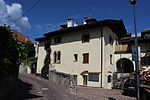
Lower angle 8 ID: 15152 |
Sub angle 8 46 ° 24 ′ 51 ″ N, 11 ° 14 ′ 26 ″ O |
July 6, 1951 (MD) |
Urban residential building |
KG: Kaltern building plot: 268
|
|
Lower angle 9 ID: 15153 |
Sub angle 9 46 ° 24 ′ 52 ″ N, 11 ° 14 ′ 25 ″ O |
Oct. 20, 1975 (BLR-LAB 5634) |
Urban residential building |
KG: Kaltern building plot: 269
|

|
Lower angle 16 ID: 50113 |
Sub angle 16 46 ° 24 ′ 53 ″ N, 11 ° 14 ′ 24 ″ O |
Oct. 20, 1975 (BLR-LAB 5634) |
Rural house / farm |
KG: Kaltern building plot: 255/1, 255/2
|

|
Lower angle 17 ID: 15147 |
Sub angle 17 46 ° 24 ′ 54 ″ N, 11 ° 14 ′ 23 ″ O |
Oct. 20, 1975 (BLR-LAB 5634) |
Urban residential building |
KG: Kaltern building plot: 251
|
| Lower angle 18 ID: 15146 |
Sub angle 18 46 ° 24 ′ 55 ″ N, 11 ° 14 ′ 24 ″ O |
Oct. 20, 1975 (BLR-LAB 5634) |
Urban residential building |
KG: Kaltern building plot: 249
|
|
| Lower angle 19 ID: 15145 |
Sub angle 19 46 ° 24 ′ 56 ″ N, 11 ° 14 ′ 25 ″ O |
Oct. 20, 1975 (BLR-LAB 5634) |
Urban residential building |
KG: Kaltern building plot: 248/1, 248/2, 248/3
|
|
| Villa Di Pauli with outbuilding and park ID: 15151 |
46 ° 24 ′ 51 "N, 11 ° 14 ′ 38" E |
May 12, 1986 (BLR-LAB 2369) |
Villa / summer cottage |
KG: Kaltern building plot : 267/3 Basic plot: 965/2
|
|
| Villa Herrenhofer ID: 50478 |
46 ° 25 ′ 0 ″ N, 11 ° 14 ′ 53 ″ E |
Sep 24 2007 (BLR-LAB 3178) |
Villa / summer cottage |
KG: Kaltern building plot: 719
|
|

|
Elementary school ID: 15173 |
46 ° 24 '48 "N, 11 ° 14' 43" E |
December 17, 1990 (BLR-LAB 8108) |
school |
KG: Kaltern building plot: 326
|

|
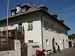
Weißenfels ID: 15193 |
46 ° 24 ′ 55 "N, 11 ° 14 ′ 49" E |
Jan 17, 1951 (MD) |
Raised hide |
KG: Kaltern building plot: 413
|
|
Widum in Altenburg ID: 50107 |
46 ° 22 ′ 39 "N, 11 ° 14 ′ 22" E |
July 26, 1999 (BLR-LAB 3201) |
Widum / Canon House |
KG: Kaltern building plot: 13
|

|
Widum in Unterplanitzing ID: 15216 |
46 ° 25 ′ 46 ″ N, 11 ° 15 ′ 13 ″ E |
Oct. 20, 1975 (BLR-LAB 5634) |
Widum / Canon House |
KG: Kaltern building plot: 2030, 473
|

|
Wieshof in Altenburg ID: 15100 |
46 ° 22 ′ 39 ″ N, 11 ° 14 ′ 12 ″ E |
December 30, 1988 (BLR-LAB 9021) |
Rural house / farm |
KG: Kaltern building plot: 17/1, 17/2
|
|
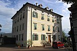
Windegg ID: 15165 |
46 ° 24 ′ 44 "N, 11 ° 14 ′ 49" E |
July 6, 1951 (MD) |
Raised hide |
KG: Kaltern building plot: 314 |
If no coordinates are known for a monument, the cadastral data at the time it was placed under protection are given as a substitute. These are neither official nor necessarily up-to-date.
The addresses taken from the State Monuments Office may be out of date.
| Photo: | Photograph of the monument. Click the photo generates an enlarged view. There are also two symbols: |
| ID | Identifier at the South Tyrolean Monuments Office |
| KG | Cadastral parish |
| MD | Ministerial Decree |
| BLR-LAB | Decision of the state government - state committee decision |
Web links
- Monument browser of the South Tyrolean Monuments Office
Individual evidence
- ^ Magdalena Hörmann-Weingartner: Altenburg . In: Magdalena Hörmann-Weingartner (ed.), Tiroler Burgenbuch. Volume X: Überetsch and South Tyrolean Unterland . Publishing house Athesia, Bolzano 2011, ISBN 978-88-8266-780-1 , pp. 305-306.
- ^ Magdalena Hörmann-Weingartner: Kaltern-Rottenburg Castle . In: Magdalena Hörmann-Weingartner (ed.), Tiroler Burgenbuch. Volume X: Überetsch and South Tyrolean Unterland . Publishing house Athesia, Bozen 2011, ISBN 978-88-8266-780-1 , pp. 301-304.