
Ulten
| Ulten | |
|---|---|
| (Italian: Ultimo ) | |
coat of arms
 |
map  |
| State : | Italy |
| Region : | Trentino-South Tyrol |
| Province : | Bolzano - South Tyrol |
| District community : | Burgrave Office |
|
Inhabitants : (VZ 2011 / 31.12.2019) |
2,921 / 2,911 |
|
Language groups : (according to 2011 census ) |
99.40% German 0.53% Italian 0.07% Ladin |
| Coordinates | 46 ° 33 ' N , 10 ° 52' E |
| Altitude : | 898– 3439 m slm (center: 1190 m slm ) |
| Surface: | 208.5 km² |
| Permanent settlement area: | 10.6 km² |
| Parliamentary groups : | St. Gertraud , St. Nikolaus , Kuppelwies , St. Walburg |
| Neighboring municipalities: | Bresimo (TN), Kastelbell-Tschars , Latsch , Laurein , Martell , Naturns , Proveis , Rabbi (TN), Rumo (TN), St. Pankraz |
| Partnership with : | Cadolzburg |
| Postal code : | 39016 |
| Area code : | 0473 |
| ISTAT number: | 021104 |
| Tax number: | 82007710211 |
| Mayor (2015): | Beatrix Mairhofer ( SVP ) |
Ulten ([ ˈʊltn̩ ]; Italian Ultimo ) is an Italian municipality with 2911 inhabitants (as of December 31, 2019) in the Ultental in South Tyrol . It consists of the four localities St. Walburg , Kuppelwies , St. Nikolaus and St. Gertraud with the surrounding scattered settlements and belongs to the district community Burggrafenamt .
geography
The municipality of Ulten occupies the uppermost section and main part of the Ulten Valley, which runs in a south-west-north-east direction, and the surrounding mountain areas. The four localities of the municipality, the main town St. Walburg ( 1190 m ), Kuppelwies ( 1153 m ), St. Nikolaus ( 1256 m ) and St. Gertraud ( 1501 m ) as well as the majority of the numerous scattered farms are close to that of the Falschauer flowed through valley floor.
The municipal area is enclosed on three sides by mountains of the Ortler Alps , some of which are protected in the Stilfserjoch National Park . The highest point in the municipality is the Hintere Eggenspitze ( 3443 m ) above the valley head. On the north side, the peaks are included in the Zufrittkamm , in which the Zufrittspitze ( 3439 m ) and the Hasenöhrl ( 3257 m ) rise. On the south side they are included in the Ilmenkamm , named after the Ilmenspitze ( 2656 m ) , which also bears the border to Trentino for a long distance .
history
In the Middle Ages and early modern times, Ulten was a princely court that consisted of twelve Werchen and was administered by Tyrolean court clerks. As such, Vlreich Fulhyn, phleger in Vltenn, is mentioned in a document in 1434 .
The municipality of Ulten was created in 1810 through the merger of the localities of St. Pankraz, St. Walburg, Kuppelwies, St. Nikolaus and St. Gertraud. In 1950 the St. Pankraz faction separated and became independent again. The historical origins of the Austrian family Kupelwieser lie in the district of Kuppelwies.
Attractions
- The Lahnersäge in St. Gertraud was in operation as a sawmill until the 1980s. Today it is a national park center of the Stilfserjoch National Park . Protective and useful functions of the forest and the cutting from tree trunk to wooden boards with the water-powered saw are shown.
- The three ancient larches from Ulten in St. Gertraud stand at 1430 m above sea level. They are around 850 years old.
- The valley museum is located in St. Nikolaus. The museum offers insights into the lifestyle of the Ulten farmers.
politics
mayor
Mayor since 1952:
- Paul Schwienbacher: 1952–1956
- Josef Gamper: 1956–1960
- Franz Gruber: 1960–1962
- Oswald Schwienbacher: 1962–1962
- Hugo Gamper : 1962–1964
- Josef Schweigl: 1964–1967
- Karl Schwienbacher: 1967–1971
- Josef Schweigl: 1971–1980
- Anton Mairhofer: 1980–1995
- Gottfried Oberthaler: 1995–1995
- Rudolf Ties: 1995-2010
- Beatrix Mairhofer: since 2010
coat of arms
Description: The coat of arms has the Tyrolean eagle at the front in silver and a white bar at the back in black .
economy
The Falschauer, which drains the valley, and its tributaries are used for energy with the help of various reservoirs ( Arzkarsee , Fischersee , Grünsee , Weißbrunnsee , Zoggler Reservoir ). There are three storage power plants in the municipality, which belong to the chain of hydropower plants in Ultental .
photos

St. Nicholas
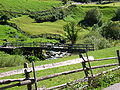
Falschauer near St. Gertraud

Zoggler reservoir


Web links
- Ulten municipality
- Landscape plan of the municipality of Ulten . Office for Landscape Ecology, Autonomous Province of Bolzano - South Tyrol (PDF file)
- History of Tyrol: Ulten
- Entry in the Tirol Atlas of the Institute for Geography at the University of Innsbruck
Individual evidence
- ↑ Otto Stolz : Political-historical description of the country of South Tyrol. Volume 1: General and the Vintschgau district and Burggrafenamt (Schlern-Schriften 40). Innsbruck: Wagner 1937, pp. 168–172.
- ^ Hannes Obermair : Bozen Süd - Bolzano Nord. Written form and documentary tradition of the city of Bozen up to 1500 . tape 2 . City of Bozen, Bozen 2008, ISBN 978-88-901870-1-8 , p. 76, No. 989 .
- ↑ The mayors of the South Tyrolean municipalities since 1952. (PDF; 15 MB) In: Festschrift 50 Years of the South Tyrolean Association of Municipalities 1954–2004. Association of South Tyrolean municipalities, pp. 139–159 , accessed on November 16, 2015 .

Abbey | Ahrntal | Aldein | Algund | Altrei | Andrian | Auer | Barbian | Bolzano | Branzoll | Burner | Brixen | Brunico | Burgstall | Corvara | Nova Ponente | Enneberg | Eppan | Feldthurns | Franzensfeste | Freienfeld | Gais | Gargazon | Glurns | Graun im Vinschgau | Casies | Avelengo | Innichen | Jenesien | Kaltern | Karneid | Kastelbell-Tschars | Castelrotto | Kiens | Klausen | Kuens | Kurtatsch | Kurtinig | Lasa | Laion | Lana | Laces | Laurein | Laives | Lüsen | Times | Margreid | Marling | Martell | Merano | Mölten | Montan | Moos in Passeier | Mühlbach | Mühlwald | Nals | Naturno | Naz-Sciaves | Neumarkt | Niederdorf | Olang | Partschins | Percha | Falzes | Pfatten | Pfitsch | Plausibility | Prad | Braies | Prettau | Proveis | Lawn Antholz | Ratschings | Riffian | Ritten | Rodeneck | Salurn | Sand in Taufers | Sarntal | Schenna | Schlanders | Schluderns | Schnals | Sexten | St. Christina in Val Gardena | St. Leonhard in Passeier | St. Lorenzen | St. Martin in Passeier | St. Martin in Thurn | St. Pankraz | Ortisei in Val Gardena | Sterzing | Stilfs | Taufers im Münstertal | Terenten | Terlan | Tiers | Tyrol | Tesimo | Toblach | Tramin | Truden | Tscherms | Ulten | Our Lady in the Walde-St. Felix | Vahrn | Villandro | Villnöß | Vintl | Fiè allo Sciliar | Verano | Waidbruck | Monguelfo Tesido | Welschnofen | Wengen | Selva in Val Gardena