Mühlwald
| Mühlwald | |
|---|---|
| (Italian: Selva dei Molini ) | |
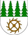
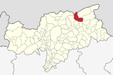
| coat of arms | map |
| State : | Italy |
| Region : | Trentino-South Tyrol |
| Province : | Bolzano - South Tyrol |
| District community : | Val Pusteria |
|
Inhabitants : (VZ 2011 / 31.12.2019) |
1.473 / 1.421 |
|
Language groups : (according to 2011 census ) |
98.90% German 0.90% Italian 0.21% Ladin |
| Coordinates | 46 ° 53 ' N , 11 ° 52' E |
| Altitude : | 982– 3479 m slm (center: 1229 m slm ) |
| Surface: | 104.52 km² |
| Permanent settlement area: | 6.6 km² |
| Parliamentary groups : | Ausermühlwald, Lappach |
| Neighboring municipalities: | Ahrntal , Finkenberg ( North Tyrol , A ), Gais , Kiens , Pfalzen , Pfitsch , Sand in Taufers , Terenten , Vintl |
| Postal code : | 39030 |
| Area code : | 0474 |
| ISTAT number: | 021088 |
| Tax number: | 81007580210 |
| Mayor (2015): | Paul Niederbrunner ( SVP ) |
Mühlwald ( Italian Selva dei Molini ) is an Italian municipality with 1439 inhabitants (as of December 31, 2016) in South Tyrol . The eponymous capital of the municipality has 899 inhabitants (as of December 31, 2016).
geography
With the exception of the estuary, the municipality of Mühlwald covers the entire Mühlwald valley in the Zillertal Alps, which is drained by the Mühlwalder Bach . This branches off from the Tauferer Tal at Mühlen in Taufers (municipality of Sand in Taufers ) , initially runs in a westerly direction and finally turns northwards to the Zillertal main ridge or the main Alpine ridge , where the last section is called Lappachtal . The two larger village settlements in the valley, as well as the numerous individual farms and small hamlets , are almost without exception on the orographically left, sun-exposed side of the valley. The municipal area is 104.52 km².
At the entrance to which is scattered settlement and municipal fraction Außermühlwald . Follows approximately in the middle of the valley - near the Mühlwalder Reservoir - the main town in Mühlwald to 1150- 1250 m slm at the upper end of the valley - after the bend in the valley to the north - is the fraction Lappach with its 1410- 1450 m high altitude village.
Above the end of the valley with the Neves reservoir ( 1860 m ), pronounced and glaciated high peaks of the Zillertal main ridge, which forms the Italian-Austrian border with the state of Tyrol , rise , including the Hohe Weißzint ( 3371 m ), the Große Möseler ( 3480 m ) and the Turnerkamp ( 3418 m ). The main town is framed by two tributaries of the Zillertal main ridge: In the south, this is the long ridge that branches off at Hohen Weißzint and first strikes south and later east and here separates the Mühlwalder valley from the Pfunderer valley and Pustertal . In this, the Reisnock ( 2663 m ) rises southwest of the main town, clearly visible from the town center . At the Turnerkamp, on the other hand, the ridge that the community u. a. with the Tristenspitze ( 2716 m ) in the north and northeast from the Weißenbachtal , and finally dominates the valley exit with the Speikboden massif.
Mühlwald can be reached all year round via the valley road from the Tauferer Tal.
history
The "speaking" place name of Mühlwald ("[water] mills in a wooded area") is attested as Mullenwalt , Mulenwalt and Mülbalt since about 1160 .
The most important landlord in the Middle Ages and early modern times was the Sonnenburg Monastery . In the 12th century (1163/64) the Counts of Valley exchanged extensive property on the southern flank of the Mühlwaldertal between the Putzenbach and the Wurmtalbach or Passenbach for a farm in Hötting for the Sonnenburg convent.
Mühlwald and Lappach belonged to the Taufers judicial district until the end of the First World War and were part of the Bruneck district .
politics
Mayor since 1952:
- Josef Forer: 1952–1956
- Josef Oberlechner: 1956–1964
- August Aschbacher: 1964–1974
- Friedrich Mair: 1974–1985
- Josef Unterhofer: 1985-2010
- Paul Niederbrunner: since 2010
economy
In contrast to the other municipalities in the Tauferer Ahrntal, the service sector including tourism and the manufacturing industry have so far only been of relatively minor importance. For this reason, a large part of the workforce works outside the community.
education
In the municipality there are two primary schools in the main town of Mühlwald and in Lappach, both of which are connected to the German school district of the neighboring municipality of Sand in Taufers.
Attractions
With the “Power of Water” project, themed trails were developed on which guided hikes are offered on a regular basis. Starting at the Mühlwald hydropower station on Lake Mühlwalder See, the theme trail leads past old mills, a moor with a headwaters and then through a gorge with a waterfall, before ending at the Neves reservoir in Lappach.
literature
- Leo Santifaller : On the history of Mühlwald. In: Der Schlern 4, 1925, pp. 52–54. (on-line)
- Bertha Richter-Santifaller : The court names of the community Mühlwald. In: Der Schlern 4, 1925, pp. 54–60. (on-line)
Web links
- Website of the municipality of Mühlwald
- Landscape plan of the community of Mühlwald . Office for Landscape Ecology, Autonomous Province of Bolzano - South Tyrol (PDF file)
- Entry in the Tirol Atlas of the Institute for Geography at the University of Innsbruck
Individual evidence
- ^ Egon Kühebacher : The place names of South Tyrol and their history . Volume 1. Bozen: Athesia 1995, p. 262. ISBN 88-7014-634-0
- ↑ Martin Bitschnau , Hannes Obermair : Tiroler Urkundenbuch, II. Department: The documents on the history of the Inn, Eisack and Pustertal valleys. Volume 2: 1140-1200 . Universitätsverlag Wagner, Innsbruck 2012, ISBN 978-3-7030-0485-8 , p. 160-161, No. 587 .
- ↑ The mayors of the South Tyrolean municipalities since 1952. (PDF; 15 MB) In: Festschrift 50 Years of the South Tyrolean Association of Municipalities 1954–2004. Association of South Tyrolean municipalities, pp. 139–159 , accessed on November 16, 2015 .
- ↑ School district Sand in Taufers. South Tyrolean Citizens' Network , accessed on October 25, 2014 .


