Tiers
| Tiers | |
|---|---|
| (Italian: Tires ) | |
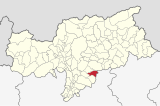
| coat of arms | map |
| State : | Italy |
| Region : | Trentino-South Tyrol |
| Province : | Bolzano - South Tyrol |
| District community : | Salten-Schlern |
|
Inhabitants : (VZ 2011 / 31.12.2019) |
969 / 1.010 |
|
Language groups : (according to 2011 census ) |
98.15% German 1.20% Italian 0.65% Ladin |
| Coordinates | 46 ° 28 ' N , 11 ° 31' E |
| Altitude : | 700– 3002 m slm (center: 1000 m slm ) |
| Surface: | 42.1 km² |
| Permanent settlement area: | 3.8 km² |
| Parliamentary groups : | Tiers (St. Georg), St. Zyprian, Breien (partly near Völs) |
| Neighboring municipalities: | Campitello di Fassa (TN), Karneid , Kastelruth , Mazzin (TN), San Giovanni di Fassa (TN), Fiè allo Sciliar , Welschnofen |
| Partnership with : | - |
| Postal code : | 39050 |
| Area code : | 0471 |
| ISTAT number: | 021100 |
| Tax number: | 80009610215 |
| Mayor (2015): | Gernot Psenner ( SVP ) |
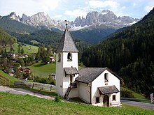
Tiers ([ tiˑɐ̯s ]; Italian Tires ) is an Italian municipality with 1010 inhabitants (as of December 31, 2019) in South Tyrol . It is located in the Tiers valley near Bolzano .
geography

The municipality occupies the upper section of the Tierser valley, which is drained by the Tierser Bach, and the surrounding mountain areas of the Dolomites . The largest settlement in the municipality is the main town of Tires, which is located on a south-facing hillside at an altitude of around 1000 m . Further into the valley lying fraction S. Cipriano ( 1100 m ) and above the small settlement Weisslahnbad ( 1200 m ). A few courtyards from Breien also belong to the Tiers municipality area further down the valley .
The community encompasses extensive mountain areas, most of which are protected in the Schlern-Rosengarten Nature Park . On the north side, Tiers is framed by the Schlern group , from the Tschafatschzug over the Roterdspitze ( 2655 m ) to the Großer Rosszahn ( 2653 m ). The rose garden dominating the valley rises to the east of the community . The Kesselkogel ( 3004 m ), the Rosengartenspitze ( 2981 m ) and the Vajolet towers ( 2821 m ) rise here . Tiers is bordered on the south by a largely wooded ridge in which the Niger Pass ( 1690 m ) provides a transition into the upper Eggental .
The neighboring communities in the lower Tierser Tal are Karneid and Völs am Schlern . On the north side in the Schlern group, Tiers also borders on Völs and in the extreme northeast on Castelrotto , on the south side on the Eggentaler municipality Welschnofen . In the Rosengarten mountain range in the east, the municipal border also forms the provincial border with Trentino .
history
The first traces of settlement date from the Bronze Age . Ersturkundlich the locality as is "animal" in the years 993 / 94-1005 testified, as in a traditional note of the Bishopric of Freising , the Bavarian Count Otto of the family of Rapotonen Bishop Gottschalk of Freising transferred there possession.
politics
Mayor since 1952:
- Rose garden list : 6
- South Tyrolean People's Party : 6
- Johann Pattis: 1952-1960
- Karl Pattis: 1960–1964
- Josef Damian: 1964–1974
- Karl Villgrattner: 1974–1990
- Paul Psenner: 1990-2000
- Martin Schönauer: 2000-2005
- Karl Villgrattner: 2005–2015
- Gernot Psenner: since 2015
Worth seeing
In addition to the architectural and natural monuments contained in the lists, there are other sights. The remains of Völsegg or Velseck Castle ( ⊙ ) date from the Middle Ages.
The Thalerbühel ( ⊙ ) is a burnt offering site from the Middle Iron Age (approx. 6th to 5th century BC). A natural elevation was artificially flattened and brought into the approximate shape of an oversized natural altar. The path of contemplation leads past it, which shows the suffering of Jesus Christ in 13 stations through metal panels set in wooden posts.
traffic
Since the end of the 1980s, the main access to Tiers has led from Blumau in the Eisack Valley via Völser Aicha on an elevated slope into the Tiers Valley. This relieved the still existing road, which also began in Blumau, through the narrow estuary of the valley, which has always been at risk of falling rocks. In addition, the road over the Niger Pass connects Tiers with the upper Eggental or Karer Pass .
Sons and daughters of the church
- Walter Ausserdorfer (* 1939), luge rider
- Sandra Robatscher (* 1995), luge rider
- Daniel Pattis (* 1998), U 20 Vice European Champion and Vice World Champion in mountain running
literature
- Education Committee Tiers (Ed.): Tiers am Rosengarten. Biography of a mountain village . Edition Raetia, Bozen 1998 ( online )
- Erika Kustatscher : Everyday life in Tiers: Contributions to population and social history from the 17th century to the First World War on the basis of serial sources . Wagner, Innsbruck 1999, ISBN 3-7030-0339-1 .
Web links
- Website of the municipality of Tiers
- Landscape plan of the municipality of Tiers . Office for Landscape Ecology, Autonomous Province of Bolzano - South Tyrol (PDF file)
- Entry in the Tirol Atlas of the Institute for Geography at the University of Innsbruck
Individual evidence
- ↑ Martin Bitschnau , Hannes Obermair : Tiroler Urkundenbuch, II. Department: The documents on the history of the Inn, Eisack and Pustertal valleys. Vol. 1: Up to the year 1140 . Universitätsverlag Wagner, Innsbruck 2009, ISBN 978-3-7030-0469-8 , p. 135-137, No. 170 .
- ↑ The mayors of the South Tyrolean municipalities since 1952. (PDF; 15 MB) In: Festschrift 50 Years of the South Tyrolean Association of Municipalities 1954–2004. Association of South Tyrolean municipalities, pp. 139–159 , accessed on November 16, 2015 .
- ↑ Helmut Stampfer : Velseck . In: Oswald Trapp (ed.), Tiroler Burgenbuch. IV. Volume: Eisacktal . Verlagsanstalt Athesia, Bozen 1977, pp. 356–357.
- ↑ Daniel Lorenz: On the prehistory and early history of the Tiers valley. In: Der Schlern 77, 2003, no. 6, pp. 4–23.


