Karneid
| Karneid | |
|---|---|
| (Italian: Cornedo all'Isarco ) | |
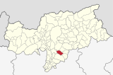
| coat of arms | map |
| State : | Italy |
| Region : | Trentino-South Tyrol |
| Province : | Bolzano - South Tyrol |
| District community : | Salten-Schlern |
|
Inhabitants : (VZ 2011 / 31.12.2019) |
3,314 / 3,421 |
|
Language groups : (according to 2011 census ) |
89.03% German 10.64% Italian 0.33% Ladin |
| Coordinates | 46 ° 28 ′ N , 11 ° 28 ′ E |
| Altitude : | 283– 1680 m slm (center: 300 m slm ) |
| Surface: | 40.4 km² |
| Permanent settlement area: | 8.2 km² |
| Parliamentary groups : | Blumau , Breien, Gummer, Kardaun , Karneid, Steinegg |
| Neighboring municipalities: | Bozen , Deutschnofen , Renon , Tiers , Fiè allo Sciliar , Welschnofen |
| Partnership with : | Oberperfuss |
| Postal code : | 39053 |
| Area code : | 0471 |
| ISTAT number: | 021023 |
| Tax number: | 80013950219 |
| Mayor (2015): | Martina Lantschner Pisetta ( SVP ) |
Karneid ([ karˈnaɪ̯t ]; Italian Cornedo all'Isarco ) is an Italian municipality in the South Tyrolean Eisack Valley near Bolzano with 3421 inhabitants (as of December 31, 2019). It is named after the village of Karneid with the castle of the same name (see Karneid Castle ), one of the most beautiful in the country. The seat of the municipality is in the Kardaun fraction .
geography
The municipality of Karneid essentially comprises the Karneider Berg, a mid-mountain range of hills to the west of the Rosengarten group of the Dolomites , which is bordered on three sides by the lower Eisack valley , the Eggental and the Tierser valley . In the valley areas, the municipal boundaries largely follow the watercourses of Eisack , Eggentaler Bach and Tierser Bach ; in the east, the municipality ends at the peaks of Gummerer Eggs and Samberg.
The town hall and other public facilities are located in the Kardaun fraction in the Eisack Valley in the far northwest of the municipality. The village is located at an altitude of 300 m at the exit of the Eggental in the immediate vicinity of the South Tyrolean capital Bolzano . Also in the Eisack Valley is the small village of Karneid on an elevated hillside at 500 m and further east at 330 m at the exit of the Tiers valley Blumau . The largely wooded ridge of the Karneider Berg offers space for the two villages of Steinegg (at 800 m above Blumau) and Gummer (at 1,100 m in the Eggental area). The sixth and smallest fraction is formed by the Höfe von Breien on the orographic left side of the Tiers valley .
history
Karneid is first documented as "Curneit" in the imbreviatur of the Bozen notary Jakob Haas from 1242. The modern form of the name "Karneyd" is documented in 1477. Etymologically, the name of the place is in Latin. cornu with the suffix -etu meaning horn-like terrain, terrain with a horn-like elevation .
Attractions
- the earth pyramids with the pyramid tour in Steinegg
- the Max Valier public observatory and the planetarium in Gummer
- the castle Karneid
- the Steinegg local history museum
- the hydroelectric power station Kardaun
politics
- Partito Democratico : 1
- South Tyrolean People's Party : 16
- Lista Civica Cornedo : 1
Mayor since 1952:
- Peter Falser: 1952–1956
- Franz Lantschner: 1956–1964
- Franz Mock: 1964–1969
- Alois Zelger: 1969–1974
- Hans Mahlknecht: 1974-2000
- Albin Kofler: 2000–2015
- Martina Lantschner: since 2015
Personalities
- Andreas Resch (born October 29, 1934 in Steinegg), theologian, psychologist and paranormologist
- Gerda Weißensteiner (born January 3, 1969 in Bozen), toboggan runner and bobsledder (lives in Steinegg)
- Ulli Mair (born September 11, 1974 in Bozen), member of the state parliament of the Freedom Party
- Katja Schroffenegger (born April 28, 1991), soccer player
literature
- Irmgard Lantschner: The community of Karneid. Edited by the Association for Culture and Home Care Karneid, Karneid 2000.
- Frieda Resch: The field names in the municipality of Karneid. Karneid, municipal administration 2007.
Web links
- Website of the municipality of Karneid
- Landscape plan of the municipality of Karneid . Office for Landscape Ecology, Autonomous Province of Bolzano - South Tyrol (PDF file)
- Entry in the Tirol Atlas of the Institute for Geography at the University of Innsbruck
Individual evidence
- ↑ Hans von Voltelini , Franz Huter : Die Südtiroler Notariats-Imbreviaturen of the 13th century. Part 2 (Acta Tirolensia 4). Wagner: Innsbruck 1951, No. 98.
- ^ Hannes Obermair : Bozen Süd - Bolzano Nord. Written form and documentary tradition of the city of Bozen up to 1500 . tape 2 . City of Bozen, Bozen 2008, ISBN 978-88-901870-1-8 , p. 167, No. 1178 .
- ^ Egon Kühebacher : The place names of South Tyrol and their history. Volume 1. Bozen: Athesia 1991. ISBN 88-7014-634-0 , pp. 183-184.
- ↑ South Tyrol Alto Adige planetarium . Planetarium website. Retrieved August 4, 2013.
- ↑ The mayors of the South Tyrolean municipalities since 1952. (PDF; 15 MB) In: Festschrift 50 Years of the South Tyrolean Association of Municipalities 1954–2004. Association of South Tyrolean municipalities, pp. 139–159 , accessed on November 16, 2015 .


