St. Pankraz (South Tyrol)
| St. Pankraz | |
|---|---|
| (Italian: San Pancrazio ) | |
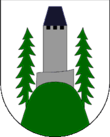
| coat of arms | map |
| State : | Italy |
| Region : | Trentino-South Tyrol |
| Province : | Bolzano - South Tyrol |
| District community : | Burgrave Office |
|
Inhabitants : (VZ 2011 / 31.12.2019) |
1,584 / 1,541 |
|
Language groups : (according to 2011 census ) |
98.84% German 0.96% Italian 0.19% Ladin |
| Coordinates | 46 ° 35 ' N , 11 ° 5' E |
| Altitude : | 370– 2608 m slm (center: 735 m slm ) |
| Surface: | 63.0 km² |
| Permanent settlement area: | 6.7 km² |
| Neighboring municipalities: | Borgo d'Anaunia (TN), Lana , Laurein , Naturns , Our Lady in the Walde-St. Felix , Tisens , Ulten |
| Postal code : | 39010 |
| Area code : | 0473 |
| ISTAT number: | 021084 |
| Tax number: | 82007130212 |
| Mayor (2015): | Thomas Holzner ( SVP ) |
St. Pankraz ([ saŋkt ˈpaŋkrats ]; Italian San Pancrazio ) is an Italian municipality with 1541 inhabitants (as of December 31, 2019) in South Tyrol . It is located in the Ulten Valley at an altitude of 736 m and is the first village in the valley.
geography
The municipality of St. Pankraz, located about 11 km southwest of Merano , occupies a lower section of the Ulten Valley, which runs in a southwest-northeast direction, as well as the surrounding mountainous areas. The higher valley areas belong to the municipality of Ulten , the valley exit to Lana . The village of St. Pankraz is located at an altitude of 735 m on the orographic left side of the Falschauer at the confluence of the Kirchbach valley. On the north side rises between the Ulten Valley and the Vinschgau valley, the Zufrittkamm of the Ortler Alps , which reaches its highest point within the municipality area reaching to the Vigiljoch at the 2608 m high Naturnser Hochwart . In the south of the municipality, the Hofmahdjoch ( 1781 m ) provides a transition to the Non Valley , where St. Pankraz borders partly on the Deutschnonsberg , which belongs to South Tyrol , and partly on the Trentino . The yoke is dominated on the east by the Laugen ( 2434 m ) , which is part of the Nonsberg group , and on the west by the peaks of the Ilmenkamm of the Ortler Alps, the Kleiner ( 2311 m ) and the Großer Kornigl ( 2418 m ).
Attractions
- Eschenlohe castle ruins , mentioned as "Ulten Castle" since the 12th century
- Parish church with a 56 m high steeple
- Sebastian Chapel next to the parish church
- Chapel of St. Helena: The chapel, first mentioned in 1338, is visible from afar on a 1550 m high forest hill.
- Häusl am Stein: The house survived the floods of the Falschauer in 1882 because it was unintentionally built on a stone block.
- Mitterbad
politics
Mayor since 1960:
- Bartholomäus Pöder: 1960–1969
- Josef Gamper: 1969–1974
- Ernst Holzner: 1974–1990
- Hermann Tumpfer: 1990–2010
- Thomas Holzner: since 2010
economy
In addition to tourism and mountain agriculture, there are several craft businesses in St. Pankraz. The place has its own heating plant for heat supply. The Falschauer is used energetically by the Pankraz reservoir . There is a storage power plant in the municipality, which is part of the chain of hydropower plants in Ultental .
traffic
From St. Pankraz you can reach Lana in the north-east after 11 km via the SP9 and the junction Meran-Süd of the MeBo expressway after 13 km. From the south you can reach the Ultental via the state road SP86.
Personalities
- Johann Nepomuk von Tschiderer (1777–1860), Prince-Bishop of Trient, was a cooperator of the parish of St. Pankraz from 1804–1807
- Josef Egger (1839–1903), historian, author of a history of Tyrol
literature
- Community of St. Pankraz (ed.): St. Pankraz - mosaic stones of a mountain community . Edition Raetia, Bozen 2010, ISBN 978-88-7283-385-8 ( online )
Web links
- Official website of the parish of St. Pankraz
- Landscape plan of the municipality of St. Pankraz . Office for Landscape Ecology, Autonomous Province of Bolzano - South Tyrol (PDF file)
- Entry in the Tirol Atlas of the Institute for Geography at the University of Innsbruck
Individual evidence
- ^ Oswald Trapp : Tiroler Burgenbuch. Volume II: Burgrave Office . Publishing house Athesia, Bozen 1980, pp. 251-257.
- ↑ The mayors of the South Tyrolean municipalities since 1952. (PDF; 15 MB) In: Festschrift 50 Years of the South Tyrolean Association of Municipalities 1954–2004. Association of South Tyrolean municipalities, pp. 139–159 , accessed on November 16, 2015 .


