Wrong
|
Falschauer Valsura |
||
|
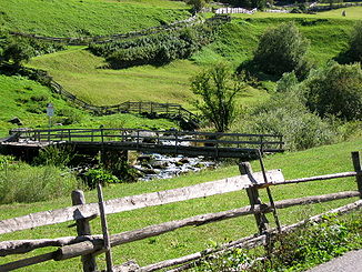
The Falschauer below St. Gertraud |
||
| Data | ||
| location | South Tyrol , Italy | |
| River system | Etsch | |
| Drain over | Adige → Adriatic Sea | |
| River basin district | Alpi Orientali | |
| origin | Union of Grünseebach and Oberem Weißbrunnbach 46 ° 28 ′ 54 ″ N , 10 ° 49 ′ 32 ″ E |
|
| Source height | 1900 m slm | |
| muzzle | in the municipality of Lana in the Adige Coordinates: 46 ° 37 '2 " N , 11 ° 11' 3" E 46 ° 37 '2 " N , 11 ° 11' 3" E
|
|
| length | 41.4 km | |
| Catchment area | 301 km² | |
| Reservoirs flowed through | Weißbrunnsee , Zoggler Reservoir , Pankrazer Reservoir | |
| Communities | Ulten , St. Pankraz , Lana | |
The Falschauer (formerly often also Valschauer , Italian Valsura ) is a river in South Tyrol that begins in the rear Ultental and flows into the Etsch in the municipality of Lana in the Adige Valley after more than 40 kilometers .
course
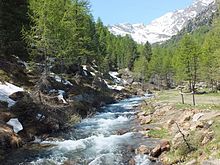
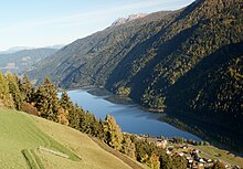
The Falschauer bears this name from the union of the Grünseebach with the Upper Weißbrunnbach about 500 meters above the Weißbrunnsee . The streams have their headwaters in the area of the Weißbrunnferner and the natural lakes Schwarzsee and Wilder Ploder, whose drainage streams unite in the Langsee. After passing the Weißbrunnsee, the Falschauer reaches the furthest settlement of the Ulten Valley near St. Gertraud . In the further course it flows through St. Nikolaus , the Zoggler reservoir , St. Walburg , the capital of the municipality of Ulten , the Pankrazer reservoir and St. Pankraz . Through the Gaul Gorge she comes to Lana , behind which she reaches the Adige.
There is an alluvial forest at the mouth of the river into the Adige . Together with the neighboring Burgstaller floodplains, these are the last remaining areas of the Adige Valley that are not affected by cultivation. Numerous protected birds breed in these natural alluvial forests.
use
While the Falschauer used to drive mills and sawmills and were used for logging , today it is used almost exclusively to generate electrical energy. In St. Gertraud, the Lahnersäge operated with water from the Falschauer is only used for demonstration purposes.
In the 1950s and 1960s, a comprehensive system for generating energy using the Falschauer's hydropower was set up in the Ultental , which has a height difference of over 2000 meters from its source to the mouth and covers a catchment area of 301 km². In their course and in the side valleys, reservoirs were created, which are connected to the associated hydropower plants , which are up to 700 meters lower, on the back of the next lower reservoir through pressure tunnels . By increasing the height of fall up to the turbine, the water power is optimally used. The pressure tunnel and pressure pipe system extends from Grünsee via the individual reservoirs to the lowest power plant in Lana. This means that a large proportion of the Falschauer's water load is carried underground and that the Falschauer often only carries water from the tributaries of the section between the reservoirs. Some of the systems can also be operated in pumped storage mode. The total installed capacity of the system is 250 MW.
Tributaries
The main tributaries of the Falschauer are downstream
Left side:
- Pilsbach
- Tupferbach
- Messnerbach
- Kuppelwieserbach
- Kirchbach
Right side:
- Kirchbergbach
- Klapfbach
- Schwarzbach
- Maraunbach
- Wiesenbach
Web links
- Falschauer on the website of the South Tyrolean Environment Agency
Individual evidence
- ↑ GeoBrowser South Tyrol
- ↑ Lahnersäge
- ↑ Folder hydropower plants Ultental ( Memento from July 24, 2014 in the Internet Archive )


