Zoggler reservoir
| Zoggler reservoir | |||||||
|---|---|---|---|---|---|---|---|
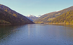
| The Zoggler reservoir seen from the dam | |||||||
|
|||||||
|
|
|||||||
| Coordinates | 46 ° 32 '17 " N , 10 ° 59' 7" E | ||||||
| Data on the structure | |||||||
| Lock type: | Earthfill dam | ||||||
| Construction time: | 1955-1964 | ||||||
| Height of the structure crown: | 66.5 m | ||||||
| Building volume: | 1 365 000 m³ | ||||||
| Crown length: | 516.35 m | ||||||
| Base width: | 200 m | ||||||
| Power plant output: | 34 MW | ||||||
| Operator: | SE Hydropower GmbH | ||||||
| Data on the reservoir | |||||||
| Altitude (at congestion destination ) | 1141 m (max. Congestion destination 1142.50 m) | ||||||
| Water surface | 1.3 km² | ||||||
| Reservoir length | 3 km | ||||||
| Reservoir width | 650 m | ||||||
| Storage space | 33.1 million m³ | ||||||
| Catchment area | 181 km² | ||||||
| Particularities: |
Pressure tunnel to the St. Pankraz power station |
||||||
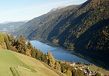
The Zoggler-Stausee (also Zoggler-See , Italian Lago di Zoccolo ) is a reservoir in the Ultental in South Tyrol . He dammed the Falschauer above St. Walburg . It is the largest of the reservoirs in the Ulten Valley to generate electricity . At the same time it serves to protect against floods.
The dam of the lake is about 1.5 kilometers up the valley from the center of St. Walburg. The lake stretches over a length of about 3 kilometers to the village of Kuppelwies. Its maximum width is 650 meters. Under its water surface of 143 hectares, it has a storage capacity of 33,100,000 m³. The normal water level (normal storage target) is 1141 meters above sea level. To protect against flooding, the level can rise 1.5 meters higher. The catchment area of the reservoir is 181 km².
The dam is an earth embankment dam with sealing layers made of bituminous mix. Its crown length is 516 meters and its height 66.5 meters. At the base it is around 200 meters wide and has a total volume of 1,365,000 m³. The valley side is greened with lawn. The dam is accessible.
The lake water used to generate electrical energy is fed through a pressure tunnel to a water lock and from there via a pressure line to the St. Pankraz power station at the back of the Pankraz reservoir. The total height of fall is 318 meters. The water volume of up to 12 m³ / s hits a Francis turbine with an installed capacity of 34 MW.
At the upper end of the Zoggler reservoir is the St. Walburg power station , which is operated with water from the Weißbrunnsee and the runoff water from the Kuppelwieser Alm power station . The runoff water from this power plant flows into the Zoggler reservoir.
The construction of the dam, which began in 1955, took nine years to reach its full height, which meant an enormous exposure to dust and noise for the valley's inhabitants. The lake lost over two dozen farms and other properties in one of the most fertile parts of the valley. Some of the courtyards could look back on a history of up to six hundred years.
Because of the great height of fall to the power plant, it was also possible to back up the dam and operate the power plant before reaching the final height of the dam. It went into operation in 1957. The dam was applied layer by layer, which initially resulted in large flat areas. Football fields were even temporarily laid out on it.
literature
- Christoph Gufler: The lost legacy: the power plant and reservoir construction in Ulten and Lana , Verlag-Anst. Athesia Bozen, 2007, ISBN 978-88-8266-096-3
- Anton Mairhofer, Zoggler reservoir in Ulten: a historical journey , S. Valburga, Ulten Education Committee, 2009
- SE Hydropower GmbH: hydropower plants Ultental , folder, ( digitized )
Web links
- The reservoirs at Prov. Bolzano State Agency for the Environment
- Zoggler reservoir on ultental-valdultimo.com
- Under power - reservoirs and power plants in Ultental (video)
Individual evidence
- ^ Prov. Bolzano State Agency for the Environment
- ↑ Video under power


