List of listed objects in Bad Tatzmannsdorf
The list of listed objects in Bad Tatzmannsdorf contains the 8 listed , immovable objects of the municipality of Bad Tatzmannsdorf .
Monuments
| photo | monument | Location | description | Metadata |
|---|---|---|---|---|

|
Jormannsdorf Castle ObjectID: 8062 |
Jormannsdorf 1 KG location : Jormannsdorf |
The simple two-storey building with two wings, an arcade in the basement and a row of Tuscan columns was built by the barons of Königsberg in the Renaissance style. First mentioned in 1591, owned by the Batthyány family from 1644. In the inter-war period there was a farmer's school here, and from 1956/57 a castle hotel and restaurant. In 1987 the castle was acquired by Kurbad Tatzmannsdorf AG, revitalized and since 2003 used as the health academy of the BFI Burgenland . |
ObjectID: 8062 Status: Notification Status of the BDA list: 2020-02-29 Name: Schloss Jormannsdorf GstNr .: 89 Schloss Jormannsdorf |

|
Barn ObjectID: 8693 |
Josef Hölzel-Allee 1 KG location : Jormannsdorf |
is in the open-air museum Bad Tatzmannsdorf |
ObjectID: 8693 Status: Notification Status of the BDA list: 2020-02-29 Name: Scheune GstNr .: 279 Freilichtmuseum Bad Tatzmannsdorf |

|
Kitting ObjectID : 8058 |
Josef Hölzel-Allee 1 KG location : Jormannsdorf |
The kitting comes from Oberwart and was built in the 1st quarter of the 19th century (re. 1820). It is a log storage tank with a pointed barrel vault with a loosely attached thatched crooked hip roof that can be thrown off if there is a risk of fire. The kitting is in the open-air museum Bad Tatzmannsdorf . |
ObjectID : 8058 Status : Notification Status of the BDA list: 2020-02-29 Name: Kitting GstNr .: 4265/1 Freilichtmuseum Bad Tatzmannsdorf |

|
Open-air museum with 23 objects ObjectID : 49840 |
Josef Hölzel-Allee 1 KG location : Jormannsdorf |
The open-air museum brings together regional wooden buildings from the 18th and 19th centuries that have been removed from their original locations. Note: see list of errors |
ObjectID : 49840 Status : Notification Status of the BDA list: 2020-02-29 Name: Open-air museum with 23 objects GstNr .: 279 Open-air museum Bad Tatzmannsdorf |

|
Catholic branch church hl. Anna ObjectID: 8061 |
Jormannsdorf, next to No. 29 KG location : Jormannsdorf |
Typical Burgenland village church from the 14th century, extension and vaulting in 1628, installation of the western gallery and construction of the stone facade tower in 1648. |
ObjectID: 8061 Status: § 2a Status of the BDA list: 2020-02-29 Name: Kath. Filialkirche hl. Anna GstNr .: 1/1 Kath. Filialkirche hl. Anna (Jormannsdorf) |

|
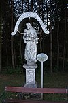
Wayside shrine St. Josef ObjectID: 8064 |
Jormannsdorf, opposite No. 132 KG location : Jormannsdorf |
Baroque wayside shrine (St. Joseph?) Mid-18th century |
ObjectID: 8064 Status: § 2a Status of the BDA list: 2020-02-29 Name: Bildstock hl. Josef GstNr .: 299/28 |

|
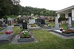
Cemetery ObjectID : 8065 |
Location KG: Jormannsdorf |
At the cemetery is the mausoleum of Count Franz Batthyány (1804–1869), Lord of Jormannsdorf and Neumarkt an der Raab and owner of the Tatzmannsdorf baths; Countess Maria, b. Edle von Eisenbach (1806–1855) and their children, Comtesse Anna Franziska (1837–1840) and Count Andreas (1840–1841). |
ObjectID : 8065 Status: § 2a Status of the BDA list: 2020-02-29 Name: Friedhof GstNr .: 37 |

|
Wayside shrine ObjectID: 8066 |
Jormannsdorf, Sulzriegel / Bernsteinweg fork (at no. 120) KG location : Jormannsdorf |
Inscription:
By God's providence, General Stefan V Szmrecsany breathed his soul here on July 14, 1917. Our Father and Hail Mary pray for him. |
ObjectID: 8066 Status: § 2a Status of the BDA list: 2020-02-29 Name: Bildstock GstNr .: 893/33 |
Web links
Commons : Listed objects in Bad Tatzmannsdorf - collection of pictures, videos and audio files
Individual evidence
- ↑ a b Burgenland - immovable and archaeological monuments under monument protection. (PDF), ( CSV ). Federal Monuments Office , as of February 14, 2020.
- ↑ Kitting. Oberwart 1920. (No longer available online.) In: Freilichtmuseum Bad Tatzmannsdorf. Archived from the original on January 16, 2014 ; accessed on January 16, 2014 . Info: The archive link was inserted automatically and has not yet been checked. Please check the original and archive link according to the instructions and then remove this notice.
- ↑ according to GIS Burgenland and position according to the site plan of the museum; GstNr. 279 according to BDA not applicable.
- ↑ § 2a Monument Protection Act in the legal information system of the Republic of Austria .