Möðrudalsleið
| Highland Road 901 Iceland |
|||||||||||||||||||||||||
| Möðrudalsleið | |||||||||||||||||||||||||

|
|||||||||||||||||||||||||
| map | |||||||||||||||||||||||||
| Basic data | |||||||||||||||||||||||||
| Operator: | Vegagerðin | ||||||||||||||||||||||||
| Start of the street: |
Hringvegur ( 65 ° 26 ′ N , 15 ° 55 ′ W ) |
||||||||||||||||||||||||
| End of street: |
Hringvegur ( 65 ° 18 ′ N , 15 ° 19 ′ W ) |
||||||||||||||||||||||||
| Overall length: | 39.80 km | ||||||||||||||||||||||||
| Möðrudalsleið | |||||||||||||||||||||||||
|
Course of the road
|
|||||||||||||||||||||||||
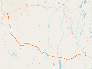
The Möðrudalsleið ![]() is a highland road in the east of Iceland .
is a highland road in the east of Iceland .
This road was originally a 40 km long section of the ring road between the Mývatn and Egilsstaðir . The ring road has been running further north since 2005, is paved along its entire length and is easier to drive on, especially in winter. The loneliest farm in Iceland is on this road: Möðrudalur . Here is also one of the few short paved stretches of the road. The three bridges of Möðrudalsleið were built in the 1950s and are single-lane. Two paths branch off towards the south into the highlands : the Arnardalsleið ![]() and the Brúarvegur
and the Brúarvegur ![]() .
.
See also
Web links
Commons : Möðrudalsleið - collection of images, videos and audio files
Individual evidence
- ↑ Vegaskrá 2018 - kaflaskipt. Retrieved August 16, 2019 (Icelandic).
- ↑ a b c Brúaskrá - Brýr á þjóðvegum (February 2016). Retrieved August 16, 2019 (Icelandic).

