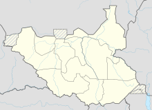
Magwi (South Sudan)
Coordinates: 4 ° 8 ' N , 32 ° 18' E
Magwi (alternative spelling Magwe ) is a place in the state of imatong (until 2015 in Eastern Equatoria ) in South Sudan .
Magwi is the capital of the administrative district of the same name (Magwi County) and the seat of its commissioner .
location
50 km to the northeast is Torit . The south Sudanese capital Juba is 130 km (as the crow flies) in the northwest, a drive by car takes about 4 hours. The Nile flows 70 km to the west and the border with Uganda 60 km to the south. Some mountains rise nearby, the eastern end of Magwi County is the Imatong Mountains . Neighboring places of Magwi are Omeio directly in the east as well as Agoro , Okura and Gesiga .
Small, unpaved roads lead to Torit in the northeast, to Juba in the northwest, to Pageri and Nimule to the southwest and to the southeast via Palotaka to Pajok and Lobone on the border with Uganda. Since the small town is located off the main asphalt connection axis Juba - Nimule to Uganda , it has so far not been able to develop into the commercial center of the administrative district. This role is played by Nimule on the Ugandan border.
In Magwi there are neither water pipes nor an electricity network and also no airfield.
population
In Magwi County 169,826 people live on an area of 5,207.95 km², in the municipality (Payam) Magwi itself 41,778 people. In the district mostly Acholi and Madi live together with minorities of the Lulobo , Lotuko and Bor- Dinka . The Catholic Church ( Diocese of Torit ) with the parishes of Palotaka (to which the city of Magwi belongs), Lerwa (now united with Palotaka) and Loa / Nimule has been present, as well as the Anglican Episcopal Church of the Sudan since the 1920s .
The county was badly affected by fighting during the Second Sudanese Civil War . There have been refugee camps in the border region with Uganda since the 1990s, initially mainly for refugees from central areas of South Sudan. However, the border area in particular was additionally affected by attacks by the Lord's Resistance Army until around 2007 . Only since this year has the population been able to return to their home regions and start rebuilding the district.
In 2008 the Secondary School in Magwi, which had been destroyed in the war, was rebuilt, at which 16 teachers teach around 500 students (as of 2011) .
Web links
Individual evidence
- ↑ See Eastern Equatoria State Map. (PDF; 868 kB) UN-OCHA, January 23, 2009, accessed on November 24, 2013 .
- ^ Statistical Yearbook for Southern Sudan. (PDF; 11.6 MB) (No longer available online.) Southern Sudan Center for Census, Statistics and Evaluation, 2010, p. 12; 32 , archived from the original on November 13, 2012 ; Retrieved November 24, 2013 (English, 2008 census data). Info: The archive link was inserted automatically and has not yet been checked. Please check the original and archive link according to the instructions and then remove this notice.
- ^ The History and Parishes of the Diocese of Torit. (No longer available online.) 2004, archived from the original on December 3, 2013 ; accessed on November 24, 2013 . Info: The archive link was inserted automatically and has not yet been checked. Please check the original and archive link according to the instructions and then remove this notice.
- ^ Anne-Felicitas Görtz: South Sudan - Time for a State. (No longer available online.) In: Le Monde diplomatique. January 2011, p. 18 , archived from the original on December 2, 2013 ; Retrieved November 24, 2013 . Info: The archive link was inserted automatically and has not yet been checked. Please check the original and archive link according to the instructions and then remove this notice.
