Maipo
| Maipo | ||
|---|---|---|
|
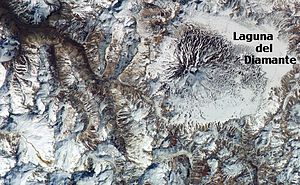
Satellite image |
||
| height | 5264 m | |
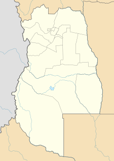
| location | Argentina , Mendoza and Chile | |
| Mountains | To the | |
| Coordinates | 34 ° 9 ′ 46 ″ S , 69 ° 49 ′ 58 ″ W | |
|
|
||
| Type | Stratovolcano | |
| Last eruption | 1908 | |
| First ascent | 1883 by Paul Güßfeldt | |
The Maipo is a 5264 m high, active stratovolcano in the Andes on the border between Chile and Argentina ( Mendoza province ). Its cone rises 1900 m above the bottom of a 15 × 20 km large caldera that was formed around 450,000 years ago.
The last known eruption dates back to 1908. At the eastern foot, an eruption in 1826 formed the approximately 7 × 4 km Laguna del Diamante at an altitude of 3300 m.
Climbing the volcano is usually done from nearby San Carlos .
See also
Web links
- Maipo in the Global Volcanism Program of the Smithsonian Institution (English)

