Mairiporã
| Mairiporã | ||
|---|---|---|
Coordinates: 23 ° 19 ′ S , 46 ° 35 ′ W Mairiporã in the Brazilian state of São Paulo Mairiporã in the Brazilian state of São Paulo
|
||
| Basic data | ||
| Country | Brazil | |
| State | São Paulo | |
| Residents | 80,920 (2010) | |
| City insignia | ||
| Detailed data | ||
| surface | 621.480 km 2 | |
| Population density | 251.71 inhabitants / km 2 | |
| Time zone | UTC −3 | |
| Website | ||
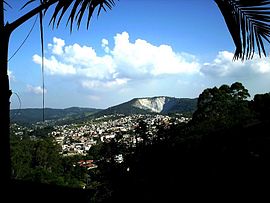
| View of Mairiporã | ||
Mairiporã is a Brazilian city in the state of São Paulo . It is located north of the city of São Paulo in the Serra da Cantareira and belongs to the metropolitan region of São Paulo . The 80,920 inhabitants (2010) are spread over an area of 321.5 km², resulting in a population density of 251.7 inhabitants / km².
Surname
The name of the city is derived from the Tupi language , in which "mairy'poranga" means something like "beautiful city" or "beautiful village".
Web links
Commons : Mairiporã - Collection of images, videos and audio files
- City Prefecture website , Prefeitura Municipal (Brazilian Portuguese)
- City Council website , Câmara Municipal (Brazilian Portuguese)
- Mairiporã - Panorama. IBGE (updated statistics).
Individual evidence
- ↑ Censo Populacional 2010 ( Memento from June 20, 2011 in the Internet Archive )


